
Last Updated on September 10, 2026 by Daniel Globe
That five-mile hike on the map can look easy until your legs start burning halfway up. Distance tells only part of the story. Elevation gain shows how much climbing the route adds, and it often explains why a short trail feels harder than a much longer, flatter walk.
This guide explains what elevation gain means, how it is measured, what counts as a lot, why tracking apps may disagree, and how to train, pack, and stay safe on steep trails.
Quick Answer
Elevation gain is the total amount of uphill climbing on a route. It adds every ascent, not just the difference between the trailhead and the highest point. A hike with more gain usually requires more time and effort, but distance, grade, terrain, weather, pack weight, and absolute altitude also affect difficulty.
What’s in This Article
- What Elevation Gain Means
- How Elevation Gain Is Measured
- How Much Elevation Gain Is a Lot?
- Elevation Gain vs. Altitude, Grade, and Elevation Change
- What Makes a High-Gain Hike Harder
- Benefits of High Elevation Gain Hiking
- Challenges of High Elevation Gain Hiking
- Training for High Elevation Gain Hiking
- Gear and Equipment
- Safety Considerations
- Popular High Elevation Gain Trails
- Frequently Asked Questions
Key Takeaways
- Elevation gain is cumulative. Every uphill segment counts, even when the trail drops between climbs.
- There is no universal cutoff for “a lot.” Total gain must be judged with distance, gain per mile, terrain, weather, and your fitness.
- Elevation gain and altitude are different. A steep low-elevation hike can be exhausting without creating altitude-illness risk.
- GPS watches, phones, maps, and apps may report different totals because they use different sensors, elevation models, and correction methods.
- Cardio work, leg strength, downhill practice, and gradually harder training hikes prepare you for sustained climbing.
- Route-specific footwear, the Ten Essentials, enough water, a turnaround time, and current trail information matter more than any single gear item.
Disclosure: As an Amazon Associate I earn from qualifying purchases. Some links on this page are affiliate links, at no extra cost to you.
What Elevation Gain Means
Elevation gain, also called total ascent, is the sum of every uphill section along a route. It is usually shown in feet or meters.
For example, imagine a trail that climbs 1,000 feet, descends 300 feet, and then climbs another 500 feet. Its total elevation gain is 1,500 feet. Its net elevation change from the start to the finish is only 1,200 feet.
Note: On an out-and-back hike, the return trip can add more gain if the route includes uphill sections on the way back. Do not assume all climbing ends at the turnaround point.
How Elevation Gain Is Measured
A topographic map estimates elevation gain from contour lines. Each contour represents a set change in elevation, so you can count the uphill contours along the route. Digital trail maps do the same calculation with an elevation model.
A GPS watch or phone records a series of locations and elevations during your hike. The app then adds the upward changes between those points. Devices with a barometric altimeter may combine air-pressure readings with GPS data, while other devices rely more heavily on satellite positioning or mapped elevation data.
Why Hiking Apps Show Different Elevation Gain
Two apps can produce different totals for the same hike. GPS signals can be blocked or reflected by cliffs, trees, and terrain, and vertical accuracy is generally weaker than horizontal accuracy. Apps also use different smoothing rules, sampling rates, map data, and elevation corrections. The U.S. government notes that GPS accuracy depends on signal blockage, atmospheric conditions, receiver quality, and other local factors through its GPS accuracy guidance.
Small up-and-down errors can be counted as real climbing, which may inflate total gain. A mapped route can also miss small dips and rises that your device records in the field. For planning, compare the trail manager’s official figure with a detailed topographic profile. During the hike, use one device and one app consistently so your training records are comparable.
How Much Elevation Gain Is a Lot?
There is no universal hiking standard for what counts as a lot of elevation gain. A total that feels moderate to a trained mountain hiker may be exhausting to a beginner. The same 1,000 feet also feels very different when spread across ten miles instead of two.
| Total Gain in One Hike | Practical Planning Guide |
|---|---|
| 0 to 500 feet | Light climbing for many hikers, though a short, very steep route can still feel hard. |
| 500 to 1,000 feet | A noticeable climb that may challenge a beginner. |
| 1,000 to 2,000 feet | Often strenuous for newer or unconditioned hikers. |
| 2,000 to 4,000 feet | A demanding mountain day for many people, especially with distance or rough terrain. |
| More than 4,000 feet | Usually a very strenuous objective that calls for strong fitness, careful pacing, and a full safety plan. |
These ranges are rough planning aids, not official ratings. Trail systems use different methods. For example, Shenandoah National Park combines distance and elevation gain in its local difficulty formula and warns that even that formula is imperfect.
Use Elevation Gain per Mile
Gain per mile gives useful context. Divide total gain by the climbing distance. A route that gains 1,000 feet over ten miles averages 100 feet per mile. A route that gains the same 1,000 feet over two miles averages 500 feet per mile and will usually feel much steeper.
You can also estimate average grade with this formula: vertical rise ÷ horizontal distance × 100. A climb of 500 feet in one mile has an average grade of about 9.5%. Short pitches may be much steeper than the route average.
Elevation Gain vs. Altitude, Grade, and Elevation Change
| Term | Meaning |
|---|---|
| Elevation gain | The total of every uphill section on the route. |
| Net elevation change | The difference between the starting and ending elevations. |
| Altitude or elevation | Your height above a reference level, usually sea level. |
| Grade | How steep a section is, usually expressed as a percentage. |
A trail can gain 3,000 feet while staying at relatively low altitude, so altitude illness is not automatically a concern. Another trail can start above 10,000 feet and gain only a few hundred feet, yet the thin air may still affect you. Always check both total gain and the route’s highest and sleeping elevations.
What Makes a High-Gain Hike Harder
Total gain is only one part of difficulty. Consider these factors together:
- Steepness: The same gain packed into fewer miles creates a steeper climb.
- Repeated climbs: Rolling routes can build large cumulative gain even when the finish is near the starting elevation.
- Trail surface: Loose rock, mud, roots, sand, snow, and scrambling slow your pace and demand more balance.
- Descending: Long descents stress the quadriceps and can be harder on tired knees than the climb.
- Altitude: High absolute elevation reduces available oxygen and can lower performance.
- Weather: Heat, cold, wind, rain, lightning, and snow can turn a manageable route into a serious problem.
- Pack weight: Extra water, overnight gear, or camera equipment increases energy use and joint load.
Switchbacks usually reduce the grade by spreading a climb over more distance. They do not automatically increase the vertical height you must gain. A direct route may feel harder per mile, while a switchbacking route may be longer but less steep.
Mountain ranges such as the Rockies, Sierra Nevada, and Appalachians contain routes with large cumulative gain. Sections of the Appalachian Trail can be especially deceptive because repeated short climbs and descents add up even when the net change looks modest.
Benefits of High Elevation Gain Hiking
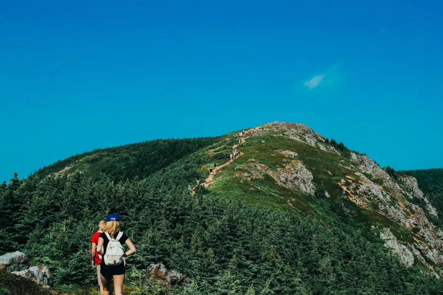
Trails with high elevation gain often lead to summits, ridgelines, and overlooks that flatter routes cannot reach. The reward may include broad views, changing plant zones, waterfalls, alpine lakes, and a stronger sense of accomplishment.
Uphill hiking can be vigorous aerobic activity. Regular physical activity supports heart health, endurance, muscle strength, balance, and daily function. The steep terrain also works your calves, glutes, quadriceps, and core. It does not guarantee a larger “lung capacity,” but consistent training can improve how efficiently your body handles sustained effort.
Time outdoors may also support mood and stress relief. The effect varies by person, so it is better to treat this as a possible benefit rather than a guaranteed medical result.
Challenges of High Elevation Gain Hiking
| Challenge | Why It Matters |
|---|---|
| Fatigue | Sustained climbing raises effort, while tired legs make slips and poor decisions more likely. |
| Long descents | Downhill travel loads the quadriceps and knees and may expose weakness that was not obvious on the climb. |
| Dehydration or heat illness | Exertion, heat, dry air, and limited water sources can increase fluid needs. |
| Altitude illness | Risk depends on absolute altitude, sleeping elevation, ascent rate, and individual susceptibility, not elevation gain alone. |
| Changing weather | Higher terrain may be colder, windier, wetter, or more exposed to lightning than the trailhead. |
| Rough footing | Loose rock, roots, snow, and uneven ground increase the chance of a fall. |
Altitude Illness Is About Height, Not Just Climbing
The CDC Yellow Book says unacclimatized travelers who sleep at 8,000 feet, or sometimes lower, can be at risk of altitude illness. It reports that acute mountain sickness affects about 25% of visitors sleeping above 8,000 feet in Colorado. Common symptoms include headache, nausea, dizziness, fatigue, and poor appetite.
Fitness does not prevent altitude illness. Gradual acclimatization helps, but anyone can develop symptoms if they go too high too quickly.
Warning: Stop ascending if altitude symptoms appear. Descend and seek urgent help for confusion, trouble walking straight, shortness of breath at rest, chest congestion, or rapidly worsening symptoms. These can signal life-threatening high-altitude illness.
Training for High Elevation Gain Hiking
A useful plan prepares you for both the climb and the descent. Begin several weeks before a major hike when possible, and increase the workload gradually.
Build Aerobic Endurance
Brisk walking, running, cycling, swimming, stair climbing, and incline treadmill sessions can build the aerobic base needed for sustained uphill work. Include easy sessions that you can repeat consistently rather than making every workout hard.
Strengthen the Muscles Used on Hills
Squats, lunges, step-ups, calf raises, hip hinges, and core exercises can improve climbing strength and stability. Controlled step-downs and downhill walking help prepare your quadriceps for the return trip.
Practice With Specific Training Hikes
Use local hills, stairs, stadium steps, or a treadmill if mountains are not nearby. Start with a distance and gain you can finish comfortably. Then increase one variable at a time, such as distance, elevation gain, pack weight, or pace.
Train with the shoes, socks, backpack, food, and water system you plan to use. A long hike is not the time to discover that your pack rubs or your footwear causes blisters.
Pro Tip: Match your hardest training hike to the goal without copying the full objective. A shorter route with similar gain per mile and a realistic pack can reveal pacing, gear, and fueling problems while leaving time to recover.
Acclimatize Separately From Fitness Training
Strong cardio fitness can help you move efficiently, but it does not protect you from altitude illness. For a high-altitude objective, allow time at a moderate elevation before sleeping higher, and avoid a rapid jump in sleeping altitude when your itinerary allows.
Gear and Equipment for High Elevation Gain Hiking
Choose footwear for the route and your experience. Well-fitted trail shoes can work well on maintained, dry trails. Supportive boots may be a better choice for rough off-trail terrain, mud, snow, cold conditions, or heavier loads. Traction, fit, and break-in time matter more than the label on the shoe.
Wear moisture-wicking socks and carry blister care. Waterproof footwear can help in wet or snowy conditions, but it may feel warmer and dry more slowly after water gets inside.
Trekking poles can improve balance and provide extra points of contact on steep or loose ground. Research has found reduced knee-joint loading during downhill walking in some conditions, but the benefit depends on technique and terrain. Adjust the poles correctly and practice before a major trip.
A lightweight, well-fitted backpack should carry the Ten Essentials, including navigation, sun protection, insulation, illumination, first aid, fire, repair tools, food, water or treatment, and emergency shelter.
Plan water around the route, weather, duration, and reliable refill points. Carry a treatment method when you expect to use natural water. Do not assume a stream shown on a map will be flowing or safe to drink untreated.
Safety Considerations for High Elevation Gain Hiking
Check the official trail page, current alerts, permit rules, weather forecast, daylight hours, fire restrictions, and snow conditions before you leave. Conditions can change faster than a general trail description can be updated.
- Leave a trip plan: Tell a trusted person your route, group, vehicle, expected return time, and when to call for help.
- Set a turnaround time: Turn back when you reach it, even if the summit is close.
- Carry navigation backups: Bring an offline map, a charged device, and a map and compass when the route calls for them. Cell coverage is not guaranteed.
- Bring a real light: Carry a headlamp or flashlight with spare power. A phone is not a dependable primary light.
- Pace the group: Let the slowest hiker set a sustainable pace and keep the group together.
- Watch the descent: Save food, water, daylight, and leg strength for the return.
- Protect against local hazards: In tick country, review these tick protection tips for hiking.
The National Park Service’s Hike Smart guidance recommends knowing your limits, leaving a trip plan, checking weather and alerts, carrying the Ten Essentials, and not relying on a cell phone for communication or navigation.
Popular High Elevation Gain Hiking Trails
Half Dome, California
Half Dome in Yosemite National Park gains about 4,800 feet over a 14- to 16-mile round trip. The final summit approach uses steel cables on steep granite. The National Park Service requires a permit when the cables are up and warns hikers not to attempt the cables during storms or when the rock is wet.
Mount Whitney, California
Mount Whitney is the highest point in the contiguous United States. The main trail climbs more than 6,000 feet in about 11 miles from Whitney Portal to the summit. The summit elevation is 14,505 feet under the current NPS reference. The Inyo National Forest requires wilderness permits year-round for overnight visitors and day visitors in the Mount Whitney Zone. Snow and ice can turn the standard trail into a mountaineering objective that requires specialized skills and equipment.
Grays Peak, Colorado
The Grays Peak Trail climbs roughly 3,000 feet over about four miles from the trailhead to a summit above 14,000 feet. The official Colorado Trail Explorer listing shows a 3,031-foot elevation range. The standard summer route is a hike, but altitude, lightning, snow, ice, and fast-changing weather still make it serious.
For longer routes, pack fit and capacity matter. This Tomtoc 40L travel backpack review may help you compare one option, while this guide to hiking backpacks for multi-day treks covers packs designed for longer trail use.
Love travel? Join Our Facebook Community For More Tips.
Frequently Asked Questions
What is considered a lot of elevation gain when hiking?
There is no universal cutoff. Around 1,000 feet can be a substantial climb for a beginner, while 2,000 to 4,000 feet is a demanding day for many hikers. Judge the total with distance, gain per mile, terrain, altitude, weather, and your recent training.
Is 1,000 feet of gain over two miles hard?
It can be. That averages 500 feet of gain per mile. If most of the two miles are uphill, the average grade is about 9.5%, with short sections that may be steeper. A fit hiker may find it moderate, while a beginner may find it strenuous.
What is the difference between elevation gain and elevation?
Elevation is your height above a reference level, usually sea level. Elevation gain is the total amount you climb along the route. You can have large gain at low elevation or small gain at very high elevation.
Why do hiking apps report different elevation gain?
Apps may use different GPS samples, barometric readings, smoothing rules, and digital elevation models. Trees, cliffs, weather, signal reflection, and sensor calibration can also affect the result. Small vertical errors may be counted as extra climbing.
Does high elevation gain cause altitude sickness?
Not by itself. Altitude illness is linked to high absolute elevation, sleeping altitude, ascent rate, and personal susceptibility. A steep hike near sea level can have large gain without altitude-illness risk.
Do switchbacks reduce elevation gain?
Switchbacks usually reduce the grade by making the route longer. They do not remove the vertical height between the trailhead and the destination, though route dips and rises can change the cumulative total slightly.
How should you train for a high elevation gain hike?
Combine aerobic exercise, leg and core strength, downhill practice, and progressively harder training hikes. Train with your planned footwear and pack. For high-altitude routes, add acclimatization because fitness alone does not prevent altitude illness.
What are popular trails with significant elevation gain?
Well-known examples include Half Dome in Yosemite, the Mount Whitney Trail in California, Grays Peak in Colorado, the Bright Angel Trail in the Grand Canyon, the Mist Trail in Yosemite, and the Franconia Ridge Loop in New Hampshire. Check official mileage, gain, permits, weather, and current conditions before choosing one.
Safety Disclaimer: This article is for informational purposes only and does not replace professional medical or wilderness safety advice. Check current trail conditions, talk to a healthcare professional before high-altitude activity if you have health concerns, and use conservative judgment on the trail.
Elevation gain can predict effort better than mileage alone, but it should never be used by itself. Check cumulative gain, distance, grade, terrain, altitude, weather, permits, and your own recent training. Start with a route that fits your current ability, build gradually, and save enough energy, water, and daylight for the descent.
Sources
- CDC Yellow Book: High-Altitude Travel and Altitude Illness — altitude risk, acclimatization, symptoms, and descent guidance.
- National Park Service: Hike Smart — trip planning, weather, equipment, pacing, and turnaround guidance.
- Shenandoah National Park: How to Determine Hiking Difficulty — an official example of combining distance and elevation gain.
- GPS.gov: GPS Accuracy — factors that affect consumer GPS readings.
- Yosemite National Park: Half Dome Day Hike — official distance, elevation gain, cable, permit, and safety information.
- Inyo National Forest: Mount Whitney Trail — official trail gain, distance, permit, water, and seasonal-condition information.
