
Last Updated on July 27, 2026 by Daniel Globe
Nestled in the Santa Monica Mountains above Pacific Palisades, Will Rogers State Historic Park combines coastal-mountain scenery with the legacy of humorist, cowboy performer, actor, and writer Will Rogers. Betty Rogers arranged for the family’s ranch property to become a California state park in 1944. The park reopened with limited access on November 8, 2025, after the January 2025 Palisades Fire, but hiking access is still restricted as recovery and trail work continue in 2026.
Quick Answer
Will Rogers State Historic Park is open daily from 8 a.m. to sunset, but hiking access remains limited after the 2025 Palisades Fire. The Inspiration Loop is partially open; Rivas Canyon, Rustic Canyon, the Backbone Trail, and southern Bone Canyon remain closed. Vehicle parking is $3 hourly or $12 all day.
Key Takeaways
- The Inspiration Point area is the main hiking destination currently accessible from Will Rogers State Historic Park, although parts of the Inspiration Loop may close intermittently for trail work.
- Rivas Canyon Trail, Rustic Canyon Trail, the Backbone Trail, and the southern segment of Bone Canyon Trail remain closed as of July 2026.
- The historic 31-room ranch house and main horse stables were destroyed in the January 2025 Palisades Fire. Long-term recovery planning is underway, but reconstruction of the ranch house has not yet been finalized.
- Dogs must be leashed and are permitted in the historic zone and on the Inspiration Loop; do not take them onto closed trails or routes leading into areas where dogs are prohibited.
- The park is open from 8 a.m. to sunset. Vehicle parking is currently $3 per hour or $12 for the day, and parking can be limited.
At a Glance
| Time Required | About 1–1.5 hours for a typical Inspiration Point outing; current closures may change the route or distance. |
| Difficulty | Easy to moderate on the open Inspiration Point route, with steady climbing on broad dirt roads. |
| Tools Needed | Water, supportive shoes, sun protection, snacks, a charged phone, and the current park map. |
| Cost | Vehicle parking is currently $3 per hour or $12 all day; fees are subject to change. |
| Park Hours | 8 a.m. to sunset. |
| Current Trail Access | Inspiration Loop partially open; several connecting trails remain closed because of Palisades Fire recovery work. |
Disclosure: As an Amazon Associate I earn from qualifying purchases. Some links on this page are affiliate links, at no extra cost to you.
Current Trail Status and Closures
Trail access is the most important thing to check before hiking here. According to California State Parks’ reopening information and its 2026 park materials, the Inspiration Loop is only partially open while repairs continue.
- Inspiration Loop Trail: Partially open. The western segment may close intermittently for trail work.
- Betty Rogers Trail: Both sections are subject to intermittent closures.
- Rivas Canyon Trail: Closed.
- Rustic Canyon Trail: Closed.
- Backbone Trail from Will Rogers: Closed.
- Southern Bone Canyon Trail: Closed.
Note: Construction schedules can change which parts of the Inspiration Loop are usable on a given day. Check the official Will Rogers State Historic Park page immediately before leaving and follow all closure signs once you arrive.
Planning Your Visit
Will Rogers State Historic Park is at 1501 Will Rogers State Park Road in Pacific Palisades. Day-use areas are open from 8 a.m. to sunset. Current vehicle-parking rates are $3 per hour or $12 for the full day, with a discounted all-day senior rate listed by State Parks. Parking is limited, especially when trail work or events reduce available space.
Allow enough time to finish your hike and return to the parking area before sunset. Because the post-fire landscape and construction zones can change quickly, download or photograph the latest official map instead of relying only on an older hiking-app route.
Pro Tip: Arrive soon after the 8 a.m. opening when temperatures are cooler and parking is more likely to be available. State Parks has also encouraged visitors to consider rideshare or public transportation when parking is limited.
Overview of Hiking Trails
Trails for All Levels
The Inspiration Point route is the park’s signature hike and the best choice for most visitors under the current restrictions. In normal conditions, State Parks describes Inspiration Point as a moderate loop of roughly 2 miles. Other trail references measure slightly longer variations, so GPS totals can differ depending on the exact route. During 2026 repairs, do not assume the complete traditional loop is available.
The open portions follow broad dirt roads and provide a steady climb toward Inspiration Point. The route suits many families and newer hikers, although heat, sun exposure, loose dirt, and elevation change can make it feel harder than the mileage suggests.
A Challenge with a View
Will Rogers normally connects hikers to much longer routes in the Santa Monica Mountains, but those connections should be treated as future options until State Parks reopens them.
When open, the Rivas Canyon Trail provides a moderate route toward Temescal Gateway Park. California State Parks describes the connection as about 2.1 miles one way. The route is currently closed because of Palisades Fire recovery work.
The park is also the eastern end of the 67-mile Backbone Trail, which crosses the Santa Monica Mountains to Point Mugu State Park. The Backbone connection from Will Rogers, including the Rogers Road approach into adjoining Topanga State Park, remains closed as of July 2026.
Navigating the Trails
The Inspiration Point area is normally straightforward, but construction fencing and temporary closures can alter familiar routes. Follow official signs and stay on designated open roads and trails. Do not use unofficial cut-throughs to get around a closure, even if a mapping app shows a route continuing beyond a barricade.
Note: The current closure map shows Rivas Canyon, Rustic Canyon, the Backbone Trail, and southern Bone Canyon closed. The western Inspiration Loop and Betty Rogers Trail may also close intermittently. Always give posted signs priority over an older printed or digital map.
Difficulty Levels of Hiking Trails
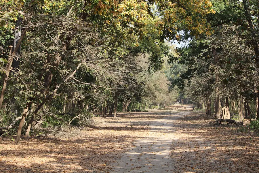
The currently accessible Inspiration Point route is generally easy to moderate. Broad dirt roads and gradual grades make it approachable for many casual hikers, but the climb is exposed and can feel much harder on a hot day.
When it eventually reopens, Rivas Canyon is a more involved outing because of its canyon terrain and greater distance. The Backbone Trail is a long-distance route rather than a simple extension of the Inspiration hike; anyone planning a future Backbone section should carry a proper map, enough water and food, and a realistic turnaround plan.
Until those routes officially reopen, do not use their normal difficulty ratings as a reason to bypass closure signs. Fire damage, unstable trail surfaces, damaged structures, and active repair work can create hazards that are not reflected in pre-fire trail descriptions.
Points of Interest Along the Trails
| Trail Name | July 2026 Status | Typical Distance When Open | Points of Interest |
|---|---|---|---|
| Inspiration Point Loop | Partially open; intermittent work affects the western segment | About 2 miles for the normal loop; current usable distance can vary | Inspiration Point overlook, polo field, historic ranch landscape, Pacific and Los Angeles views |
| Rivas Canyon Trail | Closed | About 2.1 miles one way to Temescal Gateway Park when open | Canyon scenery and connection toward Temescal Gateway Park |
| Backbone Trail via Rogers Road | Closed from Will Rogers | 67 miles for the complete Backbone Trail | Long-distance Santa Monica Mountains route to Point Mugu State Park |
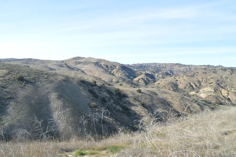
Inspiration Point remains the standout scenic destination. On a clear day, State Parks describes views across the Los Angeles Basin, Santa Monica Bay, surrounding mountains, and as far as Catalina Island. The post-fire landscape looks different from before 2025, with recovering vegetation and visible signs of fire and restoration work in parts of the park.
Historic Ranch and Palisades Fire Recovery
The park’s cultural landscape changed dramatically during the January 7, 2025 Palisades Fire. The historic 31-room ranch house, horse stables, and several other park facilities were destroyed. Approximately 300 historic trees, fencing, and miles of trails were also affected. State Parks staff were able to evacuate more than 150 artifacts, including Will Rogers’ typewriter, artwork, and family belongings.
The gatehouse, foreman’s cottage, and polo field survived with minimal damage. The guest house/visitor-center building was damaged, and the official park page says it will undergo a full restoration.
It is important to separate that work from the future of the destroyed ranch house. California State Parks has launched a broader recovery-planning process for Will Rogers State Historic Park and neighboring Topanga State Park. Decisions about how the ranch house and other lost resources will be treated are being developed with public and community input rather than through an already-finalized ranch-house rebuilding project.
The park is open again, but it is still a recovery site. Treat trail closures, construction fencing, and restoration areas as part of the current hiking experience rather than temporary obstacles to bypass.
Wildlife and Nature Viewing Opportunities
The Santa Monica Mountains support coyotes, mule deer, red-tailed hawks, California quail, scrub jays, western fence lizards, Pacific rattlesnakes, king snakes, and many other species. Wildlife sightings vary with season, time of day, weather, and ongoing habitat recovery after the fire.
Early morning and late afternoon can be productive times for wildlife viewing, but give every animal plenty of space. Never feed wildlife, and keep dogs controlled so they do not chase animals or enter closed habitat-restoration areas.
Safety Tips for Hiking in the Park
Start by checking trail conditions on the day of your visit. Recovery work can produce closures that are not reflected in an older map or saved GPS route.
Carry enough water for every member of your group. Much of the climb is exposed, and Southern California heat can make a short hike surprisingly demanding. Wear shoes with traction for dusty or loose surfaces, use sun protection, and keep enough daylight in reserve to return before the park closes at sunset.
Stay alert for poison oak, ticks, and rattlesnakes, all of which occur in the Santa Monica Mountains. Keep hands and feet where you can see them, avoid stepping into thick vegetation, and check yourself and pets for ticks after the hike.
Wildfire weather is another consideration. California State Parks and other Santa Monica Mountains land managers may close recreation areas during severe fire-weather or Red Flag conditions. Check official alerts before driving to the park.
Warning: Do not attempt to reach the Backbone Trail, Rivas Canyon, Rustic Canyon, or other closed routes by walking around gates, fencing, or signs. Fire damage and active construction may create hazards that are not obvious from the open portion of the trail.
Recommended Gear for Hiking in the Park
Comfortable, supportive hiking shoes help on the park’s dirt roads and uneven surfaces. Lightweight, moisture-wicking clothing is useful on exposed sections. Carry water, snacks, a basic first-aid kit, sun protection, and a charged phone. A downloaded official map is useful because mobile coverage can vary and temporary closures may require a different return route.
Trekking poles are optional for the Inspiration Point outing but can help hikers who want more stability on loose dirt or steeper grades. If longer routes such as Rivas Canyon or the Backbone Trail reopen in the future, poles and additional water become more useful.
Pro Tip: For cooler conditions, begin shortly after the park opens at 8 a.m. Late-afternoon light can also be beautiful, but leave enough time to complete the open route and return to your vehicle before sunset.
Accessibility and Family Considerations
The broad Inspiration Point roads make this one of the more approachable hiking areas in the Santa Monica Mountains, and families often choose it for a relatively short outing. Still, a child who is comfortable walking two flat miles may find the steady climb, sun, or heat more tiring than expected.
California State Parks provides accessible parking, restroom, picnic, and trail information for the park, but post-fire repairs can temporarily change accessible routes. Visitors who need a specific accommodation or step-free route should check the current State Parks accessibility information or contact the park before traveling rather than relying on a pre-fire trail description.
Additional Activities and Amenities at Will Rogers State Park
The polo field, main lawn, and picnic area reopened with the park in November 2025. The polo field survived the fire with minimal damage, and the official park page continues to list seasonal polo activity. Check the current event calendar before making a trip specifically for a match because restoration work can affect programming.
Equestrian activity is also part of the park’s historic identity. Limited equestrian operations resumed after reopening, although the destruction of the historic stables and continuing recovery work mean the experience is not the same as it was before the fire.
Picnic areas make it easy to combine a short hike with a relaxed visit to the grounds. The damaged visitor-center building is undergoing restoration, while the future treatment of the destroyed ranch house remains part of the broader State Parks recovery-planning process.
Will Rogers State Historic Park remains a rewarding place to experience Los Angeles history and Santa Monica Mountains scenery. For now, the best plan is to treat Inspiration Point and the designated open ranch grounds as the main attractions rather than building an itinerary around the park’s closed long-distance connections. Check conditions immediately before visiting, carry water, and give restoration crews and recovering habitat plenty of space.
For a very different hiking-focused getaway, you may also be interested in this guide to traveling to St. John in the Virgin Islands, including places to stay, outdoor activities, and planning tips for the island.
Frequently Asked Questions
What hiking trail is open at Will Rogers State Historic Park?
The Inspiration Loop is partially open and provides access toward Inspiration Point, but the western segment can close intermittently for trail work. Check the current State Parks notice before visiting because the usable route can change.
Which trails are closed at Will Rogers State Historic Park?
As of July 2026, State Parks lists Rivas Canyon Trail, Rustic Canyon Trail, the Backbone Trail, and the southern segment of Bone Canyon Trail as closed. The western Inspiration Loop and both sections of Betty Rogers Trail may also close intermittently for trail work.
How difficult is the Inspiration Point hike?
It is generally an easy-to-moderate hike on broad dirt roads with a steady climb. The normal loop is roughly 2 miles, but current construction and closures can change the distance. Heat and sun exposure can make the hike feel harder.
Is the hiking at Will Rogers State Historic Park suitable for families?
Yes. The open Inspiration Point route is a practical choice for many families because it uses broad dirt roads and is relatively short. Bring plenty of water, sun protection, and enough time for children to handle the steady uphill sections comfortably.
Are dogs allowed on the hiking trails at Will Rogers State Historic Park?
Dogs are permitted on leash in the historic zone and on the Inspiration Loop. Keep dogs under control and do not take them onto closed routes or trails where State Parks signs prohibit dogs, including routes leading into adjoining areas with different rules.
How much is parking at Will Rogers State Historic Park?
California State Parks currently lists vehicle parking at $3 per hour or $12 for the full day. Parking is limited and rates can change, so check the official park page before your visit.
What are the park hours?
The park’s day-use areas are open from 8 a.m. to sunset. Plan your turnaround so you are back at the parking area before the park closes.
What should hikers bring to Will Rogers State Historic Park?
Bring water, sunscreen, a hat, supportive hiking shoes, snacks, a charged phone, and the current park map. In warm weather, carry extra water because much of the route is exposed. Check trail and fire-weather conditions before leaving home.
Sources
- California State Parks — Will Rogers State Historic Park — current hours, parking fees, dog rules, visitor-center status, park history, amenities, and visitor information
- California State Parks — Reopening of Will Rogers State Historic Park FAQ — reopening date, current access limitations, Palisades Fire damage, and recovery planning
- California State Parks — 2026 Will Rogers State Historic Park Infosheet — trail closures, intermittent closures, parking rates, hours, and post-fire conditions
- California State Parks — Topanga State Park — current adjoining-park restrictions, including Rogers Road and Temescal-area closures
- National Park Service — About the Backbone Trail — official 67-mile Backbone Trail length, history, and regional trail context

