Last Updated on September 11, 2026 by Daniel Globe
Bang Pae Waterfall is a small rainforest waterfall in Pa Khlok, Phuket, known for its short forest trail, seasonal flow, natural stream pools, and nearby gibbon conservation project. Although it is often described as being on the “Bang Pae River,” authoritative sources reviewed for this guide do not identify an officially named river by that name.
Quick Answer
Bang Pae Waterfall is fed by a small rainforest stream in Phuket’s Khao Phra Thaeo Non-Hunting Area. Official sources reviewed do not identify the watercourse as the “Bang Pae River,” so describing it as a named river is not well supported. Its flow becomes stronger after seasonal rain.
Key Takeaways
- Bang Pae Waterfall is fed by a forest stream, but the official sources reviewed do not name it the Bang Pae River.
- The waterfall is within Khao Phra Thaeo Non-Hunting Area, not a legally designated national park.
- The short trail is manageable for many visitors, but wet rocks, roots, and uneven ground require suitable footwear.
- Rain can improve the waterfall’s appearance while making swimming and stream crossings more dangerous.
- The nearby Gibbon Rehabilitation Project now requires advance learning-session bookings.
At a Glance
| Time Required | About 1 to 2 hours for the waterfall trail; allow more time for a booked gibbon learning session or a meal nearby. |
| Difficulty | Easy to moderate for most active visitors, with uneven, rocky, and sometimes slippery ground. |
| Tools Needed | Grippy shoes, drinking water, insect repellent, sun protection, and a dry bag or change of clothes if you may enter the water. |
| Cost | Admission and vehicle fees may apply. Published prices conflict, so confirm the current amount before travel or at the entrance. |
Warning: Do not enter the stream during heavy rain or when the water is rising, muddy, fast-moving, or carrying debris. Rainforest waterfalls can experience sudden flash flooding. Follow staff instructions and closure signs, even when the lower pools appear calm.
Disclosure: As an Amazon Associate I earn from qualifying purchases. Some links on this page are affiliate links, at no extra cost to you.
What River Is Bang Pae Waterfall On?
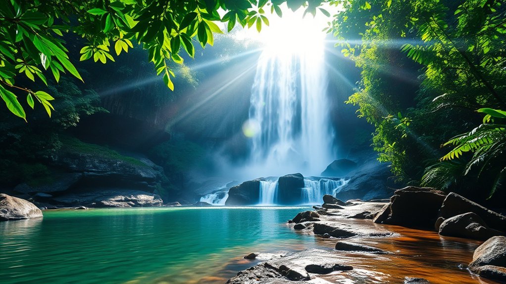
Bang Pae Waterfall is fed by a small stream that drains the rainforest of Khao Phra Thaeo in northeastern Phuket. However, the official Phuket Province and Thai tourism sources reviewed for this article do not identify that stream as an officially named “Bang Pae River.” They refer instead to the waterfall, its streams, and its natural ponds.
For that reason, the most accurate answer is that Bang Pae Waterfall is on a rainforest-fed local stream, not a verified river officially called the Bang Pae River. The water runs downhill through the protected forest, forms small cascades and pools, and continues toward lower communities and coastal areas.
The amount of water changes through the year. During wetter months, the stream may produce a stronger and broader cascade. During a prolonged dry spell, the main fall can become narrow and the smaller pools can shrink.
Note: Many travel websites call the surrounding forest “Khao Phra Thaeo National Park.” Thailand’s Department of National Parks currently identifies it as Khao Phra Thaeo Non-Hunting Area.
Bang Pae Waterfall Location and Setting
Bang Pae Waterfall is in Pa Khlok, Thalang District, on the northeastern side of Phuket. It lies within the Khao Phra Thaeo protected forest, one of the island’s most important remaining rainforest areas.
Protected-Area Location
The official Khao Phra Thaeo Non-Hunting Area covers 13,925 rai, or approximately 22.3 square kilometers. According to Thailand’s Department of National Parks, the protected area extends across parts of Thep Krasattri, Si Sunthon, and Pa Khlok in Thalang District.
Khao Phra Thaeo protects 13,925 rai, approximately 22.3 square kilometers, of Phuket’s remaining tropical forest.
The Bang Pae entrance is generally reached from the Heroines Monument area by driving east toward Pa Khlok and following signs for Bang Pae Waterfall and the Gibbon Rehabilitation Project. The exact journey time depends heavily on your starting point and Phuket traffic.
Rainforest Setting
The trail passes through humid tropical forest with tall trees, dense vegetation, exposed roots, insects, birds, and the sounds of running water. The protected area supports more than 100 reported wildlife species and includes rare plants such as the white-backed palm associated with Phuket’s native forest.
| Detail | What You May Experience |
|---|---|
| Main trail | A short forest path with roots, stones, damp patches, and a gradual incline. |
| Near the water | Slippery rocks and uneven stream edges, especially after rain. |
| Trees | Large tropical trees, dense foliage, and visible buttress roots. |
| Wildlife | Birds, insects, reptiles, and other forest animals may be heard or seen. |
| Accessibility | Step-free access is limited because the route includes natural, uneven terrain. |
The forest is usually cooler than Phuket’s exposed beaches, but humidity can be high. Mosquitoes and other insects are common, so insect repellent is useful.
Nearby Landmarks
The best-known nearby attraction is the Gibbon Rehabilitation Project, which rehabilitates rescued white-handed gibbons and works to return suitable animals to protected forest habitat.
Ton Sai Waterfall is on another side of the Khao Phra Thaeo forest. It can be reached separately by road. Longer forest routes between the two sides should not be attempted casually without current route information, suitable preparation, and local guidance.
Bang Rong Pier and the Pa Khlok coastal area are also nearby. They provide access to mangrove scenery, boat services, and waterfront restaurants, making it possible to combine the waterfall with other northeastern Phuket stops.
Bang Pae Waterfall’s Height and Flow
Bang Pae is one of Phuket’s best-known and largest waterfalls, although it remains modest compared with major waterfalls elsewhere in Thailand. Its appearance depends strongly on recent rainfall.
Waterfall Height Details
Bang Pae Waterfall is commonly reported as being approximately 15 to 18 meters high. No current primary-source engineering measurement was found, so the figure should be treated as an estimate rather than an exact specification.
The main cascade drops over dark rock into a stream area surrounded by dense vegetation. During good flow, the waterfall creates an attractive white curtain. During dry periods, the same rock face may hold only a narrow stream.
Visitors who move close to the base should watch for algae-covered stones, unstable footing, and sudden changes in depth. The safest viewpoint can vary with the water level.
Rainy-Season Flow
Phuket’s wetter period generally runs from May through October, sometimes extending into November. Bang Pae often looks fuller during this period, particularly after several days of moderate rain.
Recent rainfall matters more than the calendar alone. A visit in a traditionally wet month can still produce limited flow after a dry spell, while a recent storm can make the stream much stronger.
Pro Tip: For a fuller waterfall without unnecessary risk, visit after recent moderate rain rather than during an active storm. Check the weather before leaving and turn back if the stream is rising quickly.
More water can create better photographs, stronger sound, and cooler mist. It does not automatically create better swimming conditions. Fast current, hidden debris, and slippery rocks can make the pools less suitable for entering.
Dry-Season Changes
Bang Pae can become much quieter during prolonged dry weather, particularly from late winter into the hottest part of the year. The cascade may shrink, and some shallow pools may contain less moving water.
A dry-season visit can still provide a peaceful forest walk, bird sounds, shade, and access to nearby attractions. However, visitors who are traveling mainly to see a powerful waterfall should check recent photographs, rainfall, or local conditions first.
Lower flow may expose more rocks, but exposed stones can remain smooth or slippery. Do not assume that dry-season footing is automatically safe.
What to Expect on the Bang Pae Trail
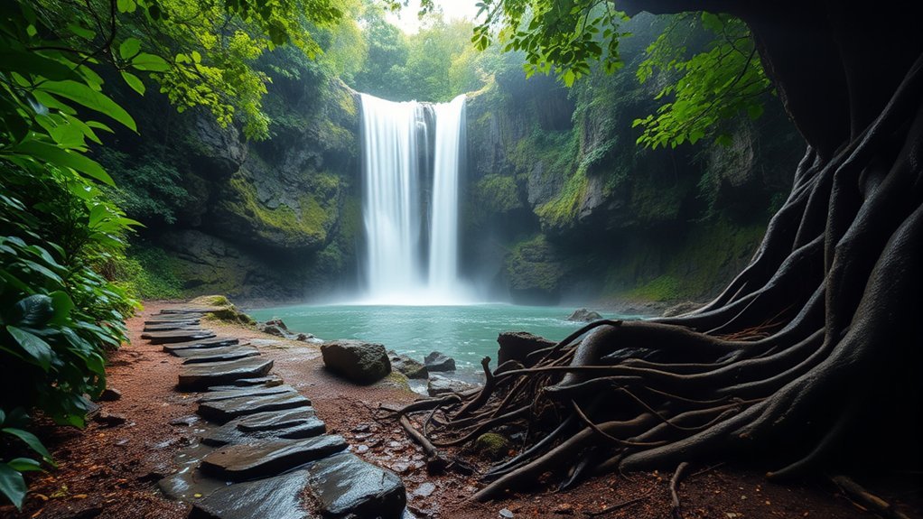
The main walk from the entrance area to Bang Pae Waterfall is short. Many visitors complete the uphill portion in approximately 10 to 15 minutes, although families, photographers, and anyone moving carefully on wet ground may need longer.
| Trail Feature | What You May Notice | Practical Tip |
|---|---|---|
| Uneven sections | Roots, rocks, and irregular footing | Wear shoes with reliable grip. |
| Wet stretches | Mud, algae, and slippery stone | Slow down and keep your hands free. |
| Stream edges | Shallow water or exposed rocks near the falls | Do not wade when water is fast or visibility is poor. |
| Optional upper routes | Steeper and less straightforward terrain | Stay on open, marked paths and follow local instructions. |
The short distance does not make the route fully accessible. Visitors with limited balance, reduced mobility, or unsuitable footwear may find the natural trail difficult. Young children should remain close to an adult, especially beside drop-offs and water.
Bring drinking water even for a short walk. A small dry bag can protect your phone, camera, passport, and money from rain or splashes.
Swimming and Picnics at Bang Pae Waterfall
Local families and visitors commonly cool off in the stream and natural pools around Bang Pae Waterfall. Whether entering the water is sensible depends on the day’s depth, current, rainfall, water clarity, posted warnings, and any instructions from staff.
Do not jump from rocks. Water depth can change, submerged stones may be difficult to see, and wet rock surfaces provide poor footing. Avoid standing directly beneath a strong cascade, where falling water and slippery surfaces can affect your balance.
Children need close, hands-on supervision near the water. Anyone who cannot swim confidently should stay in shallow, calm areas or remain out of the stream. Leave immediately if the water becomes darker, louder, faster, or begins rising.
The shaded surroundings can also suit a simple picnic. Bring water, fruit, and light snacks, use designated resting areas where available, and carry all rubbish out with you. Avoid leaving food scraps because they can attract animals and insects.
Small vendors or refreshment points may operate near the entrance, but availability can change. Carry enough water rather than depending entirely on shops being open.
Visit the Gibbon Rehabilitation Project
The Gibbon Rehabilitation Project is near Bang Pae Waterfall and has worked with rescued and rehabilitated gibbons since 1992. Its mission includes rescue, rehabilitation, reintroduction, research, and education about the illegal wildlife and tourist-photo trades.
The project should not be treated as a casual walk-in animal attraction. According to its current visitor information, educational visits are available through advance learning-session bookings. On days without bookings, no staff may be on-site and the project may remain closed.
Current programs include one-hour learning sessions and a longer learning option. Visitor numbers are limited to reduce disturbance and unnecessary contact with the gibbons. Check available dates and reserve through the official Gibbon Rehabilitation Project booking page.
| Experience | What You Can Learn | Important Detail |
|---|---|---|
| Learning session | How rescued gibbons are assessed and rehabilitated | Advance booking is required. |
| Conservation education | Why gibbons are harmed by poaching, captivity, and tourist-photo businesses | Avoid attractions that offer direct wildlife handling. |
| Reintroduction work | How suitable gibbons prepare for life in the forest | Release decisions require long-term professional assessment. |
| Family visit | Age-appropriate lessons about wildlife protection | Review the program details before bringing children. |
A responsible visit means observing the project’s rules, keeping noise low, avoiding attempts to touch or feed wildlife, and not expecting close-contact entertainment.
How to Get to Bang Pae Waterfall
Bang Pae Waterfall is in Pa Khlok, Thalang District. From Phuket Town, drive north toward the Heroines Monument, turn east toward Pa Khlok, and continue along Route 4027. Follow signs for Bang Pae Waterfall and the Gibbon Rehabilitation Project before turning onto the access road.
The protected area is roughly 20 to 25 kilometers from central Phuket Town, depending on the exact starting point and route. Travel time can vary considerably because of traffic, roadwork, rain, and the time of day.
A car, taxi, or motorcycle provides the most flexible access. Motorcycle riders should take extra care after rain because road surfaces, leaves, and painted markings can become slippery.
The Phuket Province visitor page also notes that local transport toward Bang Rong Pier may allow passengers to get off near the waterfall entrance. However, schedules, stopping points, and return services may be limited. Confirm the same-day route before relying on public transport.
Published admission prices and operating hours are inconsistent. Some listings show daytime access beginning around 8:00 or 9:00 a.m. and ending in the afternoon, but visitors should not rely on a late-evening arrival. Allow enough time to enter, walk to the falls, and return before the gate closes.
Note: Admission and vehicle charges can change, and published sources currently disagree about the foreign visitor rate. Carry Thai baht and confirm the current fee at the entrance rather than planning around one guaranteed amount.
Where to Eat Near Bang Pae Waterfall
Peang-Prai is a verified dining option near the Bang Pae Waterfall entrance. The Michelin Guide describes it as a family-run restaurant serving Thai and Southern Thai food in a forest setting beside a lagoon.
Opening hours can change, so check the restaurant’s current listing or call before making a special journey. It can become busy during weekends and holidays.
Bang Pae Seafood is another established name in the wider Pa Khlok area, known for seafood and mangrove or coastal surroundings. Because restaurant ownership, opening hours, and operating days can change, confirm its current status before traveling there specifically.
The Bang Rong Pier area also has waterfront dining options. This can work well if you plan to combine the waterfall with mangrove scenery, a pier visit, or onward travel by boat.
Small snack and drink stalls may operate closer to the waterfall entrance. They are convenient for a quick refreshment, but carrying your own water remains sensible.
Best Time to Visit Bang Pae Waterfall
The best time for a fuller waterfall is normally during Phuket’s wetter period, from approximately May through October. September and October can bring strong flow, but they can also bring intense rain and a higher risk of temporary closures.
- Early morning: Cooler temperatures, softer light, and a better chance of avoiding weekend crowds.
- After moderate recent rain: Better flow without deliberately visiting during an active storm.
- Early afternoon: Possible for a shorter visit, provided you leave enough time to return before closing.
Avoid arriving late in the day. Published closing times are generally in the afternoon, and the forest becomes darker earlier than open coastal areas.
During drier months, expect a smaller cascade. That can still suit visitors who are more interested in a shaded forest walk, conservation learning, photography, or lunch nearby than in seeing a powerful waterfall.
Weekends and Thai public holidays can attract local families. A weekday morning may provide a quieter visit.
Frequently Asked Questions
Is Bang Pae Waterfall on the Bang Pae River?
Authoritative sources reviewed for this guide do not identify an official river called the Bang Pae River. The waterfall is more accurately described as being fed by a small rainforest stream within Khao Phra Thaeo.
Is Bang Pae Waterfall inside a national park?
It is commonly described as being inside Khao Phra Thaeo National Park, but Thailand’s Department of National Parks officially identifies the protected forest as Khao Phra Thaeo Non-Hunting Area.
Is Bang Pae Waterfall good for swimming?
People commonly cool off in its stream pools, but swimming is condition-dependent. Stay out during heavy rain, rising water, strong current, poor visibility, or a closure. Watch children closely and never jump from rocks.
How long is the walk to Bang Pae Waterfall?
The main uphill walk commonly takes about 10 to 15 minutes. Allow longer when the trail is wet, when traveling with children, or when stopping for photographs.
Do you need to book the Gibbon Rehabilitation Project?
Yes. The project’s current visitor information says educational visits are available through advance learning-session bookings. On days without bookings, the site may have no staff and remain closed.
How tall is Bang Pae Waterfall?
It is commonly reported as approximately 15 to 18 meters high. Treat that as an estimate because no current official measurement was found.
What is the most beautiful waterfall in Thailand?
Beauty is subjective. Erawan Waterfall is one of Thailand’s most photographed waterfalls because of its tiered pools, while Thi Lo Su is known for its scale. Bang Pae is much smaller and is best appreciated as a convenient Phuket forest stop.
Is Haew Suwat Waterfall easy to access?
Haew Suwat is in Khao Yai National Park, not Phuket. It has road access and a developed visitor area, but reaching the lower viewpoint involves steps. Check current park conditions before visiting.
Conclusion
Bang Pae Waterfall is fed by a small rainforest stream within Phuket’s Khao Phra Thaeo Non-Hunting Area. The official sources reviewed do not confirm that the stream is named the Bang Pae River.
The waterfall works best as a short nature outing rather than a major waterfall expedition. Its appeal comes from the shaded forest trail, seasonal cascade, stream pools, nearby conservation work, and access to other Pa Khlok attractions.
Visit in the morning, wear grippy footwear, check recent weather, and stay out of the water during dangerous conditions. Reserve the Gibbon Rehabilitation Project separately if you want to include its learning program in your day.
Sources
- Thailand Department of National Parks: Khao Phra Thaeo Non-Hunting Area – official protected-area classification, size, location, wildlife, and forest information.
- Phuket Province: Bang Pae Waterfall – official provincial description, swimming activity, gibbon project location, and basic directions.
- Gibbon Rehabilitation Project: Visit and Booking Information – current reservation requirements, session times, visitor limits, and contact information.
- Gibbon Rehabilitation Project: Phuket Release Site – rainforest, water system, habitat, and conservation context.
- Thailand Department of National Parks: Rainy-Season Waterfall Safety – flash-flood monitoring, visitor warnings, rescue preparation, and temporary closures.
- Michelin Guide: Peang-Prai – current restaurant location, cuisine, contact details, and listed opening hours.