
Last Updated on July 28, 2026 by Daniel Globe
Italy’s national parks protect Alpine peaks, volcanic slopes, coastal villages, marine archipelagos, ancient forests, and some of the country’s rarest wildlife. The best park for your trip depends on whether you want high-mountain hiking, a car-free coastal route, a volcanic day trip, quiet wildlife habitat, or beaches paired with archaeological sites. This guide compares the standout parks, explains current access rules, and helps you plan around transport, seasons, permits, and trail conditions.
Quick Answer
Italy has 25 national parks, ranging from Alpine wilderness and volcanic slopes to coastal villages and marine archipelagos. Choose Gran Paradiso for wildlife, Cinque Terre for car-free coastal hiking, Vesuvius for a volcanic day trip, Pollino for remote adventure, or Cilento for beaches, caves, and archaeology.
Key Takeaways
- Italy has 25 national parks; Matese became the newest park in 2025.
- Gran Paradiso is ideal for Alpine wildlife, while Cinque Terre is the easiest major park to explore without a car.
- Pollino is Italy’s largest national park, covering 192,565 hectares across Basilicata and Calabria.
- Vesuvius requires an online timed ticket, and some Cinque Terre and La Maddalena sites have reservations or controlled access.
- Late spring and early fall suit most parks, but high Alpine routes may remain snowy well into June.
Disclosure: As an Amazon Associate I earn from qualifying purchases. Some links on this page are affiliate links, at no extra cost to you.
What Makes Italy’s National Parks Special
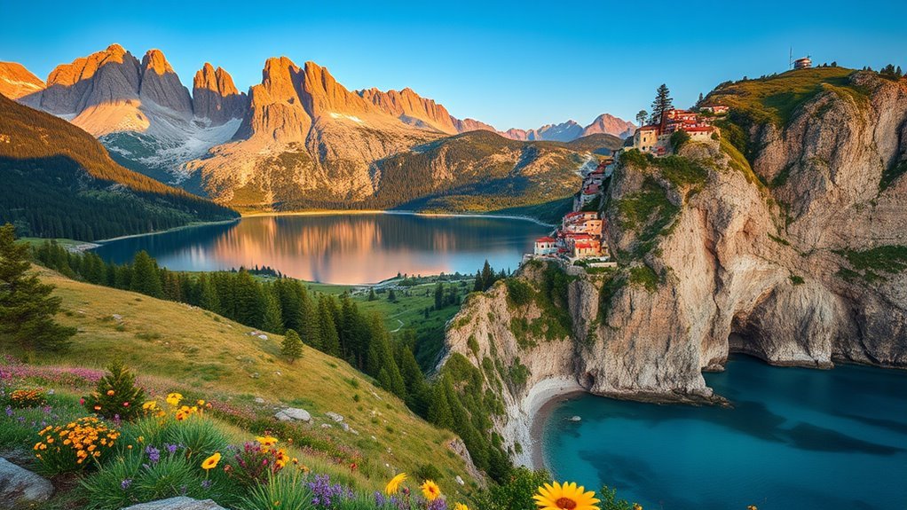
Italy’s national parks protect roughly one-twentieth of the country’s land, including high Alpine valleys, Apennine forests, Mediterranean islands, volcanic terrain, and historic farming landscapes. Matese, established as the 25th national park in 2025, is the newest addition to the system.
These areas are not empty wildernesses. Many include working villages, vineyards, pilgrimage routes, archaeological remains, and traditional grazing land. Several parks also contain UNESCO-listed cultural or natural sites, including the Cinque Terre landscape, Cilento’s archaeological heritage, and old-growth beech forests in Gargano and Pollino.
Italy’s 25 national parks protect approximately 1.6 million hectares, bringing glaciers, volcanoes, beaches, forests, villages, and wildlife habitat into one national conservation network.
Complete List of Italy’s 25 National Parks
The parks below are listed alphabetically. The nine parks covered in greater detail later in this guide offer the broadest mix of scenery, wildlife, transport options, and major visitor attractions.
| National Park | Region or Regions |
|---|---|
| Abruzzo, Lazio and Molise | Abruzzo, Lazio, Molise |
| Alta Murgia | Puglia |
| Appennino Lucano–Val d’Agri–Lagonegrese | Basilicata |
| Appennino Tosco-Emiliano | Emilia-Romagna, Tuscany |
| Arcipelago di La Maddalena | Sardinia |
| Arcipelago Toscano | Tuscany |
| Asinara | Sardinia |
| Aspromonte | Calabria |
| Cilento, Vallo di Diano and Alburni | Campania |
| Cinque Terre | Liguria |
| Circeo | Lazio |
| Dolomiti Bellunesi | Veneto |
| Foreste Casentinesi, Monte Falterona and Campigna | Emilia-Romagna, Tuscany |
| Gargano | Puglia |
| Gran Paradiso | Piedmont, Aosta Valley |
| Gran Sasso and Monti della Laga | Abruzzo, Lazio, Marche |
| Majella | Abruzzo |
| Matese | Campania, Molise |
| Monti Sibillini | Marche, Umbria |
| Pantelleria | Sicily |
| Pollino | Basilicata, Calabria |
| Sila | Calabria |
| Stelvio | Lombardy, Trentino-Alto Adige/South Tyrol |
| Val Grande | Piedmont |
| Vesuvius | Campania |
Best National Parks by Travel Style
| Park | Best For | Getting Around | Best Period |
|---|---|---|---|
| Gran Paradiso | Alpine wildlife and hiking | Car helpful; limited valley buses | June–September |
| Cinque Terre | Coastal trails and villages | Train, boat, and walking | April–June; September–October |
| Stelvio | Glaciers and high mountains | Car helpful; local buses vary | Late June–September |
| Vesuvius | Volcanic geology and a day trip | Bus, shuttle, or organized tour | Spring and fall |
| La Maddalena | Boating, snorkeling, and coves | Ferry, boat, bicycle, or car | May–October |
| Abruzzo, Lazio and Molise | Forests and rare wildlife habitat | Car strongly recommended | May–October |
| Gargano | Forest and Adriatic coastline | Car helpful; seasonal boats | April–October |
| Pollino | Remote hiking and adventure | Car normally essential | May–October |
| Cilento | Coast, caves, and archaeology | Train for Paestum; car for wider park | April–June; September–October |
Gran Paradiso National Park
Established in 1922, Gran Paradiso was Italy’s first national park. It protects approximately 71,043 hectares, or 710 square kilometers, across Piedmont and the Aosta Valley. Its official trail network extends for more than 500 kilometers through five Alpine valleys.
| Wildlife | Alpine ibex, chamois, marmots, and golden eagles |
| Trail Network | More than 500 kilometers, with routes for different skill levels |
| Highest Peak | Gran Paradiso, 4,061 meters |
| Useful Bases | Cogne, Valsavarenche, Rhêmes-Notre-Dame, Ceresole Reale, and Noasca |
The park is one of Italy’s strongest choices for wildlife watching, but sightings are never guaranteed. Ibex and chamois are often easier to see around quieter high valleys, especially early or late in the day. Use a telephoto lens, remain on the trail, and never approach or feed animals.
Lower valley paths can suit casual walkers, while high passes and refuge routes require mountain fitness, navigation skills, and suitable weather. Snow may remain at elevation into early summer. Review the official Gran Paradiso trail information before choosing a route.
Pro Tip: Stay for at least two nights in one valley instead of trying to cross the entire park. Mountain roads are slow, and the separate valleys do not connect directly through the park by car.
Cinque Terre National Park
Cinque Terre National Park protects the steep coastal landscape around Monterosso al Mare, Vernazza, Corniglia, Manarola, and Riomaggiore. Trails cross terraced vineyards and cliffs above the Ligurian coast, while frequent local trains make this the easiest major Italian national park to explore without a car.
Coastal Village Trails
The Sentiero Verde Azzurro, commonly called the Blue or Green-Blue Trail, links sections of the five villages. The best-known portions include Monterosso–Vernazza and Vernazza–Corniglia, but steep stone steps, exposed sun, and uneven surfaces make them more demanding than a simple seaside walk.
| Route Type | Main Appeal | What to Expect |
|---|---|---|
| Village-to-village trail | Classic sea and village views | Steps, narrow sections, and crowds |
| Higher ridge route | Quieter panoramas | More climbing and longer distances |
| Harbor and village walk | Food, architecture, and waterfronts | Shorter but often crowded |
The restored Via dell’Amore operates under controlled access. Ordinary visitor entry is reserved in timed slots and normally runs one way from Riomaggiore to Manarola. Rules can change with maintenance, weather, and crowd controls.
Note: A Cinque Terre Trekking Card is required for designated paid trail sections, while the Train Card adds regional train travel between La Spezia, the five villages, and Levanto. Check the official trail-status page on the day of your hike.
Scenic Train Access
Regional trains connect La Spezia, Riomaggiore, Manarola, Corniglia, Vernazza, Monterosso, and Levanto. Stations are close to village centers and major trail access points, so you can hike one section and return by rail instead of retracing your route.
Driving is usually less convenient. Roads are narrow, village parking is limited, and private vehicles cannot reach the historic center of every village. Travelers arriving from Florence, Pisa, Genoa, or Milan should normally connect through La Spezia or Levanto and continue by local train.
Warning: Trails may close with little notice after heavy rain, landslides, wildfire risk, or heat alerts. Do not cross a barrier or use an unofficial detour around a closed section.
Stelvio National Park
Stelvio National Park covers approximately 130,700 hectares, or 1,307 square kilometers, across Lombardy and Trentino-Alto Adige/South Tyrol. Ortler, the park’s highest mountain, rises to 3,905 meters. Glaciers, high passes, larch forests, and broad valleys make Stelvio one of the largest protected Alpine landscapes.
The park supports day hikes, long-distance routes, cycling, wildlife watching, and mountaineering. Bormio, Santa Caterina Valfurva, Peio, Rabbi, and communities in Val Venosta provide practical bases, but different sides of the park can require long drives.
Summer hiking conditions normally improve from late June through September. Snow, thunderstorms, rockfall, and rapid temperature changes remain possible even in midsummer. The Stelvio Pass road and high routes are seasonal, so verify current conditions through the official Stelvio National Park website.
Note: Seeing a glacier from a marked viewpoint is different from walking on one. Glacier travel requires technical equipment, route knowledge, and usually a qualified mountain guide.
Vesuvius National Park
Vesuvius National Park surrounds Mount Vesuvius and the older Monte Somma caldera east of Naples. The volcano is closely associated with the 79 AD eruption that buried Pompeii, Herculaneum, and nearby settlements. Today, the Gran Cono crater trail offers views across the Bay of Naples and into the volcano’s crater.
Mount Vesuvius History
Vesuvius is an active stratovolcano that has erupted many times since antiquity, including major eruptions in 1631 and 1944. It is currently quiescent rather than extinct and is monitored continuously by Italian volcanic authorities.
- Elevation: approximately 1,281 meters, although summit measurements can change slightly
- Historic eruption: 79 AD destruction of Pompeii and Herculaneum
- Most recent eruption: 1944
- National park established: 1995
Crater Hike Views
The official Gran Cono route is approximately 4.01 kilometers in total. The park gives an overall planning time of about 2.5 hours, although the exact route and permitted turnaround point can vary under current visitor protocols.
| Distance | Approximately 4.01 kilometers total |
| Planning Time | About 2–2.5 hours for the standard visit |
| Trail Surface | Loose ash, lapilli, gravel, and exposed volcanic ground |
| Main Views | Crater walls, fumaroles, Naples, Capri, and the Campanian plain in clear weather |
| Exposure | Limited shade, wind, sun, and changing visibility |
Warning: Gran Cono tickets are sold online, and trail access can close for weather alerts, strong wind, poor visibility, or other safety reasons. Buy through the official Vesuvius National Park page and avoid unauthorized resellers.
Visitor Tips and Access
The crater entrance is at the Quota 1000 area above Ercolano. Private parking is not permitted in the entrance square, so drivers must use designated lower parking and transfer arrangements. Public transport and shuttle options operate from areas such as Pompeii, but schedules should be checked shortly before travel.
The official visitor notice also warns that public toilets are not currently available at the trailhead. Use facilities before the final ascent and carry enough water, especially in summer.
- Reserve your timed ticket before arranging parking or a shuttle.
- Wear closed shoes with grip; loose volcanic gravel can slide underfoot.
- Bring water, sun protection, and a wind layer.
- Allow extra travel time for transfers between parking, buses, and the gate.
- Do not leave the authorized route or cross barriers around the crater.
La Maddalena Archipelago National Park
Off Sardinia’s northeastern coast, La Maddalena Archipelago National Park protects seven main islands—La Maddalena, Caprera, Santo Stefano, Spargi, Budelli, Santa Maria, and Razzoli—along with smaller islets and surrounding marine habitat.
Passenger and vehicle ferries connect Palau with the main island of La Maddalena. From there, a road bridge leads to Caprera, where trails reach pine woodland, coastal viewpoints, and sites connected with Giuseppe Garibaldi. Boat excursions provide access to outer islands and coves, but anchoring, landing, swimming, and commercial operations are regulated by zone.
Protected areas around Cala Coticcio and Cala Brigantina on Caprera have controlled access. Excursions in these highly protected zones require an authorized environmental hiking guide and prior park authorization under current rules. Review the official Cala Coticcio and Cala Brigantina guidance before planning a visit.
Note: A general boat tour does not automatically authorize landing in every cove. Confirm that the operator holds the required park permissions and follows current anchoring and passenger-transport rules.
Abruzzo, Lazio and Molise National Park
Legally recognized in 1923, Abruzzo, Lazio and Molise National Park protects approximately 50,000 hectares of beech forest, limestone mountains, high grasslands, rivers, and traditional villages in the central Apennines.
The park is central to the survival of the endangered Marsican brown bear. Park information estimates about 40 bears within the park and surrounding territory. Apennine chamois, wolves, deer, wild boar, and golden eagles also live in the wider ecosystem.
Pescasseroli is the main visitor base, while Civitella Alfedena, Villetta Barrea, Barrea, Opi, Scanno, and other communities provide access to different valleys. A car is useful because trailheads and villages are spread across three regions and public transport is limited.
- Choose marked walks suited to your fitness and the season.
- Join a qualified local guide for wildlife interpretation rather than trying to approach animals independently.
- Keep food secured and never leave scraps beside trails or picnic areas.
- Expect wildlife sightings to be uncertain, even in strong habitat.
Warning: Never follow, surround, or move closer to a bear for a photograph. Give the animal an open escape route, keep dogs controlled under local rules, and follow ranger instructions.
Gargano National Park
Gargano National Park covers much of northern Puglia’s mountainous promontory. Its landscape shifts from white limestone cliffs and Adriatic coves to wetlands, farmland, pilgrimage sites, and the cool interior of Foresta Umbra.
Coastal Cliffs and Grottoes
The coast between Vieste, Mattinata, Peschici, and nearby bays is known for sea arches, stacks, caves, and small beaches beneath limestone walls. Seasonal boat trips offer the easiest way to see many caves, but routes depend on sea conditions, vessel size, and local restrictions.
- Choose a licensed operator with life jackets and a clear weather policy.
- Expect itineraries to change when wind or swell makes cave entrances unsafe.
- Carry sun protection and a light layer for wind on the water.
- Do not swim into a cave without the operator’s approval.
Foresta Umbra Trails
Foresta Umbra is the park’s forested interior, with beech, oak, maple, yew, and other woodland species. Specific old-growth beech areas within Gargano are included in UNESCO’s transnational Ancient and Primeval Beech Forests property; this designation should not be confused with the boundaries of the entire forest.
Marked forest walks range from short family routes to longer trails. Conditions are cooler than the coast, but fog, mud, fallen branches, and limited mobile service are possible. Stop at an official visitor point for current trail information and follow closures protecting sensitive reserves.
Pro Tip: Combine an early forest walk with a late-afternoon coastal stop. Midday heat can be intense along exposed cliffs, while Foresta Umbra usually remains cooler.
Pollino National Park
Pollino National Park extends across 192,565 hectares in Basilicata and Calabria, making it Italy’s largest national park. Its 56 municipalities surround limestone peaks, high meadows, beech forests, river valleys, and the distinctive Heldreich’s pine, often called the Bosnian pine.
The park contains Italus, a scientifically dated Heldreich’s pine more than 1,230 years old. Its exact remote location is not promoted as a casual tourist attraction, helping protect the tree and its fragile mountain habitat.
Popular activities include hiking, mountain biking, climbing, and professionally operated rafting on suitable sections of the Lao River. Rotonda, Viggianello, Civita, Morano Calabro, and San Severino Lucano are useful bases, but a car is normally needed.
- Hike open mountain routes with wide views across the southern Apennines.
- Book rafting or canyon activities with qualified local operators.
- Visit Civita and viewpoints above the Raganello Gorge.
- Use the park’s official maps rather than relying only on crowd-sourced routes.
Warning: Do not enter the Raganello Gorge independently. Flash floods can occur even when the immediate sky appears clear, and deeper routes involve water, falling-rock, navigation, and escape hazards. Confirm current access with local authorities and use an authorized professional guide where entry is permitted.
Cilento National Park
Cilento, Vallo di Diano and Alburni National Park covers more than 181,000 hectares, or about 1,810 square kilometers, making it one of Italy’s largest national parks. It stretches from the Tyrrhenian coast into the Campanian Apennines and includes approximately 80 municipalities.
The park forms part of a UNESCO World Heritage landscape with the archaeological sites of Paestum and Velia and the Certosa di San Lorenzo at Padula. Greek temples, medieval villages, karst caves, coastal cliffs, river valleys, and mountain trails make Cilento one of the most varied parks in the country.
Paestum is easy to reach by train, but a car is helpful for exploring the wider park, including Palinuro, Marina di Camerota, the Alburni Mountains, and inland villages. Boat trips visit sea caves along the coast, while inland cave visits and adventure activities should be booked only through authorized operators.
- Choose Paestum for archaeology and straightforward rail access.
- Choose Palinuro or Marina di Camerota for coastal walks and boat trips.
- Choose the Alburni area for karst scenery and quieter mountain routes.
- Allow several days if you want to combine the coast and inland heritage sites.
Planning Your Visit
Best Time to Visit
Late spring and early fall provide the best overall balance of mild weather and smaller crowds, but Italy’s parks span several climate zones.
| Park Type | Usually Best | Main Caution |
|---|---|---|
| High Alpine parks | Late June–September | Lingering snow and afternoon storms |
| Coastal parks | April–June and September–October | Summer heat, crowds, and wildfire closures |
| Central Apennine parks | May–October | Cold nights and sudden mountain weather |
| Southern mountain parks | May–June and September–October | Summer heat at lower elevations |
| Vesuvius | Spring and fall | Exposed sun, wind, and weather closures |
Pro Tip: May, June, and September work well for a multi-park trip. Coastal routes are usually comfortable, while many mountain valleys are open without the peak crowds of July and August.
Fees, Tickets, and Permits
Many Italian national parks do not charge a single general entrance fee. However, specific attractions, trail sections, parking areas, museums, boats, guided activities, and protected marine zones may charge separately.
- Vesuvius: online timed ticket required for the Gran Cono.
- Cinque Terre: designated trail sections and the Via dell’Amore require the appropriate card or reservation.
- La Maddalena: boats and commercial operators may need park tickets or authorizations; highly protected coves have separate access controls.
- Guided activities: rafting, canyoning, cave visits, wildlife excursions, and technical mountain routes have operator fees.
Prices and access systems change, so use the relevant park authority’s website rather than relying on an old blog post or an unofficial ticket seller.
Getting Around
Cinque Terre is the clearest choice for a car-free park trip. Vesuvius can also be reached with buses, shuttles, or an organized excursion, although the final transfer requires planning. Paestum in Cilento has rail access, and La Maddalena begins with a ferry from Palau.
A car is much more useful in Gran Paradiso, Stelvio, Abruzzo, Gargano, Pollino, and inland Cilento. Roads can be narrow and slow, and two trailheads that appear close on a map may sit in separate valleys with no direct connection.
Hiking and Wildlife Safety
- Download an official map before entering areas with weak mobile service.
- Check weather, trail closures, fire restrictions, and daylight before departure.
- Carry water, sun protection, an insulating layer, and footwear suited to the route.
- Turn around when weather, snow, heat, fitness, or trail conditions exceed your ability.
- Keep a safe distance from all wildlife and never feed animals.
- Follow local leash rules; dogs may be restricted in sensitive wildlife zones.
- Do not launch a drone without confirming park and aviation rules. Many protected areas prohibit or tightly regulate drone flights.
- Pack out food, tissues, and other waste, and remain on marked trails where required.
Note: Italian hiking signs use route classifications that may differ from systems in the United States. A route described as “hiking” can still include steep climbs, exposed terrain, loose rock, or long sections without services.
Frequently Asked Questions
What is the best national park in Italy?
Gran Paradiso is a strong overall choice for Alpine hiking and wildlife. Cinque Terre is better for car-free coastal travel, Vesuvius for a short volcanic experience, and Cilento for travelers who want beaches, archaeology, caves, and villages in one region.
How many national parks are there in Italy?
Italy has 25 national parks. Matese, which spans parts of Campania and Molise, became the country’s 25th national park in 2025.
Do you have to pay to enter Italy’s national parks?
Many parks have no general entrance gate, but individual attractions can charge. Vesuvius requires a paid timed ticket, designated Cinque Terre trails require a card, and boats, parking areas, museums, guides, and protected marine zones may have separate fees.
Can you visit Italy’s national parks without a car?
Cinque Terre is easy to visit by train and on foot. Vesuvius has bus and shuttle options, Paestum in Cilento has a train station, and La Maddalena is reached by ferry. A car is usually more practical for Pollino, Abruzzo, Gargano, Stelvio, and most Gran Paradiso valleys.
When is the best time to visit Italy’s national parks?
May, June, and September suit many coastal and southern parks. High Alpine hiking is generally best from late June through September, depending on snow. Spring and fall are usually more comfortable than midsummer for Vesuvius and exposed coastal trails.
What predators live in Italy’s national parks?
Italy’s parks provide habitat for Apennine wolves, Marsican brown bears, European wildcats, foxes, golden eagles, and other predators. Most avoid people, and sightings are uncommon. Observe wildlife from a distance and never follow, feed, or surround an animal.
Conclusion
Italy’s national parks range from the glaciers and ibex habitat of Gran Paradiso and Stelvio to the coastal paths of Cinque Terre, the crater of Vesuvius, and the beaches and archaeological sites of Cilento. Choose the park that matches your transport, fitness, season, and available time. Before setting out, confirm current tickets, permits, trail conditions, and weather through the relevant park authority.
Sources
- Italian Ministry of Environment and Energy Security — National Parks — official national-park system and park list
- Gran Paradiso National Park — Paths and Excursions — official trail network and route planning
- Cinque Terre National Park — Trails and Outdoor Information — trail status, closures, and hiking guidance
- Vesuvius National Park — The Great Cono — crater route, ticketing, access, distance, and safety rules
- Pollino National Park — Official Website — area, municipalities, landscapes, and visitor information
- Cilento, Vallo di Diano and Alburni National Park — UNESCO Heritage — park scale, UNESCO status, and archaeological heritage
