
Last Updated on July 24, 2026 by Daniel Globe
Sardinia’s best beaches range from easy family shores with shallow water to remote limestone coves reached by boat or a demanding hike. Costa Smeralda offers polished surroundings and road access, while the Gulf of Orosei delivers the island’s wildest scenery. Before choosing a beach, check its access rules, facilities, weather, and seasonal reservation requirements.
Quick Answer
The best beaches in Sardinia include Spiaggia del Principe for Costa Smeralda scenery, La Pelosa and Cala Brandinchi for shallow water, Cala Mariolu and Cala Luna for boat trips, Cala Goloritzè for hiking, Poetto for city access, and Is Arutas for its unusual quartz shoreline.
Key Takeaways
- Choose Costa Smeralda for convenient road access, beach clubs, and clear swimming water.
- Use Cala Gonone, Arbatax, or Santa Maria Navarrese as a base for Gulf of Orosei boat trips.
- La Pelosa, Cala Brandinchi, Cala Coticcio, and Cala Goloritzè have important access controls or reservation rules.
- Remote coves may have little shade, limited food service, and no simple road access.
- Check official booking systems and weather conditions shortly before your visit because seasonal rules can change.
Disclosure: As an Amazon Associate I earn from qualifying purchases. Some links on this page are affiliate links, at no extra cost to you.
Why Sardinia’s Beaches Stand Out
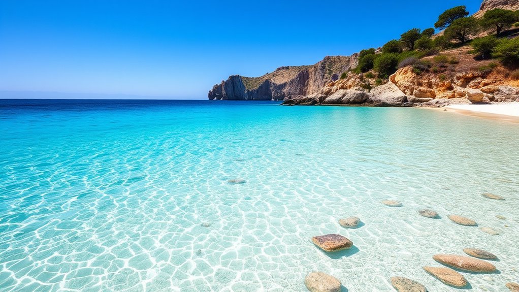
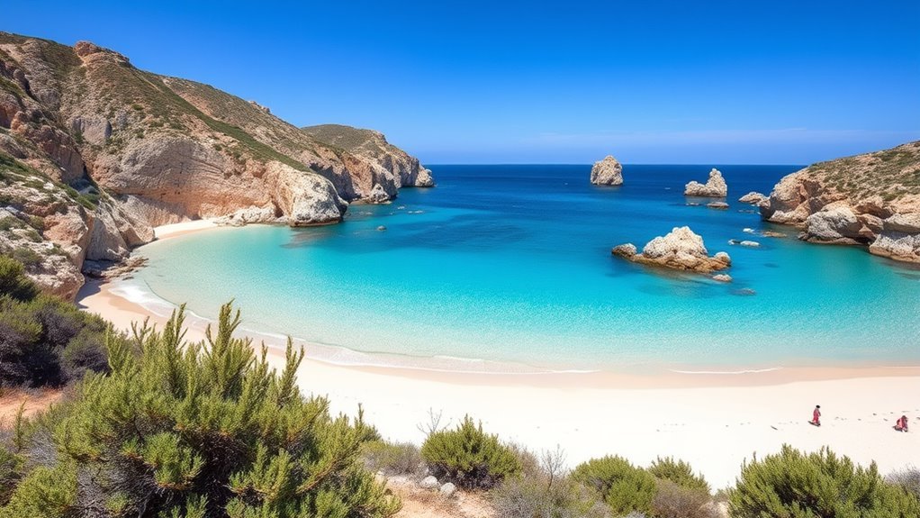
Sardinia has about 2,000 kilometres of coastline, or roughly 1,240 miles. Its shores include long city beaches, protected dunes, granite coves, quartz beaches, and limestone inlets that can be reached only by sea or hiking trail.
You can swim in shallow turquoise water at La Pelosa and Cala Brandinchi, snorkel beside rocky coves at Capriccioli, or travel beneath high cliffs on the Gulf of Orosei. Is Arutas is known for rounded quartz grains, while Cala Goloritzè is protected by controlled hiking access. This variety makes Sardinia suitable for families, confident swimmers, hikers, boat travelers, and visitors who want an easy beach close to restaurants and transport.
The best Sardinian beach is not always the most famous one. It is the beach that matches your swimming ability, transport, preferred crowd level, and willingness to book or hike.
How to Choose the Best Beach Area
Start by choosing a region. Costa Smeralda works well when you want attractive road-access beaches, nearby restaurants, and polished resorts. San Teodoro combines shallow family beaches with water sports. The Gulf of Orosei is better for dramatic cliffs, boat excursions, and challenging hikes. Cagliari gives you easy urban access, while the Sinis Peninsula offers a quieter and more natural west-coast setting.
| Beach | Best For | Main Access | Planning Note |
|---|---|---|---|
| Spiaggia del Principe | Classic Costa Smeralda scenery | Car or taxi, then a walk | Parking fills early in summer |
| Capriccioli | Families and snorkeling | Car or taxi | Several small coves share the area |
| Cala Coticcio | Protected scenery and guided hiking | Regulated guided trail | Arrange an authorized guide |
| Cala Luna | Boat trips and limestone caves | Boat or difficult hike | The trail is for experienced hikers |
| Cala Mariolu | Snorkeling and boat excursions | Boat or expert trail | Bring water, food, and sun protection |
| Cala Goloritzè | A challenging beach hike | Reserved trail from Su Porteddu | Ticket, closed shoes, and water required |
| Cala Brandinchi | Shallow water and families | Car or taxi | Reservation required in the controlled season |
| Poetto | City access, services, and nightlife | Bus, car, bicycle, or taxi | Check current CTM routes |
| Is Arutas | Quartz shore and west-coast scenery | Car | The seabed becomes deep relatively quickly |
| La Pelosa | Iconic shallow water | Car, taxi, or seasonal transport | Advance booking and beach rules apply |
- Choose a shallow lagoon-style beach for young children and relaxed swimming.
- Choose San Teodoro or Poetto for paddleboarding, wind sports, and nearby services.
- Choose the Gulf of Orosei for boat trips beneath limestone cliffs.
- Choose Costa Smeralda when you want road access and beach-club options.
- Choose the Sinis Peninsula when you prefer a quieter shore and a scenic drive.
Always compare water depth, exposure to wind, shade, parking, food service, and the distance from your accommodation. A beautiful beach can still be a poor choice when its trail, crowd level, or facilities do not suit your group.
When to Visit and What to Book
June and September usually offer warm beach weather with fewer visitors than the busiest weeks of July and August. May and early October can also be pleasant, but sea temperatures, boat schedules, and beach services may be less predictable. During peak summer, leave early for road-access beaches and reserve regulated beaches or boat trips as soon as the official system allows.
Note: Reservation periods, fees, transport timetables, parking arrangements, and daily access rules may change each season. Use official municipal or park websites rather than third-party ticket sellers.
For the 2026 season, advance reservations are required for Cala Brandinchi and Lu Impostu from June 1 through September 30 through the official San Teodoro beach system. La Pelosa uses controlled access from May 15 through October 15 through the official La Pelosa booking website. Cala Goloritzè has a separate booked hiking system, while Cala Coticcio requires regulated access through an authorized environmental hiking guide.
Best Costa Smeralda Beaches
Costa Smeralda is a good starting point when you want clear water, attractive road-access beaches, and nearby accommodation. Spiaggia del Principe, Capriccioli, and Grande Pevero each offer a different balance of natural scenery, services, and crowd levels.
Spiaggia del Principe
Spiaggia del Principe has a curved shore of fine pale sand, granite rocks, and clear water in several shades of blue. The setting feels natural despite its location in one of Sardinia’s most exclusive resort areas.
- Fine sand and clear swimming water
- Rocky edges suitable for careful snorkeling
- A small seasonal refreshment point
- Paid parking followed by a walk to the shore
- Limited open space during the busiest summer hours
Arrive early in July or August, carry drinking water, and avoid bringing more equipment than you can comfortably carry from the parking area.
Capriccioli Beach
Capriccioli consists of small sandy coves divided by rounded granite rocks. Its sheltered sections and generally shallow water make it one of Costa Smeralda’s more practical family choices. The rocky edges also provide better snorkeling interest than an open sandy beach.
You can reach the area by car or taxi, with paid parking nearby. In peak season, arrive early enough to choose a cove before the easiest sections become crowded.
Grande Pevero Bay
Grande Pevero forms a broad half-moon of pale sand backed by Mediterranean vegetation. The bay suits swimming, walking, and a slower beach day, with seasonal services and upscale beach clubs available nearby.
- A wide curved shoreline
- Clear water with a gently changing depth
- Seasonal restaurants and beach services
- Paid parking
- Quieter corners outside the busiest central section
Grande Pevero is useful when you want more space than a small cove but still prefer the facilities and easy access associated with Costa Smeralda.
Planning a Visit to Spiaggia del Principe
Spiaggia del Principe is one of the most recognizable Costa Smeralda beaches, but its popularity means timing and preparation affect the experience. The beach is best suited to travelers who can handle a walk from the parking area and do not need extensive facilities.
Clear Water and Snorkeling
The sheltered shape of the bay often provides clear water for swimming. Snorkel near the rocky edges only when the sea is calm, maintain distance from other swimmers, and avoid touching marine life or standing on underwater vegetation.
- Clear shallows near the central shore
- Rocky edges with more underwater variety
- Calmer conditions in suitable weather
- Few facilities compared with an urban beach
- Limited natural shade
Curved White-Sand Bay
The curved beach is framed by reddish granite and low vegetation. Its shape creates several visual sections, but the usable sand can feel limited when summer crowds arrive. Walk beyond the first open area before choosing a place, while respecting any protected vegetation or marked paths.
When to Arrive and What to Bring
In peak summer, aim to arrive before 9 a.m. Bring water, snacks, sun protection, swimming shoes if you plan to explore rocky edges, and a bag for all your waste. Carry only equipment you can manage on the walk between the parking area and beach.
Pro Tip: Save the parking location on your phone before leaving the car. Similar paths and vegetation can make the return route less obvious at the end of the day.
Capriccioli Beach: Family-Friendly Details
Capriccioli is especially appealing when you want calm sections of water without giving up Costa Smeralda scenery. The beach is divided into several coves, so conditions and crowd levels can vary within a short walk.
Families should choose a section with a clear view of the water and keep children within reach even in shallow areas. Snorkelers can follow the rocky margins, but should avoid entering narrow spaces when waves or boat traffic make conditions uncomfortable. Seasonal sunbed rental and food service may be available, while paid parking makes access relatively straightforward.
Best La Maddalena Beaches
The La Maddalena Archipelago lies off Sardinia’s northeastern coast and is protected as a national park. Its granite islands contain pale beaches, rocky inlets, and clear shallow water. Many locations are reached by organized boat excursion or private vessel, while some Caprera beaches use regulated land access.
- Turquoise water around granite inlets
- Small coves suitable for swimming in calm weather
- Snorkeling above bright sand and rock seabeds
- Protected habitats with strict access rules
- Boat excursions departing from La Maddalena and nearby ports
Choose an operator that follows park navigation and anchoring rules. Do not assume that a boat tour permits landing at every beach shown along the route.
Cala Coticcio and Budelli Highlights
Cala Coticcio on Caprera and Spiaggia Rosa on Budelli are two of the archipelago’s best-known sights, but neither should be treated like an ordinary unrestricted beach.
| Location | Main Feature | Access Rule |
|---|---|---|
| Cala Coticcio | Small turquoise coves framed by granite | Regulated land access with an authorized guide |
| Cala Coticcio trail | Rocky protected terrain | Follow the guide and park instructions |
| Spiaggia Rosa | Pink color created by bioclastic material | No access to the sand and no swimming in front |
| Budelli viewing | Protected landscape | View only from authorized routes or a permitted distance |
For Cala Coticcio, consult the La Maddalena National Park access information and arrange an authorized environmental hiking guide. Do not attempt to bypass trail controls.
Warning: Spiaggia Rosa is under integral protection. Visitors may not enter or walk on the beach, swim in front of it, or navigate, anchor, or moor in the protected water immediately offshore. Follow the current national park rules for Budelli.
Cala Luna on the Gulf of Orosei
Cala Luna lies between the territories of Dorgali and Baunei. High limestone walls frame a beach of sand and pebbles, while large natural caves provide some relief from the sun. The water is generally inviting for swimming, and the rocky surroundings add interest for snorkeling when conditions are calm.
The most practical access is by boat from Cala Gonone, Santa Maria Navarrese, Arbatax, or other authorized departure points. The land routes are long and difficult, and the official SardegnaTurismo guide describes them as suitable for experienced hikers.
- High limestone cliffs around the cove
- A mixture of sand and pebbles
- Natural caves near the back of the beach
- Seasonal refreshments and dining
- Boat and expert hiking access
Boat schedules can change because of sea conditions. Confirm your return departure and understand where the crew will collect passengers before leaving the vessel.
Cala Mariolu for Boat Trips
Cala Mariolu is known for small rounded pink-and-white pebbles, transparent water, and cliffs rising sharply behind the shore. Most visitors arrive by boat because the land trail crosses difficult terrain and is recommended only for experienced hikers.
Boat Access Tips
Regular excursions commonly depart from Cala Gonone, Arbatax, and Santa Maria Navarrese. Compare the itinerary carefully because some tours make a full beach stop while others pass certain coves without landing.
- Confirm the departure port and check-in time.
- Ask which beaches include a landing rather than an offshore viewing stop.
- Bring water, food, a hat, and reef-safe sun protection.
- Use a dry bag for electronics and documents.
- Wear stable footwear for pebbles and boat boarding.
Services on the beach are limited, so arrive prepared rather than depending on food, shade, or equipment rental.
Peak-Season Timing
June through August usually brings the widest choice of boat departures, but it also brings the highest demand. Reserve ahead and monitor the operator’s messages in case wind or sea conditions require a schedule change.
| Timing | What to Expect |
|---|---|
| June | Warm conditions and generally lighter demand than midsummer |
| July | Frequent departures and heavy demand |
| August | Warm sea and the busiest holiday period |
| September | Warm water with fewer visitors, depending on weather |
| Early departure | More time on the water and a better chance of calmer morning conditions |
Cala Goloritzè
Cala Goloritzè is a protected natural monument on the Baunei coast, recognized for white pebbles, clear water, a natural rock arch, and the limestone pinnacle known as Punta Caroddi. Unlike nearby boat-trip beaches, ordinary access to the shore is through a controlled hiking trail from Su Porteddu on the Golgo Plateau.
Reserve through the system identified by the official Baunei tourism office. The route is approximately 3.5 kilometres each way with about 500 metres of elevation change. The descent commonly takes around 90 minutes, while the uphill return may take about two hours.
- Advance reservation and an access ticket
- Closed shoes with reliable grip
- At least two litres of water per person in hot weather
- Food and sun protection
- Enough time and energy for the steep return climb
Warning: Do not plan to hike down and return by boat. The official visitor guidance states that return by boat is not allowed. Complete the uphill trail unless an authorized emergency arrangement is made.
Boat excursions can view the cove from offshore, but visitors should not assume they can land on the beach. Follow marked areas, carry out all waste, and do not disturb the limestone, plants, or marine environment.
Cala Brandinchi in San Teodoro
Cala Brandinchi, often called “Tahiti,” lies near Capo Coda Cavallo north of San Teodoro. Its pale sand, clear shallow water, and protected-looking bay make it a popular choice for families. The beach is reached by road rather than being only two kilometres from central San Teodoro.
For the 2026 season, controlled access applies from June 1 through September 30. Reserve through the official San Teodoro beach portal and use only the reservation details shown by that system.
| Feature | Why It Matters |
|---|---|
| Shallow water | Suitable for gentle swimming, with normal supervision for children |
| Seasonal services | Parking, beach facilities, refreshments, and water activities may be available |
| Natural setting | Pine vegetation, dunes, and views toward Tavolara |
| Controlled access | A valid reservation may be required during the stated summer period |
Arrive within the time and entry conditions shown on your booking. A reservation does not guarantee unlimited parking, so allow extra time for the final approach.
La Cinta Beach
La Cinta forms an arc of approximately five kilometres beside San Teodoro. Fine pale sand separates the sea from a lagoon that supports birdlife, while the shallow seabed makes the beach attractive to families.
- Long sections of sand for walking
- Shallow water near the shore
- Views toward Tavolara Island
- Lagoon birdlife, including seasonal flamingo sightings
- Parking, equipment rental, water sports, and refreshments
La Cinta can become busy near its main entrances. Walk farther along the beach for more space, but stay off protected dunes and do not enter restricted lagoon areas. Water-sport users should remain inside designated zones and follow local safety instructions.
Poetto Beach Near Cagliari
Poetto stretches for about nine kilometres between Cagliari and Quartu Sant’Elena. It is one of the easiest Sardinian beaches to visit without planning a remote excursion because it has restaurants, beach clubs, sports facilities, rental services, and urban transport connections.
Swimming, paddleboarding, windsurfing, walking, cycling, and evening dining are all possible along different sections of the shore. PF, PQ, and other CTM services stop along the Poetto area, but routes and seasonal schedules can change. Check the current CTM network information before leaving.
Poetto is livelier and more developed than Sardinia’s remote coves. Choose it when convenience, food service, accessibility, and a social atmosphere matter more than seclusion.
Is Arutas on the Sinis Peninsula
Is Arutas lies on the Sinis Peninsula and is famous for a shoreline formed from small rounded grains of white, green, and pink quartz. Clear water and a relatively quick increase in depth make it especially appealing to confident swimmers and snorkelers.
Unique Quartz Shoreline
The quartz grains create a texture and color unlike ordinary sand. Admire them on the beach, but leave every grain in place. Removing quartz or sand damages the shoreline and can lead to serious penalties.
- Rounded multicolored quartz grains
- Clear aqua water
- An open, natural west-coast setting
- Few large resorts immediately beside the beach
- Paid parking and developing visitor services
Swimming and Snorkeling
Visibility can be excellent in calm weather, but the seabed becomes deeper more quickly than at La Pelosa or Cala Brandinchi. Enter gradually, watch for waves and currents, and keep children and uncertain swimmers close to shore.
Snorkel with slow movements and avoid standing on marine plants or disturbing animals. When the sea becomes rough, choose observation from shore instead of pushing beyond your ability.
Amenities and Access
Is Arutas is primarily reached by car. Paid parking operates seasonally, and small food services or equipment rentals may be available. Facilities can change, so bring water, sun protection, and anything essential for your group.
Warning: Never remove quartz, sand, stones, or other natural material from Is Arutas. Shake towels and rinse footwear at designated points so grains do not leave the beach accidentally.
La Pelosa Beach in Stintino
La Pelosa is one of Sardinia’s most recognizable beaches. Isola Piana, Asinara, and nearby rock formations shelter its shallow, clear water, making it particularly attractive to families and relaxed swimmers.
For 2026, controlled access applies from May 15 through October 15, with 1,500 daily places shown by the official La Pelosa reservation system. Book through the official platform rather than an unauthorized reseller.
| Feature | What You Get | Planning Impact |
|---|---|---|
| Sand | Fine, pale shoreline | Use a mat beneath your towel |
| Water | Clear and shallow for a long distance | Still supervise children continuously |
| Access | Controlled entry during the stated season | Reserve before traveling |
| Services | Rentals and food options nearby | Availability varies by date and section |
| Protection rules | Mat, rinsing, and smoking controls | Read the current rules before entry |
The official rules require a mat beneath beach towels, rinsing sand from feet and equipment, and no smoking outside designated areas. These measures reduce the amount of sand accidentally carried away and help protect the beach.
Best Sardinia Beaches by Travel Style
- Best for families: La Pelosa, Cala Brandinchi, La Cinta, and sheltered sections of Capriccioli.
- Best for boat trips: Cala Mariolu, Cala Luna, and the La Maddalena Archipelago.
- Best for hiking: Cala Goloritzè for prepared hikers and Cala Coticcio with an authorized guide.
- Best for snorkeling: Cala Mariolu, Capriccioli, Cala Brandinchi, and Is Arutas in calm conditions.
- Best for city convenience: Poetto near Cagliari.
- Best for Costa Smeralda scenery: Spiaggia del Principe and Grande Pevero.
- Best unusual shoreline: Is Arutas and its quartz grains.
- Best protected sight to view responsibly: Spiaggia Rosa on Budelli.
Where to Stay for Sardinia’s Beaches
Your base can determine how much of each day is spent driving or boarding boats.
- Porto Cervo, Baja Sardinia, or nearby Costa Smeralda resorts: convenient for Spiaggia del Principe, Capriccioli, and the Pevero beaches.
- San Teodoro: practical for La Cinta, Cala Brandinchi, Lu Impostu, and Tavolara-area excursions.
- Cala Gonone: one of the most convenient bases for northern Gulf of Orosei boat trips.
- Santa Maria Navarrese or Arbatax: useful for southern Gulf of Orosei excursions and the Baunei coast.
- La Maddalena town or Palau: suitable for archipelago boat trips and visits to Caprera.
- Stintino: the natural base for La Pelosa and trips toward Asinara.
- Cagliari: best for Poetto, restaurants, public transport, and a wider city itinerary.
- Cabras or Oristano: practical for Is Arutas and the Sinis Peninsula.
Beach Safety and Conservation
Water that looks calm from a viewpoint can still have currents, sudden depth changes, boat traffic, or waves near rocks. Check local flags and warnings, and use lifeguarded sections when available. Do not rely on a beach’s family-friendly reputation as a substitute for supervision.
Warning: Remote beaches may have no dependable shade, drinking water, mobile signal, or rapid emergency access. Turn back from a trail or cancel a swim when heat, wind, waves, footwear, or fitness make the plan unsafe.
- Check the marine and weather forecast before a boat trip or exposed beach visit.
- Carry more water than you expect to need on summer hikes.
- Wear closed shoes on difficult trails rather than sandals or flip-flops.
- Keep away from cliff edges and areas marked for rockfall risk.
- Do not swim across boat approach lanes.
- Never remove sand, quartz, pebbles, plants, or protected shells.
- Use marked paths instead of crossing dunes or vegetation.
- Take all rubbish away when bins are unavailable.
- Follow park, municipality, lifeguard, and boat-crew instructions.
What to Bring
For an easy urban beach, a towel and sun protection may be enough. Remote coves require more preparation.
- Drinking water and food
- High-protection sunscreen, hat, and protective clothing
- Closed hiking shoes for Cala Goloritzè and other difficult trails
- Stable sandals or water shoes for pebbled shores
- Dry bag for boat trips
- Snorkel equipment that fits correctly
- Mat required for La Pelosa
- Small rubbish bag
- Offline maps and saved booking confirmations
- Cash or card according to the parking and operator’s stated policy
Frequently Asked Questions
Which part of Sardinia has the best beaches?
The northeast is best for Costa Smeralda, San Teodoro, and La Maddalena. The east is best for the dramatic Gulf of Orosei coves. The northwest has La Pelosa, the south has Poetto and other broad sandy beaches, and the west offers the quartz shores of the Sinis Peninsula.
What is the number-one beach in Sardinia?
There is no official number-one beach because rankings depend on scenery, access, swimming conditions, and personal preference. Cala Mariolu is a leading boat-trip choice, La Pelosa is famous for shallow water, and Spiaggia del Principe is one of Costa Smeralda’s classic beaches.
Are there white-sand beaches in Sardinia?
Yes. La Pelosa, Cala Brandinchi, La Cinta, Spiaggia del Principe, and several Costa Smeralda and La Maddalena beaches have very pale sand. Cala Mariolu has small light-colored pebbles, while Is Arutas has quartz grains rather than ordinary white sand.
Which Sardinia beaches require reservations?
For 2026, La Pelosa requires controlled access from May 15 through October 15, while Cala Brandinchi and Lu Impostu require reservations from June 1 through September 30. Cala Goloritzè uses a separate hiking reservation, and Cala Coticcio land visits require an authorized guide. Always confirm the current season on official websites.
Can you reach Cala Goloritzè by boat?
Boat tours can view Cala Goloritzè from offshore, but ordinary beach access is through the reserved trail from Su Porteddu. Do not expect a boat to land on the beach or collect you after the hike.
Can you walk or swim at Spiaggia Rosa?
No. Access to the pink shoreline is prohibited, and swimming, navigation, anchoring, and mooring are restricted in the protected water in front of it. Visitors may admire the beach only from authorized viewing routes or a permitted distance.
What food is Sardinia famous for?
Well-known Sardinian foods include pane carasau, pecorino sardo, culurgiones, fregola, bottarga, seafood, and porceddu. Vermentino is a popular local white wine. Restaurant specialties vary by region, so coastal menus may differ from those in the island’s interior.
Conclusion
Sardinia offers a beach for almost every travel style. Choose Costa Smeralda for attractive road-access shores, San Teodoro and La Pelosa for shallow water, the Gulf of Orosei for boats and hiking, Poetto for city convenience, and Is Arutas for a distinctive quartz coastline.
The most memorable visit comes from matching the beach to your abilities and planning ahead. Confirm reservations, transport, trail conditions, and weather through official sources, then follow every conservation rule once you arrive. Sardinia’s beaches remain extraordinary because visitors treat their sand, dunes, water, and wildlife with care.
Sources
- SardegnaTurismo — official regional beach descriptions, access information, coastline details, and facilities.
- San Teodoro Spiagge — official Cala Brandinchi and Lu Impostu reservations and seasonal access rules.
- Spiaggia La Pelosa — official booking availability, 2026 controlled-access dates, and visitor rules.
- Tourism Baunei: Cala Goloritzè — official trail distance, access process, footwear, water, and return guidance.
- La Maddalena National Park: Cala Coticcio — regulated guided-access information.
- La Maddalena National Park: Budelli — Spiaggia Rosa protection and prohibited activities.
