
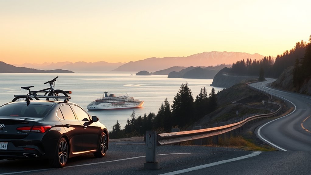
Last Updated on July 23, 2026 by Ethan Caldwell
The best way to travel from Seattle to Port Angeles depends on your starting point, whether you have a car, and how much schedule risk you can accept. From downtown Seattle, the Bainbridge Island ferry plus a drive is usually the most scenic and often the most convenient. The all-driving route avoids ferry waits, while two bus options work for car-free travelers.
Quick Answer
From downtown Seattle, take the 35-minute Bainbridge Island ferry, then drive about 70 miles via WA-305, WA-3, WA-104, and US-101 to Port Angeles. To avoid ferries, drive about 138 miles through Tacoma Narrows and the Hood Canal Bridge. Car-free travelers can pair the ferry with Clallam Transit Route 123.
Key Takeaways
- The ferry crossing takes about 35 minutes, but vehicle queues can make the total trip longer.
- The no-ferry route is about 138 miles and typically takes around 2 hours 45 minutes to 3 hours in light traffic.
- The Seattle-Bainbridge route does not accept vehicle reservations, so drivers board first-come, first-served.
- The lowest-cost car-free route is usually the ferry plus Clallam Transit Route 123, which charges $10 per boarding for adults.
- Port Townsend is a detour, Sequim is directly along US-101, and Hurricane Ridge is a separate side trip from Port Angeles.
What’s in This Article
- Before You Begin: Trip-Planning Basics
- Your Travel Options at a Glance
- Take the Bainbridge Island Ferry
- Drive From Seattle to Port Angeles
- Travel From Seattle to Port Angeles Without a Car
- Best Stops Between Seattle and Port Angeles
- Where to Eat and Stay in Port Angeles
- Common Mistakes to Avoid
- Planning Tips for the Route
- Frequently Asked Questions
- Conclusion
Disclosure: As an Amazon Associate I earn from qualifying purchases. Some links on this page are affiliate links, at no extra cost to you.
Before You Begin: Trip-Planning Basics
Choose your route before leaving Seattle, but check conditions again shortly before departure. Ferry delays, Seattle traffic, Hood Canal Bridge openings, and Olympic Peninsula roadwork can change which option is fastest on a particular day.
- Check the current Seattle-Bainbridge sailing schedule, terminal loading information, and ferry alerts.
- Check the Hood Canal Bridge status if you are driving either route.
- Remember that Seattle-Bainbridge vehicle space is first-come, first-served. WSDOT does not offer reservations on this route.
- Plan to reach the vehicle tollbooth at least 20 minutes before departure. Allow considerably more time when WSDOT shows heavy vehicle demand.
- At ferry terminals, you can use major cards, cash at staffed payment points, or an ORCA card with e-purse value. Self-service kiosks do not accept cash.
- As of March 1, 2026, WSF adds a 3% recovery surcharge to credit and debit card purchases. Cash and qualifying ORCA e-purse payments avoid that card surcharge.
- If Hurricane Ridge is part of your day, check Olympic National Park conditions separately because weather, roadwork, and limited facilities can affect access.
Your Travel Options at a Glance
Travel Options at a Glance
| Ferry + drive | Best for downtown departures and scenery. Allow about 35 minutes for the crossing, about 1 hour 40 minutes of driving after Bainbridge, plus loading and waiting time. |
| Drive via Tacoma | Best when you want full schedule control. The route is about 138 miles and usually takes roughly 2 hours 45 minutes to 3 hours before major traffic or bridge delays. |
| Ferry + Route 123 | Best low-cost car-free option. Walk onto the Bainbridge ferry, then board Clallam Transit Route 123 at the Bainbridge terminal. Connections are limited and the bus does not wait for late ferries. |
| Dungeness Line | Best for a booked through-coach trip from selected Seattle or SeaTac stops. Some downtown stops require phone booking at least 24 hours ahead. |
Driving gives you the most control, but the ferry route cuts the road portion of the trip to about 70 miles after you land on Bainbridge Island. The crossing itself is scenic, with views of Elliott Bay, the Seattle skyline, and Puget Sound.
Do not choose by mileage alone. A ferry route can be faster when Tacoma traffic is heavy, but one missed sailing can erase that advantage. Compare live ferry loading with the WSDOT traffic map before committing.
Take the Bainbridge Island Ferry
- Check the sailing schedule and alerts. The crossing takes about 35 minutes, but departure times and service levels vary by day and season.
- Enter the Seattle ferry terminal at Colman Dock. Follow signs for the Bainbridge Island vehicle line. Walk-on passengers use the passenger entrance.
- Arrive early enough for your vehicle. WSDOT recommends reaching the tollbooth at least 20 minutes before sailing on most routes. Heavy summer demand can require a much larger buffer.
- Cross to Bainbridge Island. Once aboard, you can leave your vehicle and use the passenger decks unless the crew gives different instructions.
- Drive toward Port Angeles. From the Bainbridge terminal, follow WA-305 north, continue toward WA-3, cross the Hood Canal Bridge on WA-104, then follow US-101 west through Sequim to Port Angeles.
Pro Tip: If you must reach Port Angeles by a fixed time, aim for the sailing before the latest one that would work. Ferry loading, vessel substitutions, and schedule resets can create delays even when you arrive on time.
Ferry Fares and Payment
As of July 2026, the Seattle-to-Bainbridge fare table lists these common fares:
- Adult walk-on passenger, age 19 to 64: $11.35.
- Senior or eligible passenger with a disability: $5.65.
- Youth age 18 and under: no passenger fare.
- Vehicle under 14 feet with driver: $21.30.
- Standard vehicle under 22 feet with driver: $27.00.
Passenger fares are collected when leaving Seattle, so walk-on passengers do not pay another passenger fare when returning from Bainbridge to Seattle. Vehicle-and-driver fares are collected in both directions. Extra adult passengers in a vehicle pay the passenger fare when departing Seattle. Fares can change by tariff and vehicle size, so check the calculator for your travel date.
Drive From Seattle to Port Angeles
The all-driving route avoids ferry queues and covers about 138 miles. In light traffic, mapping services commonly estimate about 2 hours 45 minutes to 3 hours, but Seattle and Tacoma congestion can add substantial time.
The standard route is I-5 south from Seattle, WA-16 west across the Tacoma Narrows Bridge, WA-3 north through the Kitsap Peninsula, WA-104 west across the Hood Canal Bridge, and US-101 west to Sequim and Port Angeles.
Note: The Hood Canal Bridge is not a toll bridge, but marine openings can stop road traffic for about 10 to 45 minutes. From May 22 through September 30, private pleasure craft cannot request openings from 3:00 to 6:15 p.m.; commercial and military vessels remain exempt.
All-Driving Route, Step by Step
- Take I-5 south from Seattle toward Tacoma.
- Use WA-16 west and cross the Tacoma Narrows Bridge.
- Continue toward Bremerton and merge onto WA-3 north.
- Take WA-104 west across the Hood Canal Bridge.
- Join US-101 west and continue through Discovery Bay and Sequim.
- Follow US-101 into Port Angeles.
Estimate fuel cost with this simple formula: 138 miles ÷ your vehicle’s miles per gallon × the current price per gallon. This is more reliable than using a fixed dollar estimate because fuel prices and vehicle efficiency vary.
Ferry vs. Drive Time
The ferry route has only about 70 miles of driving after Bainbridge Island, compared with about 138 miles for the no-ferry route. However, the ferry option also includes terminal access, vehicle queuing, loading, a 35-minute crossing, and unloading.
For a smooth ferry connection, the ferry-and-drive route can be competitive with the all-driving route. During a full vehicle sailing or reduced ferry service, driving through Tacoma may be more predictable. The best choice can change within the same day.
The ferry saves road miles, not guaranteed time. Compare live terminal loading, sailing alerts, and Tacoma traffic before you leave.
Travel From Seattle to Port Angeles Without a Car
Ferry and Clallam Transit Route 123
The most economical public-transit route is usually a walk-on trip from Seattle to Bainbridge Island followed by Clallam Transit Route 123, the Strait Shot, from the Bainbridge ferry terminal to Port Angeles Gateway Transit Center.
- Walk onto the Seattle-Bainbridge ferry.
- After arriving on Bainbridge, go to the Route 123 pickup area at the ferry terminal.
- Pay $10 per adult boarding by cash, Token Transit, or an accepted ticket. Riders age 18 and under ride Clallam Transit free.
- Allow a generous connection buffer because Route 123 does not wait for delayed ferries.
Current service runs several times per day, with fewer trips on Sundays and some holidays. The bus ride from Bainbridge to Port Angeles is generally about 1 hour 45 minutes to 1 hour 55 minutes. Including the ferry and connection, plan roughly 3 to 4 hours.
Warning: Route 123 has limited departures and does not hold for late ferries. Check both schedules together and leave enough time to catch the next bus if your sailing is delayed.
Dungeness Line Bus
The Dungeness Line provides through-coach service between Port Angeles, selected Seattle stops, and SeaTac Airport. Current schedules include some downtown Seattle pickups, but not every trip serves every stop.
Selected downtown trips take about 3 hours 20 minutes to 3 hours 30 minutes on the published timetable. The operator lists base fares from $24 to $54 by distance, and a 15% fuel surcharge has applied since March 19, 2026. Stops marked with an asterisk on the schedule must be booked through the call center at least 24 hours before departure.
Train or Direct Ferry Options
There is no direct passenger train from Seattle to Port Angeles, and there is no direct ferry between the two cities. A car-free trip requires a bus or a ferry-and-bus connection.
Best Stops Between Seattle and Port Angeles
Poulsbo, Port Townsend, and Sequim can turn the trip into a relaxed Olympic Peninsula road trip. Their locations are different, so choose stops that fit your route and available time.
Scenic Add-Ons and Viewpoints
- Bainbridge Island: Pause near Winslow for shops and dining, or check current entry information for Bloedel Reserve. This works best when you are not rushing to Port Angeles.
- Hood Canal Bridge: Both main driving routes use this floating bridge. Scenic water views are brief, so the driver should keep attention on traffic and wind conditions.
- Hurricane Ridge: Treat this as a separate trip from Port Angeles, not a stop between Seattle and the city. The 17-mile mountain road takes about 45 minutes each way from Port Angeles in normal conditions.
Charming Town Stopovers
| Poulsbo | A convenient stop on the ferry route for a waterfront walk, marina views, bakeries, and small shops. |
| Port Townsend | Victorian architecture, galleries, and waterfront streets. This is a worthwhile detour from the direct route, not a quick roadside stop. |
| Sequim | Directly on US-101, with a walkable center and lavender farms that are especially active during summer. |
In Poulsbo, browse the waterfront and marina before continuing north. Port Townsend requires a detour from the Discovery Bay area, so give it several hours rather than treating it as a short fuel stop. Sea J’s Café at the Boat Haven is known for fish and chips, but check current opening hours before making the detour.
Sequim is the easiest stop to add because US-101 passes through the city. Many farms in the Sequim-Dungeness Valley open during the summer lavender season, while downtown offers cafés and local shops.
Nature and Coastal Pauses
- Port Townsend waterfront: Walk the historic district and shoreline if your schedule allows the detour.
- Sequim: Stop for lavender farms in summer or take a short walk before the final drive to Port Angeles.
- Hurricane Ridge: From Port Angeles, drive into Olympic National Park for mountain views and trail access. The former day lodge burned in 2023. In 2026, the area has limited services, portable or temporary restroom facilities, no potable water, and ongoing utility work that may affect parking or trails.
If you take the Bainbridge ferry, the Seattle skyline and Elliott Bay views are part of the trip before the road continues through the Kitsap Peninsula.
Where to Eat and Stay in Port Angeles
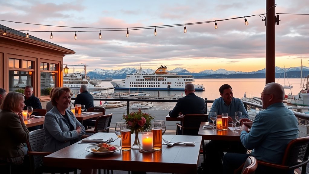
Port Angeles has motels, chain hotels, waterfront lodging, pubs, and seafood restaurants within a short drive of the Gateway Transit Center and the Black Ball Ferry terminal.
For a simple motel stay, the Flagstone Motel at 415 E 1st St offers parking and a central location. The Quality Inn Port Angeles – near Olympic National Park at 101 E 2nd St includes a free hot breakfast and sits close to downtown services.
For casual seafood, Hook & Line Pub at 201 E Front St serves chowder, fish and chips, seafood platters, and sandwiches. For a more formal meal, Kokopelli Grill at 203 E Front St lists grilled oysters, smoked salmon chowder, and Dungeness crab-stuffed halibut on its current menus.
Restaurant menus, lodging amenities, and prices can change. Confirm hours and availability directly before planning your arrival around a specific business.
Common Mistakes to Avoid
- Assuming there is a direct ferry: The Seattle ferry ends at Bainbridge Island, where you must continue by car or bus.
- Treating the ferry as automatically faster: The crossing is short, but a missed sailing can make the no-ferry drive quicker.
- Arriving at departure time with a vehicle: Boarding closes before sailing, and the vehicle deck may fill.
- Looking for a Bainbridge reservation: This route is first-come, first-served. Reservations are offered only on selected WSF routes.
- Using one fare for every vehicle: WSF charges by vehicle length, and a standard vehicle costs more than a vehicle under 14 feet.
- Ignoring the 2026 card surcharge: Credit and debit card ferry purchases include an extra 3% recovery fee.
- Planning a tight Route 123 connection: The bus does not wait for delayed ferries.
- Calling Port Townsend or Hurricane Ridge an en-route stop: Port Townsend requires a detour, and Hurricane Ridge is reached from Port Angeles.
Warning: Ferry vehicle capacity is not a fixed 202-car limit. Vessel assignments differ, so available deck space changes by sailing. Use WSDOT terminal loading information instead of relying on one capacity number.
Planning Tips for the Route
- Compare live conditions: Check ferry alerts, terminal loading, Seattle-Tacoma traffic, and Hood Canal Bridge status immediately before departure.
- Protect fixed appointments: Build in at least one extra sailing or a meaningful road-delay buffer when catching the Victoria ferry, a tour, or a hotel check-in deadline.
- Keep ferry payment rules straight: A standard vehicle-and-driver fare is collected each direction, while passenger fares on the Seattle-Bainbridge route are collected on the Seattle side.
- Pack for public transit: Route 123 has luggage space, but passenger space has priority and large bags are not recommended.
- Plan stops realistically: Poulsbo and Sequim are easy additions to the ferry route. Port Townsend and Hurricane Ridge require extra time.
- Check park services: Bring water, food, and layers for Hurricane Ridge because there is no potable water or indoor visitor lodge.
For most downtown Seattle travelers with a car, the Bainbridge ferry offers the best mix of scenery and reduced road mileage. For travelers who value predictability above scenery, the Tacoma Narrows route removes the risk of missing a sailing.
Frequently Asked Questions
What is the quickest way from Seattle to Port Angeles?
There is no route that is always quickest. From downtown Seattle, the Bainbridge ferry plus a drive is often competitive when vehicle loading is light. The all-driving route through Tacoma is usually more predictable because it avoids ferry queues.
Can you drive from Seattle to Port Angeles without taking a ferry?
Yes. Take I-5 south, WA-16 across the Tacoma Narrows Bridge, WA-3 north, WA-104 across the Hood Canal Bridge, and US-101 west to Port Angeles. The route is about 138 miles.
Is there a shuttle or bus from Seattle to Port Angeles?
Yes. Dungeness Line operates booked through-coach service from selected Seattle and SeaTac stops. A lower-cost option is the Seattle-Bainbridge ferry followed by Clallam Transit Route 123 to Port Angeles.
Can you take a train from Seattle to Port Angeles?
No. Port Angeles has no passenger rail station. You must drive, use an intercity coach, or combine the Seattle-Bainbridge ferry with a bus.
Do you need a reservation for the Bainbridge Island ferry?
No. The Seattle-Bainbridge route does not offer vehicle reservations. Drivers board first-come, first-served, so arrive early and check terminal loading before leaving.
How much does the Bainbridge Island ferry cost?
As of July 2026, an adult passenger pays $11.35, a vehicle under 14 feet with driver costs $21.30, and a standard vehicle under 22 feet with driver costs $27.00 from Seattle. Card payments have a 3% surcharge, and fares can change.
How long is the Bainbridge ferry and drive to Port Angeles?
The ferry crossing takes about 35 minutes, and the drive from Bainbridge terminal to Port Angeles takes about 1 hour 40 minutes in light traffic. Add time for terminal access, waiting, loading, and unloading.
Conclusion
For a scenic trip from downtown Seattle, take the Bainbridge Island ferry and continue by car across the Hood Canal Bridge to US-101. For the most schedule control, drive through Tacoma Narrows. Without a car, use the ferry and Route 123 or book a Dungeness Line trip.
Check live ferry loading, bridge status, traffic, and park conditions before leaving. A small time buffer can prevent a missed bus, sailing, tour, or hotel arrival from disrupting the rest of your Olympic Peninsula trip.
Sources
- WSDOT Seattle-Bainbridge sailing schedule: crossing time and current seasonal departures.
- WSDOT Seattle-to-Bainbridge fares: passenger and vehicle fares.
- WSDOT Hood Canal Bridge: marine-opening duration, restrictions, and bridge status.
- Clallam Transit Route 123: Strait Shot schedule, fare, luggage, and connection rules.
- Dungeness Line schedules: Seattle, SeaTac, and Port Angeles stops and booking requirements.
- Olympic National Park alerts and conditions: Hurricane Ridge road and facility status.
