
Last Updated on September 11, 2026 by Daniel Globe
Charlottetown tide times can change shoreline access, water depth, and harbour conditions within a few hours. For accurate planning, use the Canadian Hydrographic Service’s Charlottetown Station 01700, confirm that the schedule is shown in Atlantic Daylight Time, and pair the prediction with current surf, wind, weather, and water-safety information.
Quick Answer
For Wednesday, July 29, 2026, Charlottetown’s predicted high waters are at 12:13 AM and 10:55 AM ADT. Low waters are at 5:24 AM and 6:03 PM. Use these times for the city harbour area only, and check local surf, weather, and safety notices before entering the water.
Key Takeaways
- Charlottetown Station 01700 is the official Canadian Hydrographic Service station for the city’s harbour area.
- Low tide often exposes more shoreline, but walkers must leave time to return before the water rises.
- High tide may provide more depth, but it does not automatically make swimming, boating, or fishing safe.
- Cavendish, Brackley, and other north-shore beaches may not match Charlottetown’s tide times.
- Always check surf flags, rip-current warnings, marine weather, water quality, and local closures.
At a Glance
| Time Required | About 5 minutes to check tides, weather, surf, and local notices |
| Difficulty | Easy, provided you select the correct station and understand that predictions are not safety guarantees |
| Tools Needed | Phone or computer, official tide table, weather forecast, and beach or marine safety report |
| Cost | Free |
Disclosure: As an Amazon Associate I earn from qualifying purchases. Some links on this page are affiliate links, at no extra cost to you.
Charlottetown Tide Times Today
The following predictions are for Charlottetown Station 01700 on Wednesday, July 29, 2026. Times are shown in Atlantic Daylight Time, or ADT, and heights are measured above chart datum.
| Time | Tide | Height |
|---|---|---|
| 12:13 AM | High water | 2.353 m / 7.7 ft |
| 5:24 AM | Low water | 1.551 m / 5.1 ft |
| 10:55 AM | High water | 2.577 m / 8.5 ft |
| 6:03 PM | Low water | 0.656 m / 2.2 ft |
Check the official Charlottetown tide station before leaving. Its live page provides seven-day and hourly predictions and allows you to change the date, units, and time zone.
Note: A tide height is measured above chart datum. It is not the total water depth at a beach, harbour entrance, or boat ramp. Actual depth also depends on the seabed, charted depth, waves, wind, and atmospheric conditions.
Charlottetown Tide Times for the Next 30 Days
Charlottetown generally follows a semidiurnal pattern, meaning two high waters and two low waters occur during a lunar day of about 24 hours and 50 minutes. Because that cycle is longer than a civil day, the listed events move later from one date to the next, and some calendar days may show only three events.
For the 30-day period from July 29 through August 27, 2026, the official annual table shows these useful planning points:
- July 29: The lower low water is predicted for 6:03 PM at 0.656 m, or 2.2 ft.
- August 1–4: Afternoon high waters are around 2.52–2.65 m, while evening lows remain around 0.68–1.05 m.
- August 13: The lowest predicted water in this 30-day window is 0.316 m, or about 1.0 ft, at 6:28 PM.
- August 14: The highest predicted water in this window is 2.919 m, or about 9.6 ft, at 12:45 PM.
- August 22–24: The tidal range becomes smaller, so less shoreline may be exposed than during the larger-range period around August 13–15.
- August 27: High water is predicted at 10:44 AM at 2.540 m, followed by low water at 5:40 PM at 0.766 m.
Use the official Charlottetown annual predictions to view every high and low time within the full 30-day period. Predictions beyond the current calendar year may be preliminary, so check again close to your trip.
The best tide table is the one for the shoreline you are actually visiting—not simply the nearest large city.
How Charlottetown Tides Affect Beach Activities
Tides change the width of exposed shore, the depth beside docks, and the flow through harbour entrances and narrow channels. They do not, by themselves, tell you whether swimming, paddling, boating, or fishing will be safe.
Charlottetown Station 01700 is most useful for the city waterfront, Hillsborough Harbour, and nearby areas. For Cavendish, Brackley, North Rustico, Covehead, or another PEI beach, select the closest suitable tide station and check the beach’s current surf report.
Tide Windows for Swimming
Some beaches have deeper water and fewer exposed rocks near high tide, while others lose usable sand or develop stronger flow near channels. There is no island-wide rule that makes high tide safer than low tide.
Before swimming, use a supervised area when available, remain between the designated flags, and review Parks Canada’s PEI water-safety guidance. A green flag indicates calmer surf during supervised hours, yellow means moderate surf, red means dangerous surf and no swimming, and orange warns of strong offshore winds. The absence of a flag does not prove that the water is safe.
Warning: Rip currents can pull strong swimmers away from shore. Do not fight the current. Swim parallel to the beach to leave the current, then angle back toward shore. If you cannot escape, float or tread water and signal for help.
Best Low Tide Beachcombing
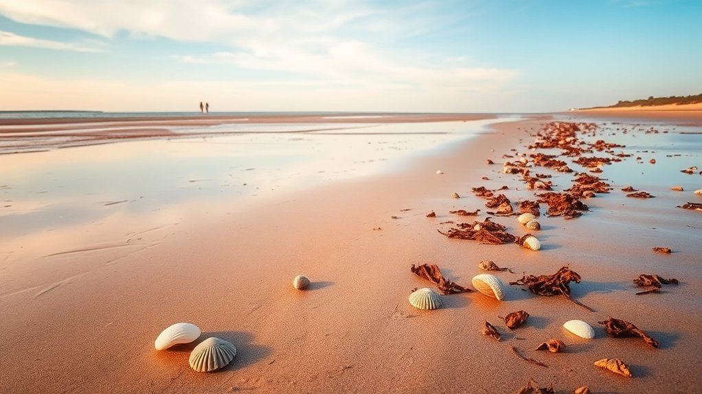
Low tide often exposes wet sand, tide pools, shell fragments, seaweed lines, and shallow bars that are covered at higher water. The evening low at 6:03 PM on July 29 is lower than the morning low and should expose more of the Charlottetown shoreline where public access is permitted.
Walk slowly, check seaweed and drift lines without disturbing wildlife, and leave living animals where you find them. Avoid unstable banks, mud flats, harbour structures, and narrow shorelines where the rising tide could block your return.
Best Low-Tide Times for Beachcombing
A useful beachcombing window often begins before predicted low water and continues for a short time afterward. The exact window depends on the beach slope, tidal range, daylight, weather, and how quickly the return route becomes covered.
- Choose the beach before checking the tide table.
- Find the closest appropriate tide station.
- Check weather, surf, closures, and daylight.
- Arrive early enough to observe the falling water.
- Set a firm turnaround time before the tide begins covering the route.
- Keep children close and stay away from channels with visible flow.
Lowest Tide Windows
On July 29, 2026, the lower of Charlottetown’s two predicted low waters is at 6:03 PM. During the following 30 days, the standout low occurs at 6:28 PM on August 13 at 0.316 m, or about 1.0 ft above chart datum.
A lower prediction may expose more ground, but it can also reveal soft mud, slippery rocks, shell beds, and channels. Wear secure footwear and test the surface before putting your full weight on it.
Pro Tip: Take a screenshot of the tide table and set an alarm for your turnaround time. Mobile service can be inconsistent along parts of the coast, and a rising tide can cover a flat shoreline faster than expected.
Best Beachcombing Beaches
Cavendish Beach and Brackley Beach provide long sandy shorelines, but their conditions should not be estimated from Charlottetown Harbour alone. Use the nearest suitable tide information and review the current PEI National Park beach information for supervision, access, parking, closures, and facilities.
Stay on official paths and boardwalks when crossing coastal areas. Do not climb or walk on protected sand dunes, and follow wildlife-closure signs, including restrictions established to protect nesting piping plovers.
Timing Around Sunrise
Sunrise can provide softer light, cooler air, and fewer visitors, but it is only useful for beachcombing when daylight overlaps with a suitable low-water period. On July 29, the 5:24 AM low falls in the early-morning period, while the lower 6:03 PM tide provides more exposed shoreline later in the day.
Check the day’s exact sunrise and weather before leaving. Bring a flashlight or headlamp when arriving before full daylight, and avoid unfamiliar cliffs, channels, and mud flats in dim conditions.
Best High-Tide Times for Swimming and Boating
Charlottetown’s predicted high waters on July 29 are 12:13 AM at 2.353 m and 10:55 AM at 2.577 m. Higher water may improve depth beside some docks or ramps, but it does not guarantee calm water, weak currents, or safe clearance.
Boaters must consider charted depth, tide height, vessel draft, under-keel clearance, wind, waves, visibility, local traffic, and currents. Tide predictions show vertical water levels; they are not a substitute for a nautical chart, current prediction, marine forecast, or local harbour advice.
Before launching, review Environment and Climate Change Canada’s marine forecasts and warnings. Every person aboard should have a correctly fitted, Canadian-approved lifejacket or personal flotation device. Transport Canada provides current guidance on choosing lifejackets and PFDs.
Pro Tip: If your route passes through a narrow harbour entrance or channel, look for current information rather than assuming the current becomes slack at the published high-water time.
How Weather Changes Charlottetown Beach Conditions
Tide tables predict the astronomical rise and fall of the water. They do not include all effects from wind, atmospheric pressure, waves, rainfall, or storm surge. Actual water levels and shoreline conditions can therefore differ from the table.
| Condition | Possible Effect | What to Check |
|---|---|---|
| Strong onshore wind | Larger waves, rough surf, and water pushed toward shore | Marine warning and beach flags |
| Strong offshore wind | Inflatables, paddleboards, and weak swimmers may drift away from shore | Orange beach flag and local advice |
| Low water temperature | Cold shock, rapid loss of swimming ability, and hypothermia risk | Water temperature and suitable protective gear |
| Fog or heavy rain | Reduced visibility for boats, paddlers, and shore users | Forecast, radar, and visibility report |
| Storm surge | Water may rise above the predicted astronomical tide | Coastal warnings and observed water levels |
| Water-quality advisory | Swimming or wading may be discouraged even during calm conditions | Posted notices and local testing results |
Warning: Do not enter the water during dangerous surf, thunderstorms, poor visibility, a red-flag warning, or a posted water-quality closure, even when the tide time appears favourable.
Best Fishing Windows Around Charlottetown Tides
Tide movement can affect where bait and fish gather, especially around harbour mouths, channels, points, and structures. However, no tide table can promise a “major bite” period. Results depend on the species, season, water temperature, weather, clarity, bait, location, and fishing pressure.
Many shore anglers prefer periods of moving water before or after high or low water. The better stage varies by species and location, so record the tide, wind, catch, and water conditions after each trip instead of relying on a universal formula.
Before fishing, review Fisheries and Oceans Canada’s recreational fishing regulations for Southern Gulf of St. Lawrence species. Seasons, retention limits, gear rules, closed areas, and licensing requirements can differ between species and between tidal and inland waters.
Fish from a stable public area, keep clear of boat traffic, and never stand where a wave or rising tide can cut off your exit. Wear a PFD when fishing from a small craft or exposed shoreline where a fall into deep or cold water is possible.
Why Charlottetown Tides Change So Much
Charlottetown’s tide is driven mainly by the gravitational effects of the moon and sun. The shape of the Gulf of St. Lawrence, Northumberland Strait, Hillsborough Harbour, and local channels changes how those astronomical forces appear at the shoreline.
The pattern is primarily semidiurnal: two high waters and two low waters occur during most lunar days. Successive highs and lows can differ in height, which is why one low tide may expose much more shoreline than the other.
A lunar day lasts about 24 hours and 50 minutes, so corresponding tides usually occur later on each following day. Local geography also means that North Rustico, Cavendish, Brackley, Victoria, and Charlottetown do not share identical times.
Spring tides occur near new and full moons, when the average tidal range becomes larger. Neap tides occur near the first- and third-quarter moons, when the average range becomes smaller. “Spring” refers to the water springing or rising more strongly; it is not limited to the spring season.
Weather can then add another layer. Wind stress, low atmospheric pressure, waves, freshwater runoff, and storm surge may move the observed water level above or below the astronomical prediction.
Frequently Asked Questions
What is the Rule of Twelfths for tides?
The Rule of Twelfths is a rough way to estimate water-level change during a simple six-hour rise or fall. It divides the total change into 1, 2, 3, 3, 2, and 1 twelfths. It works poorly where the tide curve is irregular and should not replace official predictions, charts, current data, or depth measurements.
Does PEI have tides?
Yes. Tides affect the shoreline around Prince Edward Island, but the timing and range vary by location. Use the closest appropriate Canadian Hydrographic Service station rather than applying Charlottetown’s schedule to the entire island.
Where is the best place to see the Bay of Fundy tidal bore?
The Fundy Discovery Site in Lower Truro overlooks the Salmon River, where the incoming Bay of Fundy tide produces a visible bore at predicted times. Parrsboro is excellent for Fundy coastal scenery, but Lower Truro is the clearer choice for viewing the classic Salmon River tidal bore.
What is the smallest tidal range in the world?
There is no universally accepted single location because measurements and definitions differ. Nearly enclosed waters can have extremely small astronomical tides. NOAA notes that the Great Lakes have true astronomical tides of less than five centimetres, although wind and atmospheric pressure can produce much larger water-level changes.
Can I use Charlottetown tide times for Cavendish or Brackley Beach?
Not as an exact substitute. Charlottetown Station 01700 represents the city harbour area. Cavendish and Brackley are on PEI’s north shore, where tide timing, wave exposure, rip-current risk, and local conditions can differ. Check the closest suitable station and the current Parks Canada surf report.
How long before the rising tide should I leave?
There is no universal margin. Leave earlier when walking beneath cliffs, across mud flats, around channels, or along a route with only one exit. Plan your return before low water, observe how quickly the shoreline changes, and turn back immediately if water begins covering the route.
Conclusion
Charlottetown’s tide table is a valuable planning tool, but it is only one part of a safe coastal visit. Confirm the date, time zone, station, and chart-datum height, then check weather, surf, currents, water quality, closures, and daylight.
Use lower water for shoreline exploration only when you have a clear return route. Treat swimming and boating conditions separately from tide height, and use a closer station when visiting Cavendish, Brackley, or another beach outside Charlottetown Harbour. A few minutes of checking official information can prevent a missed activity—or a dangerous situation.
Sources
- Canadian Hydrographic Service — Charlottetown Station 01700 — current seven-day and hourly tide predictions
- Canadian Hydrographic Service — Charlottetown Annual Predictions — 2026 high- and low-water times and heights
- Canadian Hydrographic Service — Tide and Current Definitions — chart datum, tide classifications, tidal currents, spring tides, and prediction limits
- Parks Canada — PEI Water Safety — rip currents, beach flags, tides, water quality, and supervised swimming
- Environment and Climate Change Canada — Marine Forecasts and Warnings — wind, waves, visibility, and marine warnings
- Transport Canada — Choosing Lifejackets and PFDs — approved flotation equipment and boating safety
