

Last Updated on July 28, 2026 by Ethan Caldwell
A scenic route can turn an ordinary road trip into part of the vacation, but the best choice depends on your time, vehicle, season, and tolerance for slower roads. Start with an official scenic-byway directory, compare exact driving times, and verify closures with the agency responsible for the road. Then add overlooks, meals, fuel stops, and a backup route before leaving.
Quick Answer
To find a scenic driving route, search the official America’s Byways directory, park maps, and state scenic-byway programs. Plot the exact road in driving mode, compare its time with the fastest route, and check current closures, weather, vehicle limits, fuel access, and offline navigation before you leave.
Key Takeaways
- Use official scenic-byway, national park, and state transportation websites to find and verify routes.
- Compare the scenic route’s driving time plus planned stops with the fastest available route.
- Do not assume an entire highway, such as US 101 or US 1, is equally scenic from end to end.
- Check seasonal access, construction, weather, and vehicle-size restrictions shortly before departure.
- Download an offline map and identify fuel, food, restrooms, and legal pullouts on remote roads.
- Use interstates as efficient connectors when a full day of slow scenic driving does not fit your schedule.
At a Glance
| Time Required | About 20–45 minutes for basic planning; longer for a multiday trip |
| Difficulty | Easy to moderate |
| Tools Needed | Driving map app, official byway or park map, state DOT road conditions, and an offline or paper backup |
| Cost | Usually $0 for planning; optional app subscriptions, park entry, tolls, fuel, and parking vary |
Disclosure: As an Amazon Associate I earn from qualifying purchases. Some links on this page are affiliate links, at no extra cost to you.
How to Identify Scenic Routes for Driving
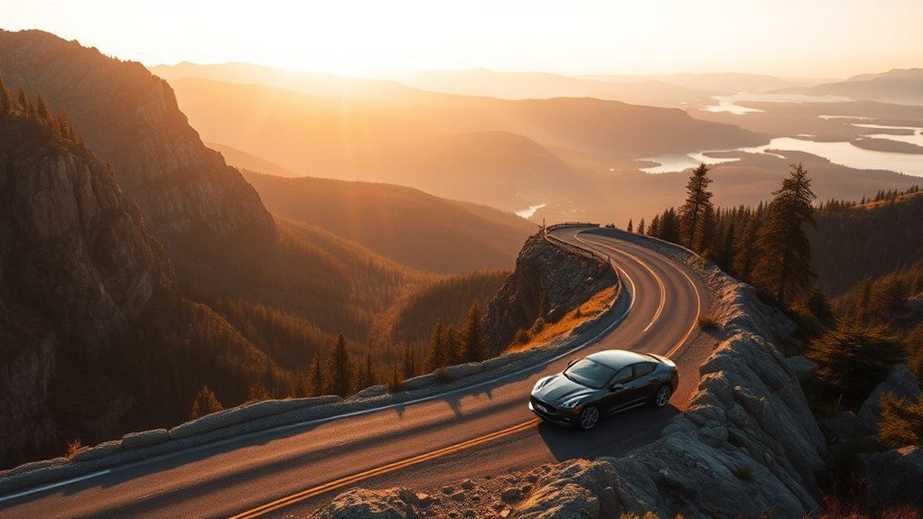
Start by deciding what “scenic” means for your trip. You may want ocean views, mountains, forests, historic towns, desert landscapes, wildlife, or a quiet road with little commercial traffic. That choice helps you avoid adding hours for a route that does not match your interests.
- Set a time budget. Decide how much extra driving and stopping time you can accept. A one-hour detour may work on a relaxed day but not when you have a hotel check-in, ferry, flight, or campground deadline.
- Find recognized scenic roads. Search the Federal Highway Administration’s America’s Byways directory, official national park maps, state scenic-byway programs, and local tourism offices.
- Check the map legend. Paper atlases and travel maps may highlight scenic roads with colors, dotted lines, or special symbols. The marking system varies, so confirm its meaning in that map’s legend.
- Plot exact endpoints. Do not enter only “Highway 101” or “US-1.” Choose the specific junction, town, park entrance, or overlook where the scenic segment begins and ends.
- Compare driving routes. Use driving mode in your navigation app. Compare the fastest route with the scenic option, and add waypoints if needed to keep the route on the road you selected.
- Verify current access. Check the responsible park, forest, county, or state transportation website for closures, construction, restrictions, and weather impacts.
Pro Tip: Plan scenic roads as individual segments instead of trying to make every mile of a long trip scenic. An interstate connector followed by a carefully chosen parkway, coast road, or mountain byway often gives you better views without creating an exhausting schedule.
Best Scenic Routes for a Road Trip
The best scenic route is one that fits your vehicle, season, available time, and interests. Famous roads such as Going-to-the-Sun Road, selected sections of US 101 and California State Route 1, US 1 in Maine, and the Blue Ridge Parkway can be memorable. However, each requires exact segment planning and a current conditions check.
Scenic Byways
Official scenic byways are a dependable place to begin because they have recognized natural, cultural, historic, archaeological, recreational, or scenic qualities. The federal America’s Byways collection includes National Scenic Byways and All-American Roads, while many states maintain additional byway programs.
Examples of well-known scenic drives include:
- Going-to-the-Sun Road in Glacier National Park: The full road is about 50 miles long and crosses mountain terrain around Logan Pass. It is seasonal, and the central section has strict vehicle-size limits. Check the official Glacier National Park road information before planning the drive.
- California State Route 1 through Big Sur: This coast road offers cliffs, ocean views, bridges, and access to state parks. Landslides, maintenance, and construction can create closures or one-way traffic, so verify the exact section through Caltrans Highway Conditions.
- Selected US 101 coastal sections: US 101 covers a long corridor. Some portions provide direct access to beaches, redwood areas, and coastal towns, while others function as ordinary highways. Choose a defined segment rather than treating the entire highway as one scenic drive.
- US 1 in Maine: Selected stretches and side roads can connect travelers with coastal towns, harbors, lighthouses, and access points for Acadia-area drives. The highway does not remain beside the visible shoreline for its entire length, so identify the exact towns and stops you want.
- Blue Ridge Parkway: This slow-paced park road is known for mountain overlooks, spring growth, and fall color. Weather, construction, and storm damage can close individual segments. Review the current Blue Ridge Parkway road status before setting your route.
- Skyline Drive: This drive through Shenandoah National Park provides mountain overlooks and trail access. Park entrance fees, weather, traffic, and wildlife can affect travel time.
Route Planning Tips
Build the route around specific roads and stops instead of relying on a navigation app to invent a scenic itinerary. A practical plan should include the following:
- Start and finish points: Record the junctions or towns where you enter and leave the scenic road.
- Estimated driving time: Compare the scenic route with the fastest route at the time of day you expect to travel.
- Stop time: Add time for overlooks, trailheads, meals, parking, restrooms, and photographs.
- Operating hours: Check visitor centers, gated roads, ferries, park entrances, and seasonal facilities.
- Road suitability: Confirm pavement, width, grades, low clearances, and vehicle restrictions.
- Backup route: Save an alternative in case of a closure, storm, heavy traffic, or full parking area.
Roadtrippers and similar commercial trip-planning tools can help organize attractions and estimate detours. Use them for ideas, but confirm road access with an official agency source.
Must-See Drives
Some drives can become a main part of the trip rather than a simple route between destinations. These popular options cover different landscapes:
- Going-to-the-Sun Road in Glacier National Park: A roughly 50-mile mountain drive with alpine views, wildlife habitat, sharp curves, and limited parking. Check opening status and vehicle restrictions first.
- US 101 and California State Route 1: Select a defined stretch for beaches, redwoods, cliffs, or coastal towns. Do not assume the entire corridor has the same scenery or road conditions.
- US 1 in Maine: Plan stops in the coastal towns and lighthouse areas that interest you, and include side roads when the main highway moves inland.
- Blue Ridge Parkway or Skyline Drive: Allow extra time for overlooks, slower speed limits, wildlife, trail traffic, and seasonal color.
If Big Sur is on your list, check California State Route 1 conditions shortly before departure. Start early when possible, carry water and snacks, and stop only in legal parking areas or designated pullouts.
Warning: Never stop in a traffic lane or on a narrow shoulder for a photograph. Continue to a designated overlook, parking area, or safe legal turnout. Follow posted signs even when your navigation app gives different instructions.
Compare Scenery and Drive Time
Compare the scenic route with the fastest route before committing to it. The true time difference includes more than the ETA shown in an app.
Total scenic-route time = driving ETA + planned stops + a reasonable delay buffer.
For example, a route that adds 45 minutes of driving may add two hours to the day after an overlook, lunch, parking search, and short trail are included. That may be worthwhile when the drive is a main attraction, but it can create stress when you have a fixed arrival time.
| Route Type | Typical Appeal | Possible Time Impact | Check Before Choosing |
|---|---|---|---|
| Coastal highway | Ocean views, beaches, cliffs, and towns | Slower traffic and frequent stops | Landslides, fog, construction, and parking |
| Park road | Overlooks, wildlife, trails, and protected landscapes | Often much slower than direct travel | Seasonal gates, entry rules, parking, and vehicle limits |
| Mountain byway | High passes, forests, valleys, and overlooks | Curves and grades may reduce average speed | Snow, storms, steep grades, and size restrictions |
| Interstate stretch | Efficient connections with occasional broad views | Often faster, but traffic can erase the advantage | Live traffic, work zones, tolls, and weather |
| Local scenic detour | Small towns, farms, historic sites, and local food | Can add a little or a lot depending on stops | Road surface, services, and local restrictions |
The best scenic route is not the road with the most viewpoints. It is the road you can enjoy safely without rushing to the next destination.
When Interstates Make More Sense
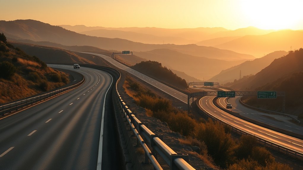
Interstates make sense when arrival time, predictable navigation, and access to major services matter more than a full day of sightseeing. They often provide a more direct connection between distant regions, but they are not automatically faster in every situation. Compare current ETAs and road conditions before deciding.
Interstates are most useful as efficient connectors when a slower scenic road does not fit your schedule, vehicle, or current conditions.
- Protect a fixed arrival time: Choose the more direct route when you must reach a flight, ferry, reservation, event, or campground before a deadline.
- Reduce night driving on unfamiliar roads: A winding scenic route may be less enjoyable after dark, especially in fog, rain, snow, or wildlife areas.
- Reach services more easily: Major highways may provide more frequent fuel, food, lodging, rest areas, repair shops, or EV charging, although availability still needs to be checked.
- Avoid unsuitable terrain: An interstate may be the better option for a large RV, trailer, low-clearance vehicle, or driver who is uncomfortable with narrow mountain roads.
- Combine speed and scenery: Use the interstate for the long connection, then exit for one carefully chosen coastal, park, mountain, or historic segment.
Note: “Avoid highways” is a route preference, not a guarantee. A navigation app may still use a highway when alternatives are impractical, and a non-highway route may include slow town traffic, stoplights, narrow roads, or seasonal closures.
Tools to Confirm Your Route
Use more than one tool because each answers a different question. A navigation app can estimate time, but the agency responsible for the road is the better source for closures, legal restrictions, and current access.
| Tool | Best Use | Important Limitation |
|---|---|---|
| America’s Byways | Finding federally designated scenic and historic roads | A byway listing does not confirm today’s road conditions |
| Google Maps driving mode | Comparing routes, adding stops, checking estimated time, and avoiding highways or tolls | It does not have a universal scenic-route setting |
| State DOT or 511 service | Closures, incidents, construction, cameras, and road conditions | Coverage and update detail vary by state |
| Official park website | Seasonal gates, entrance rules, parking, shuttles, and vehicle restrictions | Conditions can still change after you check |
| Google Earth or terrain view | Previewing terrain, nearby development, and the general character of the area | Do not use imagery to determine legal access or safe vehicle clearance |
| Offline map or paper map | Backup navigation in areas with weak cellular service | Offline navigation may not include live traffic or new alternate routes |
How to Use Google Maps for a Scenic Drive
- Open driving directions, not the bicycling layer.
- Enter your starting point and final destination.
- Compare the alternate routes displayed on the map.
- Open route options and select Avoid highways when that supports your plan.
- Add towns, overlooks, park entrances, or junctions as stops to keep the route on the scenic road.
- On a computer, adjust the route when appropriate by dragging it through the desired road.
- Compare the new ETA with the fastest route and add time for stops.
Google’s official driving-directions instructions explain alternate routes, added destinations, route options, and highway avoidance. These features help shape a route, but you must first identify the scenic road through a byway, park, or local source.
Note: Download the full travel area before entering a remote region. Google Maps can provide offline driving guidance when the route is covered by the downloaded map, but live traffic and alternate routes may not be available offline. Review Google’s offline map instructions before departure.
Plan Stops Along the Way
Scenic stops make a road trip more rewarding, but too many can turn an easy day into a rushed one. Choose a few priorities, estimate how long each stop will take, and keep one or two optional locations that you can skip if traffic or weather slows the trip.
Scenic Stop Priorities
Plan stops around your strongest interests, whether that means a national park, historic site, beach, short trail, local restaurant, or viewpoint. Use maps and trip-planning tools to find possibilities, then verify parking, hours, fees, and access through the attraction’s official website.
- Match the stop to your energy. Choose a short overlook when you need a quick break or a trail and visitor center when you have more time.
- Check seasonal conditions. Wildflowers, foliage, snow, heat, fog, and wildfire smoke can change the experience.
- Ask for local context. Visitor centers, lodging staff, park rangers, and local tourism offices may know which legal pullouts or side roads fit your schedule.
- Build in parking time. A popular overlook may require waiting, using a shuttle, or continuing to another stop.
- Separate priorities from options. Mark two or three must-see stops and treat the rest as optional.
Timing Breaks Smartly
A break about every two hours can be a useful planning rhythm for many travelers, but it is not a safety guarantee. Stop sooner when you feel tired, stiff, distracted, hungry, or unable to maintain focus. For longer trips, plan enough time to stretch, eat, change drivers, and rest, as recommended in the National Highway Traffic Safety Administration’s road-trip guidance.
| Stop Type | Useful Timing | Benefit |
|---|---|---|
| Scenic viewpoint | When lighting and legal parking are favorable | Provides a short mental reset and a clear view |
| Meal stop | Before hunger affects concentration | Supports comfort and avoids rushed food choices |
| Park or short trail | During a planned longer break | Lets you move, stretch, and spend time outside |
| Rest or driver change | Immediately when alertness begins to fall | Reduces the risk of continuing while drowsy |
| Popular attraction | Early or outside the busiest period when possible | May reduce parking delays and crowds |
Warning: Do not wait for the next planned stop if you become drowsy. Leave the road at a safe location and rest or change drivers. Coffee, open windows, loud music, and cold air are not substitutes for adequate sleep.
Check Weather, Closures, and Vehicle Limits
A route shown in a map app may still be closed, restricted, or unsuitable for your vehicle. Complete a final conditions check the evening before departure and again shortly before entering the scenic road.
- Road closures: Review the park, forest, county, or state DOT page responsible for the exact segment.
- Weather: Check for snow, ice, fog, high winds, heavy rain, flooding, extreme heat, and thunderstorms.
- Wildfire and smoke: Confirm evacuation restrictions, fire closures, and visibility before entering an affected area.
- Vehicle dimensions: Compare your total vehicle or vehicle-and-trailer length, width, and height with posted limits.
- Road design: Look for steep grades, narrow lanes, sharp curves, low clearances, unpaved sections, and limited turnaround space.
- Seasonal services: Fuel stations, restrooms, visitor centers, food concessions, and campgrounds may close even when part of the road remains open.
- Entry systems: Check whether the park or attraction requires an entrance pass, timed entry, shuttle, parking reservation, or separate activity permit.
Going-to-the-Sun Road illustrates why this step matters. Even when the full road is open, the restricted central section does not allow vehicles or vehicle combinations longer than 21 feet or wider than 8 feet. Other scenic roads have different rules, so never copy a restriction from one road to another.
Prepare for Remote Scenic Roads
Some scenic roads have weak cellular service, long gaps between businesses, limited shoulders, and few places to turn around. A small amount of preparation can prevent a beautiful detour from becoming stressful.
- Start with enough fuel or battery range to reach the next confirmed service point with a reserve.
- Check EV charging compatibility, operating hours, and recent station status before relying on a remote charger.
- Download an offline map that covers the entire scenic segment and the backup route.
- Save screenshots or written notes showing important junctions, road numbers, and addresses.
- Carry drinking water, food, essential medication, a phone charger, and clothing suitable for changing weather.
- Check tire pressure, visible tire condition, lights, windshield wipers, and fluid levels before a long drive.
- Tell someone your route when traveling through a remote area with limited reception.
- Keep enough daylight for narrow, unfamiliar, or wildlife-heavy roads whenever possible.
Pro Tip: Save the official road-condition page as well as the navigation route. The map helps you find the road; the agency page helps you decide whether you should drive it.
Frequently Asked Questions
What does it mean to optimize a road-trip route?
Route optimization means choosing a path that balances your priorities, such as travel time, scenery, safety, fuel use, road conditions, vehicle suitability, and planned stops. The optimized route is not always the shortest or fastest route.
What does route mean?
A route is the path you follow between a starting point and a destination. It can include several roads, stops, detours, park entrances, ferries, or waypoints.
What is an optimal scenic route?
An optimal scenic route provides the views and stops you value without creating unsafe driving, missed reservations, excessive fatigue, or a route that is unsuitable for your vehicle. It should also have a practical backup.
How do I turn on preferred routes in Google Maps?
Open driving directions, enter your start and destination, and review the alternate routes. Open route options to avoid highways or tolls when needed. You can also add stops, and on a computer you may be able to drag the route through a specific road. Do not select the bicycling layer for a car trip.
Does Google Maps have a scenic-route option?
Google Maps does not provide a universal scenic-driving button. Find the scenic road through an official byway directory, park map, or local source, and then use added stops or route adjustments to guide the trip along that road.
How much extra time should I allow for a scenic route?
There is no fixed percentage. Subtract the fastest-route ETA from the scenic-route ETA, then add realistic time for overlooks, meals, parking, trails, traffic, and a delay buffer. Allow more time on mountain and park roads.
Should I download an offline map for a scenic drive?
Yes, especially for mountain, desert, forest, and national park routes. Make sure the download covers the entire scenic segment and backup route. Remember that live traffic and alternate-route updates may be unavailable offline.
Can I take an RV or trailer on any scenic road?
No. Scenic roads may have length, width, height, weight, tunnel, grade, or trailer restrictions. Check the official road page using the full dimensions of the vehicle and anything being towed.
Conclusion
Before you leave, confirm the exact scenic segment with a driving map, the road’s official conditions page, and a weather check. Scenic roads can add views, memorable stops, curves, limited services, and significant travel time. Choose a route that fits your schedule and vehicle, download a backup map, stop only in safe legal areas, and switch to a faster route when conditions no longer support the original plan.
Sources
- Federal Highway Administration — America’s Byways — official directory and designation criteria for National Scenic Byways and All-American Roads.
- Glacier National Park — Going-to-the-Sun Road Information — seasonal access, road status, and vehicle restrictions.
- Blue Ridge Parkway — Road Status and Closures — current open, closed, and restricted parkway segments.
- Caltrans — California State Route 1 Conditions — current closures, construction controls, and reported delays.
- National Highway Traffic Safety Administration — Road Trip Safety — vehicle preparation, rest planning, and safe driving guidance.
- Google Maps Help — Driving Directions and Offline Maps — route alternatives, added stops, highway avoidance, downloads, and offline limitations.

