
Last Updated on September 10, 2026 by Daniel Globe
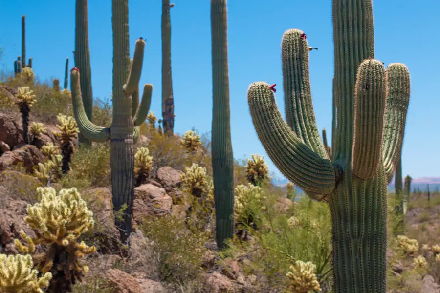
Saguaro National Park surrounds Tucson, Arizona, with two separate districts: the Tucson Mountain District (west) and the Rincon Mountain District (east). Together they protect roughly 92,000 acres of Sonoran Desert and mountain habitat, with more than 150 miles of designated trails. The park is famous for giant saguaros, but the best hike depends on whether you want an easy paved walk, a family outing, a sunset viewpoint, birding, or a strenuous climb into the Rincon Mountains.
Quick Answer
For an easy first hike, choose the 0.5-mile Desert Discovery Trail or 0.8-mile Valley View Overlook Trail. Families and accessibility-focused visitors should consider Mica View. Experienced hikers can climb Tanque Verde Ridge or hike from King Canyon toward Wasson Peak. Signal Hill is the standout short walk for petroglyphs and desert views.
Key Takeaways
- Best beginner hike: Valley View Overlook is an easy 0.8-mile round trip in the west district with a rewarding ridge view.
- Best paved nature walk: Desert Discovery is a 0.5-mile accessible loop with interpretive signs, benches, and shade structures.
- Best challenging route: Tanque Verde Ridge can be as short or long as your fitness and weather allow; Tanque Verde Peak is 8.7 miles one way from the trailhead.
- Best family options: Desert Discovery, Freeman Homestead, Mica View, and Valley View all provide short ways to experience the cactus forest.
- Best cultural stop: Signal Hill’s 0.5-mile petroglyph trail combines rock art with a short desert walk.
- Best birding strategy: Walk slowly through cactus forest and wash habitat early in the day, especially on Cactus Wren Trail or easy east-district routes.
- Most important safety rule: Carry ample water, avoid the hottest summer hours, and watch weather closely during monsoon season.
- Plan by district: The west district excels at short cactus-and-view hikes, while the east district offers both easy walks and longer routes climbing into the Rincon Mountains.
Disclosure: As an Amazon Associate I earn from qualifying purchases. Some links on this page are affiliate links, at no extra cost to you.
Choosing Between the East and West Districts
The two districts sit on opposite sides of Tucson, so it helps to choose your hiking area before you drive across town. The Tucson Mountain District (west) is a strong choice for short hikes among dense stands of saguaros, petroglyphs, sunset views, and routes toward Wasson Peak. The Rincon Mountain District (east) has easy cactus-forest walks near the scenic drive as well as long trails that climb from desert scrub into higher-elevation woodland and mountain environments.
The National Park Service currently describes Saguaro National Park as having more than 150 miles of designated trails, ranging from short paved walks to wilderness routes.
Pro Tip: Check the current Saguaro National Park conditions and the official park maps before leaving Tucson. Road, trail, fire, storm, and maintenance conditions can change.
The Best Hiking Trails for Beginners
Saguaro National Park has several short trails that give first-time desert hikers a rewarding experience without requiring an all-day outing. Even easy trails can feel harder in high heat, so distance is only one part of choosing the right route.
Desert Discovery Trail
The Desert Discovery Trail in the Tucson Mountain District is an easy, paved 0.5-mile loop. Interpretive signs introduce Sonoran Desert plants, wildlife, and ecology, while benches and shade structures make it one of the park’s most comfortable short walks. It is also accessible to wheelchairs and allows leashed pets.
Valley View Overlook Nature Trail
The Valley View Overlook Nature Trail is an easy 0.8-mile round trip from the Bajada Loop Scenic Drive. The path dips through a couple of washes, then climbs gradually to a ridge with benches and broad views over Avra Valley. The trail has some rougher footing and rock steps, so it is less uniformly smooth than Desert Discovery.
Freeman Homestead Trail
The Freeman Homestead Trail in the Rincon Mountain District is a 1-mile route, not a 1.5-mile loop. It leads to the site of an old homestead foundation and passes mature saguaros, desert wash habitat, and interpretive signs about local history and plant life. The National Park Service specifically highlights the trail’s exploration activities for younger visitors.
Mica View Trail
The Mica View Trail is 0.7 mile one way between the Mica View Picnic Area and Broadway Trailhead. It is wide, paved, and designed to accessibility standards, with close-up views of saguaros and Mica Mountain. Hikers often use it as an out-and-back or combine it with nearby trails for a longer loop.
The Most Challenging Hiking Trails for Experienced Hikers
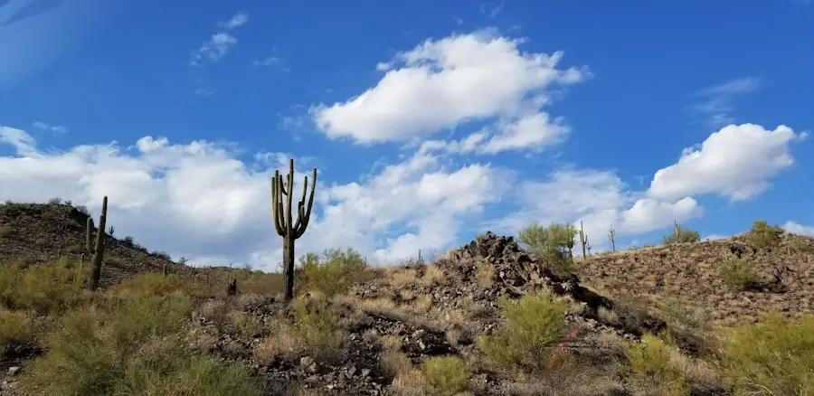
Longer hikes in Saguaro National Park add heat exposure, elevation gain, rough footing, and in some cases remote backcountry travel. Experienced hikers should choose a turnaround point before starting and be willing to shorten the route if water, weather, or pace becomes a problem.
Tanque Verde Ridge Trail
The Tanque Verde Ridge Trail begins at Javelina Picnic Area in the east district and extends about 11 miles to Cow Head Saddle Trail. You do not have to hike the entire route. The National Park Service notes viewpoints within the first mile, a crested saguaro around mile 2.5, Juniper Basin Campground at about 6.9 miles, and Tanque Verde Peak at about 8.7 miles one way. Reaching Tanque Verde Peak involves roughly 4,000 feet of climbing and is a strenuous undertaking.
King Canyon Trail and Wasson Peak
King Canyon is a flexible west-district option because hikers can choose a shorter loop or continue toward Wasson Peak. The National Park Service lists the King Canyon/Gould Mine Loop at about 2.4 miles with 380 feet of elevation change. From the King Canyon Trailhead, the route toward Wasson Peak is about 3.5 miles one way, making a summit outing roughly 7 miles round trip before accounting for any side trips. Rocky sections, sun exposure, and the sustained climb make the summit version much harder than the short loop.
Douglas Spring and Backcountry Routes
The Douglas Spring Trailhead provides access to a large east-district trail network and the Saguaro Wilderness. The official wilderness guidance places Douglas Spring Campground about 6.5 miles from the trailhead with roughly 1,800 feet of elevation gain. Shorter loops such as the NPS-recommended Garwood Dam and Wildhorse Tank route can still be demanding because of rocky grades, wash crossings, and exposure.
Warning: In hot, dry summer conditions, the National Park Service advises about 1 quart of water per hour of hiking and recommends avoiding the hottest part of the day, roughly 10 a.m. to 4 p.m. Carry electrolytes or salty food as appropriate, turn around before half your water is gone, and never assume a backcountry water source will be available.
Family-Friendly Hiking Trails
| Trail Name | Location | Trail Length | Difficulty Level |
|---|---|---|---|
| Desert Discovery Trail | Tucson Mountain District (west) | 0.5-mile loop | Easy, paved, accessible |
| Valley View Overlook | Tucson Mountain District (west) | 0.8 mile round trip | Easy, some rough footing |
| Freeman Homestead Trail | Rincon Mountain District (east) | 1 mile | Easy |
| Mica View Trail | Rincon Mountain District (east) | 0.7 mile one way | Easy, paved, accessible |
Families can also use the scenic drives to break up the day with short walks. The Bajada Loop Drive in the west district connects several trailheads and viewpoints, while the Cactus Forest Loop Drive in the east district provides access to Mica View, Freeman Homestead, and Tanque Verde Ridge.
Be careful with the name Cactus Forest Loop. The Cactus Forest Loop Drive is an 8-mile scenic road, while the Cactus Forest Trail is a separate 2.5-mile one-way multi-use trail. For a family-friendly hike of about 2 miles, the National Park Service notes that Mica View can be combined with Cactus Forest Trail and Mica View South to form a loop.
Note: Pets are prohibited on most park trails. The park lists only a small number of dog-friendly routes, including Desert Discovery, Mica View, Desert Ecology Trail, and certain roads. Dogs must remain on a leash no longer than 6 feet.
Hiking Trails with the Best Views
You do not need a long summit hike to get a memorable panorama in Saguaro National Park. Several short trails reach open ridges or rocky overlooks, while experienced hikers can climb higher for broader views.
Signal Hill Petroglyphs Trail
The Signal Hill Petroglyphs Trail is about 0.5 mile and climbs a small rocky hill in the west district. The destination is one of the park’s best-known concentrations of petroglyphs, with desert views along the way. The trail is short, but it includes rocky and uneven sections and is not an ADA-accessible route.
Valley View Overlook
Valley View earns its name at the end of a 0.8-mile round trip. From the ridge, hikers can look over Avra Valley and toward surrounding desert landmarks. It is one of the best effort-to-view ratios in the park.
Tanque Verde Ridge Overlooks
For east-district sunset views, Tanque Verde Ridge offers a useful choose-your-own-distance option. The National Park Service highlights rocky viewpoints roughly 0.25 mile and 0.75 mile from the trailhead. The farther you climb, the more demanding the route becomes, so a sunset outing should leave enough daylight and time for a safe return.
Ridgeview Trail and Rincon Peak Views
Rincon Peak rises to 8,482 feet, but reaching its summit is a serious backcountry objective rather than a simple 10-mile tourist hike. For a much more manageable view of the mountain, the Ridgeview Trail in the Rincon Valley area is about 2.2 miles out and back and climbs to views of side canyons and Rincon Peak.
Hiking Trails for Bird Watching
Diverse Habitats and Bird Species
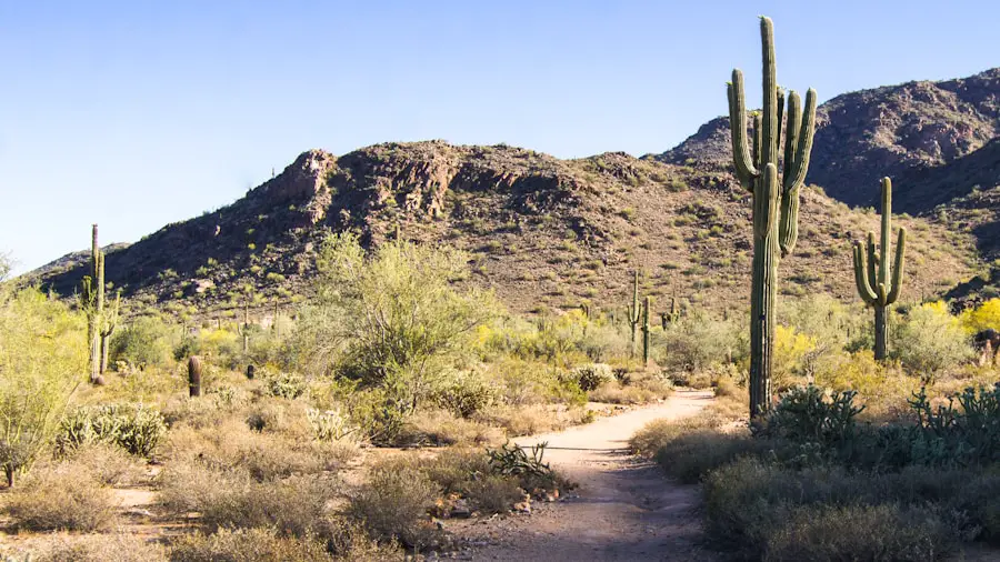
Saguaro National Park’s bird life changes with habitat and elevation. Cactus forest supports cavity-nesting species that use saguaros, while washes, foothills, and the higher Rincon Mountains attract a different mix of resident and migratory birds. The National Park Service notes species such as hooded orioles, painted redstarts, hepatic tanagers, zone-tailed hawks, elf owls, purple martins, and ash-throated flycatchers in or around suitable park habitats.
Trails for Bird Watching
The Cactus Wren Trail in the west district runs about 1.8 miles from Access Point 3 to Signal Hill and passes large saguaros and other desert vegetation. The park describes it as a good wildlife-viewing route. Easier options such as Desert Discovery and Mica View also let birders move slowly through cactus habitat without committing to a long hike.
In the east district, use the Rincon Valley area rather than looking for a single official trail called “Rincon Valley Trail.” Hope Camp, Ridgeview, and the Ruiz/North Coyote Wash loop cross desert, wash, and foothill habitat. Gambel’s quail and Harris’s hawk are among species documented in park bird records. Elegant trogon has also been documented in the Rincon Mountain District, but it is not a bird visitors should expect to see on a routine low-desert hike.
Connecting with Nature
Birding is usually best when you walk quietly, pause often, and scan both cactus tops and shaded vegetation. Early morning typically provides cooler conditions and more bird activity. Keep a respectful distance from nests and wildlife, stay on designated routes where required, and avoid disturbing animals for a closer photograph.
Tips for Hiking in Saguaro National Park
Carry Enough Water and Manage Heat
Desert heat is the park’s most important hiking hazard. The National Park Service hiking-safety guidance recommends about 1 quart of water per hour of hiking on hot, dry summer days. Drink before you feel thirsty, carry electrolyte replacement or salty snacks for longer hot-weather outings, rest often, and turn back while you still have a safe water reserve.
Lightweight sun-protective clothing, a wide-brimmed hat, sunscreen, and sturdy closed-toe footwear are practical choices. In summer, the park recommends avoiding the hottest period from about 10 a.m. to 4 p.m.; start early or hike near sunset instead.
Watch for Monsoon Storms, Flash Floods, and Lightning
Arizona’s monsoon season officially runs from June 15 through September 30. Afternoon thunderstorms can produce lightning and fast-moving water in washes and canyons. Do not enter or remain in a wash when thunderstorms are nearby, even if the ground where you are standing is dry. If water is flowing across a road, do not drive through it.
Give Cacti and Wildlife Space
Cholla segments can detach and embed in skin, clothing, or footwear, so avoid brushing against desert plants. Rattlesnakes use shade and rock crevices, especially in warm weather; do not place hands or feet where you cannot see. Never approach or feed wildlife. For more general background on snake movement, see how far snakes travel in a day.
Carry a Map and Share Your Plan
Take an official park map, know your intended route and turnaround point, and leave your itinerary with someone who is not hiking with you. Cell service is not dependable on every route. For wilderness trips, do not rely on springs or seasonal pools unless current park information confirms water availability and you have a safe treatment plan.
Check Pet, Camping, and Trail Rules
Most hiking trails do not allow pets. Backcountry camping requires a reservation and permit, and hiking regulations limit on-trail groups to 18 people. Before a long hike, review the park’s current rules and any temporary closures.
Pro Tip: Ranger-led walks and guided hikes are offered seasonally in both districts. Check the official park calendar close to your visit rather than assuming a particular tour runs every day or year-round.
Must-See Hiking Trails in Saguaro National Park
For a first visit, the best short-hike combination is hard to beat: Desert Discovery for an accessible introduction, Valley View for a quick panorama, Signal Hill for petroglyphs, Freeman Homestead for history, and Mica View for an easy east-district cactus walk. These routes cover much of what makes Saguaro special without requiring a major backcountry commitment.
Hikers who want more challenge can choose the 2.4-mile King Canyon/Gould Mine Loop, continue from King Canyon toward Wasson Peak, explore the Douglas Spring network, or climb as far as conditions allow on Tanque Verde Ridge. Bird watchers can slow the pace on Cactus Wren Trail, Mica View, or other cactus-forest routes and listen for desert species.
The most important planning step is to match the trail to the day’s heat, storms, water supply, and your group’s ability. Saguaro’s trail network is broad enough that turning a strenuous plan into a short scenic walk is often the smartest way to preserve a good day in the desert.
Frequently Asked Questions
What are the best hiking trails in Saguaro National Park?
Top choices include Valley View Overlook and Desert Discovery for short hikes, Freeman Homestead and Mica View for easy east-district walks, King Canyon/Gould Mine for a moderate outing, Wasson Peak via King Canyon for a harder west-district hike, and Tanque Verde Ridge for a strenuous east-district climb. Douglas Spring also provides access to excellent longer routes.
What is the difficulty level of the hiking trails in Saguaro National Park?
Difficulty ranges from paved, accessible walks under a mile to long wilderness routes with thousands of feet of climbing. Heat can make even an easy trail strenuous, so judge difficulty by distance, elevation, surface, temperature, sun exposure, and your water supply.
Are there guided hiking tours available in Saguaro National Park?
Yes. Both districts offer ranger programs that can include short walks and guided hikes, but schedules change by season. Check the National Park Service calendar for the dates of your visit.
What should I bring with me when hiking in Saguaro National Park?
Bring ample water, salty snacks or electrolytes for longer hot-weather hikes, sun protection, sturdy closed-toe footwear, an official map, and a charged phone. For longer or remote routes, add navigation tools, emergency supplies, and enough water to remain self-sufficient.
Are there any safety tips I should be aware of when hiking in Saguaro National Park?
Avoid the hottest summer hours, drink regularly, check the forecast, stay out of washes when storms threaten, give wildlife and cacti space, carry a map, and tell someone your route and return time. Turn back early if anyone is overheating, running low on water, or moving slower than planned.
Which side of Saguaro National Park is better for hiking?
The west district is especially convenient for short cactus-forest hikes, petroglyphs, viewpoints, and Wasson Peak. The east district offers easy walks near the scenic drive plus much longer routes into the Rincon Mountains. Choose based on the trails you want rather than trying to see both districts in a rushed visit.
Can I bring my dog on Saguaro National Park hiking trails?
Only on designated pet-friendly routes. Most trails prohibit pets. Dog-friendly options include Desert Discovery, Mica View, Desert Ecology Trail, and certain park roads. Keep your dog on a leash no longer than 6 feet and protect paws from hot surfaces and cactus spines.
When is the best time to hike in Saguaro National Park?
Cooler months generally provide more comfortable daytime hiking. In late spring and summer, start very early or near sunset and avoid the hottest part of the day. During monsoon season, check the forecast carefully because afternoon thunderstorms can bring lightning and flash floods.
Sources
- National Park Service — Hiking Trail Recommendations — official trail distances, routes, and elevation information.
- National Park Service — Hiking Safety Information — water, heat, storms, flash floods, wildlife, and emergency guidance.
- National Park Service — Accessibility — accessible trail lengths and visitor-access information.
- National Park Service — Current Conditions — current road, trail, water, and project information.
- National Park Service — Pets — dog-friendly routes, leash rules, and desert pet safety.
- National Park Service — Neotropical Migratory Birds — bird habitats and species documented in the park.
