

Last Updated on September 10, 2026 by Daniel Globe
Hiking trails range from short, well-maintained paths to demanding backcountry routes that require navigation skills, careful planning, and strong fitness. The right trail can offer exercise, scenery, wildlife viewing, and time in nature, but the experience depends heavily on choosing a route that matches your abilities and the current conditions. Nature exposure may also support stress reduction and mental well-being, although benefits vary from person to person.
Quick Answer
Hiking trails range from short, maintained paths to remote, strenuous routes. Choose a trail by checking distance, elevation gain, terrain, weather, daylight, closures, and your group’s ability. Bring essential safety gear, carry or safely treat water, respect wildlife, and leave a trip plan with someone before heading into remote areas.
Key Takeaways
- Hiking trails vary greatly in distance, elevation gain, terrain, exposure, navigation demands, and overall difficulty.
- Choose a trail that fits the ability of the least-experienced person in your group rather than relying only on an “easy,” “moderate,” or “difficult” label.
- Check official trail conditions, weather, closures, permits, daylight, and wildlife notices before leaving.
- Carry appropriate safety gear, food, water, navigation tools, layers, illumination, first aid, and emergency supplies.
- Observe wildlife from a safe distance, stay on appropriate surfaces, pack out waste, and follow local regulations.
Disclosure: As an Amazon Associate I earn from qualifying purchases. Some links on this page are affiliate links, at no extra cost to you.
Difficulty Levels of Hiking Trails
Hiking trails are commonly described as easy, moderate, difficult, strenuous, or similar terms. These labels can help narrow your choices, but they are not universal. Different parks and trail systems use different criteria, so an “easy” trail in one location may be noticeably harder than an “easy” trail somewhere else.
Easy trails are often shorter, smoother, and relatively level. They may suit beginners, families, or hikers looking for a relaxed outing. More difficult trails can involve substantial elevation gain, steep grades, loose rock, roots, scrambling, stream crossings, exposure to heights, limited signage, or long distances from roads and emergency help.
For example, Shenandoah National Park uses a rating system that considers distance and elevation gain, while also warning hikers that a mathematical rating cannot capture every terrain-related challenge. The safest approach is to look beyond the label and read the actual trail details.
How to Choose the Right Hiking Trail
Before choosing a route, compare these factors with your recent hiking experience:
- Total distance: Confirm whether the published mileage is one-way, round trip, a loop, or point-to-point.
- Elevation gain: A short trail with a steep climb may be harder than a much longer, nearly flat trail.
- Terrain: Rock, sand, mud, roots, snow, ice, stream crossings, and scrambling can slow your pace and increase risk.
- Route type: Out-and-back trails offer an obvious turnaround option. Point-to-point trails may require a shuttle or second vehicle.
- Highest elevation: Higher elevations may bring colder temperatures, stronger winds, lingering snow, and altitude-related difficulty.
- Exposure: Narrow ledges, steep drop-offs, or open ridges can make a route inappropriate for some hikers.
- Navigation: Some trails are heavily marked; others require map, compass, or GPS skills.
- Current conditions: Rain, snow, wildfire, flooding, fallen trees, extreme heat, or temporary closures can dramatically change a trail.
- Daylight: Allow enough time to return before dark and still carry a headlamp in case the hike takes longer than expected.
- Group ability: Plan around the least-experienced or slowest member rather than the strongest hiker.
Pro Tip: When trying a new difficulty level, increase one major challenge at a time. For example, choose a longer trail with familiar terrain before combining extra distance, steep climbing, rough footing, and difficult navigation in a single trip.
Some famous trails require additional preparation. The Half Dome route in Yosemite National Park includes a steep cable-assisted section and is much more demanding than an ordinary maintained hiking path. A Half Dome permit is required when the cables are up, so hikers must check current rules and conditions before attempting the route.
Scenic Views and Landscapes

One of the main reasons people explore hiking trails is to experience landscapes that may be difficult to reach by road. Trails can pass through forests, alpine meadows, deserts, wetlands, river valleys, coastlines, canyons, and mountain environments. Even short hikes can lead to viewpoints, waterfalls, rock formations, or quiet natural areas away from busy roads.
The Appalachian Trail is one of the best-known examples. The official Appalachian Trail length for 2026 is 2,197.9 miles, running through 14 states from Georgia to Maine. Its exact mileage changes slightly as trail sections are relocated, measured, or rerouted.
The Pacific Crest Trail offers another dramatic range of landscapes, including desert environments, the Sierra Nevada, forests, and volcanic peaks of the Cascade Range. The Pacific Crest Trail Association still commonly describes the route as about 2,650 miles, while its January 2026 mapping data gives a current best estimate of approximately 2,655.84 miles.
You do not need to complete a famous long-distance trail to enjoy its scenery. Both the Appalachian Trail and Pacific Crest Trail can be explored through shorter day hikes and section hikes. For most people, choosing a manageable section provides a safer and more enjoyable way to experience these landscapes.
Wildlife and Nature Encounters
| Location | Wildlife You May Encounter | Important Consideration |
|---|---|---|
| Yellowstone National Park | Bison, elk, bears, wolves, coyotes, deer, birds, and smaller mammals | Wildlife is wild and potentially dangerous; follow National Park Service distance rules and never approach animals. |
| Amazon Rainforest | Wildlife varies greatly by country, habitat, season, and specific protected area | Use established routes and follow local park or guide instructions, especially in remote areas. |
| African Safari Areas | Species vary widely by reserve, national park, and ecosystem | Walking access may be restricted or require an authorized guide because of large wildlife. |
Hiking trails can provide excellent opportunities to observe wildlife in natural habitats. Depending on the region, hikers may see deer, birds of prey, bison, elk, small mammals, insects, reptiles, or predators such as bears and mountain lions. Wildlife sightings are never guaranteed, and animals should not be approached for photographs.
Yellowstone National Park is home to a particularly diverse mammal community that includes bison, elk, grizzly and black bears, wolves, coyotes, mountain lions, and many smaller species. The safest way to enjoy these animals is from a distance.
Warning: Wildlife rules vary by location and species. In Yellowstone, the National Park Service instructs visitors to remain at least 100 yards from bears, wolves, and cougars and at least 25 yards from other wildlife, including bison and elk. Always follow the rules for the specific place you are visiting, and never feed wildlife.
Smaller encounters can be just as rewarding. Birds, insects, amphibians, wildflowers, fungi, and tracks or other animal signs can reveal how much life exists around a trail. Observe without disturbing animals, nests, plants, or habitat.
Trail Conditions and Safety Tips
Trail conditions can change quickly. Rain can make rock and soil slippery, storms can cause flash flooding or falling branches, snow can cover trail markers, wildfire can close entire areas, and extreme heat can turn an otherwise moderate trail into a serious challenge. Check the official land manager’s website, weather forecast, and current alerts as close to departure time as possible.
A trail app can be useful for planning, but it should not replace official closure notices or reliable navigation. Download maps for offline use when possible, and carry a physical map or another navigation backup in remote terrain. Cell coverage is limited or nonexistent in many hiking areas.
The National Park Service Ten Essentials provide a useful baseline for hiking preparedness:
- Navigation: map, compass, GPS, or another appropriate navigation system.
- Sun protection: sunscreen, sunglasses, hat, and protective clothing as needed.
- Extra clothing: layers appropriate for sudden changes in temperature, wind, or precipitation.
- Illumination: a headlamp or flashlight, ideally with backup power.
- First-aid supplies: a kit appropriate for your group and trip.
- Fire: fire-starting equipment where legal and appropriate.
- Repair kit and tools: supplies suited to your equipment and route.
- Extra food: enough to handle an unexpected delay.
- Hydration: sufficient water plus water-treatment capability where necessary.
- Emergency shelter: an appropriate lightweight shelter or emergency covering for the environment.
Tell a trusted person where you are going, which trail you plan to use, who is with you, and when you expect to return. If your route changes significantly, update that person when communication is available.
What to Do If Conditions Get Worse
Turning around is a normal part of safe hiking. If the route becomes harder than expected, weather deteriorates, a group member becomes exhausted, water is running low, or you are falling far behind schedule, returning early may be the best decision.
If you become lost, avoid wandering without a plan. Stop, assess your location, check your map and navigation tools, and determine whether safely retracing your route is possible. If someone is seriously injured or the group cannot return safely, use available emergency communication and follow instructions from local authorities or rescue services.
Note: General hiking advice cannot account for every environment. Desert heat, high altitude, avalanche terrain, river crossings, tropical conditions, bear country, and technical routes may require specialized knowledge and equipment beyond normal day-hiking preparation.
Nearby Amenities and Facilities
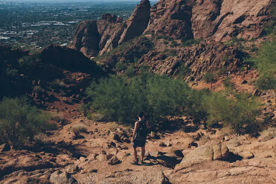
Nearby amenities can make a hiking trip easier, but they vary widely. Popular trailheads may have restrooms, visitor centers, potable water, parking areas, ranger stations, picnic tables, shuttle stops, or campgrounds. Remote trailheads may have none of these.
Before leaving, check whether the trailhead requires a parking reservation, entrance fee, permit, shuttle, or timed-entry reservation. Also confirm opening hours and seasonal road access. A trail itself may be open while the road leading to it is closed because of snow, flooding, construction, or another hazard.
Water availability deserves special attention. Do not assume that water from a stream, lake, or spring is safe to drink simply because it looks clean. Carry sufficient drinking water whenever practical. If you must collect natural water, use an appropriate filtration, purification, boiling, or disinfection method and follow local guidance.
Swimming or wading also may be prohibited or dangerous in some locations because of currents, cold water, waterfalls, contamination, sensitive habitat, or park regulations. Check before entering natural water.
Permits, Seasonal Access, and Closures
Some hiking trails require permits throughout the year or during busy seasons. Others have quotas for parking, camping, wilderness access, or particularly sensitive sections. Wildfire, wildlife activity, storm damage, snow, maintenance, or environmental restoration can also cause temporary closures.
Whenever an official park, forest, refuge, or land-management agency provides current conditions, use that information as your primary source rather than assuming that an older blog post or trail-app report is still accurate.
Trail Length and Duration
The length of a hiking trail is only one part of estimating how long a hike will take. A smooth, nearly level five-mile route can be completed much faster than a steep five-mile route with loose rock, stream crossings, snow, or difficult navigation.
Consider all of the following when estimating hiking time:
- Total distance and whether the stated mileage is one-way or round trip.
- Total elevation gain and how steeply that climbing is concentrated.
- Surface conditions such as rock, mud, sand, roots, ice, or snow.
- Altitude and expected temperature.
- The pace of the slowest person in the group.
- Rest, food, water, navigation, and photography stops.
- Expected crowds or bottlenecks.
- Time required for the return journey, including downhill travel.
- Available daylight and a reasonable turnaround time.
For example, an experienced walker might cover a relatively flat five-mile trail in roughly two hours of moving time, while a shorter but steep or technical route could take considerably longer. Do not plan a hike so tightly that a minor delay forces you to rush or finish in darkness.
Distance tells you how far you will travel; elevation gain, terrain, weather, navigation demands, and your group’s pace help determine how hard and how long the hike will actually feel.
Tips for Hiking Preparation
Preparation makes a major difference in both safety and enjoyment. Research the route before leaving, including distance, elevation gain, route type, expected trail surface, permit requirements, weather, water availability, hazards, current closures, and the time of sunset.
Wear footwear appropriate to the terrain rather than assuming every trail requires heavy hiking boots. Well-fitting hiking shoes, trail-running shoes, or boots may all be suitable depending on the route, conditions, pack weight, and personal preference. Whatever you use, avoid testing unfamiliar footwear for the first time on a long or remote hike.
Dress in layers that can be adjusted as temperature, wind, precipitation, and exertion change. Pack enough food and water for the planned outing plus a margin for delays. Bring required medications and any specialized equipment needed for the environment.
Physical preparation matters as well. If a planned trail is longer or steeper than anything you have recently completed, build up gradually on shorter hikes. Walking hills, climbing stairs, strength training, and carrying a light pack can help prepare you for longer days on uneven ground.
Trail Etiquette and Leave No Trace
Good hiking habits protect both the environment and other visitors. The Leave No Trace 7 Principles emphasize planning ahead, traveling on durable surfaces, disposing of waste properly, leaving natural and cultural objects where they are, minimizing campfire impacts, respecting wildlife, and being considerate of other people.
Stay on established trails where required, avoid cutting switchbacks, pack out trash and food scraps, keep noise reasonable, and follow local rules for pets, camping, fires, drones, bicycles, and other activities. Never feed wild animals.
Groups, Children, Pets, and Accessibility Needs
A trail that works well for one person may be unsuitable for another. When hiking with children, inexperienced hikers, older adults, or anyone with mobility or health considerations, check surface type, steepness, obstacles, shade, rest areas, restroom access, and realistic turnaround options.
If bringing a dog, verify that pets are permitted on the specific trail. Some parks prohibit dogs on most hiking trails, while others require leashes or have restrictions designed to protect wildlife and visitors. Bring enough water for the animal and consider heat, rough surfaces, wildlife, and waste-disposal requirements.
For hikers with accessibility needs, look for official descriptions of trail width, surface firmness, grade, cross slope, steps, obstacles, seating, and accessible facilities rather than relying only on a general “easy” rating.
If your hiking trip also includes RV or travel-trailer camping, the existing guide to travel trailer batteries for outdoor trips may help with campsite power planning. Hiking safety gear and backcountry preparation should still be planned separately from vehicle or campground equipment.
Love travel? Join Our Facebook Community For More Tips.
Frequently Asked Questions
What are the benefits of hiking?
Hiking combines physical activity with time outdoors. Depending on the route and your pace, it can support cardiovascular fitness, muscular endurance, balance, and general activity levels. Research also suggests that nature exposure may support stress reduction and mental well-being, although individual results and the strength of evidence vary.
Where can I go hiking?
Hiking trails can be found in national, state, provincial, and local parks; national forests; wildlife refuges; conservation lands; urban green spaces; and other public recreation areas. Start with the official website of the park or land manager to confirm current access, regulations, trail conditions, permits, and closures.
What should I bring when going hiking?
Bring supplies appropriate to the route and conditions. A strong baseline is the Ten Essentials: navigation, sun protection, extra clothing, illumination, first aid, fire-starting equipment where appropriate, repair tools, extra food, water and water-treatment capability, and emergency shelter. You may need additional equipment for snow, heat, wildlife, river crossings, high altitude, or overnight travel.
How do I prepare for a hiking trip?
Research the trail’s distance, elevation gain, terrain, route type, current conditions, weather, permits, hazards, water availability, and daylight. Match the hike to your group’s abilities, carry appropriate supplies, download or carry a reliable map, and leave your planned route and return time with a trusted person.
What are some important hiking safety tips?
Check official conditions and weather, carry appropriate emergency gear, know how to navigate, stay hydrated, observe wildlife from a safe distance, and keep track of time and daylight. Turn around if the route, weather, or a group member’s condition becomes unsafe. In remote areas, do not rely on cell service being available.
How do I know if a hiking trail is too difficult for me?
Compare the route’s distance, elevation gain, terrain, steepest sections, exposure, navigation demands, altitude, and expected weather with hikes you have recently completed comfortably. Difficulty labels are only a starting point. If several major challenges are new to you at once, choose a shorter or easier route first.
How long does a hiking trail take to complete?
There is no single pace that works for every trail. Distance, elevation gain, grade, footing, altitude, weather, group speed, crowds, navigation, and rest stops all affect hiking time. Use official time estimates when available, compare the route with hikes you have already completed, and build in extra time for delays.
Can I drink water from a stream or lake while hiking?
Do not assume natural water is safe to drink because it looks clear. Carry sufficient potable water whenever possible. If you need to collect backcountry water, use an appropriate filtration, purification, boiling, or disinfection method and follow the specific guidance for the park or region you are visiting.
Sources
- U.S. National Park Service — Ten Essentials — supports hiking gear, emergency preparedness, navigation, food, hydration, and shelter guidance.
- U.S. National Park Service — Trip Planning Guide — supports trip planning, emergency preparation, and leaving a trip plan.
- Appalachian Trail Conservancy — 2026 Official Mileage — supports the current 2,197.9-mile Appalachian Trail figure.
- Pacific Crest Trail Association — PCT Data — supports the current best estimate of the Pacific Crest Trail’s length.
- Yosemite National Park — Half Dome Permits — supports the current permit requirement for hiking Half Dome when the cables are up.
- Leave No Trace — 7 Principles — supports responsible trail use, wildlife respect, waste disposal, and low-impact outdoor practices.
