Last Updated on September 10, 2026 by Daniel Globe
Yosemite National Park is one of California’s great hiking destinations, with more than 800 miles of trails ranging from short paved walks to all-day climbs above Yosemite Valley. The park covers about 759,620 acres, or 1,187 square miles, and its landscape includes waterfalls, granite walls, alpine meadows, forests, and peaks such as 13,114-foot Mount Lyell. Yosemite was established as a national park in 1890 and was inscribed as a UNESCO World Heritage Site in 1984 for its exceptional scenery and glacier-shaped geology.
Quick Answer
The best hiking trails in Yosemite include Bridalveil Fall and Lower Yosemite Fall for easy walks, the Valley Loop and Vernal Fall routes for moderate outings, and Yosemite Falls, Clouds Rest, Four Mile Trail, and Half Dome for experienced hikers. Choose by distance, elevation gain, season, current trail conditions, and permit requirements.
Key Takeaways
- For an easy first hike, consider Bridalveil Fall, Lower Yosemite Fall, Cook’s Meadow, or the 2-mile Mirror Lake out-and-back.
- For a moderate hike, the Vernal Fall Footbridge and portions of the Valley Loop offer more distance and climbing without committing to Yosemite’s hardest routes.
- Four Mile Trail, the full Yosemite Falls Trail, Clouds Rest, and Half Dome are strenuous hikes that require substantially more fitness and preparation.
- A permit is required to go beyond the Subdome to the top of Half Dome whenever the cables are up.
- Glacier Point Road and Tioga Road are seasonal, so some scenic and high-country hikes are inaccessible by car during the snowy part of the year.
- Check current NPS conditions on the morning of your hike because trail closures, wildfire activity, snow, water levels, and road access can change.
- Bear spray is prohibited in Yosemite. Protect wildlife by keeping food within arm’s reach while eating and following the park’s food-storage rules.
At a Glance
| Time Required | About 20 minutes for the shortest walks to 10–12+ hours for strenuous summit hikes. |
| Difficulty | Easy to strenuous, with elevation gains ranging from nearly flat to about 4,800 feet. |
| Gear Needed | Water, food, sturdy footwear, sun protection, layers, trail map or offline map, and a headlamp. Carry additional safety gear for long backcountry-style day hikes. |
| Cost & Permits | The park entrance fee applies. Most ordinary day hikes need no separate hiking permit, but Half Dome requires a permit when the cables are up and overnight wilderness trips require wilderness permits. |
Disclosure: As an Amazon Associate I earn from qualifying purchases. Some links on this page are affiliate links, at no extra cost to you.
Best Hiking Trails in Yosemite at a Glance
| Trail | Difficulty | Distance | Elevation Gain | Best For |
| Bridalveil Fall Trail | Easy | 0.5 mi round trip | 80 ft | Short waterfall walk |
| Lower Yosemite Fall | Easy | 1 mi loop | 50 ft | Families and first-time visitors |
| Mirror Lake | Easy to Moderate | 2 mi lake-and-back; 5 mi full loop | 100–200 ft | Valley scenery and a gentler outing |
| Valley Loop Trail | Moderate | About 7.2 mi half loop or 11.5 mi full loop | Mostly level | Longer Valley walk and wildlife watching |
| Vernal & Nevada Fall Routes | Moderate to Strenuous | About 1.6–8 mi round trip depending on turnaround | 400–2,000 ft | Waterfalls and classic Yosemite hiking |
| Yosemite Falls Trail | Moderate to Strenuous | 2 mi to Columbia Rock; 7.2 mi full trip | 1,000–2,700 ft | Major climb and waterfall views |
| Four Mile Trail | Strenuous | 4.8 mi one way | About 3,200 ft climbing from Valley | Glacier Point views |
| Clouds Rest from Sunrise Lakes Trailhead | Strenuous | 14 mi round trip | 2,300 ft | High-country panorama |
| Half Dome | Strenuous | About 14–16.4 mi round trip | About 4,800 ft | Experienced, permitted hikers |
Distances and difficulty ratings can change with the exact route or turnaround point. Before leaving, compare your plan with the National Park Service’s Yosemite Valley day-hike information and current trail conditions.
Tips for Hiking in Yosemite
Check Current Conditions Before You Leave
Weather, snow, road access, trail work, wildfire conditions, and waterfall flow can change quickly in Yosemite. Check the official Yosemite current conditions page shortly before starting a hike instead of relying only on an older guide or saved itinerary.
2026 Update: Yosemite does not require a timed vehicle reservation for park entry in 2026. Separate reservations or permits may still be needed for camping, lodging, overnight wilderness trips, and Half Dome.
Current Mist Trail Warning: As of the National Park Service’s July 24, 2026 update, repair work beginning July 27 restricts access on part of the Mist Trail above the Vernal Fall Footbridge during portions of Monday through Thursday. The John Muir Trail provides an alternate route when that section is closed. Conditions and work schedules can change, so check the live NPS conditions page before hiking.
Hydration and Nutrition
Carry enough water and food for the length, heat, elevation, and difficulty of your hike. The National Park Service recommends carrying and drinking plenty of water and gives a general minimum guideline of about one quart every two hours while hiking. Longer, hotter, and steeper hikes may require more.
Do not assume streams or waterfalls provide safe drinking water. Natural water should be properly treated before drinking. Pack calorie-dense snacks such as trail mix, sandwiches, nut or seed butter, energy bars, or other foods that you know sit well during exercise.
Footwear, Layers, Navigation, and Light
Wear footwear with dependable traction, especially on steep stone steps and wet granite. Carry sun protection and clothing layers because temperature and wind can change substantially between Yosemite Valley and higher elevations.
Bring a map or an offline map that works without cell service. A headlamp belongs in your pack even on a planned day hike; delays, slower-than-expected hiking, injuries, or route changes can keep you out after sunset.
Pro Tip: Start strenuous Valley climbs early. You get cooler temperatures, more turnaround time, and a better margin if the hike takes longer than expected.
Weather, Waterfalls, and Exposed Granite
Spring snowmelt can make Yosemite’s waterfalls spectacular, but it also makes rocks, stone steps, and trail edges wet. Never enter closed areas or climb around railings for a photograph. Stay back from fast water and wet granite.
In the high country, thunderstorms can develop rapidly. Exposed domes and ridges are poor places to be during lightning. Turn around when conditions become unsafe rather than treating the summit as mandatory.
Black Bears and Food Storage
Yosemite is home to hundreds of American black bears. While hiking or picnicking, keep food within arm’s reach and never leave packs or food unattended. Overnight wilderness travelers must follow Yosemite’s bear-resistant food-container requirements.
Warning: Do not bring bear spray to Yosemite. The National Park Service states that bear spray and other pepper-spray devices are prohibited in the park. Instead, follow Yosemite’s official food-storage and black-bear encounter guidance.
Easy Hiking Trails in Yosemite
Mirror Lake Trail
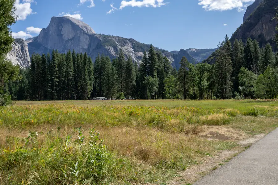
Mirror Lake is a good option for visitors who want a gentler Yosemite Valley hike. The shortest route is about two miles round trip to the lake and back with roughly 100 feet of elevation gain. Hikers wanting more distance can continue around the full loop, which is about five miles with roughly 200 feet of gain.
The lake is generally most reflective when it holds more water, while later in the season it may shrink substantially. Even when water levels are low, the route gives hikers close views of the granite walls around Tenaya Canyon.
Bridalveil Fall Trail
Bridalveil Fall Trail is one of Yosemite’s shortest waterfall walks. The paved route is approximately 0.5 mile round trip with about 80 feet of elevation gain, and NPS estimates roughly 20 minutes for the outing.
Bridalveil Fall drops 620 feet. Spring usually brings the strongest flow and the most mist near the viewing area, while the waterfall often becomes lighter later in the year.
Lower Yosemite Fall Trail
Lower Yosemite Fall is another strong choice for beginners and families. The complete loop is approximately one mile with only about 50 feet of elevation gain. Spring and early summer typically provide the strongest waterfall flow.
Cook’s Meadow Loop
Cook’s Meadow Loop is a flat, roughly one-mile walk through the heart of Yosemite Valley. It provides views toward Yosemite Falls, Half Dome, Glacier Point, Sentinel Rock, and surrounding granite walls without a major climb.
Moderate Hiking Trails in Yosemite
Yosemite’s middle ground includes routes that require more time and stamina but stop short of the park’s biggest climbs. Difficulty can increase quickly when hikers continue beyond an intermediate turnaround point, so decide your destination before starting.
Vernal Fall Footbridge and Mist Trail Options
The trail from Happy Isles toward Vernal Fall can be scaled to your fitness. Reaching the Vernal Fall Footbridge is about 1.6 miles round trip with roughly 400 feet of climbing. Continuing toward the top of Vernal Fall or Nevada Fall adds considerably more distance and elevation and moves the outing toward the strenuous end of the spectrum.
The famous stone steps near Vernal Fall can become wet from waterfall spray. They require careful footing, especially when flow is high. Do not use one generic “Mist Trail distance” when planning; select a specific turnaround point and check which sections are open.
Valley Loop Trail
The Valley Loop Trail is useful for hikers who prefer mileage over steep climbing. The route passes through forests and meadows and alongside sections of the Merced River, with views of El Capitan, Bridalveil Fall, Yosemite Falls, and other Valley landmarks.
NPS currently describes roughly a 7.2-mile half loop and an 11.5-mile full loop, although there are several ways to shorten a Valley walk. Because the route is mostly level, it can be physically easier than shorter trails with thousands of feet of climbing.
Yosemite Falls Trail to Columbia Rock
The first part of the Yosemite Falls Trail gives hikers a shorter alternative to climbing all the way to the top. Columbia Rock is about two miles round trip with approximately 1,000 feet of elevation gain. Continuing higher changes the hike into a much more strenuous undertaking.
The full Yosemite Falls route is about 7.2 miles round trip with approximately 2,700 feet of climbing. That complete route should be treated as a strenuous hike rather than an ordinary moderate outing.
What About Four Mile Trail?
Four Mile Trail is sometimes grouped with intermediate Yosemite hikes because it is well developed and easy to follow, but its physical demands are substantial. Despite the historical name, the trail is about 4.8 miles one way between Yosemite Valley and Glacier Point and climbs about 3,200 feet when hiked uphill from the Valley. The National Park Service rates it strenuous.
Its switchbacks provide changing views across Yosemite Valley toward landmarks such as El Capitan and Half Dome. Glacier Point is the reward at the top, but hikers should not assume transportation will be available for a one-way hike. Check seasonal road and transportation information before planning a point-to-point trip.
Challenging Hiking Trails in Yosemite
Half Dome
Half Dome is Yosemite’s best-known strenuous day hike. Depending on the exact route, the round trip is roughly 14 to 16.4 miles with about 4,800 feet of elevation gain. Hikers travel past Vernal and Nevada Falls, continue toward Little Yosemite Valley, climb the Subdome, and finally reach the cable route on Half Dome’s steep granite shoulder.
A permit is required to hike beyond the base of the Subdome to the top of Half Dome whenever the cables are up. Day-hiker permits are distributed through lotteries, so this is not a hike to leave until the morning of your visit. Review the official Half Dome permit rules before building a trip around it.
Warning: Do not attempt the Half Dome cables during storms or when the granite is wet. The route is long, highly exposed near the top, and unsuitable for hikers who are unprepared for steep terrain and major elevation gain.
Clouds Rest
Clouds Rest provides one of Yosemite’s broadest high-country panoramas. From the Sunrise Lakes Trailhead near Tenaya Lake, NPS lists approximately 14 miles round trip, 2,300 feet of elevation gain, and an 8–10 hour time estimate. The summit stands at 9,926 feet.
The final approach follows an exposed granite ridgeline with views toward Tenaya Canyon, Half Dome, Yosemite Valley, and the High Sierra. Stay off the summit and ridgeline during thunderstorms or when conditions make the granite unsafe.
Upper Yosemite Fall
The full climb to the top of Yosemite Falls is about 7.2 miles round trip with roughly 2,700 feet of elevation gain. The trail climbs steeply out of Yosemite Valley and can be hot and sun-exposed, especially later in the day.
Waterfall flow varies dramatically by season. A strong spring flow can make the scenery especially impressive, while the waterfall may become very low later in a dry summer.
Four Mile Trail to Glacier Point
Hiking Four Mile Trail uphill from Yosemite Valley to Glacier Point involves about 3,200 feet of climbing over approximately 4.8 miles one way. That makes it a serious workout even for hikers who are comfortable on maintained trails.
The route is seasonal and can close because of snow or unsafe winter conditions. Check access before planning it, especially in spring and fall.
Scenic Hiking Trails in Yosemite
Glacier Point Overlook
For a major view with very little walking, the Glacier Point Overlook is one of the park’s best options when Glacier Point Road is open. From the parking area, the paved route is about 300 yards one way on a gentle incline.
The overlook sits more than 3,000 feet above Yosemite Valley and provides views toward Half Dome, Yosemite Falls, and the high country. This is more accurately described as a short overlook walk than a one-mile “Glacier Point Trail.”
Taft Point
Taft Point offers a short hike to the rim above Yosemite Valley. The trail is about 2.2 miles round trip with roughly 200 feet of elevation gain on the return. Near the viewpoint are deep granite fissures and major cliff edges, so stay well back from unprotected drops.
Sentinel Dome
Sentinel Dome is about two miles round trip with approximately 400 feet of elevation gain. The final scramble onto the dome opens a 360-degree view over Yosemite Valley and the surrounding high country.
The granite dome is exposed to weather. Leave the dome if thunderstorms threaten and carry a headlamp when hiking around sunset.
Soda Springs and Parsons Lodge
In Tuolumne Meadows, the Parsons Lodge and Soda Springs walk is approximately 1.4 miles round trip. It passes through open high-country meadow scenery and gives visitors a very different Yosemite experience from the steep granite walls of Yosemite Valley.
Gaylor Lakes and the High Country
For hikers seeking a more rugged alpine setting, the Tioga Pass area provides access to higher-elevation trails and lakes. Routes such as Gaylor Lakes trade Valley waterfalls for open granite, alpine terrain, and broad Sierra views. Because these trails depend on Tioga Road access, always check road and snow conditions first.
Hiking Trails for Wildlife Viewing in Yosemite
Yosemite supports more than 400 vertebrate species, including mammals, birds, reptiles, amphibians, and fish. Wildlife sightings are never guaranteed, but quieter trails through meadows, forest edges, and riparian areas can provide good opportunities to observe animals from a respectful distance.
Valley Loop and Merced River Areas
Sections of the Valley Loop follow forest, meadow, and Merced River habitat. Mule deer and a variety of birds may be seen along the route, especially during quieter parts of the day.
Wawona Meadow Loop
The Wawona Meadow Loop is approximately 3.5 miles and mostly flat, though parts of the surface are uneven. Its mix of meadow and forest-edge habitat makes it a pleasant option for hikers interested in plants, birds, and the possibility of seeing other wildlife.
Tuolumne Meadows
Tuolumne Meadows provides wide-open high-country habitat where hikers may see mule deer, birds, small mammals, and other wildlife. Lembert Dome and nearby meadow routes also provide broad views across the landscape.
Early morning and evening can be quieter times to walk, but never approach an animal for a better photograph. Give wildlife space, stay on established trails, and never feed animals.
Note: If you encounter a black bear away from developed areas, Yosemite asks visitors to keep a substantial distance. Food storage and responsible behavior are far more important in Yosemite than trying to carry a defensive spray, which is prohibited.
Best Time of Year to Hike in Yosemite
Spring
Spring is often the best period for Yosemite Valley waterfalls. Snowmelt can create powerful flows at Yosemite, Bridalveil, Vernal, and Nevada Falls. Higher roads and trails may still be buried in snow, however, and wet granite can be slippery.
Summer
Summer usually gives hikers the greatest access to Glacier Point Road and the Tioga Road high country, although exact opening dates depend on snow and weather. Yosemite Valley can become hot and crowded, so early starts are especially valuable.
Fall
Fall can bring cooler hiking weather and fewer visitors, but waterfall flow is usually lower. Tioga Road and Glacier Point Road eventually close after significant snow, so check access before planning a late-season high-country hike.
Winter
Winter changes Yosemite’s hiking options completely. Many high-elevation roads and trails become inaccessible to ordinary vehicle traffic, while Valley routes may have snow or ice. A summer trail description should never be treated as sufficient winter route guidance.
How to Choose the Right Yosemite Hike
Start with the amount of time you realistically have, then look at elevation gain rather than distance alone. A flat five-mile walk can be easier for many visitors than a two-mile route that gains 1,000 feet.
- Less than one hour: Bridalveil Fall, Lower Yosemite Fall, Cook’s Meadow, or Glacier Point Overlook when the road is open.
- One to three hours: Mirror Lake out-and-back, Taft Point, Sentinel Dome, or Wawona Meadow Loop.
- Half day: Valley Loop sections, Vernal Fall routes, or Columbia Rock depending on fitness.
- Full day: Upper Yosemite Fall, Four Mile Trail, Clouds Rest, Nevada Fall routes, or Half Dome for properly prepared and permitted hikers.
The best Yosemite hike is not necessarily the longest one. Choose a route that fits your fitness, available daylight, weather, seasonal access, and comfort with steep or exposed terrain.
Conclusion and Final Thoughts on Hiking in Yosemite
Hiking in Yosemite National Park ranges from easy walks beneath waterfalls to long climbs onto exposed granite summits. For first-time visitors, Lower Yosemite Fall, Bridalveil Fall, Mirror Lake, and Cook’s Meadow offer memorable scenery without major elevation gain. Hikers looking for more challenge can progress toward Vernal Fall, Yosemite Falls, Four Mile Trail, Clouds Rest, or Half Dome.
The most important part of planning is matching the route to current conditions and your own ability. Check NPS trail and road information before leaving, carry enough water and food, take a headlamp, respect wildlife, and turn around when weather or terrain exceeds your comfort level.
Yosemite’s granite cliffs, waterfalls, meadows, forests, and high-country trails support an unusually varied hiking experience. Responsible visitors also help protect those landscapes by staying on trails, storing food correctly, packing out waste, and giving wildlife plenty of space.
If you’re planning the rest of your hiking gear, you may also be interested in this guide to the best waterproof sneakers for travel. Appropriate footwear with dependable traction is especially useful on Yosemite’s rocky and sometimes wet trails. Travelers who use a CPAP machine can also review these travel CPAP options when planning overnight trips away from home.
Love travel? Join Our Facebook Community For More Tips.
Frequently Asked Questions
What are the best hiking trails in Yosemite?
Some of the best Yosemite hikes are Lower Yosemite Fall and Bridalveil Fall for easy outings, Mirror Lake and the Valley Loop for gentler longer walks, Vernal Fall routes for waterfall scenery, and Yosemite Falls, Four Mile Trail, Clouds Rest, and Half Dome for strenuous hiking.
What is the difficulty level of the hiking trails in Yosemite?
Yosemite has everything from flat or paved walks to strenuous mountain routes gaining several thousand feet. Distance alone does not determine difficulty, so compare elevation gain, trail surface, exposure, weather, altitude, and estimated hiking time before choosing a route.
Are there guided hiking tours available in Yosemite?
Yes. Ranger and interpretive programs vary by season, and authorized commercial or nonprofit organizations also provide hiking and backpacking services. Check the National Park Service’s current program calendar and authorized-guide list before booking.
What should I bring when hiking in Yosemite?
Bring enough water and food, sturdy footwear, sun protection, appropriate clothing layers, a map or offline navigation, and a headlamp. Longer hikes may require additional emergency supplies. Do not bring bear spray; Yosemite prohibits bear spray and other pepper-spray devices.
Are there hiking restrictions in Yosemite?
Yes. Trails may close because of snow, repair work, fires, wildlife protection, or other hazards. Overnight wilderness travel requires a wilderness permit, Half Dome requires a permit when the cables are up, and seasonal roads can prevent access to some trailheads. Check current NPS conditions before every hike.
Do you need a permit to hike Half Dome?
Yes. A Half Dome permit is required seven days per week when the cables are up. Day-hiker permits are distributed through preseason and daily lotteries. A Half Dome day-hike permit does not include camping or lodging.
What is the best month for hiking in Yosemite?
There is no single best month for every trail. Spring is excellent for Valley waterfalls, while summer usually provides the widest access to Glacier Point and Tuolumne Meadows. Fall brings cooler temperatures but lower waterfall flow and eventual seasonal road closures. Always check current snow and road conditions.
Sources
- National Park Service — Yosemite Valley Day Hikes — official difficulty, distance, and elevation information for major Yosemite Valley trails.
- National Park Service — Day Hikes Along Glacier Point Road — Glacier Point Overlook, Taft Point, Sentinel Dome, Four Mile Trail, and seasonal access.
- National Park Service — Day Hikes in Tuolumne Meadows — official high-country trail and seasonal-access guidance.
- National Park Service — Hiking Safety — water, footwear, navigation, headlamp, and general hiking-safety guidance.
- National Park Service — Half Dome Permits for Day Hikers — cable-season permit and lottery requirements.
- National Park Service — Current Conditions — live trail, road, waterfall, fire, and seasonal-access updates.