
Last Updated on July 27, 2026 by Daniel Globe
Los Angeles is one of the few major cities where you can leave a dense neighborhood and reach a mountain or canyon trail within minutes. The best hiking trails in Los Angeles range from short city-view walks in Griffith Park and Runyon Canyon to steeper, more remote routes in the Santa Monica Mountains. Because heat, wildfire damage, rain, and park rules can change access, choose your hike by distance, difficulty, season, and current conditions.
Quick Answer
For the easiest all-around LA hiking experience, start with Griffith Park; choose Runyon Canyon for a short social workout and city views; head to the Santa Monica Mountains for longer, wilder routes such as Los Leones, Sandstone Peak, and the Backbone Trail. Check official closures before leaving, especially after fires, storms, or red-flag weather.
Key Takeaways
- Griffith Park is the best all-around starting point, with a 53-mile network of trails, fire roads, and bridle paths.
- Runyon Canyon is convenient and scenic, but its West Trail is closed until further notice as of July 27, 2026.
- The Santa Monica Mountains offer everything from short hikes to the 67-mile Backbone Trail and 3,111-foot Sandstone Peak.
- Summer heat can be severe. Start early, carry enough water for the entire trip, use sun protection, and turn around before you exhaust your supplies.
- Dog rules vary by land manager: Griffith requires leashes, Runyon permits off-leash dogs only in designated areas, and many California State Park backcountry trails prohibit dogs.
Disclosure: As an Amazon Associate I earn from qualifying purchases. Some links on this page are affiliate links, at no extra cost to you.
Best Los Angeles Hiking Trails at a Glance
There is no single “best” LA hike. A first-time visitor who wants skyline views has different needs from a hiker looking for an all-day mountain challenge. This table compares several of the area’s most useful options.
| Trail or Area | Best For | Distance | Difficulty | What to Know |
|---|---|---|---|---|
| Griffith Observatory West Trail Loop | First-time visitors and city views | About 2.5 miles | Easy to moderate | Dogs must remain leashed; higher-elevation parking gets busy. |
| Runyon Canyon | Short workouts and Hollywood views | Varies by route | Easy to moderate | West Trail currently closed; no restroom facilities; open sunrise to sunset. |
| Los Leones to Parker Mesa Overlook | Coastal and canyon views | About 7 miles round trip | Moderate | Check Topanga State Park restrictions before leaving. |
| Sandstone Peak Trail | A short but steep summit hike | 3 miles round trip | Strenuous | Climbs about 1,081 feet to the 3,111-foot high point of the Santa Monica Mountains. |
| Backbone Trail | Long-distance hiking | 67 miles one way | Strenuous | About 19,000 feet of total ascent west-to-east; reliable water is limited. |
| Malibu Creek State Park | Creeks, rock formations, and varied day hikes | Varies by route | Easy to moderate | Dogs are not permitted on the park’s dirt roads or hiking trails. |
Warning: Trail access is still affected by recent fires. As of July 27, 2026, the Runyon Canyon West Trail is closed until further notice. Topanga State Park is open with restrictions, but Temescal Canyon Trail and several other areas remain closed. Eaton Canyon Natural Area is closed until further notice due to the Eaton Fire. Recheck official conditions on the day of your hike.
Griffith Park: The Heart of LA Hiking
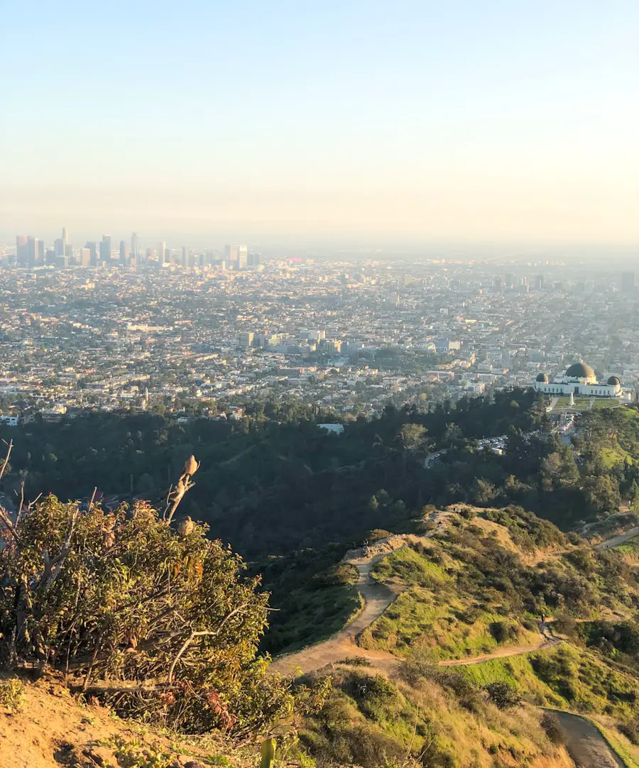
Griffith Park is the most versatile hiking area for many Los Angeles visitors. The City of Los Angeles describes it as a park of more than 4,210 acres, and hikers can use a 53-mile network of trails, fire roads, and bridle paths. Routes range from short walks near Fern Dell to steeper climbs toward Mount Hollywood and the Griffith Observatory.
For classic city views, trails near the Griffith Observatory provide a good balance of scenery and manageable distance. One commonly used option is the Griffith Observatory West Trail Loop, while hikers looking for more climbing can continue toward Mount Hollywood. On clear days, viewpoints can extend across the Los Angeles Basin and toward the coast.
Griffith Park also combines hiking with some of the city’s best-known attractions. The Griffith Observatory, Greek Theatre, Los Angeles Zoo, Travel Town, and the Old Zoo area are all within the larger park. That makes it easy to combine a trail with other activities instead of committing an entire day to hiking.
The park’s undeveloped hills support chaparral and native wildlife, including birds, coyotes, deer, and rattlesnakes. Stay on designated trails, do not feed wildlife, and keep dogs leashed.
Pro Tip: Parking around the Observatory and upper parts of Griffith Park can become congested on weekends, holidays, and busy summer days. The park recommends the DASH Observatory shuttle as an alternative to driving all the way up. Check the official Griffith Park trip-planning page before you go.
Runyon Canyon: A Popular Hiking Spot with Stunning Views
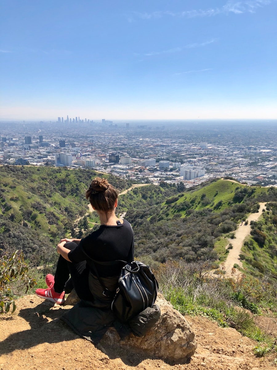
Runyon Canyon is one of the easiest hiking areas to reach from Hollywood and is especially popular with walkers, runners, fitness groups, tourists, and dog owners. The 160-acre park sits at the eastern end of the Santa Monica Mountains and offers elevated views across Hollywood and the Los Angeles Basin.
The experience is different from a remote backcountry hike. Trails can be busy, and the park has a social, workout-oriented atmosphere. Visitors may encounter runners, outdoor exercise groups, dog walkers, or people stopping at viewpoints rather than completing a long route.
Runyon Canyon is open from sunrise to sunset. According to the City of Los Angeles Department of Recreation and Parks, there are no restroom facilities, smoking is prohibited, visitors should remain on designated trails, and dogs may be off leash only in designated areas.
Note: The Runyon Canyon West Trail is currently closed until further notice because of a recent fire. Do not assume an older online loop map is fully usable; check the official park page before choosing your route.
Santa Monica Mountains: A Diverse Range of Hiking Trails
More than 500 miles of public trails cross the Santa Monica Mountains, ranging from short beginner routes to long-distance ridge hiking.
The Santa Monica Mountains stretch from the Los Angeles area toward Ventura County and contain a mix of National Park Service land, California State Parks, city parks, conservancy property, and other open space. That variety creates excellent hiking, but it also means parking fees, dog rules, hours, and closures can change when you cross from one jurisdiction to another.
| Trail Name | Difficulty | Distance | Key Detail |
|---|---|---|---|
| Backbone Trail | Strenuous | 67 miles one way | About 19,000 feet of total ascent west-to-east; commonly completed in sections. |
| Los Leones Trail to Parker Mesa Overlook | Moderate | About 7 miles round trip | Coastal views; check Topanga State Park restrictions before visiting. |
| Malibu Creek State Park Trails | Easy to moderate | Varies by route | Multiple creek, canyon, and park routes; dogs are not permitted on hiking trails. |
| Sandstone Peak Trail | Strenuous | 3 miles round trip | About 1,081 feet of climbing to the 3,111-foot summit. |
Sandstone Peak is the highest point in the Santa Monica Mountains at 3,111 feet. The National Park Service’s direct Sandstone Peak Trail is a strenuous 3-mile round trip from the Sandstone Peak Trailhead. Hikers who want a longer outing can combine nearby trails, including portions of the Backbone Trail and Mishe Mokwa Trail.
The Mishe Mokwa Trail itself offers a different experience. The National Park Service Circle X Ranch guide lists the Mishe Mokwa Trail to Split Rock as a moderate 3.5-mile round trip through riparian areas, coastal sage scrub, and chaparral. A longer loop can continue toward the Backbone Trail and Sandstone Peak.
Los Leones is another useful coastal-side option. The trail can connect with East Topanga Fire Road and longer routes toward Parker Mesa Overlook. California State Parks currently lists visitor parking and restroom facilities near the Los Leones trailhead while other portions of Topanga State Park remain affected by Palisades Fire closures.
Malibu Creek State Park offers a different landscape of creek corridors, oak woodland, rock formations, and open hills. Instead of treating the park as one 15-mile hike, choose a specific route based on your available time and fitness level. Dogs are allowed in designated developed areas but not on the park’s dirt roads or hiking trails.
Tips for Hiking in LA: What to Bring and How to Prepare
Good preparation matters more in Los Angeles than the city’s mild climate may suggest. Many trails have limited shade, dry terrain, steep climbs, and little or no dependable drinking water.
- Check current conditions first. Look at the official park or land-manager page for closures, fire restrictions, storm damage, or parking changes.
- Choose a route that fits your ability. Distance alone does not show difficulty. Elevation gain, heat, exposure, and trail surface can turn a short route into a demanding hike.
- Carry enough water. There is no universal amount that works for every hike. Plan for the temperature, duration, elevation gain, your own needs, and unexpected delays. Carry extra on hot or exposed routes.
- Bring food for longer outings. Pack easy-to-carry snacks such as fruit, nuts, sandwiches, or energy bars.
- Use sun protection. Sunscreen, sunglasses, a hat, and lightweight sun-protective clothing are especially useful on exposed ridges.
- Wear suitable footwear. Comfortable hiking shoes or trail shoes with dependable traction are a better choice than casual footwear on loose or steep terrain.
- Carry navigation. Download your route before leaving and consider a paper map for more remote areas. Cell service can be unreliable in the Santa Monica Mountains.
- Bring basic emergency gear. The National Park Service hiking guidance recommends planning for navigation, sun protection, insulation, illumination, first aid, food, hydration, and unexpected delays.
Pro Tip: Download the official trail map and save the park’s closure page before leaving home. A screenshot can still be useful when mobile service disappears.
Safety Precautions for Hiking in LA
Heat is one of the most common problems on exposed Southern California trails. During warm weather, hike early in the morning or later in the day, reduce the length or difficulty of your route, take breaks, and turn back if you or anyone in your group develops dizziness, weakness, confusion, nausea, or other signs of heat illness.
Wildfire conditions require equal attention. The Santa Monica Mountains can close recreation areas during dangerous Red Flag conditions, and fire can also block the roads you planned to use for your return. Never enter a posted closure, and avoid assuming that a trail is safe simply because an older map or app still shows it.
Rain creates a different set of hazards. Trails may become muddy and unstable, creek crossings can rise quickly, and recently burned slopes are especially vulnerable to erosion. Avoid trails that are officially closed after storms and do not cross fast-moving water.
Wildlife is part of hiking in LA. Coyotes, rattlesnakes, deer, birds, and many smaller animals use the same open spaces. Give wildlife room, stay on the trail, never feed animals, and keep pets under control. Most wildlife encounters end uneventfully when hikers maintain distance.
Know your physical limits as well. It is easy to keep climbing because a viewpoint appears close, only to discover that the return trip is longer or hotter than expected. Tell someone where you are hiking and when you expect to return, particularly in the Santa Monica Mountains or San Gabriel Mountains.
Warning: Do not rely on a phone as your only navigation or emergency plan. Cell coverage can be spotty in mountain and canyon terrain. Carry your route offline, stay on established trails, and leave your itinerary with someone who is not on the hike.
Parking, Dogs, and Trail Rules in Los Angeles
Rules change quickly when a hike crosses property managed by a different agency. Check the signs at the trailhead even when you have researched the route in advance.
- Griffith Park: Dogs must remain leashed. Hiking trails close at dusk, and smoking and open fires are prohibited.
- Runyon Canyon: Dogs may be off leash only in designated areas. The park is open sunrise to sunset and has no restroom facilities.
- National Park Service areas in the Santa Monica Mountains: Where dogs are allowed, they generally must remain on a leash six feet or shorter and stay on permitted trails, roads, and developed areas.
- California State Parks: Rules are stricter on many backcountry trails. Dogs are not permitted on the hiking trails of Malibu Creek, Topanga, Point Mugu, and several other state-park areas.
- Eaton Canyon: Dogs normally must remain leashed, but the natural area is currently closed due to the Eaton Fire.
Note: Hot ground can burn a dog’s paws, and dogs are also vulnerable to heat illness and rattlesnake encounters. The National Park Service advises avoiding Santa Monica Mountains hikes with dogs on days above 85°F.
Best Times to Hike in Griffith Park, Runyon Canyon, and Santa Monica Mountains
Los Angeles has year-round hiking, but the best time depends on the route and the weather.
Griffith Park: Early morning is usually the most comfortable choice during warm months. Late afternoon can also bring softer light and cooler conditions, but remember that hiking trails close at dusk. Spring can bring greener hillsides and seasonal flowers.
Runyon Canyon: Weekday mornings generally provide a calmer experience than busy weekend periods. Sunrise and the cooler part of the late afternoon are preferable during hot weather. Because the park has little shade in exposed areas, midday summer hiking can be uncomfortable or unsafe.
Santa Monica Mountains: The National Park Service identifies late winter through early spring as an especially good period for the Backbone Trail because temperatures are cooler and vegetation is green and blooming. Summer is hot and dry, often with limited shade. Fall can offer pleasant temperatures but may also bring very dry vegetation and elevated wildfire risk.
After rain: Give trails time to dry and obey closure signs. Mud, erosion, unstable slopes, and swift creek crossings can create hazards even after the rain has stopped.
Exploring the Best Hiking Trails in LA
Los Angeles hiking ranges from urban workouts to serious mountain travel. Griffith Park is the strongest choice for first-time visitors because it combines many routes with easy access and famous landmarks. Runyon Canyon works well for a shorter workout near Hollywood, while the Santa Monica Mountains offer the most variety for hikers who want longer distances, steeper climbs, coastal terrain, or sections of the Backbone Trail.
The best hike is the one that matches your experience, available time, weather, and current trail status. Check official conditions before leaving, carry enough water and sun protection, stay on established trails, and turn around when conditions no longer match your plan.
For an overnight trip that combines hiking with camping or other travel, recovery and sleep can matter as much as your daytime route. This guide to portable white noise machines for travel may be useful when building a compact sleep setup for a campsite, hotel, or road trip.
Frequently Asked Questions
What are some popular hiking trails in Los Angeles?
Popular options include Griffith Park trails around the Observatory and Mount Hollywood, Runyon Canyon, Los Leones, Sandstone Peak, and sections of the Backbone Trail. Eaton Canyon is also historically popular, but the natural area is currently closed until further notice because of the Eaton Fire.
Are there any beginner-friendly hiking trails in Los Angeles?
Yes. Shorter Griffith Park routes around Fern Dell and the Observatory are good starting points. Solstice Canyon in the Santa Monica Mountains is another easier option when open. Los Leones becomes more demanding if you continue to Parker Mesa Overlook. Temescal Canyon is often listed as a beginner-to-moderate hike, but the trail is currently closed because of Palisades Fire impacts.
What are some challenging hiking trails in Los Angeles?
Long or steep options include strenuous Backbone Trail sections and the Sandstone Peak Trail. Mount Baldy and the Bridge to Nowhere are challenging regional hikes in the San Gabriel Mountains rather than Los Angeles city trails. Check current Angeles National Forest alerts, weather, and access before attempting either route.
Are there any family-friendly hiking trails in Los Angeles?
Fern Dell in Griffith Park and the Discovery Trail area at Franklin Canyon are useful family options when conditions are comfortable. The Santa Ynez Canyon area can also offer family hiking, but current Topanga State Park restrictions should be checked before leaving because fire recovery continues in portions of the park.
What are some scenic hiking trails in Los Angeles?
Sandstone Peak is one of the strongest choices for broad mountain and Pacific views. Escondido Canyon, Griffith Park viewpoints, Los Leones toward Parker Mesa, and Echo Mountain are also scenic regional options. Check current closures before traveling to fire-affected portions of the San Gabriel or Santa Monica Mountains.
Are there any dog-friendly hiking trails in Los Angeles?
Yes, but rules differ. Griffith Park allows dogs on leash, and Runyon Canyon has designated off-leash areas. Fryman Canyon also has dog-accessible routes subject to local leash rules. Eaton Canyon normally allows leashed dogs, but it is currently closed. California State Park backcountry trails such as those in Malibu Creek and Topanga generally do not allow dogs.
What is the best time of year to hike in Los Angeles?
Late winter through spring is often the most comfortable period for longer Santa Monica Mountains hikes because temperatures are cooler and hillsides may be greener. Hiking is possible year-round, but summer outings should generally begin early to avoid the hottest part of the day.
How can I check whether an LA hiking trail is open?
Check the website of the agency that manages the trail on the same day you plan to hike. In this area that may be the City of Los Angeles, LA County Parks, California State Parks, the National Park Service, the Mountains Recreation and Conservation Authority, or the U.S. Forest Service.
Sources
- City of Los Angeles Recreation and Parks — Griffith Park Hiking — trail network, rules, and park hiking information.
- City of Los Angeles Recreation and Parks — Runyon Canyon Park — current closure, hours, facilities, and dog rules.
- National Park Service — Backbone Trail FAQs — Backbone Trail length, elevation gain, Sandstone Peak elevation, water, and seasonal conditions.
- California State Parks — Topanga State Park — current Palisades Fire restrictions and Los Leones access information.
- California State Parks — Malibu Creek State Park — current park information and pet restrictions.
- Los Angeles County Parks — Eaton Canyon Natural Area — current Eaton Fire closure status.

