Last Updated on September 10, 2026 by Daniel Globe
Zion National Park offers everything from paved riverside walks to exposed ridge climbs, river hikes, and full-day wilderness routes. The best trail depends on how much time you have, whether you are comfortable with heights or water, and whether your chosen route requires a permit. Trail access also changes, so checking current National Park Service conditions before leaving the trailhead is essential.
Quick Answer
The best hikes in Zion include The Narrows for a river adventure, Angels Landing for an exposed climb, Observation Point for high canyon views, Emerald Pools for a shorter outing, The Subway for experienced wilderness hikers, and West Rim for a long backcountry day. Check current closures and permit rules before choosing.
Key Takeaways
- The Narrows is Zion’s signature river hike. The bottom-up route does not require a permit, but water level, flash-flood, and cyanobacteria conditions must be checked first.
- Angels Landing is a strenuous 5.4-mile round trip with exposed terrain. A permit is required beyond Scout Lookout.
- Observation Point remains reachable from the east side, but the old route from Weeping Rock is under a long-term closure.
- Hidden Canyon is under a long-term rockfall closure and should not be treated as a current hiking option.
- Emerald Pools offers shorter hikes from Zion Lodge, but swimming, bathing, and wading in the pools are prohibited.
- The Subway and overnight West Rim trips require more planning, with Wilderness Permit requirements applying to The Subway and to overnight backpacking.
Disclosure: As an Amazon Associate I earn from qualifying purchases. Some links on this page are affiliate links, at no extra cost to you.
Best Zion National Park Hikes: 2026 Trail Status
| Trail | Distance | Difficulty | Permit / Status |
| The Narrows, bottom-up | Up to 9.4 miles round trip | Strenuous river hiking | No permit; check river and flood conditions |
| Angels Landing | 5.4 miles round trip | Strenuous, exposed | Permit required beyond Scout Lookout |
| Observation Point via East Mesa | 6.8 miles round trip | Moderate | Weeping Rock approach closed |
| Hidden Canyon | — | — | Long-term closure |
| Emerald Pools | About 1.2 miles to Lower Pool; about 3 miles for Upper Pool trip | Easy to moderate | No permit; no swimming or wading |
| The Subway, bottom-up | 9 miles round trip | Strenuous wilderness route | Wilderness Permit required |
| West Rim through-hike | 13.6–14.2 miles | Strenuous | Permit required for overnight camping |
| Canyon Overlook | 1 mile round trip | Moderate | No permit; parking extremely limited |
Warning: Zion trail access can change because of rockfall, flooding, high river flow, snow, wildfire, and other hazards. Check the National Park Service current conditions page on the day of your hike and never enter a closed trail.
The Narrows: Zion’s Signature River Hike
The Narrows is one of Zion National Park’s most distinctive hikes because the Virgin River itself becomes the route. Bottom-up hikers start at the Temple of Sinawava, follow the paved Riverside Walk for about one mile, and then enter the river. From there, the route travels upstream between towering sandstone walls before hikers turn around and retrace their path downstream.
The scenery changes at nearly every bend. Sandstone walls rise high above the river, springs and hanging vegetation appear along the canyon, and the rock can shift from deep red and orange to lighter gold in changing light. There is no single summit or mandatory turnaround point, so hikers can make the outing relatively short or continue toward Big Spring. The farthest permitted point for bottom-up hikers is Big Spring, making the maximum trip about 9.4 miles round trip.
The bottom-up Narrows route does not require a Wilderness Permit. The separate top-down route from Chamberlain’s Ranch is about 16 miles and does require a permit. See the NPS Narrows bottom-up guide before deciding which route fits your group.
Warning: The Narrows closes when Virgin River flow exceeds 150 cubic feet per second and when the National Weather Service issues a Flash Flood Warning. NPS also advises visitors not to drink river water or submerge their heads because of toxic cyanobacteria concerns. Check conditions immediately before entering the river.
Expect slippery, uneven rocks, cold moving water, and long stretches of wading. Appropriate footwear, clothing for the water temperature, and good judgment matter more here than raw mileage. Turn around before you are exhausted because the return journey still requires traveling through the river.
Angels Landing: A Challenging and Rewarding Adventure
Angels Landing is one of Zion’s most famous hikes, combining a steep climb with an exposed final ridge. The hike begins at the Grotto and follows the West Rim Trail uphill. Walter’s Wiggles—a tight series of switchbacks—come later in the climb shortly before Scout Lookout rather than at the beginning of the route.
Scout Lookout is an excellent destination by itself. Hikers can reach it without an Angels Landing permit, covering about 2.25 miles one way and gaining roughly 1,000 feet. From Scout Lookout, the final half-mile toward Angels Landing follows the famous chain-assisted ridge with major drop-offs.
Every hiker continuing beyond Scout Lookout to Angels Landing needs a permit. Zion distributes permits through seasonal and day-before lotteries. Check the current Angels Landing permit information before your trip.
The full Angels Landing hike is 5.4 miles round trip and gains 1,488 feet in elevation; the exposed section beyond Scout Lookout requires a permit.
The summit rewards qualified hikers with broad views across Zion Canyon, but the chain section is not appropriate for everyone. NPS advises against attempting it when the ground is wet or icy, when storms are nearby, in darkness, or for hikers who are uncomfortable with heights. Good footwear, sufficient water, and enough daylight for the return are essential.
Observation Point: A Stunning View of Zion Canyon
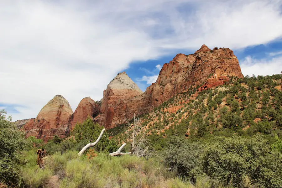
Observation Point remains one of Zion’s great high-elevation viewpoints, but the traditional approach described in many older guides is no longer available. The East Rim Trail from Weeping Rock through Echo Canyon is under a long-term closure because of major rockfall damage.
A current approach is the East Mesa Trail to Observation Point. NPS lists this route at about 6.8 miles round trip with roughly 300 feet of elevation change and an estimated hiking time of about three hours. It reaches the same broad viewpoint over Zion Canyon, including a striking perspective above Angels Landing.
The main challenge is reaching the trailhead. The East Mesa Trailhead is approached by dirt roads that NPS describes as best suited to high-clearance or four-wheel-drive vehicles. They can become muddy or inaccessible after storms and during wetter seasons. Parking is limited to designated spaces, and nearby private property must be respected.
Note: Do not navigate to the old Weeping Rock trailhead expecting to reach Observation Point. Review the current NPS East Rim trail information before leaving.
At the viewpoint, the scale of Zion Canyon is especially clear, with the canyon walls, Great White Throne, and Angels Landing spread below. Early and late light can add dramatic color, but hikers planning sunrise or sunset should carry a reliable light for the approach or return.
Hidden Canyon: Current Long-Term Closure
| Current Status | Long-term closure |
| Reason | Large rockfall |
| Visitor Action | Do not enter the closed trail |
| Alternatives | Scout Lookout, Observation Point via East Mesa, Watchman Trail |
Hidden Canyon was historically known for narrow sandstone walls, secluded scenery, rock scrambling, seasonal vegetation, and a quieter atmosphere than Zion’s busiest trails. Older descriptions may still list its former mileage, elevation gain, or access from Weeping Rock.
Those descriptions should not be used for current trip planning. The National Park Service lists Hidden Canyon as a long-term closure due to a large rockfall. Stay out of the closed area and choose an open alternative instead.
For hikers looking for a similar sense of elevation and canyon scenery, Scout Lookout offers a strenuous but permit-free viewpoint, while Observation Point via East Mesa provides a longer high-country option.
Emerald Pools: A Family-Friendly Hiking Option
The Emerald Pools trail system provides several shorter hiking choices near Zion Lodge. The Lower, Middle, and Upper Emerald Pools can be combined in different ways, allowing visitors to choose a route that matches their time and ability.
The Lower Emerald Pool Trail begins across the bridge from Zion Lodge. The rough paved path passes through pinyon-juniper woodland toward a seasonal waterfall and the Lower Pool. Continuing toward the Middle and Upper Pools adds steeper, unpaved sections, rock steps, sandy terrain, and additional drop-offs.
The Zion Lodge bridge that provides direct access to the Emerald Pools system reopened in June 2025 after major reconstruction, restoring the convenient trail connection from Shuttle Stop #5.
Warning: Do not swim, bathe, wade, or dip your feet in the Emerald Pools. The pools are fragile wildlife water sources, and entering them is prohibited. Stay on the trail and enjoy the waterfalls and pools from the permitted viewing areas.
The Lower Pool works well for visitors seeking the shortest outing, while the Middle and Upper Pools require more climbing. Waterfalls are seasonal, so their flow can vary greatly with weather and time of year. Review the NPS Emerald Pools guidance before hiking.
The Subway: A Thrilling Slot Canyon Adventure
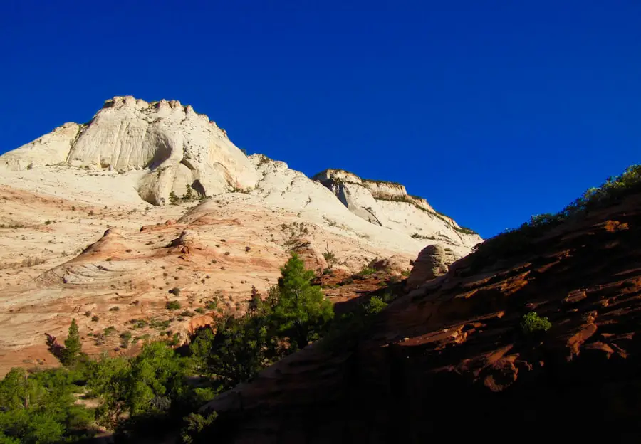
The Subway, officially part of the Left Fork of North Creek, is a wilderness destination rather than a standard maintained trail. Every trip into the Subway area requires a Wilderness Permit, and hikers must understand the major difference between the bottom-up and top-down routes before applying.
The Trail’s Unique Features
The bottom-up route is a strenuous 9-mile round trip with about 1,300 feet of elevation change. NPS estimates six to ten hours for most hikers. There is no maintained trail through much of the route, so hikers must scramble over large boulders, repeatedly cross or hike in the creek, and navigate through rugged terrain.
The top-down Subway route is not simply a harder version of the hike. It is a technical canyoneering trip that requires ropes, harnesses, rappelling skills and equipment, route-finding ability, and swims through cold water.
Breathtaking Views and Safety Considerations
The Subway is known for sculpted sandstone, rounded canyon walls, pools, flowing water, and mineral colors that change with the light. Those features also create hazards. Wet rock can be extremely slippery, water can be cold, and flash floods can make narrow canyons deadly.
Route-finding is another major concern. NPS notes that hikers become lost in this area every year. A detailed route description, topographic map, appropriate clothing, and an honest assessment of the group’s skills are essential.
Permits are required year-round. Review the current NPS Left Fork/Subway permit information before making transportation or hiking plans.
An Unforgettable Experience
For properly prepared hikers, the bottom-up Subway can provide a challenging wilderness day without the technical rappelling required by the top-down route. Experienced canyoneers may choose the top-down route, but it should never be treated as a casual hiking trail. Matching the route to your skills is the most important part of planning this adventure.
West Rim Trail: A Long Backcountry Hike or Overnight Trip
The West Rim Trail crosses some of Zion’s quieter high country before descending into Zion Canyon. The through-route begins near Lava Point on Kolob Terrace Road and ends at the Grotto.
The mileage is shorter than many older descriptions suggest. According to current NPS trail information, the West Rim Trailhead to the Grotto is 14.2 miles via the Rim Trail or 13.6 miles via Telephone Canyon, with about 3,400 feet of overall elevation change.
The first miles travel through high-elevation terrain with views toward Wildcat Canyon and Potato Hollow. Farther south, hikers can follow the Rim Trail for broad views over Phantom Valley or use Telephone Canyon as a shorter connection. From Cabin Spring, the trail drops about 2,500 feet toward the Grotto.
This route can be completed as a demanding day hike by experienced hikers, but transportation must be arranged because the trailheads are far apart. NPS notes that many through-hikers use a commercial shuttle to reach the northern trailhead.
Backpackers may camp only in designated West Rim sites and need a Wilderness Permit for overnight trips. Do not assume seasonal springs will provide water: Potato Hollow and Sawmill Springs may dry up, especially later in summer. Review the NPS wilderness trail descriptions and current water-source information before leaving.
Canyon Overlook Trail: Short, Scenic, and More Rugged Than It Looks
Canyon Overlook is one of Zion’s best short hikes, but “short” does not mean flat or hazard-free. The trail begins near the east end of the Zion-Mount Carmel Tunnel and covers about one mile round trip with roughly 163 feet of elevation change.
The route crosses rocky and uneven terrain, includes steps and narrow sections, and passes long drop-offs that are mostly—but not completely—protected by railings or fencing. Hikers uncomfortable with heights should consider that exposure before starting.
The final overlook provides broad views into Pine Creek Canyon and lower Zion Canyon. Sunrise and sunset can produce striking light on the sandstone, but anyone hiking near darkness should carry a headlamp.
Pro Tip: Parking at Canyon Overlook is extremely limited. Do not stop in an unsafe or unauthorized roadside location. Be prepared to continue driving and try again later if the designated spaces are full.
More Open Zion Hikes Worth Considering
Watchman Trail
The Watchman Trail is a useful moderate option that begins near the Zion Canyon Visitor Center, so it avoids the logistics of reaching many deeper-canyon trailheads. NPS lists it at about 3.3 miles round trip and roughly two hours for the average hiker. Expect sandy, rocky, uneven terrain, limited summer shade, and views over lower Zion Canyon and Springdale.
Riverside Walk
Riverside Walk is the paved approach to The Narrows and is worthwhile even for visitors who do not want to enter the river. It runs about one mile each way from the Temple of Sinawava through the narrowing upper canyon. The route is relatively flat, although some paving is irregular and sandy sections can be slippery.
Pa’rus Trail
The paved Pa’rus Trail follows the Virgin River near the visitor center and Canyon Junction. It is one of Zion’s most accessible options and is also the park’s only trail where leashed pets are allowed. Bicycles are permitted as well. The NPS accessibility assessment lists the main route at about 1.6 miles one way, and the open views make it a popular sunset walk.
Plan Before Hiking in Zion National Park
A trail that is appropriate in cool, dry weather may be unsafe after a storm, during extreme heat, or when river levels rise. Build your itinerary around current conditions rather than assuming a trail will be available.
- Check closures first: Review the NPS current conditions page on the day of your hike.
- Know your permit: Angels Landing requires a permit beyond Scout Lookout; every Subway trip requires a Wilderness Permit; Narrows top-down trips require a permit; overnight wilderness camping also requires a permit.
- Watch the weather: Thunderstorms can create dangerous flash floods far from where rain actually falls.
- Carry drinking water: Do not rely on seasonal backcountry springs without checking their current status.
- Plan around the shuttle: Zion Canyon shuttle service operates seasonally, and shuttle hours change during the year. No reservation is required to ride, but hikers should check the day’s schedule so they do not miss the final bus.
- Turn around early: Distance, heat, water, elevation, and difficult footing can make the return trip harder than expected.
Zion National Park offers hiking experiences for very different comfort levels. The Narrows puts hikers directly in the Virgin River, Angels Landing tests tolerance for exposure, Observation Point rewards a longer east-side approach, and Emerald Pools offers shorter canyon scenery. The Subway and West Rim demand significantly more planning, while Watchman, Riverside Walk, and Pa’rus provide strong alternatives when a shorter or less technical hike fits the day better.
If you’re planning a trip to Zion National Park and considering footwear for wet or muddy conditions, you may also be interested in this guide to the best waterproof sneakers for travel. For The Narrows in particular, remember that appropriate river-hiking footwear and secure footing matter more than simply choosing a shoe labeled waterproof.
Love travel? Join Our Facebook Community For More Tips.
Frequently Asked Questions
What are the best hiking trails in Zion National Park?
Popular choices include The Narrows, Angels Landing, Observation Point via East Mesa, Emerald Pools, The Subway, West Rim, Canyon Overlook, Watchman Trail, Riverside Walk, and Pa’rus Trail. The best choice depends on your experience, available time, comfort with heights or water, and current trail conditions.
Do you need a permit to hike Angels Landing?
Yes. Every hiker continuing from Scout Lookout onto the chain-assisted Angels Landing route needs a permit. You can hike from the Grotto to Scout Lookout without an Angels Landing permit.
Do you need a permit for The Narrows?
The common bottom-up Narrows hike from the Temple of Sinawava does not require a permit. The 16-mile top-down route from Chamberlain’s Ranch does require a Wilderness Permit.
Can you hike Observation Point from Weeping Rock?
No. The East Rim Trail from Weeping Rock through Echo Canyon is under a long-term closure because of major rockfall damage. Observation Point can currently be approached from east-side trailheads such as East Mesa.
Is Hidden Canyon open?
No. The National Park Service lists Hidden Canyon as a long-term closure caused by a large rockfall. Do not enter the closed trail.
Can you swim in the Emerald Pools?
No. Swimming, bathing, and wading in the Emerald Pools are prohibited. The pools are fragile natural water sources, so visitors should remain on permitted trail and viewing areas.
What is The Subway in Zion National Park?
The Subway is a sculpted section of the Left Fork of North Creek. The bottom-up trip is a strenuous off-trail wilderness hike, while the top-down trip is a technical canyoneering route involving rappelling and swims. Every trip into the Subway area requires a Wilderness Permit.
Is Canyon Overlook Trail easy?
It is short at about one mile round trip, but it is better described as moderate than universally easy. The route is rocky and uneven, has steps and long drop-offs, and may not suit hikers who are uncomfortable with heights.
Sources
- National Park Service — Zion Current Conditions — current trail closures, river restrictions, flash-flood closures, and cyanobacteria guidance.
- National Park Service — Angels Landing Permits & Hiking — permit rules, mileage, elevation gain, Scout Lookout access, and safety guidance.
- National Park Service — The Narrows From the Bottom Up — route distance, Big Spring boundary, permit status, and river-hiking guidance.
- National Park Service — East Rim Wilderness Trail Descriptions — Observation Point access, Weeping Rock closure, East Mesa conditions, and Canyon Overlook details.
- National Park Service — Left Fork (Subway) — Wilderness Permit rules and route-planning requirements.
- National Park Service — Wilderness Trail and Campsite Descriptions — West Rim distances, elevation change, seasonal water, campsites, and backcountry planning.