
Last Updated on September 11, 2026 by Daniel Globe
Playas de Tijuana is a coastal neighborhood where you can walk beside the Pacific, see the international border reach into the ocean, explore murals, eat Baja-style seafood, and watch the sunset from the malecón. However, swimming requires serious caution. In its latest summer report published July 10, 2026, COFEPRIS classified Playa de Tijuana as not suitable for recreational water contact.
Quick Answer
Playas de Tijuana is worth visiting for its boardwalk, border views, murals, seafood, cafés, and sunsets. As of July 10, 2026, Playa de Tijuana is officially classified as not suitable for swimming, so plan a dry-side beach visit unless health authorities publish a newer result confirming that the water is safe.
Key Takeaways
- The malecón, murals, lighthouse, border views, restaurants, and sunsets make Playas enjoyable even when you do not enter the water.
- COFEPRIS classified Playa de Tijuana as not suitable for recreational water contact in its July 2026 monitoring.
- The elevated viaduct connecting the airport, border area, central Tijuana, and Playas fully opened in March 2026.
- Travelers should review current entry documents, U.S. re-entry requirements, border waits, and Mexican insurance rules before crossing.
- Visit during daylight, stay in populated areas, use tracked transportation, and follow the latest official travel advisory.
Disclosure: As an Amazon Associate I earn from qualifying purchases. Some links on this page are affiliate links, at no extra cost to you.
Why Playas de Tijuana Stands Out
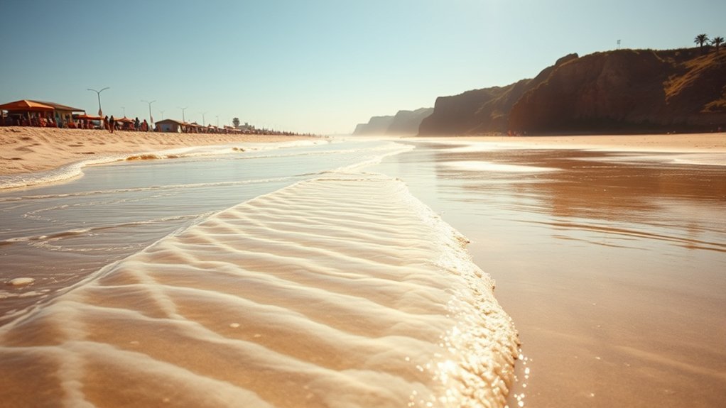
Playas de Tijuana combines a sandy urban shoreline with one of North America’s most recognizable border landscapes. At the northern end of the coast, the international barrier extends into the Pacific beside El Faro, the local lighthouse. The malecón continues south past murals, cafés, food stands, restaurants, seating areas, and neighborhood streets.
The area feels more residential than central Tijuana. Families walk the promenade, cyclists pass along the waterfront, vendors sell snacks, and visitors gather for sunset. You can spend several hours here without needing a formal attraction ticket. Food, transportation, parking, and special events may cost extra.
Playas is also a place of cultural and political meaning. Art along the border reflects migration, separation, community, identity, and hope. Visit respectfully, especially near Friendship Park, where families and community groups have historically gathered.
Playas de Tijuana at a Glance
Plan Your Visit
| Best For | Boardwalk walks, murals, border views, seafood, photography, and sunsets |
| Suggested Time | Three to six hours |
| General Admission | No general beach or boardwalk admission fee; parking, food, and events may cost extra |
| Best Time of Day | Morning for lighter crowds or late afternoon for sunset |
| Getting Around | Walking along the malecón, plus an authorized taxi, tracked rideshare, or private vehicle |
| Swimming Status | Not recommended under the July 10, 2026 COFEPRIS classification; check for a newer official result |
Best Time to Visit Playas de Tijuana
Spring and fall are comfortable times for long waterfront walks because the weather is often mild and the boardwalk can be less crowded than on major summer weekends. Summer brings longer daylight and more activity, but parking and restaurants can become busier. Winter days can still be pleasant, although rain, wind, and rough ocean conditions are more likely.
Morning is best when you want easier parking, softer light, and fewer people. Late afternoon is better for food, people-watching, and sunset photography. Bring a light layer because wind from the Pacific can make the waterfront feel cooler than inland Tijuana.
Pro Tip: Arrive two or three hours before sunset. You will have time to see the lighthouse and murals, walk the malecón, order food, and choose a safe viewpoint before the light begins to change.
Best Places to Visit in Playas de Tijuana
The malecón is the easiest place to begin. It follows the waterfront through the main visitor area and gives you access to ocean views, murals, cafés, food vendors, seating, and neighborhood restaurants. Conditions along the promenade can vary after storms or construction, so watch for uneven surfaces and temporary closures.
At the northern end, El Faro and the border wall create the area’s most recognizable view. The nearby Mexico-side area of Friendship Park remains accessible from Playas. However, the U.S. Friendship Circle on the other side of the border is currently closed to normal public access, even though parts of Border Field State Park may be open with restrictions.
Los Arcos provides another recognizable waterfront meeting point and is sometimes used for community or seasonal activities. South of the busiest part of the malecón, local shoreline sections such as El Vigía and Playa Delfín may feel quieter. Access, tides, erosion, and water quality can change, so do not assume that a quieter section is safe for swimming.
Things to Do at Playas de Tijuana
The safest and most reliable activities are on land. Walk the malecón, photograph the murals, watch surfers from shore, browse food stands, listen to street performers, or sit with an ocean view. The wide horizon and border landscape make the area especially interesting for photography.
You can also explore local cafés and seafood restaurants, try fish or shrimp tacos, order ceviche, buy churros or elote, and finish with an agua fresca or fresh fruit drink. Vendor schedules are not fixed, so the selection is usually better on busy afternoons and weekends.
Surfing and other water activities have a local following, but participation should depend on both water-quality results and ocean conditions. Do not rely only on the presence of other swimmers or surfers. Official pollution warnings, rip currents, waves, submerged hazards, and the availability of lifeguards all matter.
Warning: COFEPRIS classified Playa de Tijuana as not suitable for recreational water contact in its summer report published July 10, 2026. Avoid swimming, surfing, paddleboarding, and other direct water contact unless authorities publish a newer result confirming safe conditions.
A Simple One-Day Playas de Tijuana Itinerary
- Start near El Faro: See the lighthouse, the border reaching into the Pacific, and the Mexico-side Friendship Park area.
- Walk the malecón: Look at murals, sculptures, cafés, and changing ocean views.
- Stop for lunch: Choose a busy seafood restaurant or established food stand and confirm prices before ordering.
- Explore the central waterfront: Continue toward Los Arcos and the neighborhood streets behind the beach.
- Watch the sunset: Return to a populated, well-lit part of the malecón and arrange your ride before it becomes late.
A half-day is enough for the main waterfront. A full day lets you add a visit to CECUT, Zona Río, or central Tijuana before returning to the border.
Playas de Tijuana Art, Murals, and Border Views
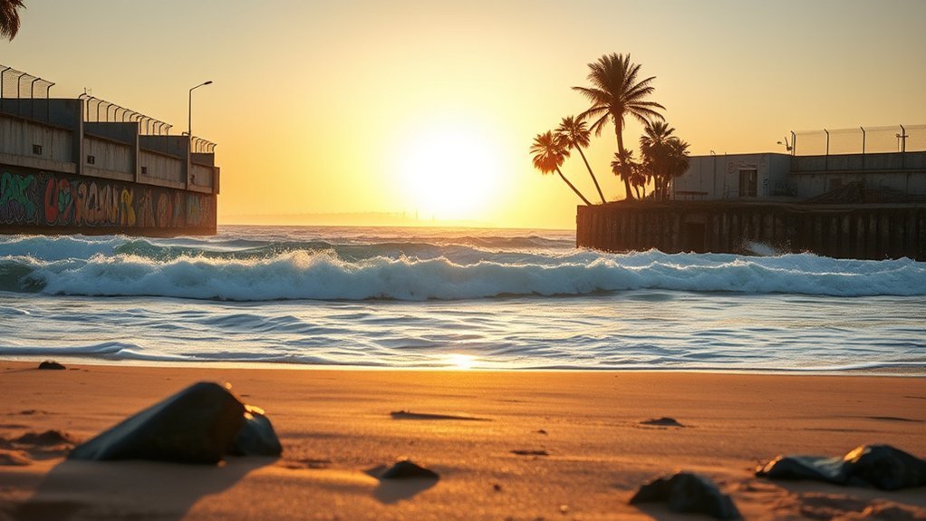
Murals and public art are central to the experience at Playas de Tijuana. Works near the border and along the waterfront often address peace, migration, family separation, local identity, resilience, and the relationship between the two neighboring countries.
Border-Fence Murals
The border barrier has served as a changing outdoor canvas for local and visiting artists. Designs, words, symbols, portraits, and memorials may change as new work appears or older work is covered. Treat the art and surrounding gathering spaces respectfully, especially when families or community groups are using the area.
You can approach the border from the Mexican side near El Faro. Do not attempt to pass food, money, notes, gifts, or other objects through the barrier. Crossing or passing items outside an authorized port of entry can lead to intervention by border authorities.
Iconic Photo Spots
The most recognizable photographs include the border wall meeting the ocean, El Faro, the malecón, murals, sculptures, and the Tijuana sign. Keep your camera or phone close to your body when you are not using it, and avoid stepping into traffic or climbing barriers for a better angle.
For straighter architectural images, keep the phone level and step back instead of tilting sharply upward. Early morning produces cleaner light and lighter crowds. Sunset creates stronger silhouettes, but you should remain in a populated area and arrange transportation before dark.
Sunset Coastal Views
On a clear evening, the Pacific can shift from silver and blue to gold, pink, and violet. The malecón gives you several viewpoints without requiring you to walk onto wet sand or approach the water. Clouds and marine haze sometimes block the horizon, but they can also create dramatic light.
The most memorable part of Playas de Tijuana is not a single attraction. It is the meeting of neighborhood life, public art, the Pacific Ocean, and an international boundary in one walkable setting.
Where to Eat and Drink by the Beach
Food choices around Playas range from informal stands to established seafood restaurants and cafés. Fish tacos, shrimp tacos, ceviche, tostadas, elote, churros, fruit drinks, coffee, and micheladas are common options. Menus, hours, and branches can change, so confirm the location before making a special trip.
Seafood Spots Near the Waterfront
Mariscos Tito’s lists a Playas de Tijuana branch and is known locally for seafood and fish tacos. Arcos Playas also promotes seafood dining near the Playas waterfront. Their exact hours, table availability, and menus may vary, especially during holidays.
Mariscos Los Chilos is another local seafood name associated with the Playas area, but verify the current branch and opening hours before you go. A restaurant located in the Playas neighborhood may still be several blocks from the sand, so check the map rather than assuming every location has a direct ocean view.
Casual Street Food
Boardwalk and neighborhood vendors may sell tacos, churros, elote, esquites, fruit cups, snacks, and drinks. Choose a stand with steady customer turnover, clean preparation surfaces, protected ingredients, and food cooked thoroughly in front of you.
Ask the price before ordering when it is not displayed. Carry small amounts of Mexican pesos because not every vendor accepts cards, and avoid displaying a large wallet or stack of cash in a crowded area.
Drinks With Ocean Views
Cafés, restaurants, and bars near the malecón may offer aguas frescas, coffee, beer, cocktails, and micheladas. Outdoor seating can fill quickly near sunset. Check the final bill, keep your payment card in sight, and arrange transportation before drinking alcohol.
Tacos El Gordo is a well-known Tijuana name, but its identified city branches should not be treated as beachfront Playas locations. Marea Alta is associated with the Rosarito area rather than the Playas de Tijuana malecón.
How to Get to Playas de Tijuana
From Central Tijuana
From central Tijuana or Zona Río, normal driving approaches include Avenida Internacional and Segundo Acceso a Playas. The elevated viaduct also connects the border, central city, airport corridor, and Playas. Use current navigation because ramp access, congestion, and construction patterns can change.
From Tijuana International Airport
The full elevated viaduct opened in March 2026. The Mexican government states that it is designed to reduce the airport-to-Playas trip from about 34 minutes to about 12 minutes. Actual time can be much longer during congestion, incidents, closures, or busy border periods.
From San Diego or San Ysidro
You can cross at San Ysidro on foot and use a tracked rideshare or authorized taxi on the Mexican side. This avoids driving in central Tijuana and removes the need to find parking at the beach. Make sure your phone has roaming or a data plan that works in Mexico.
If you drive across, carry valid travel documents, vehicle registration, a permanent valid license plate, and Mexican liability insurance. The U.S. Department of State states that Mexican car insurance is required. Baja California is generally within Mexico’s permit-free vehicle zone, so a temporary vehicle import permit is normally not required for a standard trip within the state.
From Rosarito or Ensenada
Travel north using Highway 1 or the 1D toll road, then follow current signs or navigation toward Playas de Tijuana. Highway 1 and 1D are useful for trips along the coast, but they are not the normal primary directions from central Tijuana to the beach.
Entry and Return Documents
Mexico’s entry requirements depend on your nationality, residency, visa status, reason for travel, and length of stay. Many visitors must present a valid passport, and Mexican immigration may issue or record an FMM authorization at the port of entry. Do not assume that crossing by land removes immigration requirements.
Your documents for returning to the United States are a separate matter. U.S. citizens returning by land can use approved Western Hemisphere Travel Initiative documents, including a valid passport book, passport card, or certain enhanced and trusted-traveler cards. Other nationalities must carry the documents required for their immigration status.
Note: Review official Mexican entry guidance and U.S. re-entry requirements before departure. Rules can differ for children, permanent residents, visa holders, rental vehicles, and travelers staying beyond the border region.
Returning Through the Border
Northbound waits at San Ysidro can change significantly within a few hours. Check the official CBP Border Wait Times service before leaving Playas. Confirm whether you are using the general, Ready, SENTRI, or pedestrian lane and whether everyone in your group has the correct documents for that lane.
Parking, Accessibility, and Facilities
Street parking and small parking areas are available around parts of Playas, but spaces can fill on weekends, holidays, and warm afternoons. Do not leave passports, shopping bags, cameras, or luggage visible in a parked vehicle. Check signs carefully and avoid blocking driveways or restricted access points.
Much of the malecón is suitable for an ordinary walk, but surfaces, ramps, curb cuts, construction zones, and sand access are not consistent along the full waterfront. Visitors using wheelchairs, walkers, or strollers should stay on the main paved promenade and be prepared for detours.
Restrooms, seating, shade, and vendor services are not equally available along every section. Use facilities when you see a suitable option, carry drinking water, and bring sun protection. Keep the area clean and take your waste with you when bins are full.
Products Worth Considering

【UV400 Protection for Your Eyes】Anti-glare lenses can block UV rays. UV400 rated sunglasses are essential for filtering out sunlight reflected glare and protecting your eyes against long term UV damage when you go out

THE ROAD TRIPPER. Ultra sheer SPF that's easy to apply anywhere. Head-to-toe coverage on the go. Includes: Travel-Sized Original SPF 30 Lotion, Full Sized Face Stick SPF 30, Full Sized Original Lip Balm 30 in Coconut, and travel bag.

[Cute Preppy Sunscreen Bag for Women & Beach Lovers] Stylish clear bag with trendy blue chenille “SUN” letter patches - the perfect preppy beach accessories that women love for organized sun protection. Essential necessities for fashionable beach vacation organization and Instagram-worthy pool days.
Safety Tips for Visiting Playas de Tijuana
The U.S. Department of State currently advises travelers to reconsider travel to Baja California because of crime, kidnapping, and other security concerns. It also notes that many serious incidents in Tijuana occur outside the main tourist areas. This does not mean that every visitor will experience a problem, but it does mean that you should plan carefully instead of treating the area like an ordinary domestic beach trip.
Personal Safety Basics
- Visit during daylight and remain near populated waterfront streets.
- Use tracked rideshares, hotel-arranged transportation, or authorized taxi stands.
- Stay on main roads and avoid remote shortcuts.
- Carry only the cash and cards you expect to use.
- Keep your phone, wallet, passport, and camera secured.
- Do not resist a robbery attempt. Move to a safe location and report the incident.
- Share your ride and location with someone you trust.
- Save your accommodation and return-crossing details offline.
Beach and Ocean Safety
Water pollution is not the only ocean hazard. Waves, currents, submerged objects, cold water, sudden drop-offs, and limited lifeguard coverage can also create risk. Watch the ocean from a safe distance during high surf and keep children within reach.
- Follow every posted closure or warning.
- Do not enter the water under the current COFEPRIS no-contact classification.
- Never assume a section is safe because other people are swimming.
- Stay back from rocks, barriers, and waves during rough conditions.
- Do not climb the border structure, lighthouse equipment, roofs, or unstable coastal edges.
Nighttime Travel Precautions
After dark, keep your route direct and use well-lit streets around established businesses. Avoid isolated sand, empty side streets, and informal transportation. Request your ride while you are still inside a restaurant or other populated location.
| Action | Why It Helps |
|---|---|
| Stay in populated, well-lit areas | Reduces isolation and makes assistance easier to find |
| Use a tracked ride or authorized taxi | Provides trip records and driver details |
| Travel with other people | Makes you less isolated and improves situational awareness |
| Keep valuables out of sight | Reduces unwanted attention |
| Arrange your return before drinking | Prevents unsafe driving and last-minute transport problems |
Mexico’s general emergency number is 911. Response times and English-language assistance can vary, so ask a restaurant, hotel, or trusted local contact for help when appropriate.
Water Quality and Swimming Conditions
Water quality is the most important current limitation at Playas de Tijuana. In its summer monitoring published July 10, 2026, Mexico’s Federal Commission for Protection against Health Risks, COFEPRIS, listed Playa de Tijuana among five Mexican beaches that exceeded the permitted microbiological criteria for recreational water contact.
COFEPRIS recommends avoiding swimming and other direct-contact recreation at beaches classified as not suitable. The result is based on enterococci levels, which are used as indicators of fecal contamination and possible health risk.
Warning: Do not swim based only on clear-looking water, good weather, or the presence of other beachgoers. Wait for an official, newer COFEPRIS or local health-authority result that specifically reclassifies Playa de Tijuana as suitable.
Rain and runoff can worsen coastal contamination, but the current concern is not limited to the hours immediately after a storm. The beach was also classified as not suitable in earlier official monitoring, making this a continuing issue rather than a rare one-day event.
- Check the latest COFEPRIS beach-monitoring result before your visit.
- Read all signs and instructions posted at the beach.
- Avoid contact with drainage outlets, discolored water, foam, strong odors, or visible waste.
- Keep children and pets away from contaminated water and wet sand near runoff.
- Wash exposed skin and seek medical guidance if you become ill after accidental contact.
You can still enjoy the malecón, murals, cafés, food, photography, and sunset without entering the water.
Best Day Trips From Playas de Tijuana
CECUT and Zona Río
The Centro Cultural Tijuana, commonly called CECUT, is a practical half-day addition rather than a distant day trip. Its exhibitions, cultural programming, museum spaces, and distinctive spherical IMAX building provide a strong contrast to the beach. Travel time from Playas depends heavily on traffic.
Rosarito
Rosarito offers a larger resort-beach setting, restaurants, nightlife, and access to the coastal Highway 1 and 1D corridor. Do not assume its swimming conditions are automatically safe. Check current monitoring for the specific Rosarito beach you plan to use.
Valle de Guadalupe
Valle de Guadalupe is best treated as a full-day trip. The wine region has vineyards, restaurants, lodging, and rural roads. Use a designated driver or organized transportation if anyone in your group will drink alcohol, and return before late night when possible.
Ensenada and El Salto
Ensenada is suitable for a full-day coastal trip with seafood, harbor views, cultural sites, and access to nearby nature. El Salto is a seasonal waterfall and canyon area farther south along the Tijuana-Ensenada corridor. Water flow and access depend on rainfall, land conditions, and current operating rules, so confirm conditions before leaving Tijuana.
Friendship Park should not be treated as a separate day trip from Playas because its Mexico-side location is at the northern end of the same waterfront area.
What Changed in Playas de Tijuana in 2026?
The most important transportation change is already complete. On March 16, 2026, Mexico’s federal government announced the opening of the second section of the elevated Tijuana viaduct. The full project connects the airport corridor, border area, central Tijuana, and Playas over approximately 11 kilometers.
The government says the route can reduce an airport-to-Playas trip from about 34 minutes to about 12 minutes. Treat that as a project estimate, not a guaranteed journey time. Traffic, ramp access, accidents, border congestion, and maintenance can still cause delays.
Playas is also receiving sanitary-infrastructure work. In June 2026, the local water utility CESPT reported an expanded rehabilitation project covering sanitary lines, household connections, and manholes across many of the waterfront walkways. The work is intended to reduce overflows and improve the sewage network.
These improvements do not cancel the current water warning. Transportation access may be better, and sewer work may support long-term improvement, but the July 2026 COFEPRIS result still classifies Playa de Tijuana as not suitable for recreational water contact.
Frequently Asked Questions
Is it safe to swim in Playas de Tijuana?
Not under the latest result available when this guide was updated. COFEPRIS classified Playa de Tijuana as not suitable for recreational water contact in its summer report published July 10, 2026. Avoid swimming and other direct water contact until authorities publish a newer result confirming safe conditions.
Is Playas de Tijuana worth visiting when swimming is closed?
Yes. The malecón, murals, lighthouse, border views, seafood, cafés, photography, and sunsets can fill a half-day or full day without entering the water.
What do I need to know before going to Tijuana?
Check Mexico’s entry requirements for your nationality and U.S. re-entry requirements for your immigration status. Carry your passport and other required documents. If driving, bring current registration and Mexican car insurance. Review the current Baja California travel advisory, use main roads, and check border waits before returning.
Is Friendship Park open at Playas de Tijuana?
The Mexico-side area near El Faro remains accessible from Playas. The U.S. Friendship Circle is currently closed to normal public access, although other parts of Border Field State Park may be open with restrictions.
What street is Tijuana’s red-light district on?
Tijuana’s red-light district is in Zona Norte, with much of its activity concentrated around Calle Coahuila and Callejón Coahuila. Avenida Revolución is the main tourist, dining, shopping, and nightlife corridor, but it is not the same area.
Does Tijuana have nice beaches?
Playas de Tijuana has an attractive urban coastline, a walkable waterfront, border views, murals, food, and memorable sunsets. It is better treated as a sightseeing and neighborhood destination than as a dependable swimming beach because water-quality warnings occur regularly.
How long should I spend at Playas de Tijuana?
Allow three to six hours for the lighthouse, border views, murals, malecón, a meal, and sunset. Add more time if you plan to visit CECUT, central Tijuana, or another part of the city.
Conclusion
Playas de Tijuana is most rewarding as a waterfront cultural visit rather than a simple swimming trip. Walk the malecón, see where the border meets the Pacific, study the murals, eat local seafood, and stay for sunset. The elevated viaduct has improved access in 2026, but water quality and personal safety still require careful planning.
Under the latest July 2026 COFEPRIS result, you should remain out of the water unless a newer official report reclassifies the beach. Visit during daylight, use tracked transportation, keep your belongings secure, and check border waits before returning.
Sources
- COFEPRIS Summer 2026 Beach Monitoring — current Playa de Tijuana water-quality classification and swimming recommendation
- U.S. Department of State Mexico Travel Advisory — Baja California safety, transportation, insurance, and driving guidance
- U.S. Customs and Border Protection Travel Documents — documents accepted from U.S. citizens returning by land
- Mexican Consulate Entry Guidance — passport, visa-exemption, residency, and FMM information
- Government of Mexico: Tijuana Elevated Viaduct — March 2026 opening and project details
- California State Parks: Border Field State Park — current U.S.-side access restrictions at Friendship Circle
