
Last Updated on July 29, 2026 by Mason Reed
Finding a campsite in the United States is easier when you separate discovery from verification. Camping apps and reviews can reveal promising locations, but official land-management pages, current maps, posted signs, and local regulations determine whether you may camp there. A reliable search also considers reservations, road access, amenities, seasonal closures, fire restrictions, and backup options.
Quick Answer
Start with Recreation.gov, state park websites, or the responsible federal land agency. Use official maps to confirm boundaries and legal access, then compare amenities and recent reviews. Before leaving, verify reservations, road conditions, fire rules, weather, pet policies, and closures directly with the campground or managing office.
Key Takeaways
- Decide whether you want a developed campground or a dispersed site before searching.
- Use official agency maps and campground pages as the final authority on legal access and current rules.
- Treat user-submitted campsite pins and reviews as leads, not permission to camp.
- Check vehicle access, operating dates, reservations, amenities, fire restrictions, and weather.
- Save maps offline and identify at least one backup campsite before you lose cellular service.
At a Glance
| Time Required | About 30–60 minutes for research; longer for remote dispersed sites |
| Difficulty | Easy for developed campgrounds; moderate for dispersed camping |
| Tools Needed | Phone or computer, official agency maps, weather forecast, offline navigation, and a backup-site list |
| Cost | Searching is usually free; campsite, reservation, permit, entrance, and app fees vary |
Disclosure: As an Amazon Associate I earn from qualifying purchases. Some links on this page are affiliate links, at no extra cost to you.
Choose the Right Type of Campsite
Begin by deciding how much structure and service you need. This narrows the search and prevents you from choosing a site that does not match your equipment, vehicle, or comfort level.
| Campsite Type | Best For | What to Expect |
|---|---|---|
| Developed campground | Beginners, families, RVs, and campers who need services | Defined sites and some combination of toilets, tables, water, fire rings, hookups, hosts, or reservations |
| Dispersed camping | Self-sufficient campers seeking fewer facilities and more solitude | Few or no services; local rules, access limits, stay limits, and waste requirements must be checked carefully |
| Private campground | Travelers seeking predictable amenities or locations near towns | Published rates and policies, with amenities that may include showers, laundry, Wi-Fi, pools, and full RV hookups |
| Backcountry campsite | Hikers, paddlers, and experienced wilderness travelers | Possible permits, quotas, assigned zones, food-storage rules, and pack-out requirements |
Camp on Public Lands
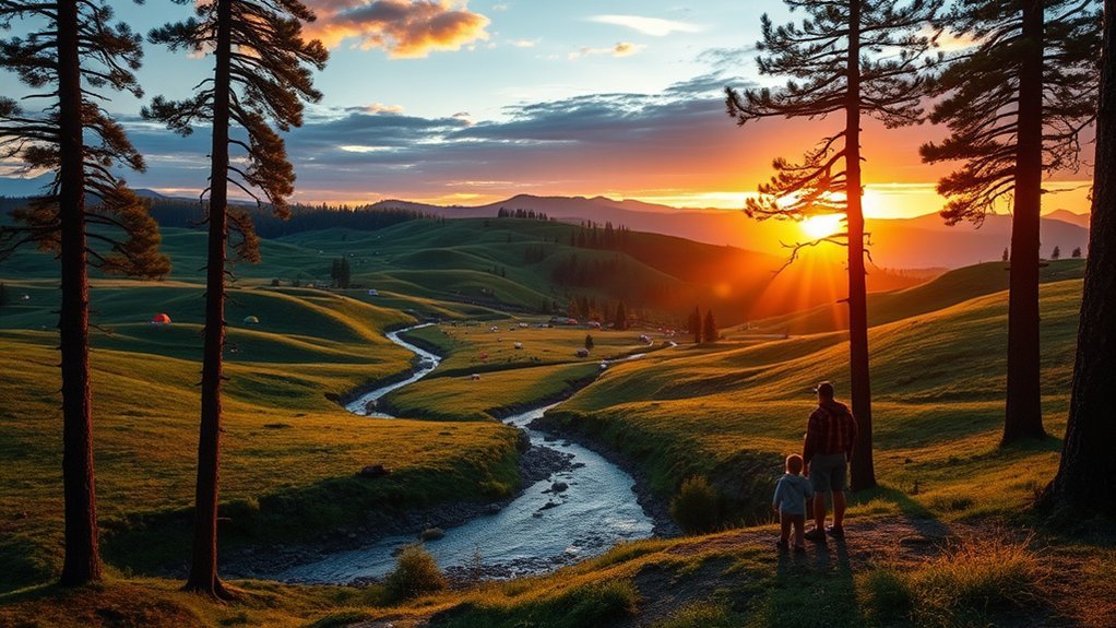
Public lands offer everything from full-service campgrounds to remote dispersed camping. Major sources include the National Park Service, US Forest Service, Bureau of Land Management, US Army Corps of Engineers, state parks, county parks, and other local agencies.
Use Recreation.gov to search many federally managed campgrounds, permits, passes, and experiences. It does not contain every public campsite in the country, so also check the website of the agency that manages your destination.
Developed campground fees vary. Some locations are free, while others charge for the site, reservation, vehicle, entrance, hookups, or additional guests. Dispersed camping on BLM or Forest Service land is often free, but it is not allowed everywhere and may be limited to existing sites or designated corridors.
Follow an Official Search Order
- Search the general area. Use Recreation.gov, a state park reservation system, an agency campground directory, or a private campground directory.
- Identify the land manager. Determine whether the site is managed by the Forest Service, BLM, NPS, a state, a county, a tribe, a utility district, or a private owner.
- Open the official location page. Check operating dates, fees, reservations, stay limits, permits, pet rules, water, toilets, food storage, and fire restrictions.
- Confirm legal vehicle access. Use the current agency route map and verify whether your vehicle is appropriate for the road.
- Check alerts shortly before departure. Look for closures, storms, wildfire smoke, flooding, road damage, and emergency restrictions.
- Contact the local office when information conflicts. A ranger district, BLM field office, park office, or campground operator can resolve uncertainty.
Pro Tip: Record the campground office number, coordinates, confirmation number, gate hours, and two backup sites before leaving. Remote areas may have no data service when you need that information.
Use Maps to Find and Verify Camping Areas
Maps help you understand land ownership, access roads, terrain, nearby water, and the distance to services. However, each map has a different purpose. A satellite image may show a clearing, but it does not prove that camping or driving there is legal.
For National Forest travel, consult the current Motor Vehicle Use Map. An MVUM shows roads, trails, areas, vehicle classes, seasonal allowances, and distance allowances that are legally open to motorized travel. Roads not shown are not open to public motorized use.
An MVUM has little terrain detail and does not guarantee that a road is maintained or suitable for a passenger car, trailer, or motorhome. Pair it with a Forest Visitor Map, topographic map, current road report, and satellite imagery.
| Tool | Best Use | Limitation |
|---|---|---|
| Forest Service MVUM | Confirming legal motorized routes, vehicle classes, and seasonal designations | Does not show detailed terrain or guarantee road condition |
| BLM maps and location pages | Checking BLM boundaries, recreation sites, and area-specific rules | Local closures and field-office orders may change access |
| Google Maps | Finding services, estimating drive time, and viewing major roads | Private roads, seasonal roads, and campsite pins may be inaccurate |
| Google Earth or satellite imagery | Viewing terrain, clearings, road shape, vegetation, and possible turnarounds | Imagery may be old and cannot establish camping permission |
| Topographic maps | Judging slope, elevation, drainage, and nearby terrain | May not reflect recent gates, washouts, or temporary closures |
Warning: A pin in a camping app, a visible fire ring, or tire tracks on satellite imagery do not prove that a site is legal. Confirm the boundary, route designation, current closure orders, and posted signs before occupying the site.
Use Apps to Find Potential Campsites
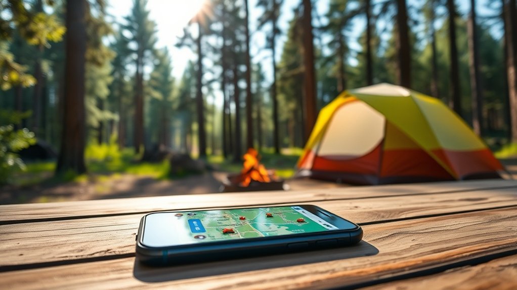
Camping apps are useful for generating ideas, comparing amenities, reading recent experiences, and saving locations. The best results usually come from combining an official source with one or two community-based tools.
Top Camping Apps and Websites
- Recreation.gov: Find and reserve participating federal campgrounds, review location details, and access existing reservations.
- The Dyrt: Search public and private campgrounds and read camper reviews. Paid features may include offline maps and public-land layers.
- iOverlander: Browse community-submitted camping, lodging, water, and traveler-service locations.
- AllStays: Compare campgrounds and RV-related services such as dump stations, hookups, road grades, and low-clearance hazards.
- FreeCampsites.net: Review user-submitted free and low-cost camping reports, but independently confirm every location before traveling.
Features to Consider
Useful filters depend on your camping style. Look for:
- Tent, car, van, trailer, or motorhome compatibility
- Maximum vehicle or trailer length
- Electric, water, and sewer hookups
- Potable water, toilets, showers, and dump stations
- Accessible sites and facilities
- Pet rules and leash requirements
- Shade, tree cover, privacy, and noise reports
- Road surface, clearance, grade, and turnaround space
- Cellular coverage and offline-map support
- Reservation availability and cancellation notifications
- Seasonal opening dates and maximum-stay rules
Some features require a subscription. Check the current price and renewal terms before starting a trial.
Use User-Generated Content Carefully
Recent reviews can reveal details that official listings may not describe, including road washouts, generator noise, crowded weekends, mosquitoes, shade, weak cellular service, or whether a long trailer can turn around.
Before relying on a report, check:
- Date: Give more weight to reports from the current season.
- Vehicle: A road that worked for a lifted four-wheel-drive vehicle may not work for a sedan or motorhome.
- Weather: Dry-road reports may be useless after rain or snow.
- Photos: Look for evidence of slope, soft sand, mud, branches, ruts, and turnaround space.
- Consistency: Compare several reports rather than relying on one enthusiastic review.
- Official confirmation: Check that the site remains on land where camping is permitted.
Note: User reviews are best for learning what a campsite felt like at a particular time. Official sources are better for current rules, boundaries, permits, closures, and legal access.
Find a Campsite Step by Step
- List your non-negotiable needs. Record your dates, group size, vehicle length, tent or RV type, pet needs, accessibility needs, preferred activities, and required amenities.
- Search official campground databases. Start with Recreation.gov, NPS, the Forest Service, BLM, state parks, county parks, or the destination’s official tourism and recreation page.
- Compare several candidates. Check total cost, distance, cancellation terms, operating season, water, toilets, shade, hookups, quiet hours, and nearby activities.
- Verify the exact managing agency. Confirm the site or dispersed area is on the land you think it is. Pay special attention to private parcels and mixed public-private boundaries.
- Check access and current conditions. Review official route maps, road reports, weather, flood risk, wildfire information, smoke, and seasonal gates.
- Reserve or plan your arrival. Book reservable sites as soon as the facility’s booking window allows. For first-come-first-served camping, arrive early and avoid assuming a site will be available.
- Prepare backups and offline information. Save maps, directions, rules, permits, confirmation details, and two alternative locations before departure.
The most useful campsite is not simply the one with the best view. It is the one that is legal, reachable by your vehicle, open on your travel date, and suitable for your group.
Optional Trip Planning: Indigenous Heritage on Route 66
If your camping trip follows Route 66, campsite planning can include respectful visits to Indigenous cultural destinations. The historic route passes through the homelands and present-day communities of numerous tribal nations. The National Park Service and the American Indian Alaska Native Tourism Association have supported resources that share Native perspectives and contemporary cultural experiences along the route.
Indigenous Land Acknowledgment
A land acknowledgment should be more than a generic statement. Learn the names of the specific nations connected to the place, use the names those communities use for themselves, and recognize that Indigenous peoples remain active members and caretakers of these landscapes.
- Learn whose ancestral and present-day lands you are visiting.
- Use tribe-operated museums, visitor centers, cultural guides, and official websites.
- Do not enter closed areas, ceremonial spaces, or private tribal lands without permission.
Cultural Heritage Sites
Tribe-operated attractions and cultural centers may share history, language, art, food, music, and contemporary community life. Check visiting hours, photography rules, permits, road access, and event etiquette before arriving.
Spending money at locally owned lodging, campgrounds, restaurants, guide services, and art markets can support the communities that maintain these cultural experiences.
Respectful Exploration Practices
- Follow signs and instructions from tribal authorities and cultural-site staff.
- Ask before photographing people, ceremonies, artwork, or culturally sensitive places.
- Purchase artwork directly from artists or reputable tribe-supported sellers.
- Do not remove pottery fragments, stone tools, plants, rocks, or other cultural materials.
- Avoid treating living cultures as roadside curiosities or historical relics.
Wildlife Experiences Near Camping Areas
Camping can place you close to seasonal wildlife activity, but timing and conditions vary by year. Confirm current viewing information with the park or refuge before organizing a trip around a migration, rut, salmon run, or nesting period.
| Wildlife Experience | Example Location | Planning Note |
|---|---|---|
| Monarch butterfly migration | Coastal California overwintering sites | Check sanctuary counts, access rules, and seasonal viewing updates |
| Brown bears feeding on salmon | Katmai National Park and Preserve, Alaska | Brooks River bear viewing is commonly strongest in July and September; follow all platform and distance rules |
| Elk rut | Rocky Mountain National Park, Colorado | Fall activity can cause crowds, traffic controls, and temporary area restrictions |
| Salmon run | Katmai National Park and Preserve, Alaska | Run timing changes with water conditions and the salmon population |
| Alligators, wading birds, and wetland wildlife | Everglades National Park, Florida | Wildlife may be easier to observe around concentrated water during the dry season |
Warning: Never approach, feed, surround, or block wildlife. Many national parks require at least 25 yards from most animals and 100 yards from bears and wolves, but distances vary by park. Follow the rule for the exact location and move farther away if an animal reacts to you.
Plan Your Camping Trip
Once you have found a possible campsite, review the full facility page rather than relying on the search-result summary. Policies listed for the individual campground or recreation area usually control.
Check the Reservation System
A campground may use one or more of these systems:
- Reservation only: Every site must be booked before arrival.
- Reservable and first-come-first-served: Some sites can be booked while others are assigned on arrival.
- First-come-first-served only: No site is guaranteed until you arrive and complete the required registration or payment.
- Permit or lottery: Popular backcountry zones, river corridors, and limited-entry destinations may use quotas.
Booking windows are set by the individual facility or agency. Check the exact opening date and time, minimum or maximum stay, cancellation policy, and whether the system offers availability alerts.
Verify That the Site Fits Your Group
- Number of people, tents, and vehicles allowed
- Driveway length and vehicle-combination limit
- Tent-pad size and surface
- Generator hours and quiet hours
- Hookup type and electrical amperage
- Water availability and whether treatment is required
- Accessible parking, paths, restrooms, and site surfaces
- Pet limits, leash rules, breed restrictions, and restricted trails
- Check-in time, gate closure, and late-arrival procedure
Prepare for the Final Road
The last few miles to a dispersed or remote campground may be harder than the highway approach. Check road surface, grade, width, low branches, water crossings, snow, mud, sand, washboards, and turnaround space. Do not assume that a route is safe merely because a map displays it.
Download directions and maps for offline use. Share your route and expected return time with someone who is not traveling with you.
Follow Responsible Camping Practices
Responsible camping protects natural resources and reduces the chance that a popular area will be restricted or closed.
- Use legal sites: Verify land ownership, boundaries, closure orders, and motorized access.
- Use existing disturbed areas: Do not create new roads, widen pullouts, cut vegetation, or build a new site when an established one is available.
- Pack out waste: Remove food scraps, foil, bottle caps, pet waste, toilet paper where required, and other small litter.
- Store food securely: Follow the campground’s rules for food, trash, coolers, toiletries, and other scented items.
- Respect water sources: Camp, wash, and dispose of waste at the required distance from lakes, streams, and springs.
- Control pets: Keep animals leashed where required and prevent them from chasing wildlife or entering neighboring sites.
- Keep noise low: Follow generator and quiet-hour rules and avoid disturbing nearby campers.
Dispose of Human Waste Correctly
Use a provided toilet whenever one is available. Where burial is permitted, Leave No Trace guidance generally recommends a cathole 6–8 inches deep and at least 200 feet from water, trails, and camp. Cover and disguise the hole when finished.
Local rules always come first. Fragile desert, alpine, river-corridor, climbing, cave, and heavily used areas may require a portable toilet or approved waste pack-out bag. Wipes and hygiene products must be packed out.
Check Fire Restrictions
Fire rules can change quickly with wind, drought, and wildfire danger. Check the managing agency’s current alerts and the BLM regional fire-restriction pages when traveling on BLM land.
Warning: An existing fire ring does not mean fires are currently permitted. Never build a fire during a ban, leave one unattended, or depart until the ashes are cold and fully extinguished.
Frequently Asked Questions
What are the best times of year to camp in the U.S.?
The best season depends on elevation, region, and climate. Spring and fall often provide mild weather and fewer crowds in many areas, while northern and high-elevation campgrounds may remain snowy or closed. Desert camping is often more comfortable outside the hottest months. Check historical conditions and the current forecast for the exact destination.
How can I find pet-friendly campsites?
Use a campground search filter when available, then read the official pet policy. Confirm leash length, pet limits, restricted trails or beaches, vaccination rules, unattended-pet rules, and whether wildlife or seasonal conditions create additional restrictions.
Are there fees for camping on public lands?
Yes, some public campgrounds charge nightly, reservation, entrance, vehicle, utility, or permit fees. Dispersed camping is often free, but not in every area. Check the official location page because costs, passes, stay limits, and payment methods vary.
What should I pack for a camping trip?
Pack shelter, sleep insulation, weather-appropriate clothing, food, water or treatment equipment, lighting, navigation, first aid, sun and insect protection, sanitation supplies, fire-safe cooking equipment, trash bags, repair items, and any required food-storage container. Remote dispersed camping also requires extra water, emergency communication, and vehicle-recovery preparation.
How do I choose the right campsite for my needs?
Match the site to your group size, vehicle, equipment, accessibility needs, pets, activities, preferred noise level, and required amenities. Then verify total cost, legal access, operating dates, weather exposure, road conditions, and the cancellation policy.
Can I camp anywhere on BLM or National Forest land?
No. Many areas allow dispersed camping, but closures, designated-site rules, stay limits, resource protections, private inholdings, motorized-route restrictions, and local orders may apply. Confirm the exact area with the relevant BLM field office or Forest Service ranger district.
How do I know whether a forest road is safe for my vehicle?
Check the current legal route map, road-condition reports, recent weather, elevation profile, satellite imagery, and reports from drivers using similar vehicles. Contact the local office when uncertain. A legally open road may still be narrow, rough, muddy, snow-covered, or unsuitable for trailers and low-clearance vehicles.
Conclusion
The safest way to find campsites in the United States is to use community tools for discovery and official sources for verification. Decide what type of site you need, identify the land manager, check legal access and current conditions, compare the full rules and amenities, and prepare backup locations. This process takes more effort than following a campsite pin, but it greatly reduces the risk of arriving at a closed, illegal, inaccessible, or unsuitable location.
Sources
- Recreation.gov — federal campground discovery, reservations, permits, passes, and facility information
- US Forest Service: Motor Vehicle Use Map FAQ — legal motorized-route designations, seasonal allowances, and map limitations
- Bureau of Land Management: Camping — developed and dispersed camping rules, fees, stay limits, and local verification
- National Park Service: 7 Ways to Safely Watch Wildlife — wildlife distance and observation guidance
- National Park Service: Tribal Tourism and Native Voices in Parks — Indigenous perspectives and cultural tourism along Route 66
- Leave No Trace: Dispose of Waste Properly — cathole, pack-out, trash, and wastewater practices
