

Last Updated on July 29, 2026 by Daniel Globe
The Jerusalem to Jericho journey was short in miles but demanding in practice. The first-century road covered about 18 miles through the rugged Judean wilderness and descended from Jerusalem’s high ground to Jericho below sea level. Its geography helps explain both the physical challenge of the trip and the vivid setting of the Good Samaritan story.
Quick Answer
The ancient road from Jerusalem to Jericho was about 18 miles, or 29 kilometers. It descended roughly 3,300 feet from Jerusalem’s highlands to Jericho below sea level, so many travelers would have needed one long day on foot. The exposed terrain also gives the Good Samaritan parable its memorable setting.
Key Takeaways
- The commonly cited first-century road distance is about 18 miles or 29 kilometers.
- Travelers descended approximately 3,300 feet from Jerusalem to Jericho.
- A full day is a reasonable historical estimate, but travel time depended on heat, pace, animals, loads, and road conditions.
- Luke uses the road as the setting for the Good Samaritan, but the text does not explain why the priest and Levite passed the injured man.
- Ancient route information should not be treated as current hiking or security guidance.
Disclosure: As an Amazon Associate I earn from qualifying purchases. Some links on this page are affiliate links, at no extra cost to you.
How Far Is Jerusalem to Jericho?
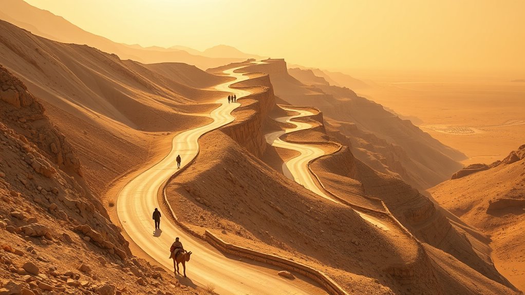
The first-century road from Jerusalem to Jericho was approximately 18 miles, or 29 kilometers. The American Bible Society’s overview of the route explains that the Jewish historian Josephus measured it at about 150 Roman stadia.
The distance alone does not show how demanding the journey was. Jerusalem stood roughly 2,500 feet above sea level, while Jericho was about 825 feet below it. A traveler heading east therefore descended approximately 3,300 feet, or about 1,000 meters, over a relatively short distance.
The road covered about 18 miles while dropping more than half a mile in elevation from Jerusalem’s highlands to the Jordan Valley.
This is why biblical accounts describe people as going down from Jerusalem to Jericho. Jericho lies northeast of Jerusalem, but “down” describes the sharp loss of elevation rather than a direction on a modern map.
Note: The 18-mile figure refers to the ancient road described by historical and biblical sources. A modern driving or walking distance can vary according to the exact starting point, destination, permitted route, road closures, and current access rules.
Why Jericho’s Location Matters
Jericho developed around a valuable oasis in the Jordan Valley. The archaeological mound known as Tell es-Sultan lies northwest of the modern city and contains evidence of human activity dating back to about 10,500 BC. UNESCO describes the site as an early permanent settlement supported by fertile land and the perennial spring of ‘Ain es-Sultan.
It is therefore safer to describe Jericho as one of the world’s earliest known permanent settlements rather than make an absolute claim that every part of the city was continuously inhabited without interruption.
How Long Did Jerusalem to Jericho Travelers Take?
A traveler could reasonably expect the Jerusalem-to-Jericho journey to occupy one long day on foot. However, no single travel time applied to everyone.
The length of the trip depended on several factors:
- Walking pace: A lightly equipped traveler could move faster than a merchant carrying goods.
- Heat and water: The landscape becomes hotter and drier as the road approaches the Jordan Valley.
- Animals and cargo: Donkeys, pack animals, and heavily loaded groups required more time.
- Rest stops: Travelers needed to manage fatigue during the long descent.
- Road conditions: Uneven ground, narrow sections, and seasonal weather could slow the journey.
- Group safety: People traveling together might choose a cautious pace rather than separate from the group.
The return trip from Jericho to Jerusalem was harder in a different way. Instead of descending, a traveler had to climb more than 3,000 feet through the same dry landscape.
Because ancient travelers differed in fitness, purpose, and equipment, “a full day” should be treated as a practical estimate rather than a fixed timetable.
What Route Connected Jerusalem and Jericho?
The exact line of the road changed across centuries, but the main corridor connected Jerusalem’s eastern side with Jericho through the Judean wilderness. Historical descriptions place the route near the Mount of Olives and Bethany before it descended toward the pass associated with Adummim and continued into the Jordan Valley.
| Route Point | Why It Mattered |
|---|---|
| Jerusalem | The high-elevation starting point for travelers heading toward the Jordan Valley. |
| Mount of Olives and Bethany area | The road left Jerusalem’s eastern side and began its descent past settlements outside the city. |
| Adummim pass | A steep, rugged section associated with the long-used corridor between Jerusalem and Jericho. |
| Jericho | An oasis city near major routes through the Jordan Valley and toward crossings of the Jordan River. |
The road was important to merchants, pilgrims, officials, soldiers, and residents moving between Jerusalem and the Jordan Valley. Its importance also meant that it remained part of the region’s geographic and religious memory for centuries.
Why Was the Jericho Road So Dangerous?
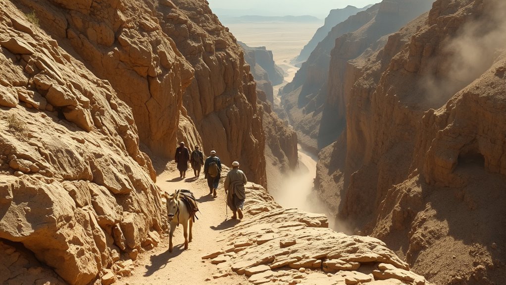
The road’s geography could leave ancient travelers vulnerable. It crossed steep, dry, and sparsely settled country, with sections where rocky slopes, bends, and ravines limited visibility.
Potential dangers included:
- Dehydration and heat: Conditions became hotter and more arid toward Jericho.
- Rough footing: Loose stones and steep slopes increased the risk of falls or injuries.
- Isolation: Help might not be close when a traveler became ill or injured.
- Robbery: A lone person carrying money or goods could be an attractive target.
- Limited visibility: Bends and uneven terrain could conceal people farther along the road.
The parable in Luke 10 begins with a traveler being attacked, stripped, beaten, and left half dead. That scene establishes robbery as part of the story. The terrain makes the event believable, but the parable alone does not provide statistics showing how often attacks occurred.
The road’s isolation raises the stakes of the parable: the wounded traveler cannot assume that another person will stop to help.
Warning: Do not treat descriptions of the ancient Jericho Road as instructions for a modern hike. Routes, checkpoints, permissions, transportation conditions, and security risks can change quickly. Review current local guidance and an official travel advisory for Israel and the West Bank before making plans.
Why Does the Jericho Road Matter in the Good Samaritan Story?
The Jerusalem-to-Jericho road gives the Good Samaritan story a realistic and urgent setting. Jesus tells the parable after an expert in the law asks, “Who is my neighbor?” A man traveling down to Jericho is attacked and left half dead.
A priest sees him and passes by. A Levite also sees him and passes by. The text does not explain their motives, so claims that they acted because of ritual purity, fear, social expectations, or another specific reason should be identified as interpretations rather than facts.
The Samaritan responds differently. He approaches the injured man, treats his wounds with oil and wine, places him on his animal, takes him to an inn, and promises to cover the cost of further care.
The force of the story comes partly from the relationship between Jews and Samaritans. The person who becomes the model of mercy is not one of the respected religious figures but someone whom Jesus’ audience might have viewed as an outsider.
At the end, Jesus shifts the emphasis from identifying which people qualify as neighbors to asking who acted as a neighbor. The answer is the one who showed mercy. The dangerous road makes that mercy practical: the Samaritan gives time, supplies, transportation, money, and a promise of continued help.
Frequently Asked Questions
How far was the ancient road from Jerusalem to Jericho?
The first-century road was commonly measured at about 18 miles, or 29 kilometers. Modern distances vary because roads, city boundaries, starting points, and permitted routes differ from the ancient corridor.
Why does the Bible say people went down from Jerusalem to Jericho?
Jerusalem stood approximately 2,500 feet above sea level, while Jericho was about 825 feet below it. Travelers therefore descended roughly 3,300 feet even though Jericho lies northeast of Jerusalem.
How long did it take to walk from Jerusalem to Jericho?
One long day is a reasonable historical estimate for the 18-mile descent. The actual time depended on the traveler’s pace, the weather, cargo, animals, rest stops, road conditions, and whether the person traveled alone or with a group.
Can you walk the Jerusalem-to-Jericho route today?
The ancient road should not be treated as one clearly marked modern walking route. Present-day roads, trails, checkpoints, jurisdictional rules, and security conditions may affect access. Travelers should consult current authorities, official advisories, and reputable local guides before planning any journey.
How far did the Israelites travel during the 40 years?
No dependable total mileage can be calculated. The biblical narrative names numerous stations, but several locations remain disputed or unidentified, and the journey included encampments and changes of direction. Scripture gives the 40-year period without providing a cumulative distance.
How far were Jewish people allowed to travel on the Sabbath?
Rabbinic law traditionally defined a Sabbath boundary of 2,000 cubits beyond a person’s settled location or designated boundary. This is often estimated at roughly 0.6 miles, although the exact modern conversion varies because ancient cubit measurements were not uniform. Rules involving an eruv can also affect how the starting boundary is determined.
How long was the journey to Canaan supposed to take?
Deuteronomy 1:2 says the journey from Horeb to Kadesh Barnea normally took 11 days. That verse does not measure the complete route from Egypt to Canaan. Numbers 14:33–34 explains the 40-year wilderness period within the biblical narrative after Israel’s refusal to enter the land.
Why is there said to be a 400-year gap between the Old and New Testaments?
“Four hundred years” is an approximate, canon-dependent description of the period between the last books in the Protestant Old Testament arrangement and the New Testament era. It was not an empty historical period. Jewish communities, governments, religious movements, and literature continued developing throughout the Second Temple period.
Conclusion
The road from Jerusalem to Jericho was about 18 miles long, but its sharp descent, heat, exposed terrain, and limited water made it far more demanding than the mileage suggests. Those conditions also deepen the Good Samaritan story. On an isolated road where a wounded traveler could not save himself, mercy required someone to stop, approach, provide care, and accept a personal cost.
Understanding the geography does not replace the parable’s message, but it makes that message easier to see. The lasting question is not simply how far the traveler had to go. It is whether someone who sees a person in need will choose to become a neighbor.
Sources
- American Bible Society — From Jerusalem to Jericho — first-century road distance, elevations, route, and environmental conditions.
- Bible Gateway — Luke 10:25–37 — the complete Good Samaritan passage.
- UNESCO World Heritage Centre — Ancient Jericho/Tell es-Sultan — archaeological age, settlement history, and the ‘Ain es-Sultan spring.
- Bible Gateway — Deuteronomy 1 and Acts 1 — the 11-day Horeb-to-Kadesh journey and the biblical phrase “Sabbath day’s walk.”
- Bible Gateway — Numbers 14:33–34 — the biblical explanation of the 40-year wilderness period.
- Sefaria — Mishneh Torah, Sabbath 27 — the traditional rabbinic Sabbath boundary.
