
Last Updated on July 27, 2026 by Daniel Globe
The Superior Hiking Trail (SHT) is a rugged long-distance footpath through northeastern Minnesota, following the highlands above Lake Superior from the Minnesota-Wisconsin border to the 270 Degree Overlook near the Canadian border. The Superior Hiking Trail Association currently describes the route as about 300 miles of main trail, plus 41 miles of spur trails. Founded in 1986, the trail has grown into one of the Midwest’s best-known routes for day hiking, backpacking, trail running, and end-to-end adventures.
Quick Answer
The Superior Hiking Trail has about 300 miles of main trail plus 41 miles of spur trails. A complete thru-hike usually takes about 2–4 weeks. The route is rugged, campsites are shared, natural water must be treated, and hikers should check current trail conditions, transportation, weather, and seasonal closures before leaving.
The SHT crosses forests, rocky ridges, rivers, waterfalls, state parks, private land, and remote stretches of the North Shore. Elevation changes are frequent even though the trail does not have the long mountain climbs found on western trails. Views range from inland lakes and boreal forest to broad overlooks of Lake Superior.
The trail is maintained through the work of the Superior Hiking Trail Association, volunteers, public land managers, and private landowners. Because conditions and access can change, successful trips depend as much on current planning as they do on fitness and gear.
Key Takeaways
- The SHT has about 300 miles of main trail and 41 miles of spur trails, rather than the older 310-mile figure often repeated online.
- A full thru-hike commonly takes 2–4 weeks, while dozens of trailheads make shorter day hikes and section hikes easy to plan.
- The 94 SHTA backcountry campsites require no permit, fee, or reservation, but they must be shared and camping is limited to designated sites.
- Natural water along the trail must be treated, and some smaller sources can become unreliable during dry periods.
- Check official trail conditions, weather, fire restrictions, transportation, and seasonal closures immediately before every trip.
At a Glance
| Time Required | A few hours for a day hike; several days for section trips; typically 2–4 weeks for a full thru-hike. |
| Difficulty | Moderate to strenuous. Rocky footing, mud, roots, repeated climbs and descents, stream crossings, and weather can slow progress. |
| Tools Needed | Current SHT map or guide, navigation backup, water treatment, weather-appropriate clothing, first-aid supplies, food storage, and overnight gear when backpacking. |
| Cost | There is no SHTA fee to hike or use SHTA backcountry campsites. Budget separately for food, gear, shuttles, lodging, state-park camping, and vehicle permits when applicable. |
Disclosure: As an Amazon Associate I earn from qualifying purchases. Some links on this page are affiliate links, at no extra cost to you.
Planning and Preparation for the Superior Hiking Trail
Start by choosing the type of trip that matches your experience, time, and fitness. A day hike may cover one short section between trailheads. A section hike may last a weekend or several days. A thru-hike covers the entire main route in one continuous trip.
The Superior Hiking Trail Association’s thru-hiking guidance says complete end-to-end trips generally take about 2–4 weeks. A faster pace is not always better. Wet rocks, mud, steep short climbs, stream crossings, fatigue, and side trips can all reduce daily mileage.
Know the Terminuses
The southern terminus is at the Minnesota-Wisconsin border south of Duluth. The northern terminus is the 270 Degree Overlook near the Canadian border. The final northern stretch is remote, and normal public transportation is not available at either terminus, so thru-hikers should arrange their pickup or shuttle before starting.
Check Trail Conditions Before Every Trip
Do not assume a route is passable simply because an older map shows a bridge or trail segment. Floods, construction, erosion, downed bridges, logging, seasonal closures, and trail-renewal projects can create temporary reroutes.
Note: As of July 2026, the SHTA is reporting multiple active bridge, wet-crossing, construction, and reroute issues along the corridor. Because those details change, always use the live SHT Trail Conditions page immediately before departure and again during a multi-day trip whenever you have service.
Plan Camping Before You Start
The SHTA maintains 94 backcountry campsites. These sites require no SHTA permit, camping fee, or reservation, but they are shared. Most have room for several tents, a central fire ring, an open-air backcountry latrine, and basic seating. Most—but not all—are near a natural water source.
Camping outside designated SHT campsites is not allowed along the trail corridor. Do not camp at trailheads or sleep overnight in trailhead parking lots.
The southern urban portion requires extra planning. There are very limited SHTA backcountry camping opportunities south of the main North Shore backpacking corridor, and there are no SHTA campsites within Duluth city limits. Long-distance hikers may need commercial campgrounds, lodging, or other legal arrangements through this portion.
The SHT also passes through Minnesota state parks. State-park campsites operate under a different system and require a reservation before they are occupied. Check the Minnesota DNR reservation rules when a trip uses a state-park campsite.
Pro Tip: Build each backpacking day around legal campsites and dependable water rather than choosing an ambitious mileage target first. This makes it easier to adjust for mud, rain, fatigue, or unexpected trail conditions.
Arrange Parking and Shuttles Early
Many SHT trailheads allow overnight parking, but not all do. Overnight parking is not allowed at state waysides, and state-park parking may require a vehicle permit. Check the exact access point instead of assuming every trailhead follows the same rule.
Several independent shuttle services serve portions or all of the trail corridor. Availability can become limited during busy summer and fall periods, so long-distance hikers should reserve transportation in advance. The SHTA maintains current options on its Parking and Shuttles page.
A practical strategy is to leave your vehicle at the end of a section, shuttle to the starting trailhead, and hike back to your car. That removes the pressure of meeting a pickup at a precise finishing time.
What to Expect: Terrain, Scenery, and Wildlife
The terrain on the Superior Hiking Trail changes constantly. Hikers encounter exposed rock, roots, forest paths, boardwalks, muddy low areas, short steep climbs, river valleys, and rocky ridges. Rather than one long mountain ascent, the SHT repeatedly climbs and drops throughout the day.
According to the SHTA, the route ranges from about 602 feet above sea level at its lowest point to roughly 1,829 feet at its highest. Those numbers do not fully describe the physical challenge because the cumulative up-and-down travel is what wears on hikers over long distances.
The SHT combines about 300 miles of main trail with frequent climbs, rocky footing, 94 SHTA campsites, and a highest point of roughly 1,829 feet.
Much of the northern trail passes through forests of spruce, fir, birch, maple, aspen, and pine. Ridges and overlooks open onto Lake Superior, inland valleys, rivers, ponds, and the Sawtooth highlands. Waterfalls and fast-moving rivers are especially dramatic during spring runoff, although high water can also make crossings dangerous.
Wildlife
Deer, black bears, foxes, wolves, small mammals, and many bird species live along the North Shore. Moose also occur in northeastern Minnesota, but no particular animal sighting should be expected.
Never feed or approach wildlife. Keep food and scented items secured at camp. SHTA advises backpackers to use a bear canister or properly hang food to keep it away from bears and other animals.
Dogs are allowed on the SHT but must be kept on a leash. This protects wildlife, other hikers, the dog, and the private-property agreements that make parts of the trail possible.
Best Time to Hike the Superior Hiking Trail
Summer: June Through August
SHTA considers summer the most favorable season for longer trips. Days are longer and backpacking logistics are simpler, but mosquitoes, ticks, warm weather, thunderstorms, crowds, and occasional dry water sources are part of the tradeoff.
Fall: September Into Autumn
September and early autumn can offer cooler temperatures, fewer insects, and bright fall color. Conditions can also change quickly from mild afternoons to freezing nights.
Later in fall, hikers must pay close attention to closures. Portions of the trail in Duluth can close during freeze-thaw periods, and significant areas north of Duluth close during the November firearms-deer season. Always confirm the current dates rather than relying on a previous year’s calendar.
Spring: Use Extra Restraint
Spring thaw can leave the trail saturated, muddy, and vulnerable to damage. The SHTA specifically asks hikers to avoid muddy and saturated sections, and the trail within Duluth may close during spring thaw. Northern portions often dry later than southern sections.
Winter
Snowshoeing and winter day hikes are possible, but North Shore winter conditions can be severe. SHTA recommends longer winter backpacking trips only for hikers with appropriate cold-weather experience and equipment.
Essential Gear for Hiking the Superior Hiking Trail
| Essential Gear | Why It Matters |
| Hiking Boots or Trail Shoes | Choose broken-in footwear with dependable traction for wet rock, roots, mud, and repeated climbs. |
| Backpack | Use a properly fitted pack sized for your food, water, clothing, shelter, and safety equipment. |
| Trekking Poles | Useful for balance on rock, mud, descents, and shallow stream crossings. |
| Water Bottle or Hydration System | Carry enough capacity for the planned section rather than assuming water is always nearby. |
| Water Filter or Purification Method | Natural river, lake, and stream water along the trail must be treated before drinking. |
| Map and Compass | Carry a current SHT map even when using a phone or GPS device. |
| First Aid Kit | Include supplies for blisters, small wounds, personal medications, and common hiking injuries. |
| Headlamp or Flashlight | Useful when mileage takes longer than expected or for overnight camp tasks. |
| Weather-Appropriate Clothing | Pack moisture-managing layers, insulation, and rain protection appropriate to the forecast and season. |
| Sun Protection | Sunscreen, sunglasses, and a hat remain useful even on a heavily forested trail. |
| Food and Snacks | Carry enough calories for the planned distance plus a reasonable emergency margin. |
| Shelter and Sleep System | Backpackers need a tent or suitable hammock setup and a sleep system matched to expected overnight temperatures. |
| Food Storage | Use a bear canister or proper bear-bagging method to protect food from wildlife. |
Waterproof hiking boots can be useful in cold or consistently wet conditions, but they are not mandatory for every hiker. Some backpackers prefer breathable trail shoes that dry faster. Fit, traction, comfort, and your experience matter more than choosing one footwear category for everyone.
Moisture-wicking layers help manage sweat and changing temperatures. Pack rain protection even when the morning forecast looks good, because Lake Superior weather can change quickly.
Your backpack should hold food, water, first-aid supplies, navigation tools, clothing, and camping equipment without exceeding what you can comfortably carry over rugged terrain. Backpackers who cook should add a lightweight stove and fuel rather than depending on campfires.
Water, Food, and Campsite Rules
Most—but not all—SHTA campsites are close to a natural water source. Water availability can change with rainfall and season, and smaller sources may dry up during late summer. Check current trail information and carry enough capacity to bridge dry stretches.
Warning: Do not drink untreated lake, river, pond, or stream water simply because it looks clear. Filter or otherwise properly treat natural water before drinking it.
At camp, use the designated latrine when available. Pack out trash and food scraps. SHTA campsites are shared, so hikers should make room for others rather than treating a site as privately reserved.
Campfires are allowed only where permitted and only in designated fire rings, but a fire ring does not override a current fire restriction or ban. Check the Minnesota DNR fire-danger and burning-restrictions page before building a fire. A backpacking stove is the more dependable cooking option.
Tips for Navigating the Trail and Finding Accommodations
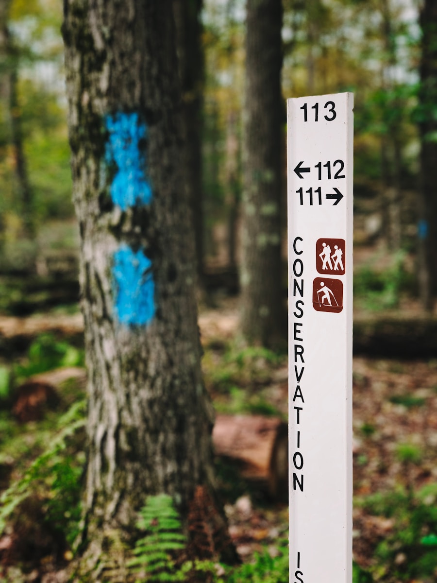
The main SHT route is marked with blue paint blazes or SHT logo signs. Spur and overlook trails generally use white blazes. At turns, two blazes may be used to show the direction of travel.
Even with good markings, carry a current map and know where you are relative to trailheads, campsites, roads, and water sources. Phones and GPS units are helpful, but batteries fail and cellular coverage is unreliable in remote parts of the trail.
Most trailheads are spaced closely enough to make day hikes and section hikes practical, and shuttle services can connect many access points. Confirm whether your chosen trailhead allows overnight parking before leaving a vehicle.
Backpackers can use the SHTA’s designated campsites, while hikers who want showers, restaurants, beds, or resupply opportunities can plan stops in North Shore communities or nearby campgrounds and lodges. Book commercial lodging and state-park campsites early during popular summer and fall weekends.
Safety and Emergency Preparedness on the Superior Hiking Trail
Safety begins before you leave the trailhead. Tell a trusted person where you are going, which trailheads and campsites you expect to use, and when they should expect to hear from you. Carry a map, first-aid supplies, rain protection, extra food, and enough water capacity for the section.
High Water and Stream Crossings
The SHT includes unbridged and occasionally damaged water crossings. A shallow creek that is easy to cross under normal conditions can become dangerous after heavy rain or spring snowmelt.
Warning: Never enter a flooded or fast-moving crossing simply because the trail continues on the opposite bank. Turn around or use an official detour when conditions are unsafe.
Emergency Communication
Cell service is unreliable along many sections, especially toward the northern end. In an emergency requiring immediate medical or law-enforcement help, call 911 when service is available. Knowing the nearest trailhead, campsite, road, GPS location, and your direction of travel can help responders locate you.
Ticks, Mosquitoes, and Weather
Ticks and mosquitoes are common during the warmer months. Use appropriate repellent, check yourself for ticks, and wear clothing suited to current conditions.
Rain, wind, heat, cold, and thunderstorms can all affect a trip. Carry layers and check the local forecast before leaving. On multi-day trips, update weather and trail-condition information whenever you regain service.
Wildlife and Food
Keep your distance from bears and other animals. Never feed wildlife. Secure all food and scented items at camp, and keep dogs leashed.
Highlights and Must-See Stops Along the Superior Hiking Trail
The Superior Hiking Trail connects or passes close to many of the North Shore’s best-known landscapes. Because an end-to-end hike is already demanding, choose side trips based on available time rather than trying to visit every attraction.
Gooseberry Falls State Park
Gooseberry Falls State Park is a classic North Shore stop, with the Upper, Middle, and Lower Falls and more than 20 miles of hiking trails. Water levels vary by season, with especially strong flow often occurring during spring runoff.
Tettegouche State Park
Tettegouche State Park contains some of the region’s most rugged terrain, including the Baptism River, High Falls, inland lakes, and extensive forested hiking routes. The SHT crosses the park and provides access to several of its backcountry landscapes.
Palisade Head
Palisade Head offers a dramatic Lake Superior overlook from high volcanic cliffs. It is best treated as a nearby North Shore side trip rather than as a normal stop directly on the SHT main route. Visitors should stay well back from cliff edges and supervise children closely.
Other Scenic Sections
Depending on your route and available time, other memorable areas include the Split Rock River corridor, Bean and Bear Lakes, Temperance River, Oberg Mountain, Cascade River, and the far-northern ridges approaching the 270 Degree Overlook. Use the official SHT trail-section descriptions to match these areas with your trip length and trailhead access.
Reflecting on the Experience of Hiking the Superior Hiking Trail
Hiking the Superior Hiking Trail is not only about reaching a mileage goal. A short section can offer the same rocky ridges, forest, waterfalls, and Lake Superior views that draw long-distance hikers to the full route.
For thru-hikers, the trail demands patience. Weather changes, tired legs, shared campsites, water availability, and rough terrain can reshape even a carefully planned itinerary. Building extra time into the schedule makes it easier to respond safely instead of forcing mileage.
The SHT also depends on cooperation among hikers, volunteers, public agencies, and private landowners. Staying on the trail, camping only in designated locations, packing out trash, respecting closures, keeping dogs leashed, and following Leave No Trace practices help preserve access for future hikers.
Whether you hike all 300 main-route miles or explore one section at a time, careful preparation allows the North Shore landscape—not preventable logistical problems—to become the focus of the trip.
If you’re planning a hiking trip along the Superior Hiking Trail, you may also be interested in checking out this article on the best ultralight tent for backpacking. A lightweight and compact shelter can make a multi-day hiking setup easier to carry.
Love travel? Join Our Facebook Community For More Tips.
Frequently Asked Questions
What is the Superior Hiking Trail?
The Superior Hiking Trail is a long-distance hiking and backpacking route in northeastern Minnesota. It follows the highlands above Lake Superior and crosses forests, rivers, rocky ridges, state parks, and other public and private lands.
How long is the Superior Hiking Trail?
The Superior Hiking Trail Association currently describes the SHT as about 300 miles of main trail plus 41 miles of spur trails. Older sources often use a 310-mile figure, but 300 main-trail miles is the current figure used for an end-to-end thru-hike.
Where does the Superior Hiking Trail start and end?
The southern terminus is at the Minnesota-Wisconsin border south of Duluth. The official northern terminus is the 270 Degree Overlook near the Canadian border, beyond the Otter Lake Road area.
How long does it take to hike the entire Superior Hiking Trail?
A complete thru-hike generally takes about 2–4 weeks. Total time depends on daily mileage, fitness, weather, trail conditions, rest days, resupply plans, and side trips.
Do you need a permit to camp on the Superior Hiking Trail?
No permit, camping fee, or reservation is required for the 94 campsites maintained by the Superior Hiking Trail Association. These campsites must be shared. Minnesota state-park campsites are separate and require reservations and applicable fees.
Can you camp anywhere along the SHT?
No. Hikers should camp only in designated campsites. Dispersed or stealth camping along the trail corridor is prohibited, and camping or sleeping in trailhead parking areas is not allowed.
What is the terrain like on the Superior Hiking Trail?
Expect rocky and root-covered paths, mud, boardwalks, river valleys, short steep climbs, frequent descents, and exposed ridges. The highest point is roughly 1,829 feet, but repeated elevation changes make the trail more demanding than the elevation figure alone suggests.
Do you need to filter water on the Superior Hiking Trail?
Yes. Natural water from lakes, rivers, ponds, and streams should be properly treated before drinking. Not every campsite has a dependable water source, and smaller sources can dry up during prolonged dry weather.
What is the best time of year to hike the Superior Hiking Trail?
Summer is generally the easiest season for longer backpacking trips, while early fall offers cooler weather and fall color. Spring thaw can make the trail muddy and vulnerable to damage, and later fall brings freeze-thaw and hunting-season closures. Winter backpacking requires advanced cold-weather preparation.
Are shuttles available for Superior Hiking Trail hikers?
Yes. Independent shuttle companies serve various parts of the trail corridor, including options for long-distance hikers. Availability changes, so reservations should be made in advance rather than depending on a same-day pickup.
Sources
- Superior Hiking Trail Association — Know Before You Go — current trail mileage, navigation, campsite count, camping rules, water treatment, food storage, and safety guidance.
- Superior Hiking Trail Association — Thru-Hiking — end-to-end mileage, typical 2–4 week duration, camping limitations, terminus logistics, and transportation planning.
- Superior Hiking Trail Association — Trail Conditions — current closures, reroutes, bridge conditions, high-water issues, and maintenance notices.
- Superior Hiking Trail Association — Parking and Shuttles — overnight parking restrictions and current transportation options.
- Minnesota Department of Natural Resources — State Park Reservations — reservation requirements for Minnesota state-park campsites.
- Minnesota Department of Natural Resources — Fire Danger and Burning Restrictions — current campfire restrictions and wildfire conditions.

