
Last Updated on July 28, 2026 by Daniel Globe
Burgazada, the third-largest of Istanbul’s Princes’ Islands, swaps much of the city’s traffic and noise for rocky shoreline, pine-covered slopes, historic streets, and wide Sea of Marmara views. Most visitors explore on foot or by bicycle, while licensed electric public transport connects the pier with stops around the island.
Quick Answer
Burgazada is best explored on foot, by bicycle, or with IETT’s electric island transport. Highlights include Bayrak Tepe, Kalpazankaya, the Sait Faik Museum, and rocky coastal coves. For summer 2026, however, forest access is restricted through October 15, and the municipality asks swimmers to use only officially designated swimming areas.
Key Takeaways
- Burgazada has heavily restricted conventional vehicle traffic, but licensed electric buses and AdaMini/taxi services do operate on the island.
- Kalpazankaya is one of the best-known coastal stops for views, food, and sunsets, while smaller coves such as Süt Koyu and Madam Marta are more rugged.
- For 2026, forest entry on Burgazada is restricted from June 8 through October 15, so do not assume hill or woodland trails are open.
- For the 2026 swimming season, Adalar Municipality lists the areas in front of Burgazada Su Sporları Kulübü and Burgazada Deniz Kulübü as the island’s designated swimming areas.
- Şehir Hatları ferry times vary by pier and stopping pattern, so check the current timetable before leaving Istanbul.
Warning: As of July 2026, forest areas in the Adalar district are subject to a seasonal entry restriction through October 15. Camping, pitching tents, lighting fires, and entering restricted forest areas are prohibited. The municipality also asks visitors to swim only at designated swimming areas. Check the latest local notices before following any woodland or shoreline route.
Disclosure: As an Amazon Associate I earn from qualifying purchases. Some links on this page are affiliate links, at no extra cost to you.
Getting to Burgazada and Getting Around
Burgazada is reached by passenger ferry rather than by road. Current Şehir Hatları Princes’ Islands services include routes involving Bostancı, Kabataş, Kadıköy, Maltepe, and selected other Istanbul piers. Journey time depends on the departure point, number of island stops, day of the week, and sailing.
On current schedules, some Bostancı services take roughly 40 minutes to reach Burgazada, while common Kabataş sailings take around 75 minutes. Treat those as examples rather than fixed journey times because seasonal timetables change.
Bicycles are allowed aboard Şehir Hatları ferries without an additional bicycle charge, which makes bringing or renting a bike practical for a day trip. Once ashore, walking and cycling remain the simplest ways to explore the central streets and coastal roads.
Electric vehicles are also part of normal island transportation. They are not rental golf carts: IETT and municipal services operate them as public transport and taxi-style services. The current IETT BU-7 Burgazada route includes stops at Burgazada Pier, Aya Nikola, Süt Koyu, and Kalpazankaya Sahili.
Discovering the Natural Charm
Arriving by ferry, you’ll see Burgazada’s low, green hillside behind the waterfront. Bayrak Tepe, historically also associated with the name Hristos Tepesi, is the island’s main high point. Official tourism sources place its height at roughly 170 meters, although some travel references give a slightly higher figure.
What makes Burgazada feel different from central Istanbul is not the complete absence of vehicles but the lack of normal big-city traffic. Walking, bicycles, and regulated electric transport dominate everyday movement, while authorized and service vehicles may also operate.
Note: Adalar Municipality reports a registered Burgazada population of 1,713 for 2025. Visitor numbers rise sharply in warmer months, so weekdays and the shoulder seasons generally feel calmer than summer weekends.
Burgazada’s Green Jewels
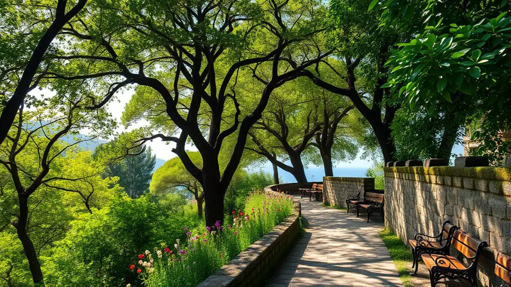
Burgazada’s greenery comes from a mix of pine-covered slopes, scrub, gardens, old olive-growing areas, coastal vegetation, and smaller green spaces woven through the residential streets. It is better understood as a network of scenic roads, viewpoints, shore paths, and hill areas than as a collection of large formal city parks.
Outside seasonal access closures, a nature-focused walk may include:
- Pine-shaded stretches on the island’s higher slopes
- Seasonal wildflowers and Mediterranean scrub along quieter roads
- Coastal walking routes linking the pier with western shore viewpoints
- Benches and open waterfront spaces suitable for short rests
- Historic streets lined with gardens and old wooden houses
During the 2026 forest restriction, stay on routes that remain legally open and follow signs or instructions from local authorities rather than entering woodland simply because an older map shows a trail.
Parks With a View
When hill access is legally open, the upper slopes near Bayrak Tepe offer broad views across the Sea of Marmara toward neighboring islands and the Anatolian coast. The hill is also associated with the historic Hristos Monastery site.
Sunset can be especially attractive from the island’s western side, but Kalpazankaya and other legal coastal viewpoints are safer choices when seasonal forest restrictions prevent access to hill paths.
Walking and Cycling Routes
Burgazada is compact enough to explore without a car, and its paved streets and coastal roads suit both walking and cycling. The key is to distinguish normal roads from woodland trails that may be seasonally closed.
- Coastal roads lead away from the pier toward the island’s western shore and Kalpazankaya.
- Bicycles work well on paved or firm coastal routes, though steep or stepped shoreline approaches are better handled on foot.
- The road network passes old houses, gardens, the waterfront, and several viewpoints without requiring entry into forest land.
- The Sait Faik Abasıyanık Museum occupies the writer’s former Burgazada home at Çayır Sokak No. 15. It currently lists Wednesday–Sunday opening hours of 10:30–16:45 and free admission.
- Hill routes toward Bayrak Tepe and Hristos Monastery should only be attempted when forest access is officially open.
Pro Tip: A bicycle is useful for the paved coastal roads if you want to cover more of Burgazada in one day. For Süt Koyu or other steep shore approaches, be prepared to park the bike and continue on foot. IETT electric transport also serves stops toward Süt Koyu and Kalpazankaya.
Picnicking Safely on Burgazada
A simple meal by the waterfront is an easy way to slow the day down, but choose a legal urban, coastal, or designated recreation space rather than heading into restricted woodland. Bring food from the pier area or carry your own supplies if you are spending time farther around the island.
During the 2026 forest restriction, do not camp, pitch a tent, light a barbecue, use an open flame, or enter closed forest areas. These rules apply even when a wooded spot appears quiet or suitable for a picnic.
Wildlife and Birdwatching
Burgazada’s mix of coastal habitat, scrub, gardens, and wooded slopes attracts a variety of birds. Gulls are common around the waterfront, while smaller birds use trees and shrubs farther inland.
Early morning and evening are usually the quietest times to watch wildlife. Keep your distance from nests and roosting birds, avoid feeding wildlife, and remain on permitted paths so that birdwatching does not disturb sensitive habitat.
The Island’s Hidden Gems
Beyond the ferry pier and central streets, Burgazada’s western coastline becomes quieter and more rugged. Some places widely described as beaches in older guides are better treated as scenic coves or shore stops under the island’s current 2026 swimming guidance.
Coves and Coastal Stops
Burgazada’s coast is mostly rocky or pebbly rather than a continuous sandy beach. Water shoes are useful around rough shorelines, but current local swimming rules should determine where you actually enter the water.
- Kalpazankaya: One of Burgazada’s best-known western coastal destinations, with broad sea views and a long-established restaurant. GoTürkiye highlights it as a scenic place for lunch and sunset. It is also served by electric island transport.
- Süt Koyu (Milk Bay): A rugged coastal cove traditionally reached from a steep path or stairs. The current IETT route includes a Süt Koyu stop, but the final approach to the shoreline can still be unsuitable for bicycles or limited mobility.
- Madam Marta Bay: A well-known cove on Burgazada’s western side. Do not rely on older guides that promote camping here during summer 2026; camping and tent pitching in restricted forest areas are currently prohibited.
- Burgazada Halk Plajı / Altı Numara: This name appears in older visitor guides, but current status should be checked locally before treating it as an approved swimming area.
- Mimi Koyu and Düşler Sahili: Smaller coastal spots reached from local roads or paths. Access conditions and facilities can change, so treat them as scenic stops unless current signage confirms otherwise.
Swimming Safety: Adalar Municipality’s July 22, 2026 notice asks visitors to swim only in designated areas. For Burgazada, the published list identifies the area in front of Burgazada Su Sporları Kulübü and Burgazada Deniz Kulübü. Kalpazankaya, Süt Koyu, Madam Marta, and the other smaller coves above are not listed as designated Burgazada swimming areas for the 2026 season.
Beach facilities, admission policies, loungers, umbrellas, and food service can change from season to season. Confirm conditions on arrival rather than relying on older fee information.
Forest Trails and Seasonal Access Rules
In normal open periods, the higher parts of Burgazada offer routes toward Bayrak Tepe and the historic Hristos Monastery site. The area has long been associated with the island’s Orthodox community and the Feast of the Transfiguration on August 6.
However, the practical situation matters more than an old trail description: for 2026, Adalar Municipality states that entry into forest areas is prohibited from June 8 through October 15 as part of wildfire-prevention measures. That means visitors should not attempt woodland shortcuts or hill trails during the closure simply because they appear on an online map.
Bayrak Tepe Views
Bayrak Tepe rises to about 170 meters and is Burgazada’s main hill. When access is officially open, the upper area gives wide views over the Marmara Sea, neighboring islands, and the Anatolian coast.
During seasonal closures, enjoy similar open-water scenery from legal coastal roads and western viewpoints instead of entering restricted forest land.
Easy Ways to Experience Burgazada
You do not need an aggressive sightseeing schedule to enjoy the island. A few simple routes cover its strongest scenery and cultural stops.
| Activity | Best For | Practical Tip |
|---|---|---|
| Pier to Sait Faik Museum walk | Easy culture-and-neighborhood stroll | Check the museum’s Wednesday–Sunday hours before you go. |
| Coastal ride to Kalpazankaya | Sea views, photography, and sunset | Use the paved route and check current access conditions before taking side trails. |
| Bayrak Tepe walk | Panoramic hill views | Only attempt it when forest access is officially open. |
Streets Worth Wandering
A short Burgazada walk can move from the waterfront to quiet residential streets in minutes. Gönüllü Caddesi and nearby Mehtap Sokak are known for old houses, gardens, and the slower neighborhood atmosphere that defines much of the island.
Instead of trying to tick off every cove, choose one coastal direction from the pier, stop at the Sait Faik Museum if it is open, and leave time for the waterfront. That approach works particularly well when seasonal rules limit forest access.
Best Time to Visit and What to Bring
For general sightseeing, spring, early summer, and autumn offer comfortable conditions, while weekdays are usually less crowded than summer weekends. Visitors specifically interested in woodland or Bayrak Tepe routes need to pay closer attention to seasonal fire restrictions.
In 2026, the current forest restriction lasts through October 15. For hill walking, verify that restrictions have ended before setting out.
A practical day bag should include:
- Comfortable walking shoes with good grip
- Water, especially if heading away from the pier
- Sun protection and a hat in warm weather
- Water shoes for rocky shore areas where swimming is officially permitted
- A light layer for windy ferry rides and cooler evenings
- A charged phone for current ferry timetables and local notices
Frequently Asked Questions
Can I bring my dog to Burgazada?
Yes, but transport and individual venue rules still apply. Şehir Hatları currently requires dogs to be leashed and muzzled on its ferries, with additional conditions in its pet rules. Once on Burgazada, check posted rules at individual beaches, restaurants, or facilities rather than assuming every space accepts pets.
How do I get to Burgazada?
Şehir Hatları serves Burgazada on several Princes’ Islands routes involving piers such as Bostancı, Kabataş, Kadıköy, and Maltepe, with other services depending on the timetable. Current journey times vary by route and stops, so check the operator’s timetable on the day you travel.
Can I rent bicycles on Burgazada?
Bicycle rental is commonly available around the ferry area, although individual shops, prices, and availability can change. Bikes are useful on Burgazada’s paved coastal roads. The municipal electric vehicles are different: they operate as public or taxi-style transport and are not visitor rental carts.
Are the parks and trails in Burgazada wheelchair accessible?
Accessibility varies considerably. Şehir Hatları operates accessible piers and vessels within its fleet, but Burgazada itself has hills, uneven surfaces, steep paths, and shoreline stairs. The central waterfront and some paved streets are the easiest areas to navigate. Check the ferry operator’s accessibility information and current local transport options before planning a hill or cove route.
Are there restaurants or cafés near the parks and coast?
Yes. The pier area has cafés and casual places to eat, while Kalpazankaya has a long-established restaurant overlooking the coast. Services become less predictable at smaller coves, so carry water and basic supplies when heading away from the center.
Can I swim at Kalpazankaya, Süt Koyu, or Madam Marta in 2026?
Adalar Municipality’s July 2026 guidance asks visitors to swim only at designated swimming areas. Its published Burgazada list names the areas in front of Burgazada Su Sporları Kulübü and Burgazada Deniz Kulübü. Kalpazankaya, Süt Koyu, and Madam Marta are not on that 2026 designated list, so treat them as scenic coastal stops unless newer official guidance says otherwise.
Are Burgazada’s forest trails open in summer 2026?
No, not as normal unrestricted hiking routes. The 2026 seasonal forest-entry restriction runs from June 8 through October 15. Adalar Municipality also prohibits camping, tents, fires, and entry into restricted forest areas during this period. Use legal coastal and residential routes and check official notices before attempting Bayrak Tepe or woodland trails.
Conclusion
Burgazada works best when you resist the urge to rush it. A ferry ride brings you to a compact island of historic streets, Marmara views, coastal roads, Kalpazankaya, and the Sait Faik Museum, all easy to combine into a relaxed day.
The important change for 2026 is that older travel guides can no longer be followed blindly. Forest restrictions currently limit hill and woodland access through October 15, while the municipality has also published designated swimming areas for the season. Check those rules first, then explore the island on foot, by bicycle, or with its electric public transport.
Sources
- Şehir Hatları — Princes’ Islands Lines — current ferry routes and timetable information.
- IETT — BU-7 Burgazada Route — current electric transport stops including Süt Koyu and Kalpazankaya.
- Adalar Municipality — Burgazada — island geography, history, landmarks, and 2025 population.
- Adalar Municipality — 2026 Forest Entry Restriction — seasonal forest, camping, tent, and fire restrictions.
- Adalar Municipality — 2026 Designated Swimming Areas — official Burgazada swimming guidance for the 2026 season.
- Sait Faik Abasıyanık Museum — museum history, current opening days, hours, and visitor information.
