
Last Updated on July 25, 2026 by Daniel Globe
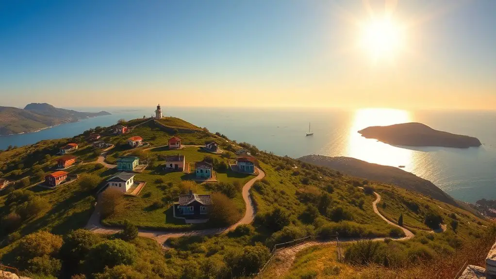
Burgazada packs several very different views into a small island: high panoramas around Bayrak Tepe, sunset scenery at Kalpazankaya, calm Sea of Marmara views along the coast, and easy waterfront compositions near the ferry pier. The best spot depends on the light, your walking plans, and current access rules, so a little planning makes a big difference.
Quick Answer
For the best views in Burgazada, prioritize Bayrak Tepe and the Hristos Monastery area for elevated panoramas when access is permitted, Kalpazankaya for sunset, and the ferry-side waterfront for easy sea views and early-morning photography. In summer 2026, check forest-access restrictions before heading onto inland routes.
Key Takeaways
- Bayrak Tepe is Burgazada’s principal high point and the place to look for broad island and Sea of Marmara panoramas when access is open.
- Kalpazankaya is the most dependable choice for sunset scenery and a relaxed end to the day.
- The ferry pier and waterfront offer attractive views without requiring a steep or unpaved walk.
- Do not assume a secluded cove is an approved swimming area; follow the municipality’s current swimming guidance.
- For 2026, forest-entry restrictions apply from June 8 through October 15, so check official notices before planning inland hikes.
Disclosure: As an Amazon Associate I earn from qualifying purchases. Some links on this page are affiliate links, at no extra cost to you.
Best Burgazada Viewpoints at a Glance
| Viewpoint | Best For | Best Light | Access Note |
| Bayrak Tepe / Hristos area | High panoramas and landscape photography | Clear morning or late afternoon | Check seasonal forest-access restrictions before going inland |
| Kalpazankaya | Sunset, rocky coast, dinner with a view | Late afternoon through sunset | Reachable from the settled part of the island by the public route toward Kalpazankaya |
| Ferry pier and waterfront | Ferries, neighboring islands, reflections, easy photography | Early morning and blue hour | One of the simplest options for visitors with limited walking time |
| Coastal coves and shore roads | Low-angle coastal scenery and rocky shoreline | Morning or late afternoon | Stay on permitted public routes and do not assume every cove is approved for swimming |
| Streets near the pier | Wooden houses, gardens, street scenes, island character | Morning or late afternoon | Easy to combine with the ferry arrival or departure |
Panoramic Views From Bayrak Tepe
For a true elevated view, focus on Bayrak Tepe, also associated with Hristos Tepesi, rather than looking for a collection of separate hilltops. Adalar Municipality describes Bayrak Tepesi as Burgazada’s single hill and places the Hristos Monastery on its slopes. You can read the municipality’s overview of the island on the official Burgazada page.
When the inland route is legally open and conditions are suitable, the higher ground gives you the broadest sense of Burgazada’s shape. Instead of seeing only one stretch of shoreline, you can take in the Sea of Marmara, nearby islands, wooded slopes, roofs, and sections of coast in the same view.
The climb is more rewarding when you treat the viewpoint as a landscape stop rather than a race to the top. Pause where public routes open onto clear sightlines, keep off unstable edges, and avoid creating unofficial shortcuts through vegetation.
Warning: For the 2026 fire season, Adalar Municipality has prohibited entry into forest areas from June 8 through October 15. The restriction also covers camping, tents, fires, barbecues, and similar activities. Check the current municipal forest notice before planning a Bayrak Tepe or forest-route visit.
Scenic Spots Along the Coastline
You do not need to climb to Burgazada’s highest ground to find good scenery. The coast gives you a different type of photograph: water at eye level, rocky edges, boats, neighboring islands, and changing reflections across the Sea of Marmara.
For an easy first look, spend a few minutes around the ferry-side waterfront after arriving. Ferries approaching and leaving the island add scale to wider photographs, while the shore is particularly useful when haze makes distant hilltop panoramas less dramatic.
As you move away from the pier, the island’s shoreline becomes quieter and more natural. Public coastal routes toward areas such as Kalpazankaya reveal a mix of rocky coast, small bays, vegetation, and open water.
Burgazada’s strongest photographs come from contrast: high panoramas for scale, waterfront views for movement, and the western coast for warm sunset light.
Burgazada’s Hidden Coves
Burgazada’s smaller coves can be beautiful, but they are better treated as scenic coastal stops than as automatically safe places to swim. The municipality’s island description identifies the small bay by Kalpazankaya and Madam Marta Bay among Burgazada’s coastal features.
These lower viewpoints can give you intimate compositions that are difficult to get from the hill: rock in the foreground, water filling the middle of the frame, and another section of the island forming the background.
Stay on public, permitted access routes. Avoid scrambling across loose rocks or entering a closed forest path merely to reach a more isolated angle.
Warning: A picturesque cove is not automatically an approved swimming area. In its July 22, 2026 notice, Adalar Municipality asked visitors to enter the sea only at designated swimming locations. On Burgazada, the notice lists Burgazada Su Sporları Kulübü önü and Burgazada Deniz Kulübü. Check the official swimming-area notice before getting in the water.
Viewing Points at Sunrise and Sunset
Light changes Burgazada more than any single camera setting. Early in the day, the waterfront near the ferry pier is a practical place to work with quiet streets, softer reflections, arriving boats, and less foot traffic. It also avoids committing to a pre-dawn inland climb.
For sunset, Kalpazankaya is the standout destination. The area’s long-established restaurant specifically promotes its sunset experience, making this a much better-supported recommendation than an unnamed “secret sunset viewpoint.” You can check current access and contact information on the official Kalpazankaya Restaurant website.
- Before sunrise: Use the waterfront for blue-hour color and ferry lights.
- Early morning: Photograph streets and coastal views before stronger midday contrast develops.
- Late afternoon: Work with side light on buildings, vegetation, and rocky shoreline.
- Sunset: Head toward an open, legally accessible western viewpoint such as the Kalpazankaya area.
Pro Tip: Arrive at your sunset location at least 30–45 minutes before the sun reaches the horizon. The softer pre-sunset light is often better for photographing people, buildings, rocks, and vegetation than the brief moment when the sun itself disappears.
Exploring the Island’s Highest Point Safely
Bayrak Tepe is Burgazada’s principal high point, so there is no need to chase a series of supposed “highest points.” The appeal is the combination of height, history, and landscape around the Hristos Monastery area.
Under normal open-access conditions, expect an uphill walk rather than a polished observation deck. Wear shoes with reliable grip, take water in warm weather, and turn around if a route is closed or the surface becomes unsafe.
Historic remains add context to the view, but treat religious and cultural sites respectfully. Do not climb on ruins, walls, or structures to gain extra height for a photograph.
Note: Access conditions can change because of wildfire risk, maintenance, weather, or local restrictions. A viewpoint that is normally reachable should never be assumed to be open on the day of your visit.
Picturesque Views of the Sea of Marmara
Burgazada sits among Istanbul’s Princes’ Islands in the Sea of Marmara, not the Aegean Sea. That setting gives the island an active maritime foreground: ferries, small boats, neighboring islands, and changing weather all alter the scene throughout the day.
A clear day can produce wide, layered views, while hazier conditions often work better for simple compositions that keep attention on a nearby boat, shoreline, tree, or building.
Waterfront Views
The original article promised predictable sightings of dolphins, sea turtles, and colorful fish. Those are not reliable features on which to plan a Burgazada viewpoint visit. Focus instead on what the setting consistently offers:
- Şehir Hatları ferries moving between the Princes’ Islands and Istanbul
- Small boats and sailboats crossing open water
- Nearby islands appearing at different distances
- Rocky shoreline, vegetation, and reflections
- Gulls and other everyday coastal birdlife when present
This approach makes the guide more useful because it does not depend on rare or unpredictable wildlife encounters.
Sea-Scape Composition Ideas
For a stronger sea-scape, avoid filling the entire frame with empty water. Use something nearby to create depth: a railing, rock, tree branch, ferry, shoreline curve, or building.
On calm days, reflections can become the subject. In stronger wind, waves and moving boats create more energy. Both conditions can work; the key is changing your composition rather than waiting for one imaginary version of perfect weather.
Capturing the Island’s Charm
Burgazada is more than its lookouts. Around the settled part of the island, wooden houses, gardens, narrow streets, waterfront buildings, and glimpses of the sea create a quieter form of scenery.
- Architecture: Frame older houses with garden walls, gates, trees, or street curves rather than photographing every facade straight on.
- Gardens: Use foliage as a foreground layer without entering private property.
- Waterfront streets: Include ferries or boats to establish the island setting.
- Winding lanes: Let the street itself lead the eye toward a house, patch of sea, or distant slope.
These details are particularly useful around midday, when strong overhead light can make broad landscapes less flattering but still creates interesting shadows along streets and buildings.
Vantage Points for Photography
You do not need a DSLR to photograph Burgazada well. A modern phone is enough for most scenes, especially when the light is good. What matters more is choosing a viewpoint that suits the photograph you want.
Photo Spots
- Bayrak Tepe / Hristos area: Best for broad landscapes when legal access is available.
- Kalpazankaya: Best for warm sunset light and rocky coastal scenery.
- Ferry waterfront: Best for boats, reflections, arrivals, departures, and easy blue-hour shots.
- Residential streets: Best for architecture, gardens, details, and a sense of island life.
A high-quality smartphone is often the most convenient tool for walking around the island because it gives you wide-angle and telephoto options without extra weight.
Panoramic Views
For a panorama, hold the camera level and overlap each frame generously if you plan to stitch several photographs later. Avoid putting fast-moving ferries or people directly on the overlap between frames because they can appear twice after stitching.
On a phone, use the built-in panorama mode slowly and steadily. Stop before the scene becomes excessively wide; a tighter panorama often looks stronger than a full 180-degree sweep.
Scenic Shots
The most useful scenic photographs fall into four groups:
- Sunset scenes: Kalpazankaya and other permitted open coastal positions.
- Island landscapes: Bayrak Tepe or another legally accessible elevated public route.
- Street scenes: The settled streets and waterfront around the pier.
- Coastal details: Public shore routes, rocks, vegetation, boats, and small bays.
Remember that Burgazada looks across the Sea of Marmara. The original description of an Aegean Sea sunset was geographically incorrect.
Pro Tip: Lock exposure on the bright part of a sunset sky before taking the photograph. This helps preserve cloud and sky color; you can usually lift slightly dark foreground shadows afterward more successfully than recovering a completely blown-out sky.
Discovering Burgazada’s Best Lookouts
The best way to explore Burgazada is not to hunt for unmarked “secret” lookouts. Build the day around a few dependable public areas and let smaller views appear naturally between them.
A simple viewpoint plan is:
- Start at the ferry pier. Photograph the waterfront while you are already there and note the weather and visibility.
- Explore nearby streets. Capture architecture and quieter island details before walking farther.
- Choose either elevation or coastline. Head toward Bayrak Tepe only if inland access is permitted, or follow a legal public route toward coastal scenery instead.
- Finish near Kalpazankaya for sunset. Leave enough time to reach your chosen position safely before the light changes.
- Return with the ferry timetable in mind. Do not let one last photograph make you miss the service you planned to take back.
This approach produces more variety than spending the entire visit looking for one supposedly perfect Instagram location.
How to Get to Burgazada and Plan Your Day
Burgazada is served by Istanbul’s public ferry network. Current Şehir Hatları services include Princes’ Islands routes that stop at Burgazada from mainland departure points such as Kabataş and Bostancı, with other island connections depending on the service.
Schedules change by season and day, so check the official Şehir Hatları Princes’ Islands timetable shortly before travelling instead of relying on an old blog schedule.
For photography, arriving earlier gives you three advantages: softer light, quieter streets, and more time to adapt if a forest or coastal route is closed.
Current Access, Swimming, and Drone Rules
Burgazada is a protected island environment, and access rules can change during periods of fire risk or other safety concerns. Treat official notices as part of trip planning, not as an afterthought.
Forest Access
For 2026, entry into forest areas across the Adalar district is prohibited from June 8 through October 15. Camping, tent pitching, fires, barbecues, and similar activities in those forest areas are also prohibited during the restriction.
If a hill or forest route is closed, use the public waterfront and settled coastal routes instead. Never bypass a barrier or closure for a photograph.
Swimming Safety
On July 22, 2026, Adalar Municipality reminded visitors to swim only in designated areas. For Burgazada, the notice names Burgazada Su Sporları Kulübü önü and Burgazada Deniz Kulübü.
That means a scenic secluded bay should not automatically be treated as a swimming or snorkeling recommendation.
Drone Photography
Do not arrive assuming you can simply launch a drone from a viewpoint. Turkey’s Directorate General of Civil Aviation states that UAS with a maximum takeoff weight of 500 grams or more are subject to registration requirements. The authority also states that flight permission is required outside designated free or green flight areas.
Foreign operators have additional flight-permission procedures. Before bringing or launching a drone, check the current map, registration requirements, and permit process through the official SHGM UAS system.
Note: A lightweight drone being below the 500 g registration threshold does not automatically make every location legal to fly. Airspace, local restrictions, protected areas, privacy, and temporary flight limitations still matter.
Frequently Asked Questions
What is the best time to visit Burgazada for optimal views?
Spring and early autumn are comfortable choices for walking and photography because temperatures are often milder than midsummer. For photographs, early morning and late afternoon usually provide softer light. Visibility still depends on haze, clouds, wind, and rain, so no season guarantees a perfectly clear panorama.
Are there guided tours available for Burgazada’s scenic viewpoints?
Private Istanbul and Princes’ Islands operators may offer walking or photography-oriented trips, but tour inventory changes and there is no single official daily Burgazada viewpoint-tour program. Confirm the operator, exact island stops, walking requirements, and cancellation terms for your travel date rather than assuming a specific photography excursion is always available.
Can I bring my drone to capture aerial views?
Possibly, but do not fly without checking the current Turkish civil aviation rules and flight-area status first. SHGM requires registration for UAS weighing 500 g or more and states that permission is required outside designated free or green flight areas. Foreign UAS operators should also check the foreign-flight permission process.
Are there restaurants with scenic views on Burgazada?
Yes. Kalpazankaya Restaurant is a verifiable scenic option and its official website specifically describes guests ending the day while watching the sunset. Restaurants around the waterfront may also offer open sea views, but businesses and hours can change, so check directly before planning a meal around a particular venue.
Can I camp overnight on the island to watch the sunrise?
Do not assume wild camping is permitted. During the 2026 forest restriction from June 8 through October 15, camping and pitching tents in forest areas are expressly prohibited. Outside that period, check current Adalar Municipality rules before making an overnight camping plan rather than relying on older travel advice.
Is Bayrak Tepe accessible during summer 2026?
Do not assume that an inland approach is accessible. Adalar Municipality’s 2026 fire-season notice prohibits entry into forest areas through October 15. Check posted local restrictions and the municipality’s current notices on the day of your visit, and use waterfront viewpoints if inland access is closed.
Can I swim at Burgazada’s secluded coves?
A secluded or attractive cove is not automatically an approved swimming area. For the 2026 season, Adalar Municipality asks visitors to use designated swimming locations and lists Burgazada Su Sporları Kulübü önü and Burgazada Deniz Kulübü on Burgazada. Follow current signage and official guidance.
Conclusion
You do not need to chase every supposed hidden viewpoint to enjoy Burgazada. Start with the waterfront, choose Bayrak Tepe and the Hristos area when inland access is legally open, and save Kalpazankaya for late-afternoon and sunset scenery. Between those anchors, the island’s streets, gardens, boats, rocky coast, and Sea of Marmara views provide plenty of photographs without leaving permitted public routes.
The most important part of planning in 2026 is checking current access before you set out. Forest closures, swimming guidance, ferry schedules, and drone rules can all affect where you can safely and legally go. Plan around those limits and Burgazada remains an excellent island for landscapes, coastal walks, and relaxed photography.
Sources
- Adalar Municipality — Burgazada — official description of Bayrak Tepe, Hristos Monastery, Kalpazankaya, Madam Marta Bay, and the island’s geography.
- Şehir Hatları — Princes’ Islands Lines — current public ferry routes and timetable access.
- Adalar Municipality — 2026 Forest Entry Restriction — current forest access, camping, tent, and fire restrictions.
- Adalar Municipality — 2026 Designated Swimming Areas — current swimming-safety guidance and approved Burgazada locations.
- Türkiye Directorate General of Civil Aviation — UAS Registry System — drone registration and flight-permission requirements.
- Kalpazankaya Restaurant — first-party confirmation of the Burgazada location and sunset experience.
