
Last Updated on July 25, 2026 by Daniel Globe
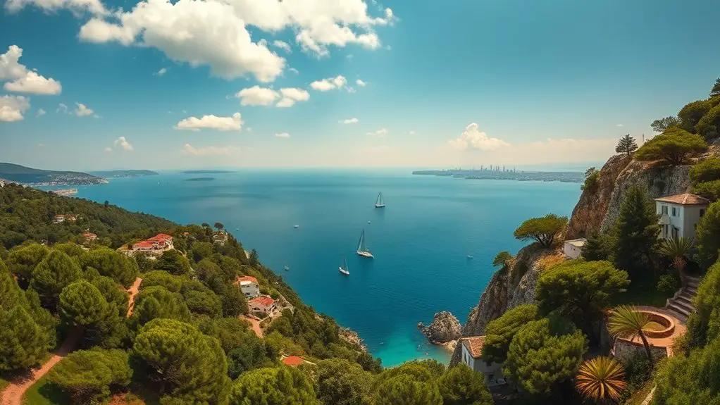
Heybeliada rewards visitors who look beyond the ferry pier. Pine-covered hills rise behind the waterfront, historic streets climb toward the island’s higher ground, and quiet stretches of the Marmara coast open up between old houses and wooded slopes. The best experience comes from combining verified viewpoints such as Ümit Tepesi with Değirmenburnu, Çam Limanı, the waterfront, and public hillside roads while paying attention to seasonal access and swimming rules.
Quick Answer
Heybeliada’s best views come from its public hillside roads, the Ümit Tepesi area, Değirmenburnu, Çam Limanı, and open waterfront stretches. Değirmentepe is the island’s highest hill at 136 metres, but access to forested routes can be restricted, so check current rules before leaving public roads.
Key Takeaways
- Değirmentepe is Heybeliada’s highest hill at 136 metres, while Ümit Tepesi is a well-known high point associated with the historic Halki Theological School.
- For an easy scenic start, walk from the ferry pier toward Değirmenburnu or follow the waterfront before heading into the residential streets.
- Çam Limanı is one of the island’s most attractive coastal areas and can also be reached using island electric public transport.
- Organized beaches may charge admission, while ordinary public roads and viewpoints generally do not.
- Summer access rules matter: forest entry and swimming outside approved areas may be restricted, so check current municipal notices before setting out.
Warning: As of July 25, 2026, Adalar Municipality says entry to forest areas is prohibited from June 8 through October 15, 2026. Camping, pitching tents, lighting fires, barbecuing, and uncontrolled swimming in affected forest areas are also prohibited. The municipality has separately asked visitors to swim only in officially designated swimming areas. Check the current forest-access notice and swimming-area notice before your visit.
Disclosure: As an Amazon Associate I earn from qualifying purchases. Some links on this page are affiliate links, at no extra cost to you.
Getting Around Heybeliada for Scenic Views
Heybeliada is reached by sea rather than by bringing a normal private car onto the island. Şehir Hatları currently serves Heybeliada on routes that include Kabataş–Adalar, the Bostancı–Adalar ring, and services from Maltepe. Timetables change by season and day of the week, so check the official schedule before leaving Istanbul.
Once on the island, walking remains one of the best ways to enjoy the scenery. For longer or steeper sections, IETT’s current route list includes electric services such as HA-1, HA-2 and HA-3, connecting the central Çarşı area with places including Akçakoca, Çam Limanı and Değirmenburnu.
Pro Tip: Do the steepest part of your sightseeing earlier in the day, then finish along the waterfront or at a coastal stop. This gives you better light for photos and makes the return to the ferry easier.
Hilltop Haven: Panoramic Views From the Island’s Highest Points
What’s the best way to experience Heybeliada’s breathtaking beauty? Start by understanding the island’s hills rather than simply walking uphill at random.
According to Adalar Municipality, Heybeliada has four main hills. Değirmentepe is the highest at 136 metres. The other named hills are Taşocağı Tepesi, Makarios Tepesi and Ümit Tepesi.
At 136 metres, Değirmentepe is Heybeliada’s highest hill, but the island’s best practical view depends as much on legal access, weather and haze as elevation.
Ümit Tepesi, at 85 metres, is particularly recognizable because the historic Halki Theological School and Aya Triada complex stand there. The public roads leading toward the hill provide a strong sense of elevation, with glimpses across rooftops, pine-covered slopes and the Sea of Marmara.
On clear days, visibility can extend toward the Istanbul mainland and neighboring islands. Haze is common, however, so a perfectly clear skyline should be treated as a bonus rather than a guarantee.
Do not assume that every track leading uphill is currently open. During seasonal forest closures, stay on permitted public roads and obey gates, signs and instructions from local authorities.
Coastal Charm: Scenic Spots Along Heybeliada’s Shores
As you meander along Heybeliada’s shores, the island feels noticeably different from central Istanbul. Boats move through the Marmara Sea, pine-covered slopes rise behind the coast, and the ferry traffic gives way to quieter stretches once you leave the main pier area.
One of the easiest scenic outings is toward Değirmenburnu. The Ministry of Education’s official visitor listing describes Değirmenburnu Tabiat Parkı as a coastal nature park with picnic areas, a beach, food facilities and accessible access. It is close enough to the pier to work as a first or last stop on an island visit.
Soak up the island’s coastal charm with a leisurely stroll, but keep to established public routes rather than treating every rocky cove as an informal path or swimming spot.
Another major coastal landmark is Çam Limanı on the southern side of the island. The bay is one of Heybeliada’s best-known natural settings, framed by wooded slopes and open water. IETT’s HA-2 route currently links the Çarşı area with Çam Limanı, making it useful for visitors who do not want to walk every hill.
- Walk the public waterfront for easy Marmara Sea views.
- Visit Değirmenburnu for a convenient mix of coast, greenery and facilities.
- Use Çam Limanı as a scenic coastal destination rather than searching for unnamed coves.
- Pause at open shoreline viewpoints to watch ferries and sailboats cross the water.
- Keep swimming separate from sightseeing and use only designated swimming areas.
Current 2026 Forest and Swimming Access Rules
Heybeliada’s forests are a major part of its visual appeal, but they are also vulnerable to summer fires. For that reason, seasonal restrictions can dramatically change which walking routes are available.
For summer 2026, Adalar Municipality announced that forest entry is prohibited between June 8 and October 15. The same notice prohibits camping, tents, fires, barbecues and uncontrolled swimming within the affected areas.
A separate municipal notice dated July 22, 2026 says visitors should enter the sea only at officially designated swimming areas. These rules take priority over old blogs, social posts, trail maps or travel articles that show unrestricted forest routes.
Note: Restrictions are seasonal and can change. A route that was open on a previous visit may be closed during high fire-risk periods, so use dated municipal information rather than assuming an old walking itinerary is still valid.
Forest Landscapes: Capturing Heybeliada’s Pine-Covered Slopes
Heybeliada’s green hills are one of the first things you’ll notice from the ferry. Pine-covered slopes frame much of the island and create a striking contrast with the blue-gray water of the Marmara Sea.
When forest access is legally open, established routes through and beside these wooded areas can offer shade, quiet surroundings and changing views through the trees. During closures, you can still appreciate much of the same landscape from permitted coastal roads, residential streets, public viewpoints and operating recreation facilities.
Get ready to capture the island’s forest character through your lens or simply with your senses, but avoid leaving established routes in search of unmarked attractions.
Woodland Walking Trails
Heybeliada has numerous hilly roads and paths through green areas, but a reliable official source does not support the old claim that exactly 25 kilometres of woodland trails are available to visitors.
Instead of planning around a fixed trail-distance number, choose your route according to current access, your fitness level and the amount of time before your return ferry.
- Use established roads and signed paths rather than creating shortcuts through vegetation.
- Wear shoes with good grip because slopes and uneven surfaces are common.
- Carry drinking water, especially in warm weather.
- Pause where public roads open onto sea views rather than crossing barriers to reach a better angle.
- During summer fire restrictions, do not enter closed forest areas even when an old map shows a route.
Canopy Views Above
While walking beside Heybeliada’s wooded slopes, you’ll often find yourself looking up at a dense canopy of pines that softens the light and gives parts of the island their secluded feel.
Clearings and roadside gaps can reveal attractive layers of trees against the sea or neighboring hills. These ordinary viewpoints are more authentic than searching for a formal treetop attraction.
Heybeliada is not documented as having a public canopy-walk system where visitors climb elevated platforms through the trees. Enjoy canopy views from legal ground-level routes and established facilities instead.
Village Vibes: Quaint Alleys and Historic Streets
Winding your way through Heybeliada’s quaint streets, you’ll find another kind of scenery: historic houses, shaded lanes, local cafes and glimpses of the water between buildings.
The area behind the ferry pier is the island’s historic settlement core. From there, streets rise inland toward residential neighborhoods and the hills, creating plenty of opportunities for street photography without needing to enter forest areas.
Some worthwhile stops and street-level areas include:
- The waterfront and Çarşı area, where island life, ferry traffic, cafes and shops come together.
- Refah Şehitleri Caddesi, a useful street for exploring the settled part of Heybeliada on foot.
- İsmet İnönü House Museum, a documented historic house museum on Refah Şehitleri Caddesi.
- Heybeliada Mosque and the surrounding residential streets, where the island’s everyday architecture becomes part of the view.
- The approach toward Ümit Tepesi, where the climb gradually opens wider views over rooftops and greenery.
These places offer more reliable sightseeing value than searching for an unverified “old town hall museum,” “Gülistan Park,” or an “iconic clock tower.”
Sunset Serenity: Prime Spots to Watch the Day Unwind
As the day’s final light settles over Heybeliada, the island’s colors soften and the busiest ferry-hour energy begins to fade.
Higher public roads can give you a broad view of the changing sky, while open coastal stretches provide reflections across the water. The exact direction of sunset changes through the year, and buildings or hills can block the horizon from some locations.
For better sunset photography, choose an open public viewpoint with a clear western sky and arrive before the sun reaches the horizon rather than rushing to an unfamiliar shoreline at dusk.
Instead of relying on the old recommendation to head specifically to the north coast, look at the sky and terrain on the day of your visit. A public hillside road, Değirmenburnu area or another open section of waterfront may provide a better angle depending on the season.
Arriving 30 to 45 minutes before sunset gives you time to frame the shot, watch the light change and leave safely before unfamiliar routes become dark.
Seaside Escapes: Discovering Heybeliada’s Scenic Swimming Areas
Beyond its hill and street views, Heybeliada also has organized places where visitors can spend time by the water.
The key distinction is between looking at the coastline and entering the sea. Not every attractive cove is an approved swimming location.
In its July 22, 2026 notice, Adalar Municipality listed the following designated swimming locations on Heybeliada:
- Değirmenburnu Tabiat Parkı Plajı
- Sadıkbey Plajı önü
- Heybeliada Su Sporları Kulübü önü
- Ada Beach Klüp önü
- Heybeliada Asaf Beach
This official list is more dependable than older guides that place unrelated beaches such as Nakibey on Heybeliada. Nakibey is a Büyükada facility.
Some organized beaches have admission charges, operating seasons, guest policies and included facilities such as loungers, showers or changing rooms. Prices and rules can change during the season, so check the venue before making a beach the centerpiece of your day.
Do not assume that an unnamed beach or secluded-looking cove is automatically safe or legal for swimming. The current municipal guidance specifically asks people to use designated swimming areas.
Elevated Experiences: Heybeliada’s Best Hillside Viewpoints
While Heybeliada’s beaches are attractive, its elevation is what gives the island many of its strongest panoramic views.
Three types of high-ground experience are worth distinguishing:
- Değirmentepe: At 136 metres, it is the island’s highest hill. Its height makes it geographically important, but forest access rules can limit which approaches visitors may legally use.
- Ümit Tepesi: At 85 metres, this well-known hill is associated with the Halki Theological School. Public approaches give you a clear sense of elevation, but access to institutional property should never be assumed.
- Public hillside roads: These often provide the easiest practical views because you can see rooftops, neighboring slopes and the sea without leaving established streets.
For scenic photography, elevation alone is not everything. A lower open road can give you a better photograph than a higher location hidden behind dense trees.
Look for clean sightlines, foreground details such as roofs or pines, and enough space to stop without blocking traffic or entering private property.
A Practical Half-Day Scenic Route From the Ferry Pier
You do not need to cover the whole island to see several different sides of Heybeliada. A flexible half-day plan works well:
- Start at the ferry waterfront. Take a few minutes to photograph the harbor and orient yourself.
- Walk toward Değirmenburnu. This gives you an easy coastal section close to the pier and access to an established recreation area.
- Return through the settled streets. Follow the Çarşı and Refah Şehitleri Caddesi area for houses, cafes and street scenes.
- Climb toward Ümit Tepesi using public roads. Stop when you find an open view; there is no need to enter restricted property or closed forest.
- Consider Çam Limanı. Walk only on permitted routes or use the HA-2 electric service if you want to see the southern coastal setting without adding another long climb.
- Finish near the water. Return toward the ferry area with enough time to eat, rest and confirm your departure.
If forest restrictions are active, adjust the route around public roads and operating facilities rather than trying to reproduce an older hiking loop.
Frequently Asked Questions
Can I Reach Heybeliada by Car or Only by Ferry?
Visitors normally reach Heybeliada by passenger ferry or other authorized sea transport rather than bringing a private car onto the island. Şehir Hatları currently serves Heybeliada from routes including Kabataş, Bostancı and Maltepe. Once you arrive, walking and IETT electric island services are the main practical ways to get around.
Are There Any Entrance Fees for the Viewpoints and Beaches?
Public streets, ordinary waterfront areas and roadside viewpoints generally do not require a sightseeing ticket. Organized beaches, picnic areas and private facilities may charge admission or service fees. Check the current facility information before visiting because prices and operating policies can change during the season.
Can I Camp on the Island or Are There Accommodations?
Do not assume that wild camping is allowed. Under the current 2026 forest-fire restrictions, camping and pitching tents in forest areas are prohibited from June 8 through October 15, 2026. For an overnight visit, a licensed hotel, guesthouse or other accommodation is the safer option.
Are the Viewpoints and Trails Accessible for People With Disabilities?
Accessibility varies considerably. Heybeliada has steep roads and uneven surfaces, so it is not accurate to describe all viewpoints or trails as accessible. Değirmenburnu Tabiat Parkı is specifically listed by the Ministry of Education as offering accessible access, and electric island transport can reduce the amount of uphill walking. Confirm individual facilities before travelling.
Can I Bring My Pet With Me to the Viewpoints and Beaches?
Pets can travel on Şehir Hatları services under its current rules. Dogs must meet the operator’s leash and muzzle requirements, while cats must be carried in an appropriate pet carrier. Beach clubs and other private facilities can set their own animal policies, so check the destination separately. See the official Şehir Hatları pet rules before boarding.
Are Heybeliada’s Forest Trails Open in Summer 2026?
Not during the current restriction period. Adalar Municipality states that entry to forest areas is prohibited from June 8 through October 15, 2026. Use permitted public streets, coastal routes and operating facilities until the restriction ends, and check for new announcements before visiting later in the year.
Where Can I Swim Safely on Heybeliada in 2026?
Adalar Municipality’s July 22, 2026 notice identifies designated Heybeliada swimming areas including Değirmenburnu Tabiat Parkı Plajı, Sadıkbey Plajı önü, Heybeliada Su Sporları Kulübü önü, Ada Beach Klüp önü and Heybeliada Asaf Beach. Use designated areas rather than entering the sea from an unnamed cove.
Sources
- Adalar Municipality — Heybeliada — island geography, four hills and Değirmentepe’s 136-metre elevation.
- Adalar Municipality — Forest Entry Restriction — 2026 forest closure, camping and fire restrictions.
- Adalar Municipality — Designated Swimming Areas — official July 2026 swimming locations and safety guidance.
- Şehir Hatları — Kabataş–Adalar Timetable — current ferry service to Heybeliada.
- IETT Route Search — current Heybeliada electric public transport routes.
- Ministry of Education — Değirmenburnu Tabiat Parkı — park facilities, location and accessibility information.
Conclusion
Heybeliada’s strongest views come from the way its hills, sea, pine-covered slopes and historic settlement overlap. Değirmentepe gives the island its highest elevation, Ümit Tepesi adds history and hillside perspective, while Değirmenburnu and Çam Limanı bring you back to the coast.
The best visit is not about chasing every hidden path. Follow public roads, use current ferry and electric-transport information, respect seasonal forest closures, and swim only in designated areas. Do that, and Heybeliada still delivers exactly what makes the island special: wide Marmara views, quiet streets, changing light and a slower rhythm just offshore from Istanbul.
