
Last Updated on September 11, 2026 by Daniel Globe
The straight-line distance from Egypt (the ancient Nile Delta region of Goshen) to the southern border of Canaan is approximately 200 to 250 miles (320 to 400 kilometers). In antiquity, an average traveler, merchant caravan, or military detachment walking the standard northern coastal trade route could make this journey in 10 to 14 days. However, the biblical Exodus route diverged significantly into the rugged wilderness of the Sinai Peninsula, turning an otherwise two-week trek into a 40-year journey spanning roughly 600 to 700 kilometers of total migration.
Quick Answer
Canaan is roughly 200 to 250 miles from Egypt along ancient coastal roads, a walk of 10 to 14 days on foot. The biblical Israelites took a southern wilderness detour toward Mount Sinai and Kadesh Barnea spanning over 400 miles (620+ km), which lasted 40 years due to divine redirection, fear of fortified border garrisons, and decades spent encamped at Kadesh Barnea.
Key Takeaways
- Direct Distance: Approximately 200–250 miles (320–400 km) via established ancient trade corridors.
- Normal Travel Time: 10 to 14 days on foot for ancient caravans traveling 15 to 20 miles per day.
- The Exodus Route: Bypassed the fortified coastal highway to avoid Egyptian military forts and Philistine outposts.
- Why 40 Years? The journey was not 40 years of continuous walking; the Israelites spent roughly 38 years encamped in the wilderness around Kadesh Barnea.
Disclosure: As an Amazon Associate I earn from qualifying purchases. Some links on this page are affiliate links, at no extra cost to you.
How Far Is Canaan From Egypt?
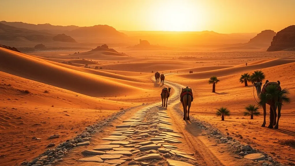
Geographically, ancient Egypt and Canaan were neighboring regions separated by the Sinai Peninsula. The physical distance between the eastern border of the Nile Delta (the biblical Land of Goshen, near modern Tell el-Dab’a/Ramses) and the southern edge of Canaan (around Beersheba or Gaza) spans roughly 200 miles (322 km) in a direct line.
Ancient travelers did not travel across open desert dunes in straight lines. Instead, they relied on distinct trade corridors equipped with water wells, waystations, and predictable topography. Depending on the route chosen, actual ground travel covered between 220 and 450 miles.
| Route / Path | Approx. Distance | Standard Travel Time | Historical Use |
|---|---|---|---|
| Way of the Philistines (Via Maris) | ~220–250 miles (350–400 km) | 10–14 days | Direct coastal military and trade highway |
| Way of Shur (Central Inland Route) | ~200–230 miles (320–370 km) | 12–16 days | Caravan route directly to Beersheba and Hebron |
| Biblical Exodus Wilderness Route | ~400–650+ miles (650–1,000+ km) | 40 Years (including nomadic stops) | Southern detour to Sinai, Kadesh Barnea, Transjordan |
What Route Did the Israelites Take?
The biblical narrative in Exodus 13:17–18 explicitly explains why the shortest road was avoided: “When Pharaoh let the people go, God did not lead them on the road through the Philistine country, though that was shorter. For God said, ‘If they face war, they might change their minds and return to Egypt.’ So God led the people around by the desert road toward the Red Sea.”
The northern coastal route—known to Egyptian chroniclers as the Ways of Horus and later called the Via Maris—was heavily fortified with Egyptian military garrisons, watchtowers, and administrative forts during the New Kingdom period. A massive migrating population traveling this route would have encountered armed resistance almost immediately.
Instead, the Exodus route led southeast into the rugged terrain of the Sinai Peninsula:
- Goshen to Succoth and Etham: Moving away from Nile Delta settlements toward the wilderness borderlands.
- Red Sea Crossing: Pausing at Pi-Hahiroth and crossing the waters, cutting off pursuit from Egyptian chariots.
- Wilderness of Shur and Sin: Traveling south along the western coastal plain of the Sinai Peninsula past Marah (bitter waters) and Elim (an oasis of palm trees and wells).
- Mount Sinai (Horeb): Reaching the southern mountain range for the giving of the Law and the establishment of the covenant.
- Kadesh Barnea: Heading north through the Wilderness of Paran to the southern border threshold of Canaan.
Pro Tip: According to Deuteronomy 1:2, the direct march from Mount Sinai (Horeb) to Kadesh Barnea via Mount Seir normally takes only 11 days. The prolonged duration was not caused by walking distance alone, but by historical and narrative events that unfolded once they reached Kadesh Barnea.
How Long Was the Exodus Journey?
The entire Exodus journey from the departure at Ramses to the crossing of the Jordan River into Canaan spanned 40 years. This timeline breaks down into distinct phases of active migration, covenant formulation, and decades of semi-nomadic settlement.
Exodus Travel Duration
The active travel time during the first year moved at a reasonable migration pace for a large community accompanied by elderly individuals, children, and livestock:
- Ramses to Mount Sinai: The journey took roughly 47 to 50 days, arriving at the base of the mountain in the third month after departing Egypt (Exodus 19:1).
- Encampment at Sinai: The Israelites remained at Mount Sinai for nearly a full year (approximately 11 months) constructing the Tabernacle and receiving civil and ceremonial laws.
- Sinai to Kadesh Barnea: A journey of roughly 11 to 20 travel days northward through the Wilderness of Paran.
- The 38-Year Delay: After the reconnaissance mission of the twelve spies resulted in widespread fear of Canaanite fortified cities (Numbers 13–14), the community was sentenced to remain in the wilderness until a new generation came of age.
Route, Distance, And Timing
| Journey Segment | Estimated Distance | Recorded Timeline | Significance |
|---|---|---|---|
| Goshen to Red Sea | ~80–100 miles (130–160 km) | ~3–4 weeks | Initial escape and crossing of the sea |
| Red Sea to Mount Sinai | ~120–150 miles (190–240 km) | ~4 weeks | Provision of manna, water from the rock, and arrival at Horeb |
| Sinai Encampment | Stationary | ~11 months | Covenant established; Ten Commandments; Tabernacle built |
| Sinai to Kadesh Barnea | ~150 miles (240 km) | 11 days (marching time) | Spies sent into Canaan; judgment of 40-year wandering |
| Wilderness Wandering | Nomadic circuits | ~38 years | Stationed primarily around Kadesh Barnea oasis |
| Transjordan to Canaan Entry | ~200 miles (320 km) | Final months of Year 40 | Bypassed Edom/Moab; crossed the Jordan near Jericho |
Where Did the Israelites Stop Along the Way?
The Book of Numbers (Numbers 33) provides a detailed itinerary cataloging more than 40 individual camping stations. Key milestones along the journey included:
- Succoth & Etham: The initial staging grounds on the eastern border of the Nile Delta marshlands.
- Marah: Located along the western Sinai coast, known for bitter alkaline springs rendered drinkable.
- Elim: A vital desert oasis featuring twelve water springs and seventy date palm trees.
- Wilderness of Sin & Rephidim: The desert expanse where manna and quail were first provided, and where Moses struck the rock for water before fighting the Amalekites.
- Mount Sinai / Horeb: The geographic and theological center of the Exodus, where the Israelites received the Torah and established their community camp for nearly a year.
- Kadesh Barnea (Ein el-Qudeirat / Ein Qadis): An expansive southern oasis region that served as the primary administrative base during the decades of wandering.
- Ezion-Geber: Located at the northern tip of the Gulf of Aqaba, marking their southward loop around Edomite territory.
- Plains of Moab: The final staging ground across from Jericho on the east side of the Jordan River.
Why Did the Journey Take 40 Years?
The extended 40-year duration was not caused by geographical confusion or getting lost in the desert. The biblical narrative attributes the four-decade timeline to a specific historical and spiritual turning point at Kadesh Barnea.
When the twelve scouts returned from surveying Canaan (Numbers 14:33–34), ten delivered a discouraging report highlighting formidable walled cities and powerful inhabitants. The resulting panic and rebellion among the people prompted divine judgment: for each of the 40 days spent scouting the land, the nation would spend one year in the wilderness until a new generation, unconditioned by Egyptian enslavement, arose to claim the land.
“Your children will be shepherds here forty years, suffering for your unfaithfulness, until the last of your bodies lies in the wilderness. According to the number of the forty days that you spied out the land, a year for each day, forty years you shall bear your iniquity…” — Numbers 14:33–34
How Far Was Goshen From Mount Sinai?
The traditional southern location of Mount Sinai (identified since the 4th century CE with Jebel Musa near Saint Catherine’s Monastery) lies approximately 220 to 250 miles (350 to 400 km) south-southeast of the ancient Land of Goshen.
Following ancient desert paths along the Gulf of Suez coastal plain and through inland wadis (such as Wadi Feiran), a large nomadic group moving at an average pace of 5 to 8 miles (8 to 13 km) per day would take between 45 and 50 days to reach the mountain. This aligns with the biblical chronology recording their arrival at Sinai in the third month after the Passover exodus.
Note: Scholars and biblical geographers debate alternative locations for Mount Sinai, including northern Sinai sites (e.g., Jebel Sin Bishar) and northwestern Arabian sites (e.g., Jabal al-Lawz). However, traditional southern Sinai routes remain the most widely documented in historical geography.
How Geography Slowed the Exodus
Beyond spiritual factors, the physical geography of the Sinai Peninsula and the Transjordan presented formidable natural barriers to rapid transit.
Desert Obstacles
- Water Scarcity and Oasis Dependency: A community traveling with flocks and herds could only move between confirmed water sources (such as Marah, Elim, and Kadesh). Daily movements were dictated by the distance between wadi wells and natural cisterns.
- Rugged Mountain Passes: The southern and central Sinai ranges feature granite peaks and narrow canyon passages (such as Wadi Mukatteb and Wadi Feiran) that force single-file travel and slow down supply trains.
- Deep Canyons of the Transjordan: Later in the journey, when seeking entry into Canaan from the east, the travelers had to navigate the sheer river gorges of the Zered and the Arnon along the Dead Sea plateau.
Divine Detours and Political Boundaries
The Israelites were forced to take extensive geographic detours around established kingdoms in the region:
- Refusal by Edom: When the King of Edom refused permission for Israel to pass peacefully along the central King’s Highway (Numbers 20:14–21), the Israelites had to detour completely around Mount Seir southward toward the Gulf of Aqaba before circling back north.
- Circumnavigating Moab: Similar diplomatic restrictions required a wide eastern circuit through the desert borderlands of Moab before approaching the Jordan River valley.
What the Bible Says About the Journey
The Hebrew Scriptures present the wilderness journey not merely as a migration log, but as a crucible of cultural, legal, and spiritual formation. Biblical texts highlight several key elements that governed their travel:
- The Guiding Pillar: Movement was synchronized with the presence of the pillar of cloud by day and fire by night (Exodus 13:21–22). When the cloud rested over the Tabernacle, whether for days, a month, or a year, the camp remained stationary (Numbers 9:15–23).
- Daily Sustenance: The physical challenge of feeding a migrating populace in arid badlands was sustained by daily provisions of manna and quail (Exodus 16).
- Generational Transition: According to Numbers 26, the census taken at the end of the 40 years on the Plains of Moab revealed an entirely new generation of military-age adults ready to cross into the Promised Land under Joshua’s leadership.
Why the Long Route Mattered
From an anthropological and historical perspective, taking the long wilderness route fundamentally altered the identity of the Israelite people. Emerging from generations of generational servitude in Egypt, the populace lacked military discipline, unified legal structures, and organized administrative institutions.
The four-decade delay served several foundational purposes:
- Legal and Social Codification: At Mount Sinai, the community received its foundational legal codes, ethical framework, and judicial systems.
- Shift to Self-Sufficiency: Decades of semi-nomadic living in the desert transformed a dependent labor class into self-governing tribes capable of logistical coordination and military defense.
- Cultural Unification: The shared experience of nomadic wandering around Kadesh Barnea solidified tribal alliances around a central religious sanctuary (the Tabernacle).
Frequently Asked Questions
How many kilometers did the Israelites walk from Egypt to Canaan?
The total circuitous route from Goshen through Mount Sinai, Kadesh Barnea, and around the Transjordan spanned roughly 600 to 700 kilometers (370 to 435 miles) of primary migration routes. This does not account for localized nomadic pastoral movements around seasonal oases during their 38-year stay at Kadesh Barnea.
How long was the trip from Canaan to Egypt for Joseph’s brothers?
When Joseph’s brothers traveled from Hebron in central Canaan down to the Nile Delta to buy grain (Genesis 42), they took the direct Way of Shur trade route. Traveling with donkeys at a typical pace of 15 to 20 miles per day, the 200-mile journey took approximately 10 to 14 days each way.
How long would it take to walk from Canaan to Egypt?
A fit individual or fast courier in the ancient world walking along the established coastal highway (Via Maris) could cover 20 to 25 miles per day, completing the 220-mile trip in roughly 8 to 10 days. Regular merchant caravans carrying supplies typically averaged 12 to 14 days.
How many days does it take from Egypt to Canaan?
On ancient direct paths, travel took between 10 and 14 days on foot. Modern highway travel by vehicle covers the distance between Cairo and Jerusalem (roughly 260 miles / 420 km via the Taba or Sinai border crossings) in approximately 6 to 8 hours, subject to international border clearance.
Conclusion
The distance between Egypt and Canaan represents two completely different realities depending on whether you measure the geography or the history. In physical geography, the two regions lie just 200 to 250 miles apart—a manageable two-week march along established ancient desert trade routes. In biblical history, the journey spanned over 400 miles of rugged wilderness and 40 years of transition, deliberately routing around military strongholds and forging a unified nation before they entered the Promised Land.
Sources
- Encyclopaedia Britannica — Historical Geography and Borders of Ancient Canaan
- World History Encyclopedia — The King’s Highway and Ancient Levantine Trade Routes
- Bible Gateway — Numbers 33: The Stations of the Exodus Wilderness Itinerary
- Biblical Archaeology Society — Archaeological and Geographical Studies of the Sinai Peninsula
