
Last Updated on September 10, 2026 by Daniel Globe
Santa Barbara and San Diego both offer excellent hiking, but they provide different experiences. Santa Barbara stands out for steep Santa Ynez foothill trails that rise quickly above the coast, while San Diego offers a larger mix of coastal bluffs, urban peaks, canyons, inland mountains, and desert-edge landscapes. The better destination depends on what kind of hike you want.
Quick Answer
Choose Santa Barbara if you want dramatic mountain-to-ocean views and challenging foothill hikes close to downtown. Choose San Diego if you value a larger variety of trail environments, from Torrey Pines’ coastal cliffs to Mission Trails and the Cuyamaca Mountains. Neither is universally better; your preferred terrain should decide.
Key Takeaways
- Santa Barbara is best for quick access to steep coastal foothills, including Inspiration Point, Tunnel Trail, and Rattlesnake Canyon.
- San Diego wins on overall terrain variety, with coastal reserves, urban mountains, canyons, oak woodland, high-country trails, and desert-adjacent hiking.
- Both destinations have beginner-friendly walks as well as strenuous hikes.
- Weather can be mild near the coast, but exposed inland and foothill trails can become much hotter than the city forecast suggests.
- Check official trail alerts before leaving because closures, wildfire restrictions, storm damage, and construction can change access quickly.
Disclosure: As an Amazon Associate I earn from qualifying purchases. Some links on this page are affiliate links, at no extra cost to you.
Santa Barbara vs. San Diego Hiking: Quick Comparison
| Factor | Santa Barbara | San Diego |
| Signature scenery | Steep foothills, chaparral, sandstone, Pacific Ocean and Channel Islands views | Coastal cliffs, canyons, urban peaks, oak woodland, mountains and desert-edge scenery |
| Easy options | Douglas Family Preserve, Stevens Park and shorter coastal walks | Short Torrey Pines trails, portions of Mission Trails and flatter canyon routes |
| Challenging options | Tunnel Trail, longer Inspiration Point approaches and higher Santa Ynez foothill routes | Cowles Mountain, longer Mission Trails routes and higher hikes in Cuyamaca |
| Trail variety | Excellent, especially for coastal foothill hiking | Broader regional variety across coast, city, mountains and desert |
| Shade | Varies; Rattlesnake Canyon has significant shade, while many ridge routes are exposed | Many popular city and coastal routes are exposed; wooded options increase in the inland mountains |
| Best for | A compact hiking trip centered on steep foothills and ocean panoramas | Travelers who want the widest choice of Southern California landscapes |
The qualities that make these destinations appealing are the same ones that draw hikers to famous routes such as the Appalachian Trail, Pacific Crest Trail, and John Muir Trail: scenery, elevation change, changing ecosystems, and a sense of discovery. You do not, however, need a multi-day expedition to experience those qualities in either Santa Barbara or San Diego.
Variety of Hiking Options
Hiking is not a one-size-fits-all activity. Beginners may want a short walking path with modest elevation gain, while experienced hikers may prefer a steep climb that takes several hours. Both Santa Barbara and San Diego cover that range, but they do it differently.
Santa Barbara Hiking
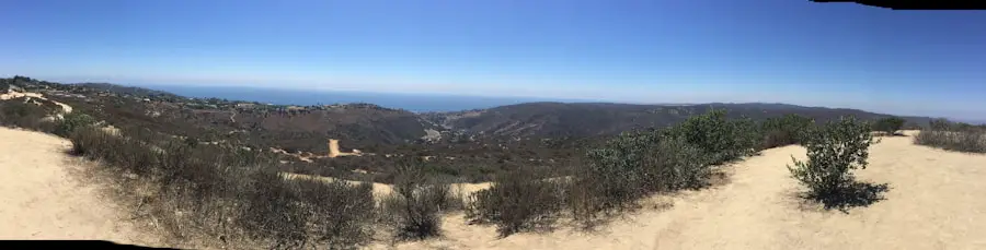
Santa Barbara’s defining feature is how quickly the landscape rises from the coast into the Santa Ynez foothills. That makes it possible to leave an urban area and begin climbing into chaparral, sandstone, oak, and canyon terrain within a short drive.
Tunnel Trail is one of the area’s signature climbs. The City of Santa Barbara says the trail climbs for nearly four miles toward Gibraltar Road at roughly 3,400 feet in elevation. The route toward Inspiration Point branches from Tunnel Trail and rewards hikers with broad views over the city and coast.
Rattlesnake Canyon Trail provides a different experience. The City describes it as a popular moderate climb with a year-round creek and a mostly shaded trail. It is a useful choice when you want a canyon setting rather than a fully exposed ridge hike.
For an easier outing, Douglas Family Preserve offers bluff-top walking rather than a long mountain ascent. That range of options helps Santa Barbara work for couples, families, casual walkers, and experienced hikers.
San Diego Hiking
San Diego’s biggest strength is breadth. You can hike coastal cliffs in the morning, an urban mountain in the afternoon, and make a separate day trip into substantially higher mountain country.
Mission Trails Regional Park spans more than 8,000 acres and contains about 60 miles of trails. Its mix of peaks, valleys, open chaparral, historical sites, and easier paths makes it one of the strongest examples of San Diego’s trail variety.
Mission Trails Regional Park alone offers about 60 miles of trails within an open-space park of more than 8,000 acres.
Along the coast, Torrey Pines State Natural Reserve offers shorter routes through rare native habitat above dramatic sandstone cliffs. Farther east, Cuyamaca Rancho State Park adds oak woodland, meadows, mountain terrain, and more than 100 miles of trails.
The result is a broader regional menu than the original article suggested. Santa Barbara excels at mountain-to-ocean immediacy, while San Diego excels at geographic variety.
Accessibility and Convenience
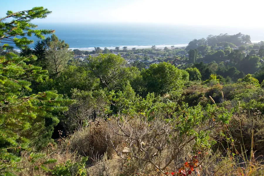
Accessibility can be just as important as scenery. A spectacular trail is less useful if you cannot reach the trailhead, find legal parking, or match the route to your available time.
Santa Barbara places several well-known foothill trailheads close to the city. Tunnel Trail, Jesusita Trail, Rattlesnake Canyon, Stevens Park, and Douglas Family Preserve make it possible to combine hiking with a normal sightseeing day. Parking can still be limited at popular foothill trailheads, especially on weekends.
San Diego spreads its hiking across a much larger metropolitan and county area. Mission Trails is only about eight miles northeast of downtown, while Torrey Pines sits on the northern coast. More ambitious mountain areas such as Cuyamaca require a longer drive east.
In that sense, Santa Barbara can feel more compact for a hiking-focused weekend. San Diego may require more driving, but it rewards that effort with more distinct environments.
Pro Tip: Choose the specific trail before choosing the city. Then check driving time, parking, elevation gain, shade, dog rules, and official trail status. A hike that fits your schedule and ability is more important than which destination wins an overall comparison.
Technology also makes both destinations easier to explore. Trail maps, official park websites, weather forecasts, and GPS apps can help with planning, although downloaded offline maps are useful when mobile reception becomes unreliable.
The principle is similar to highly accessible urban green spaces such as Central Park in New York: convenient access makes outdoor recreation easier to fit into an ordinary day. Santa Barbara and San Diego both benefit from having major trail systems close to populated areas.
Diverse Terrain and Elevation
The original comparison understated San Diego’s terrain and overstated the usefulness of a simple “mountain versus coast” distinction. Both destinations can provide significant climbing, but their landscapes feel different.
Santa Barbara’s Santa Ynez Mountains rise abruptly behind the coastal plain. That creates a striking mountain-to-ocean setting. Hikers can climb through shaded canyon bottoms, oak and sycamore areas, chaparral-covered slopes, and exposed ridges while looking back toward the Pacific and Channel Islands.
San Diego County covers a much wider east-to-west transition. Near the coast, Torrey Pines features sandstone bluffs and coastal vegetation. Mission Trails adds rugged urban peaks and valleys. Farther east, Cuyamaca Rancho State Park provides oak woodland, meadows, streams, and high mountain terrain.
This variety is why saying Santa Barbara simply has “more elevation” than San Diego is misleading. Santa Barbara often gives hikers faster access to steep foothills from the coast, while San Diego provides a broader range when the entire surrounding region is considered.
Elevation also affects temperature, exposure, water needs, and hiking speed. A route that looks short on a map can still be demanding when it climbs steeply with little shade. The same principle is obvious on famous destinations such as the Grand Canyon or the Inca Trail, where elevation and terrain can change the experience dramatically even over relatively short horizontal distances.
Wildlife and Nature Conservation
Both destinations pass through sensitive Southern California habitats, so good trail behavior matters. Common wildlife can include birds of prey, deer, coyotes, snakes, and smaller mammals. Mountain lions also occur in Southern California, although encounters are uncommon.
Santa Barbara’s Douglas Family Preserve covers 68.35 acres above Arroyo Burro Beach. The City manages the area for recreation while also protecting native vegetation, wildlife habitat, and the coastal bluff environment.
Torrey Pines is especially conservation-focused. The reserve protects the rare Torrey pine along with coastal habitat, sandstone formations, and wildlife areas. Visitors should remain on designated trails because shortcuts can accelerate erosion and damage fragile vegetation.
Trail etiquette also reduces wildlife conflicts. Do not feed animals, keep a safe distance, pack out trash, and follow each park’s dog rules. Dogs are not allowed at Torrey Pines State Natural Reserve, while Santa Barbara rules vary by trail and park. Rattlesnake Canyon and Tunnel Trail require dogs to be leashed, while designated portions of Douglas Family Preserve allow controlled off-leash use.
Note: Dog policies differ sharply between parks. Never assume that a dog-friendly city means every trail allows dogs, and check the official park page before arriving.
Historical and Cultural Significance
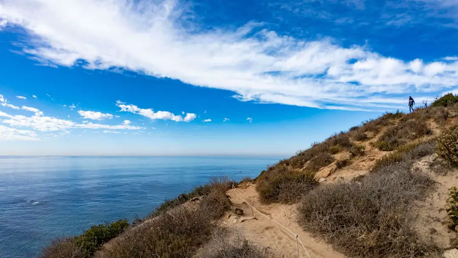
Hiking is not only about scenery. Trails also cross landscapes with long human histories, and both Santa Barbara and San Diego deserve more cultural context than the original article provided.
Santa Barbara’s documented history begins long before European settlement. Chumash communities lived throughout the Santa Barbara region for thousands of years, and the modern city and surrounding foothills remain part of a landscape with deep Indigenous cultural significance.
Mission Trails Regional Park also combines natural and cultural resources. The City of San Diego highlights the area’s long Indigenous history and the historic Old Mission Dam, giving visitors opportunities to learn about the region while hiking.
This relationship between walking routes and history exists around the world. Historic corridors associated with the Oregon Trail and long pilgrimage routes such as the Camino de Santiago show how landscapes can preserve stories of migration, trade, religion, survival, and community. Local hiking deserves the same awareness: enjoy the scenery while respecting cultural sites and protected resources.
Outdoor Recreation and Adventure
Hiking can also be a starting point for a larger outdoor trip. Santa Barbara’s coastline makes it easy to combine a morning hike with beach time, paddling, cycling, or other coastal recreation. The surrounding mountains attract trail runners, mountain bikers on permitted routes, climbers, and backcountry travelers.
San Diego offers an even wider regional mix. Depending on where you stay, hiking can be combined with surfing, kayaking, mountain biking, camping, wildlife viewing, or a trip into the higher inland mountains.
More experienced hikers can also use these outings to practice navigation, route planning, first aid, pacing, water management, and weather awareness. Multi-day backpacking requires much more preparation than a short city-adjacent hike, but the same basic skills apply.
That progression mirrors famous long-distance routes such as the Pacific Crest Trail and John Muir Trail: hikers build confidence through shorter outings before tackling longer distances, heavier packs, remote terrain, and more complicated logistics.
Weather and the Best Time to Hike
Both Santa Barbara and San Diego have relatively mild coastal climates, which allows hiking during much of the year. That does not mean every trail has mild conditions.
Santa Barbara receives most of its rain during the cooler part of the year. Winter and spring can produce greener hills, flowing creeks, wildflowers, mud, and occasional storm damage. Summer and fall are usually drier, but exposed foothill routes can become hot and fire risk can increase.
San Diego is generally drier, especially near the coast, but conditions vary dramatically between coastal and inland areas. A pleasant morning near Torrey Pines does not mean an exposed inland trail will have the same temperature. Mountain areas can also be much cooler than low-elevation city trails.
The National Weather Service Los Angeles/Oxnard climate resources cover the Santa Barbara region, while the National Weather Service San Diego climate page provides regional climate information for San Diego.
For most hikers, fall through spring provides the broadest selection of comfortable inland routes. During warmer months, an early start and a coastal trail can be a much better choice than a sunny midday climb.
Safety, Heat, Wildfire, and Current Trail Conditions
Southern California trail conditions can change quickly. Heat, wildfire restrictions, storm damage, construction, erosion, and temporary closures should always be checked before leaving.
Warning: Do not rely only on a coastal city weather forecast. Exposed foothill, canyon, mountain, and inland trails can be much hotter. Carry adequate water, use sun protection, start early in warm weather, stay on open trails, and turn around if conditions exceed your ability.
Santa Barbara trail pages specifically warn that hikers may encounter hazards such as poison oak, snakes, cyclists, horses, and other wildlife depending on the route. Good footwear and attention at trail junctions are important on rocky or steep terrain.
There is also an important 2026 freshness issue. A USDA Forest Service storm-damage recovery order affecting specified sites, roads, and trails in the Santa Barbara Ranger District remains effective through September 17, 2026. Check the current Los Padres National Forest closure order before entering National Forest land.
As of July 26, 2026, Torrey Pines State Natural Reserve reports that all trails are open, although some services are restricted.
Note: California State Parks says Phase II construction at Torrey Pines is scheduled to begin in August or September 2026 and is expected to continue until before March 1, 2027. The park road, upper parking areas, and trails within the Reserve are expected to close during active construction. Check the official construction page immediately before planning a visit.
After rain, avoid trails that are officially closed or obviously saturated. Walking around mud widens trails and damages surrounding vegetation. On coastal bluff routes, stay behind barriers and away from unstable cliff edges.
Local Amenities and Services
Both destinations have strong tourism infrastructure, which makes hiking easier to combine with meals, lodging, transportation, and other activities.
Santa Barbara’s compact layout is especially convenient for travelers who want a hike without turning the entire day into a driving trip. Several front-country trailheads are relatively close to downtown, while beaches, restaurants, hotels, and outdoor shops are nearby.
San Diego covers a much larger geographic area, so lodging location matters more. Staying near the coast is convenient for Torrey Pines and beach activities, while central San Diego provides quicker access to Mission Trails. Travelers planning Cuyamaca or other inland hikes should allow additional driving time.
Visitor centers can also add value. Mission Trails has a Visitor and Interpretive Center, while Torrey Pines offers interpretive resources and scheduled nature programs when available. These are useful for families and anyone who wants to understand the area’s geology, plants, animals, and history rather than simply walk the trail.
Local outdoor businesses in both regions provide hiking equipment and related services. For more remote hikes, however, carry your own water, navigation, food, sun protection, and basic emergency supplies rather than assuming services will be available near the trailhead.
Which Is Better for Hiking: Santa Barbara or San Diego?
Choose Santa Barbara when your ideal trip involves steep foothills, fast elevation gain, canyon hiking, sandstone landscapes, and sweeping views over the Pacific. It is particularly appealing for a short hiking getaway because several excellent trails sit close to the city.
Choose San Diego when variety matters most. The region offers coastal bluffs, city-adjacent peaks, broad canyon systems, mountain forests, meadows, and access toward desert landscapes. It also provides a larger overall pool of trails when you are willing to drive beyond the urban core.
For beginners, either destination works. Douglas Family Preserve provides an approachable Santa Barbara outing, while Torrey Pines and selected Mission Trails routes give San Diego visitors short scenic choices. For experienced hikers, both regions offer harder routes, but the type of challenge differs.
In practical terms, Santa Barbara has the edge for a compact mountain-and-ocean hiking weekend. San Diego has the edge for overall diversity and the number of distinct hiking environments available across a longer trip.
Whichever destination you choose, the best experience comes from matching the trail to your fitness, checking current conditions, starting at an appropriate time, and leaving enough flexibility to change plans when heat, rain, fire restrictions, or closures intervene.
If photography is part of your hiking trip, the existing travel camera backpack guide can help you choose a practical way to carry camera gear while exploring coastal overlooks and mountain trails.
Love travel? Join Our Facebook Community
Frequently Asked Questions
What are the hiking options in Santa Barbara?
Santa Barbara offers coastal walks, shaded canyon trails, and steep foothill climbs. Popular options include Inspiration Point, Tunnel Trail, Rattlesnake Canyon, Jesusita Trail, Stevens Park Trail, and Douglas Family Preserve. Difficulty ranges from easy bluff-top walks to long, exposed mountain routes.
What are the hiking options in San Diego?
San Diego offers coastal hiking at Torrey Pines, a large network of urban wilderness trails at Mission Trails Regional Park, canyon routes such as Los Peñasquitos, and higher mountain hiking east of the city at places such as Cuyamaca Rancho State Park.
What are the differences in terrain between Santa Barbara and San Diego?
Santa Barbara is especially known for steep Santa Ynez foothills that rise quickly behind the coast, creating strong mountain-to-ocean views. San Diego covers a wider regional range, including coastal bluffs, urban peaks, chaparral canyons, oak woodland, higher mountains, and desert-adjacent terrain.
Which city has better weather for hiking, Santa Barbara or San Diego?
Both have mild coastal climates and can support year-round hiking. San Diego is generally drier, while Santa Barbara receives more cool-season rain. However, trail location matters more than the city average: exposed foothills and inland San Diego routes can become much hotter than nearby coastal areas.
Are there notable hiking events or groups in Santa Barbara and San Diego?
Yes. Both regions have active trail-maintenance groups, guided walks, volunteer programs, and outdoor organizations. Schedules change throughout the year, so check the City of Santa Barbara Parks and Recreation, Mission Trails Regional Park, and California State Parks event calendars for current programs.
Is Santa Barbara or San Diego better for beginner hikers?
Both work well for beginners when the route is chosen carefully. Santa Barbara’s Douglas Family Preserve and Stevens Park provide approachable walking, while San Diego offers short Torrey Pines trails and easier routes within larger park systems. Always check distance and elevation gain rather than relying only on an “easy” label.
Which destination is better for challenging hikes?
Santa Barbara is excellent for steep front-country climbing close to the coast, while the wider San Diego region adds substantial mountain terrain in places such as Cuyamaca. Santa Barbara is particularly strong for quick elevation gain; San Diego provides a larger regional selection.
Do I need to check trail conditions before hiking?
Yes. Heat, storms, erosion, wildfire restrictions, maintenance, and construction can close trails with little notice. This is especially important in 2026 because parts of the Santa Barbara Ranger District have storm-recovery restrictions and another construction phase is scheduled at Torrey Pines.
Sources
- City of Santa Barbara — Rattlesnake Canyon Trail — trail character, shade, creek, wildlife and dog rules.
- City of Santa Barbara — Douglas Family Preserve — acreage, walking trails, coastal views and park rules.
- City of San Diego — Mission Trails Regional Park — park size, trail mileage, amenities and recreation.
- California State Parks — Torrey Pines State Natural Reserve — current trail status, rules, facilities and natural resources.
- California State Parks — Torrey Pines Construction Project — planned 2026–2027 construction and closures.
- California State Parks — Cuyamaca Rancho State Park — mountain terrain and regional trail network.

