
Last Updated on September 10, 2026 by Daniel Globe
Mount Baldy, officially Mount San Antonio, rises to 10,064 feet in the San Gabriel Mountains northeast of Los Angeles. It is the highest peak in the range and one of Southern California’s best-known mountain hikes. Its steep trails, exposed ridges, high elevation, changing weather, and seasonal snow also mean that access and conditions should always be checked before a trip.
Quick Answer
Yes. As of July 27, 2026, the Forest Service lists Manker Flat as open and identifies Baldy Bowl and Devil’s Backbone as summit routes. No Mt. Baldy trail closure appears on the current Angeles National Forest alerts page. Conditions and emergency closures can change quickly, so check official alerts again on the day of your hike.
Key Takeaways
- Mt. Baldy is currently accessible from the Manker Flat area, but individual trails can close temporarily because of storms, snow, wildfire, or other hazards.
- The Forest Service describes an 11.3-mile summit loop combining the Baldy Bowl trailhead and Devil’s Backbone.
- Snow or hard ice can turn Mt. Baldy from a strenuous hike into a mountaineering objective. Equipment alone is not a substitute for training and experience.
- Potable water is not available at Manker Flat, so arrive with all the water you expect to need.
- Check Forest Service alerts, weather, fire danger, and parking or pass requirements before leaving home.
At a Glance
| Time Required | Plan a full day for the 11.3-mile summit loop; hiking time varies greatly with fitness, weather, trail surface, and stops. |
| Difficulty | Strenuous in dry conditions; potentially technical mountaineering terrain when snow or ice is present. |
| Tools Needed | Hiking footwear, water, food, layers, sun protection, navigation, headlamp, and first-aid supplies. Snow and ice require appropriate mountaineering skills and equipment. |
| Cost | Trail access does not have one universal admission price. A $5 Daily Adventure Pass or other accepted pass may be required at designated parking areas, while developed sites can charge separate fees. Follow posted signs. |
| Main Summit Route | Baldy Bowl trailhead + Devil’s Backbone: 11.3-mile loop according to the Forest Service. |
| Water | Potable water is not currently available at Manker Flat. Carry your supply from the start. |
Disclosure: As an Amazon Associate I earn from qualifying purchases. Some links on this page are affiliate links, at no extra cost to you.
Is Mt. Baldy Open for Hiking Right Now?
As of this update on July 27, 2026, the USDA Forest Service lists Manker Flat Campground as open. The same official page identifies the Mt. Baldy Bowl trailhead and Devil’s Backbone as routes that can be combined to reach the summit.
The current Angeles National Forest alerts page does not list an active Mt. Baldy trail closure. However, that does not guarantee that every road, trail segment, parking area, or facility will remain accessible when you arrive.
Note: Mt. Baldy access is unusually sensitive to storms, snow, wildfire, road damage, and public-safety closures. Treat the Forest Service alerts page as the final authority and check it again on the morning of your hike.
Fire conditions also matter. Angeles National Forest raised its forestwide fire-danger level to Very High on July 24, 2026. Fire danger and restrictions can change independently of whether hiking trails remain open, so hikers should review current fire information along with trail closures.
About Mount Baldy
Mount San Antonio is better known locally as Mt. Baldy because of the comparatively bare upper slopes visible from the Los Angeles Basin. At 10,064 feet, it is the highest point in the San Gabriel Mountains. The peak lies within the Angeles National Forest and San Gabriel Mountains National Monument.
At 10,064 feet, Mount San Antonio is the highest point in the San Gabriel Mountains.
The landscape changes dramatically with elevation. Lower slopes include chaparral and canyon vegetation, while higher areas contain conifers, exposed rock, and sparse high-elevation plant communities. The mountain’s mostly treeless upper slopes give the summit its distinctive appearance.
The broader San Gabriel Mountains also have a long Indigenous cultural history. Historical and archaeological research identifies Gabrielino/Tongva connections in the San Gabriel Valley and Serrano connections in the eastern San Gabriel Range. Visitors should respect archaeological sites, cultural resources, plants, and other natural features and leave them undisturbed.
Mt. Baldy Hiking Routes and Difficulty
Mt. Baldy has several approaches, but route names can be confusing because hikers sometimes combine multiple trails into loops. Conditions can also change enough that an established route may be much harder than its mileage suggests.
Baldy Bowl and Devil’s Backbone Loop
The Forest Service describes an 11.3-mile loop from the Manker Flat area that uses the Mt. Baldy Bowl trailhead and Devil’s Backbone to reach the summit. Baldy Bowl is also commonly associated with the Ski Hut route.
From the Manker Flat area, hikers initially follow the approach toward San Antonio Falls before branching toward the upper mountain. The Baldy Bowl side climbs steeply toward the Sierra Club Ski Hut and higher slopes. The Devil’s Backbone side follows an exposed ridge where steep terrain drops away from portions of the trail.
This is a strenuous high-elevation hike even when the trail is dry. Loose rock, sun exposure, long climbing sections, and nearly 10,000-foot elevations near the summit can slow hikers considerably.
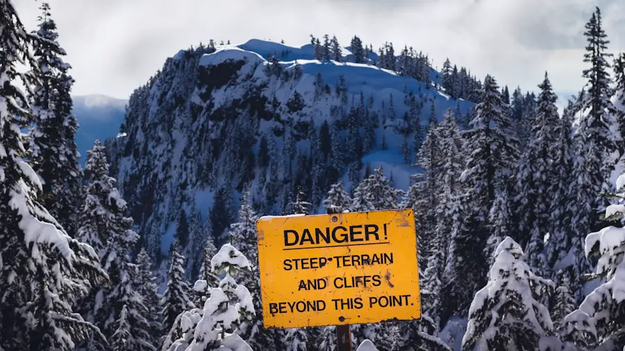
Warning: Do not assume the normal hiking route is safe just because the trail is technically open. Snow, hard ice, strong wind, thunderstorms, or poor visibility can make exposed sections such as Devil’s Backbone substantially more dangerous.
San Antonio Falls
For visitors who want to experience the Mt. Baldy area without attempting the summit, the Forest Service lists San Antonio Falls as a 1.4-mile round-trip outing from the Manker Flat area. The falls are about 75 feet high.
This shorter walk is a more realistic choice for casual visitors, although mountain weather, heat, snow, and icy surfaces can still affect conditions.
Other Routes
Bear Canyon, often called the Old Baldy Trail, and routes through the ski-area side of the mountain are also used by hikers. These approaches differ substantially in distance, climbing, exposure, and current condition. Do not assume that because one Mt. Baldy route is open, every approach is open. Verify your exact route before leaving.
Safety Before You Hike Mt. Baldy
Mt. Baldy is close to a major metropolitan area, but it should be treated as a serious mountain. A trail that feels warm and dry near the start can have cold wind, snow, ice, or poor visibility higher up.
Assess Your Abilities
Choose a route that matches your fitness and mountain experience. The summit loop is not a beginner walk. Anyone who has not recently completed long hikes with several thousand feet of climbing should consider a shorter outing before attempting the summit.
Elevation also matters. The CDC’s high-altitude guidance explains that altitude illness can occur above roughly 8,000 feet. Headache, nausea, dizziness, unusual fatigue, or loss of appetite after gaining elevation should be taken seriously.
If symptoms worsen while ascending, do not continue higher simply to reach the summit. Stop, reassess, and descend when necessary. Severe shortness of breath, confusion, poor coordination, or other serious symptoms require immediate descent and medical help.
Packing Essentials
For a dry-season summit attempt, carry enough supplies to remain self-sufficient if the hike takes longer than planned. Useful essentials include:
- All the drinking water you expect to need.
- High-energy food and extra snacks.
- Warm and wind-resistant layers.
- Sun hat, sunglasses, and sunscreen.
- Offline map or GPS navigation plus a backup method.
- Headlamp with sufficient battery power.
- Basic first-aid supplies.
- Fully charged phone and, when available, an emergency satellite communicator.
Note: The Forest Service currently states that potable water is not available at Manker Flat. Do not plan to fill your bottles there.
Hike with a Buddy
Hiking with another prepared person gives you help if someone becomes injured, develops altitude symptoms, or encounters a navigation problem. Whether hiking alone or with a group, tell someone at home your exact route, vehicle location, planned turnaround time, and expected return time.
Cell coverage in mountain terrain can be unreliable. Do not make a phone signal your emergency plan.
Set a Turnaround Time
A summit is optional; getting back safely is not. Decide in advance when you will turn around even if you have not reached the top. Allow extra daylight for a slower descent, route-finding problems, fatigue, and unexpected weather.
Pro Tip: Check the Forest Service alert page, the mountain weather forecast, and your route map before driving to the trailhead. Download your map for offline use and start early enough that a delay will not leave you descending without daylight.
Winter, Snow, and Ice on Mt. Baldy
Winter conditions deserve a separate warning. Snow and ice can turn ordinary hiking trails into steep fall terrain. The Forest Service warns that high-elevation hiking around Mt. Baldy in winter and spring—and sometimes even into early or mid-summer—can require experienced mountaineering skills.
Crampons, an ice axe, helmet, snowshoes, or other winter equipment may be appropriate in specific conditions, but carrying equipment does not make a person qualified to travel on steep snow or ice. Proper use requires training and practice.
If your planned route contains hard snow or ice and you do not know how to assess snow conditions, use an ice axe, travel in crampons, or arrest a fall, the safer choice is to turn around and return when the route is dry.
Avalanche terrain is another concern after snowfall and wind loading. Avoid assuming that a familiar summer trail follows a safe winter line. Snow can cover the trail completely and create hazards that do not exist during dry weather.
Warning: Do not attempt a snowy or icy Mt. Baldy summit because you bought traction equipment the night before. When winter conditions are present, experience and judgment matter more than owning the gear.
Best Time to Hike Mt. Baldy
There is no single month when Mt. Baldy is guaranteed to be safe. Current trail and weather conditions matter more than the calendar.
Spring
Lower elevations may become mild and green while high slopes still hold snow and ice. Spring should not automatically be treated as an easy hiking season. Check recent mountain conditions before choosing a summit route.
Summer
Summer often brings dry trails, but heat can become severe on exposed slopes and at lower elevations. Start early, carry ample water, use sun protection, and pay attention to heat advisories. Summer and early fall can also bring elevated wildfire danger and restrictions.
Fall
Dry fall days can offer cooler hiking weather, but strong winds, wildfire conditions, and early-season storms remain possible. Shorter daylight also makes an early start important.
Winter
Winter can produce a completely different mountain. Snow, ice, wind, and poor visibility can turn familiar hiking terrain into technical mountaineering terrain. Hikers without the required winter skills should wait for dry conditions or choose a lower-elevation trail.
What to Expect on the Hike
As you climb Mt. Baldy, vegetation becomes thinner and the terrain more exposed. Lower areas include chaparral and forested sections, while higher slopes transition toward sparse trees, rock, scree, and open summit terrain.
Wildlife may include deer, birds, bears, coyotes, and other species found in the surrounding national forest, although sightings are never guaranteed. Observe animals from a distance and never leave food or trash behind.
The physical demands increase rapidly as the trail climbs. Steep grades, loose footing, exposure, reduced oxygen, and changing temperatures make the summit substantially harder than its distance alone might suggest.
On clear days, hikers near the summit can see across large portions of the San Gabriel Mountains and Los Angeles Basin, with exceptionally clear conditions sometimes revealing distant coastal features. The broad summit views are one of the reasons Mt. Baldy remains such a popular Southern California hike.
Parking, Passes, and Fees
Parking rules depend on exactly where you leave your vehicle. The Forest Service’s Adventure Pass program currently lists a Daily Adventure Pass at $5 and an Annual Adventure Pass at $30 for designated fee sites and areas in Southern California national forests.
An America the Beautiful Interagency Pass is accepted where an Adventure Pass is required. Developed recreation sites may instead charge their own site-specific fee, so do not assume one parking rule applies everywhere around Mt. Baldy.
Manker Flat Campground currently charges separate developed-site fees, including a day-use vehicle fee. Always read signs where you park rather than relying on an old trail report or social-media post.
Respect the Mountain and Natural Environment
Use established trails where they exist, obey all posted Forest Orders and closure signs, and avoid cutting switchbacks. Shortcuts damage vegetation, accelerate erosion, and can loosen rock onto hikers below.
Pack out all food wrappers, tissues, fruit peels, and other waste. Do not carve into trees or rocks, move archaeological objects, pick protected plants, or disturb wildlife.
Fire regulations deserve particular attention during Southern California’s dry season. Before carrying a stove or planning any type of flame, check current Forest Service fire restrictions. Fire rules can become stricter even while hiking trails remain open.
Alternative Hikes Near Mt. Baldy
If the summit is beyond your experience level or conditions are poor, turning to a different hike is a better decision than forcing a Mt. Baldy attempt.
San Antonio Falls
The 1.4-mile round trip from the Manker Flat area is the most straightforward nearby alternative listed by the Forest Service. It provides mountain scenery and a view of the approximately 75-foot waterfall without requiring a 10,000-foot summit attempt.
Icehouse Canyon Saddle
Icehouse Canyon Saddle is another established outing near Mt. Baldy Village. The Forest Service lists the hike to the saddle as 7.2 miles round trip with about 2,600 feet of climbing.
From the saddle, trails continue toward destinations including Ontario Peak and Cucamonga Peak. A free wilderness permit is required once hikers travel beyond the Cucamonga Wilderness boundary. These summit extensions should not be described as easy substitutes for Mt. Baldy; they are substantial mountain hikes in their own right.
Mount Wilson
Mount Wilson has long offered another high-elevation hiking destination in the San Gabriel Mountains. However, some roads and trails in the broader Mount Wilson area remain affected by Eaton Fire closure orders. Verify your specific route on the Angeles National Forest alerts page before treating Mount Wilson as an available alternative.
Whichever route you choose, plan around actual conditions rather than a trail’s reputation. A shorter open trail in good conditions is usually a better outing than a summit route affected by snow, extreme heat, wildfire, or a closure.
Frequently Asked Questions
Is Mt. Baldy open for hiking?
Yes, as of July 27, 2026. The Forest Service lists Manker Flat as open and identifies Baldy Bowl and Devil’s Backbone as summit routes. Because short-notice closures can occur, check the Angeles National Forest alerts page again immediately before your trip.
Are there restrictions or regulations for hiking at Mt. Baldy?
Restrictions vary with fire danger, storms, winter conditions, road damage, and temporary Forest Orders. Obey posted closure signs, parking rules, fire restrictions, and other Forest Service orders. Check current alerts before every visit.
What is the best time to hike Mt. Baldy?
The best time is a dry, mild day when your chosen trail is open and free of conditions beyond your experience. Spring can retain snow and ice, summer can bring extreme heat and fire danger, fall can be windy, and winter can require mountaineering skills.
Are there fees for hiking at Mt. Baldy?
There is no single universal Mt. Baldy hiking admission fee, but parking in designated Forest Service fee areas may require a pass. The Daily Adventure Pass is currently $5 and the annual pass is $30. Developed sites can charge separate fees, so follow signs at your parking location.
What should I bring for a Mt. Baldy hike?
Bring all needed water, food, supportive hiking footwear, sun protection, warm and wind-resistant layers, navigation, a headlamp, first-aid supplies, and a charged communication device. Potable water is not currently available at Manker Flat.
Do I need a permit to hike to the Mt. Baldy summit?
The Forest Service does not currently list a general day-hiking wilderness permit for the standard Baldy Bowl and Devil’s Backbone summit loop. Parking passes or developed-site fees may still apply. Other nearby destinations have different rules; for example, continuing beyond the Cucamonga Wilderness boundary from Icehouse Canyon requires a free wilderness permit.
Is Devil’s Backbone safe for beginners?
It is not a good first mountain hike. Devil’s Backbone includes exposed ridge terrain, and the full summit outing is long, steep, and high in elevation. Snow, ice, strong wind, or poor visibility can make the route substantially more dangerous. Beginners should build experience on shorter, less exposed hikes first.
Sources
- USDA Forest Service — Manker Flat Campground — current site status, summit-loop distance, San Antonio Falls distance, fees, and water availability.
- USDA Forest Service — Angeles National Forest Alerts — current closures, Forest Orders, fire danger, and restrictions.
- USDA Forest Service — Adventure Pass — current daily and annual pass prices and fee-area rules.
- USDA Forest Service — Icehouse Canyon Saddle — route distance, elevation gain, wilderness permits, and high-elevation winter guidance.
- CDC Yellow Book — High-Altitude Travel and Altitude Illness — altitude effects, symptoms, acclimatization, and descent guidance.
- USDA Forest Service — San Gabriel Mountains National Monument Fact Sheet — Mount San Antonio’s 10,064-foot elevation and geographic context.

