
Last Updated on July 28, 2026 by Daniel Globe
When examining biblical history, one of the most striking geographical questions is the true distance between ancient Egypt and Canaan. While modern maps show a direct overland distance of roughly 250 miles (400 km)—a route manageable on foot in under three weeks—the biblical narrative describes a 40-year wilderness trek spanning over 500 miles (800+ km). Understanding this contrast requires looking beyond simple mileage to explore ancient trade roads, strategic detours, harsh desert terrain, and spiritual testing.
Quick Answer
The direct distance from Egypt to Canaan is approximately 250 miles (400 km), which could be walked in 2 to 3 weeks along the northern coastal road. However, the biblical Exodus route extended over 500 miles (800+ km) and took 40 years due to strategic detours around military outposts, harsh desert terrain, and a 38-year encampment at Kadesh-Barnea.
Note: The exact Exodus route and specific campsite GPS coordinates are not explicitly defined in historical records. Figures cited represent widely accepted scholarly and geographic estimates, while the precise historical routes and dates remain subjects of ongoing scholarly and archaeological discussion.
Key Takeaways
- Direct Distance: Egypt (Nile Delta) to Canaan is roughly 250 miles (400 km) direct—a 14 to 21 day journey for ancient travelers.
- Exodus Route Length: The wilderness path taken stretched well over 500 miles (800+ km) due to southern detours through the Sinai Peninsula.
- Why 40 Years: The timeline was defined by spiritual readiness rather than geography, including a 38-year encampment at Kadesh-Barnea.
- Key Stations: Crucial focal points included Mount Sinai (reception of the Law) and Kadesh-Barnea (the report of the twelve spies).
Disclosure: As an Amazon Associate I earn from qualifying purchases. Some links on this page are affiliate links, at no extra cost to you.
How Far Was Egypt to Canaan?
Although Egypt and Canaan were separated by only about 250 miles (400 kilometers) in a straight line from the Nile Delta to southern Canaan, the actual migration route was far longer and substantially more complex. When counting every turn, mountain pass detour, and circuitous wilderness track across the Sinai Peninsula, modern geographic estimates place the total journey at well over 500 miles (800+ kilometers).
Rather than a swift, direct march, the Israelite migration unfolded as a slow, deliberate movement across hostile desert ecosystems. Spread across 40 years, the overall average moving pace computes to only a few dozen meters per day. This reflects the reality that the journey was not continuous walking, but rather comprised long periods of stationary settlement interrupted by brief periods of movement when dictated by water, grazing land, and divine direction.
Why Did the Israelites Spend 40 Years in the Wilderness?
The Israelites did not spend four decades in the desert because the physical road was impassable; they remained there because of a crisis of faith and readiness. According to biblical historical records in Numbers 14:33–34, after reaching the border of Canaan at Kadesh-Barnea, ten of the twelve spies returned with a fearful report regarding the fortified cities and inhabitants of the land. The resulting panic and refusal to enter led to a decree that the generation would wander until a new generation was prepared to lead.
This prolonged desert period served several vital historical and spiritual functions:
- Transition from Slavery to Self-Governance: A population newly freed from centuries of Egyptian servitude required institutional structure, moral law, and judicial systems.
- Establishment of the Covenant: At Mount Sinai, the reception of the Ten Commandments and the construction of the Tabernacle formed the religious foundation of the nation.
- Survival Training in Arid Conditions: Decades in the wilderness forged high endurance, reliance on shared resources, and military readiness for entry into Canaan.
What Was the Exodus Route and Its Main Stops?
The path from Egypt to Canaan was defined by ancient trade corridors, natural water sources, and strategic military avoidance. Tracing this route requires comparing the commercial highways of the ancient Near East with the specific wilderness stations documented in biblical accounts.
Northern Coastal Route vs. Southern Wilderness Route
The fastest route between Egypt and Canaan was the direct northern coastal highway, known historically as the Via Maris (“Way of the Sea”) or biblical “Way of the Land of the Philistines.” Spanning roughly 150 to 200 miles along the Mediterranean coast, an ancient caravan or military division could traverse this path in 10 to 14 days.
However, as recorded in Exodus 13:17–18, this northern corridor was deliberately bypassed. The coastal route was heavily fortified with Egyptian military garrisons, border fortresses, and hostile Philistine settlements. Taking an unprepared population directly into armed conflict would have triggered a retreat back to Egypt. Consequently, the route turned south toward the rugged interior of the Sinai Peninsula.
Key Stations of the Wilderness Journey
According to the detailed itinerary preserved in Numbers 33, the journey included 42 distinct encampments. Among these, several key locations marked major milestones:
- Succoth and Etham: The initial staging areas on the eastern border of Egypt marking the exit from the Nile Delta region.
- Marah and Elim: Early desert stops where bitter water was made drinkable and twelve natural springs provided life-saving water and palm groves.
- Mount Sinai (Horeb): The central landmark of the southern route, where the Israelites remained encamped for nearly a full year to receive the Law and build the Tabernacle.
- Kadesh-Barnea: Located in the wilderness of Paran near southern Canaan, this oasis served as the primary encampment for approximately 38 of the 40 years (Deuteronomy 2:14).
- Plains of Moab: The final gathering point east of the Jordan River across from Jericho, where Moses delivered his farewell addresses before his death.
Pro Tip: When mapping the Exodus route, refer to Numbers 33. It provides the most structured biblical log of encampments from Rameses to the Jordan River, serving as the primary text for geographical reconstructions by scholars like those at Encyclopædia Britannica.
How Did the Terrain Affect the Journey?
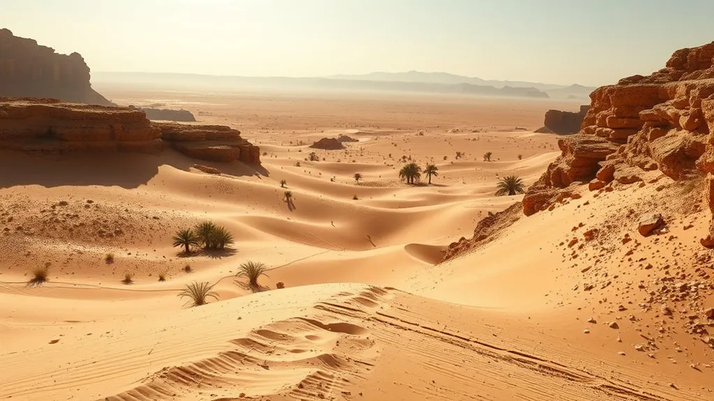
The physical geography of the Sinai Peninsula and Transjordan presented formidable obstacles that dictated both the speed and directional changes of travel. The severe landscape transformed a straightforward migration into a continuous endurance challenge.
- Extreme Temperature Swings: Scorching daytime desert heat combined with freezing nighttime temperatures required deliberate, slow pacing and morning/evening travel.
- Arid Water Scarcity: Large-scale movement required traveling strictly between established desert oases and seasonal wadis (dry riverbeds).
- Rugged Canyon Topography: Navigating steep granite mountains, narrow gorges (such as Zered and Arnon), and rocky plains made direct lines impossible.
- Hostile Border Kingdoms: Regional powers, such as the Edomites and Moabites, refused passage along established trade roads like the King’s Highway, forcing long detours around territorial borders.
A 250-mile trip that could take two weeks on open highways instead required forty years of wilderness wandering—demonstrating that geography was only one part of a far greater story.
What Does the Exodus Journey Teach Us Today?
While the historical distance from Egypt to Canaan spans about 250 miles in a straight line, the lessons derived from the 40-year journey continue to resonate. The narrative demonstrates that personal and collective transformation often requires passing through periods of difficulty and waiting.
The desert experience highlights how environmental pressure and extended delays can forge resilience, character, and deeper trust. Rather than viewing wilderness periods strictly as lost time, the Exodus narrative frames them as necessary seasons of preparation, ensuring that individuals and communities are fully equipped before entering their intended destinations.
Frequently Asked Questions
How many miles did Mary and Joseph have to travel to reach Bethlehem?
Mary and Joseph traveled approximately 70 to 90 miles (110 to 145 km) from Nazareth to Bethlehem. Taking the route along the Jordan River valley or through Samaria, the trip took roughly 4 to 7 days on foot across hilly terrain.
How far was the distance from Egypt to the Promised Land?
The direct distance from the Nile Delta in Egypt to southern Canaan was about 250 miles (400 km). However, the indirect wilderness route taken during the Exodus extended well over 500 miles (800+ km) due to southern detours around fortified areas.
How far was Moses from the Promised Land when he died?
According to biblical accounts in Deuteronomy 34, Moses viewed Canaan from Mount Nebo in modern-day Jordan. Located directly across the Jordan River from Jericho, he was within sight of the land—roughly a few miles away across the river valley—but died before entering.
How many miles a day did the Israelites walk?
Averaged across the full 40-year duration, the pace computes to less than 0.1 miles per day. This low average reflects long stationary encampments—most notably 38 years spent centered around the oasis of Kadesh-Barnea—rather than constant daily walking.
What was the “Way of the Philistines”?
The “Way of the Philistines” (Via Maris) was the primary ancient trade road along the Mediterranean coast connecting Egypt to Canaan. Spanning 150 to 200 miles, it was the shortest route but was heavily fortified by Egyptian military outposts, prompting the detour southward into the desert.
Conclusion
The journey from Egypt to Canaan was far more than a simple geographical transit across 250 miles of desert. While the physical path could have been walked in weeks, the complex interplay of military avoidance, rugged geography, and necessary spiritual formation extended the journey into a 40-year saga. Examining the route reveals how terrain, detours, and long periods of settlement shaped an enduring historical narrative of freedom, endurance, and transformation.
Sources
- Numbers 33, Bible Gateway (NIV) — The detailed stage-by-stage biblical log of Exodus encampments.
- Exodus 13:17–18, Bible Gateway (NIV) — Historical record detailing the bypass of the northern coastal highway.
- Numbers 14:33–34, Bible Gateway (NIV) — The 40-year timeframe and decree at Kadesh-Barnea.
- Encyclopædia Britannica: Exodus Overview — Scholarly context on ancient Near Eastern routes and historical perspectives.
