
Last Updated on July 28, 2026 by Ethan Caldwell
Water leaving Lake Itasca in northern Minnesota takes about three months—roughly 90 days—to reach the Mississippi River’s outlet in the Gulf of Mexico. That is a broad travel-time estimate, not a fixed schedule for every drop. River stage, channel shape, tributaries, backwaters, navigation pools, and seasonal weather can all change how quickly water moves downstream.
Quick Answer
Water leaving Lake Itasca takes about three months—roughly 90 days—to reach the Mississippi’s outlet in the Gulf. This National Park Service estimate is not a stopwatch value. High water may shorten the trip, while low water, backwaters, channel geometry, and regulated navigation pools may lengthen it.
Key Takeaways
- The best-supported general estimate is about three months from Lake Itasca to the Gulf.
- The Mississippi is roughly 2,300 to 2,350 miles long, depending on the source and measurement method.
- Local water speed is not constant; the National Park Service cites about 1.2 mph near the headwaters and about 3 mph at New Orleans.
- The river’s 29-lock-and-dam navigation system is on the Upper Mississippi, not along the entire river.
- Anyone paddling or boating should check river stages, weather, closures, navigation rules, and safety-equipment requirements before departure.
Disclosure: As an Amazon Associate I earn from qualifying purchases. Some links on this page are affiliate links, at no extra cost to you.
How Long Does It Take Water to Travel the Mississippi River?
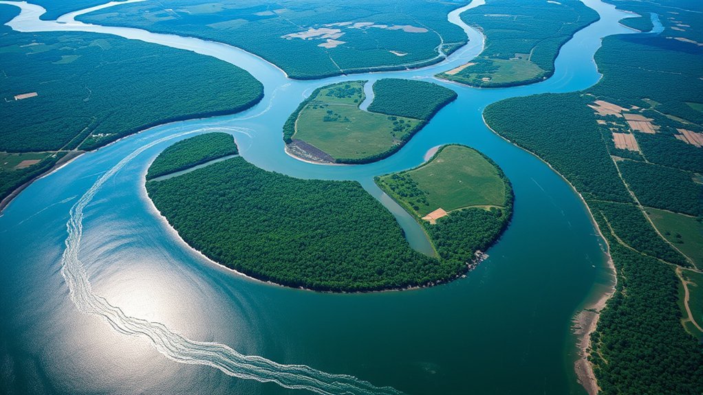
According to the National Park Service, water leaving Lake Itasca takes about three months to reach the Gulf. The river’s reported length varies by source: the NPS uses approximately 2,350 miles, while other federal references use figures closer to 2,300 or 2,340 miles.
Those different length figures do not mean one agency has necessarily measured the river incorrectly. A river’s length depends on the map scale, the channel surveyed, the route through its delta, and changes caused by erosion and sediment deposition.
A useful rule of thumb is three months from Lake Itasca to the Gulf—but the river does not move at one steady speed.
You may see a calculated average of about 1.1 mph, found by dividing the river’s length by 90 days. That arithmetic is useful for illustrating the estimate, but it is not a measured, river-wide velocity. The NPS reports an average surface speed of about 1.2 mph at the headwaters and approximately 3 mph near New Orleans. Speeds between those locations rise and fall with river stage, channel depth, width, slope, and local obstructions.
What the 90-Day Estimate Actually Means
The estimate describes the general downstream movement of river water. It does not mean that scientists can mark one untouched droplet at Lake Itasca and recover that exact droplet in the Gulf 90 days later.
As water moves downstream, it continually mixes with rain, groundwater, wastewater discharges, tributaries, and water already in the channel. Some water enters lakes, wetlands, side channels, navigation pools, or the floodplain. Some may evaporate, soak into the ground, be withdrawn for municipal or industrial use, or return to the atmosphere through plants.
Note: “Three months” is an educational average for the river’s overall flow, not a guaranteed arrival time for a floating object, boat, contaminant, or individual parcel of water.
A floating object may also behave differently from the surrounding water. Wind can push it into shore, debris can trap it, and currents can carry it into backwaters. Releasing objects into the river can create litter and wildlife hazards, so it should not be used as an experiment.
Factors Affecting Travel Time of Water in the Mississippi River
The Mississippi’s travel time changes because the river is a connected system of channels, tributaries, floodplains, reservoirs, navigation pools, and delta wetlands. The most important influences are below.
| Factor | How It Affects Travel Time |
|---|---|
| River stage and discharge | High-flow periods often move water downstream faster. Low water generally reduces velocity and may expose sandbars or narrow navigable channels. |
| Channel width and depth | Water speeds up or slows down as the river narrows, widens, deepens, becomes shallow, or bends around islands and bars. |
| Tributary inflows | Major tributaries such as the Missouri, Ohio, Arkansas, and Red rivers add large amounts of water and can change downstream flow conditions. |
| Locks, dams, and navigation pools | The Upper Mississippi’s 29-lock-and-dam system creates pools and regulates navigation depths, changing how water moves through those reaches. |
| Floodplains and backwaters | During high water, part of the flow may spread into side channels, wetlands, and floodplain areas before returning to the main channel. |
| Season and weather | Snowmelt, prolonged rain, drought, heat, ice, and storms can change river stage and velocity over short periods. |
| Erosion and sediment | Erosion on the outside of bends and deposition on the inside continually reshape channels, bars, and flow paths. |
Route From Lake Itasca to the Gulf
The Mississippi begins as a small outlet from Lake Itasca in Minnesota. It then grows as streams and major tributaries join it, eventually becoming a broad commercial waterway before reaching its delta in coastal Louisiana. The river passes through or forms borders along 10 states: Minnesota, Wisconsin, Iowa, Illinois, Missouri, Kentucky, Tennessee, Arkansas, Mississippi, and Louisiana.
Current U.S. federal sources call the receiving body of water the “Gulf of America,” while “Gulf of Mexico” remains the familiar international name. This article uses Gulf of Mexico for broad reader recognition.
Key River Stages
| River Reach | What the Water Encounters |
|---|---|
| Headwaters | A narrow, shallow river flowing through northern Minnesota lakes, wetlands, forests, and small communities. |
| Upper Mississippi | Minneapolis–St. Paul, bluff country, navigation pools, islands, backwaters, and the 29-lock-and-dam system used for commercial navigation. |
| Central confluences | Large increases in volume near St. Louis and Cairo as the Missouri and Ohio rivers join the Mississippi. |
| Lower Mississippi | A deep, powerful commercial river bordered by levees, floodplain forests, ports, agricultural land, and major cities including Memphis, Baton Rouge, and New Orleans. |
| Delta and passes | The river divides into distributary channels and passes through coastal marshes before entering the Gulf. |
How Timing Changes Along the Route
The headwaters are narrow and hold far less water than the lower river. Downstream, tributaries increase the Mississippi’s discharge dramatically. Navigation pools affect the Upper Mississippi, while the lower river’s bends, levees, deep channel, commercial traffic, and flood-control structures create a different flow environment.
Heavy rain and snowmelt can raise river stages across long reaches, but a flood wave is not the same thing as an individual parcel of water. A rising gauge records a change in water level at that location; it does not show that the same water has traveled untouched from one end of the river to the other.
Where Can Travelers Access the River?
Travelers can reach the Mississippi at state parks, city riverfronts, national park sites, marinas, boat ramps, trails, overlooks, and wildlife refuges. Access conditions vary widely, so check local rules, parking, launch fees, closures, and water conditions before visiting.
Popular Access Points Along the River
| Access Area | Common Activities | What to Know |
|---|---|---|
| Lake Itasca State Park, Minnesota | Walking at the headwaters, hiking, paddling, camping | The river begins as a small, shallow stream. Use designated access areas and follow park rules. |
| Minneapolis–St. Paul, Minnesota | Walking, cycling, birdwatching, paddling, museum visits | The Mississippi National River and Recreation Area follows a 72-mile urban river corridor. |
| St. Louis waterfront, Missouri | Sightseeing, riverfront walks, museums, cruises | This busy reach is near the Missouri River confluence and carries significant commercial traffic. |
| Memphis riverfront, Tennessee | Walking, cycling, parks, festivals, sightseeing | Strong current and tow traffic make casual swimming or unsupervised paddling unsafe. |
| New Orleans riverfront, Louisiana | Riverfront walking, sightseeing, ferries, cruises | The river is deep, swift, and heavily used by large vessels. Enter the water only through authorized activities. |
For paddling maps and access information in Minnesota, consult the Minnesota DNR Mississippi River State Water Trail. Alerts may identify downed trees, dangerous currents, construction, ice, or temporarily unsuitable segments.
Scenic Routes and Trails
The Great River Road is a roughly 3,000-mile network of federal, state, and county roads following the river from northern Minnesota to Louisiana. It passes through all 10 river states and hundreds of communities. It is not one uninterrupted highway, so travelers should plan state-by-state segments.
The Mississippi River Trail also covers approximately 3,000 miles from Minnesota to Louisiana. Much of it follows public roads rather than protected, traffic-free paths. Cyclists should review each state’s route map, surface conditions, traffic exposure, lodging, and water availability.
Pro Tip: Plan a Mississippi trip by river region rather than by total mileage. The headwaters, Upper Mississippi navigation pools, lower commercial river, and Louisiana delta require very different maps, equipment, and safety decisions.
How Historical Events Shaped the Mississippi River
The Mississippi is a natural river, but people have changed how much of it behaves. Indigenous nations lived, traveled, traded, and gathered food along the river for thousands of years. Later settlement, agriculture, cities, steamboat commerce, levees, wing dams, dredging, and navigation projects changed its banks, channels, and floodplain.
The Great Mississippi Flood of 1927 inundated approximately 11 million acres and displaced more than 750,000 people. Congress responded with the Flood Control Act of 1928, which authorized a broad federal flood-protection program for the lower Mississippi. The resulting Mississippi River and Tributaries project expanded and coordinated levees, floodways, outlets, channel work, and large spillways. The U.S. Army Corps of Engineers continues to operate and maintain major parts of this system.
These projects support flood-risk reduction and navigation, but they also separate the river from portions of its natural floodplain and alter sediment, habitat, and water movement. That is why the modern Mississippi should be understood as both a natural ecosystem and a heavily managed transportation corridor.
Claims that the river once had one exact length and was shortened to its present figure solely by engineering are too simple. Federal sources publish different modern lengths because river channels and deltas change and because measurement methods differ.
Wildlife Found in the Mississippi River Ecosystem
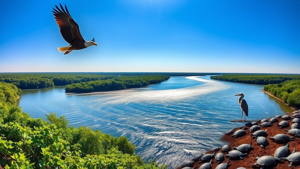
The Mississippi River and its floodplain form one of North America’s major wildlife corridors. According to the National Park Service, at least 260 fish species live in the river, and 326 bird species use the Mississippi River Basin as a migratory flyway.
Species totals depend on the area being counted. River-wide fish estimates should not be treated as if every species lives in every reach. Likewise, the NPS documents 38 mussel species from Cairo, Illinois, upstream to Lake Itasca, while the Lower Mississippi may contain as many as 60 mussel species.
| Wildlife Group | Examples | Ecosystem Importance |
|---|---|---|
| Fish | Catfish, paddlefish, bass, sturgeon, sunfish | Support aquatic food webs, recreational fishing, and commercial fisheries. |
| Birds | Bald eagles, pelicans, herons, ducks, terns | Use islands, wetlands, forests, and open water for migration, feeding, resting, and nesting. |
| Mammals | River otters, beavers, muskrats, white-tailed deer | Shape wetland habitats and link aquatic and terrestrial food webs. |
| Freshwater mussels | Dozens of native species with different habitat needs | Filter suspended material, cycle nutrients, and provide evidence of long-term habitat conditions. |
| Floodplain plants | Cottonwoods, willows, silver maples, marsh plants | Provide shade, nesting sites, bank protection, organic material, and cover for wildlife. |
Anglers should check the fish-consumption advisory issued by the state where they are fishing. Advisories may differ by location, species, fish size, and contaminant.
Tips for Planning Your Mississippi River Adventure
A road trip, bicycle trip, day paddle, and full river descent require very different preparation. Start with the exact reach you plan to visit instead of assuming one set of conditions applies to the entire Mississippi.
- Check current river conditions. Review river stages, flood forecasts, weather, water temperature, access alerts, and local closures. The National Weather Service Lower Mississippi River Forecast Center publishes observations and forecasts for the lower river.
- Match the route to your experience. A protected urban riverfront walk is different from paddling a remote headwater segment or operating near towboats and barges.
- Wear an approved life jacket. The U.S. Coast Guard requires a suitable wearable personal flotation device for each person aboard a recreational vessel. Wearing it is safer than storing it.
- Learn navigation rules. Understand channel markers, right-of-way rules, sound signals, lock procedures, and how to communicate with commercial vessels.
- File a float plan. Tell someone your route, launch point, expected stops, passenger names, vessel description, and return time.
- Carry communication and emergency gear. Depending on the reach, this may include a charged phone, marine VHF radio, whistle, lights, charts, first-aid supplies, drinking water, spare clothing, and repair equipment.
- Do not plan travel from the river’s average speed. Boat speed, current, wind, lock delays, portages, rest stops, fuel range, daylight, and weather determine a traveler’s schedule.
- Treat the Great Loop as a separate journey. The Great Loop links several waterways around the eastern United States and part of Canada. It uses portions of the inland river system, while an Upper Mississippi trip may be an optional side journey rather than a complete Mississippi descent.
Warning: The Mississippi carries strong currents, submerged hazards, cold water, rapidly changing stages, and heavy commercial traffic. Large towboats have limited maneuverability and major blind spots. Never swim or paddle in a navigation channel, approach a dam, or begin a trip without checking local conditions and rules.
Frequently Asked Questions
How many bodies are found in the Mississippi River each year?
No authoritative agency publishes one verified annual total for the entire Mississippi River. The river passes through or borders 10 states, and recoveries are recorded by separate police, sheriff, fire, medical-examiner, and emergency-management agencies. The often-repeated claim that more than 100 bodies are found every year lacks a reliable river-wide source.
How long does it take water to flow down the Mississippi?
The National Park Service gives an estimate of about three months, or roughly 90 days, from Lake Itasca to the Gulf. Actual movement varies with river stage, tributary inflow, weather, channel geometry, floodplain storage, and Upper Mississippi navigation pools.
Is it possible to boat the entire Mississippi River?
Experienced paddlers have traveled from Lake Itasca to the Gulf, but it is not a simple uninterrupted cruise for every boat. The headwaters are shallow, some sections require careful handling or portage decisions, the Upper Mississippi contains locks and dams, and the lower river has powerful currents, heavy tow traffic, and long distances between suitable services. A full trip requires extensive route, safety, weather, and resupply planning.
What is the fastest-flowing river in the United States?
There is no single official answer. River velocity changes by location, depth, channel shape, slope, discharge, season, and whether researchers measure surface, average, or peak current. Individual rapids on rivers such as the Colorado can be extremely fast, but that does not make the entire river the nation’s fastest under every condition.
Does Mississippi River water move faster during floods?
It often moves faster when discharge and river stage rise, but the effect is not identical everywhere. Water may also spread into side channels, wetlands, and floodplains. A flood crest moving downstream should not be treated as the travel time of one unchanged parcel of water.
How long does it take to drive the Great River Road?
The Federal Highway Administration suggests allowing about six days to drive the route or around 10 days to enjoy it more fully. Many travelers take longer because the Great River Road is a roughly 3,000-mile network with museums, parks, historic sites, overlooks, and river towns across 10 states.
Conclusion
Water takes about three months to travel from Lake Itasca to the Mississippi River’s outlet in the Gulf, but that estimate simplifies a complex system. The river changes from a shallow northern stream into a managed navigation corridor, a vast commercial waterway, and finally a network of delta channels and wetlands.
Understanding the difference between a general travel-time estimate and actual local conditions makes the river easier to appreciate—and safer to explore. Whether you visit the headwaters, follow the Great River Road, cycle part of the Mississippi River Trail, or launch a boat, plan for the specific reach in front of you rather than relying on one river-wide number.
Sources
- National Park Service — Mississippi River Facts — travel time, speed, length estimates, locks and dams, watershed, and wildlife.
- U.S. Army Corps of Engineers — Three Key Flood Control Acts — the 1927 flood, Flood Control Act of 1928, and Mississippi River and Tributaries project.
- Federal Highway Administration — Great River Road — route length, states, and suggested driving time.
- Lower Mississippi River Conservation Committee — Mississippi River Trail — corrected trail mileage and route description.
- Minnesota Department of Natural Resources — Mississippi River State Water Trail — paddling segments, maps, and access alerts.
- U.S. Coast Guard — Life Jacket Wear — recreational-vessel PFD requirements and boating-safety guidance.
