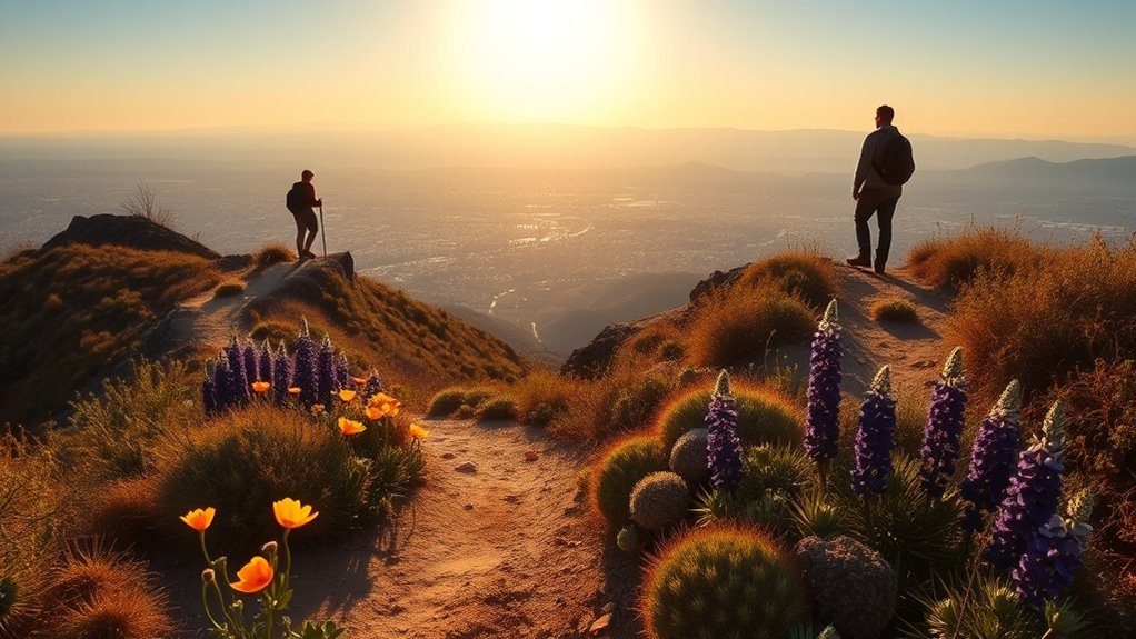
Last Updated on July 28, 2026 by Daniel Globe
Anaheim sits within reach of oak canyons, coastal wetlands, ocean-view ridges, and the highest summit in Orange County. The best choice depends on how much time you have, your fitness level, whether you are bringing children or a dog, and whether the route has current access restrictions. This guide compares easy walks, family trails, coastal routes, wildlife areas, and demanding summit hikes using official park and agency information.
Quick Answer
The best hikes near Anaheim include Oak Canyon Nature Center and Quail Hill for easy outings, Crystal Cove and Upper Newport Bay for coastal scenery, Bolsa Chica for birding, and Santiago Peak for experienced hikers. Route mileage and access vary, so check official maps, fees, weather, and closures before leaving.
Key Takeaways
- Oak Canyon Nature Center and Quail Hill offer the most manageable natural-surface outings for beginners and families.
- Crystal Cove has both short coastal walks and strenuous backcountry loops, but mileage depends on the trail segments you combine.
- Bolsa Chica prohibits dogs and bicycles, while Upper Newport Bay and Quail Hill allow leashed dogs.
- Santiago Peak is a strenuous full-day hike, and the status of its access roads and approaches can change because of weather, fire danger, and closures.
- Carry water according to the hike’s duration and heat; California State Parks recommends at least one quart every two hours as a baseline.
At a Glance
| Oak Canyon Nature Center | Four-mile trail network; easy to moderate; shaded canyon setting in Anaheim; no dogs. |
| Quail Hill Loop | Two-mile natural-surface loop; easy; open dawn to dusk; leashed dogs allowed. |
| Carbon Canyon Redwood Grove | A 1.1-mile nature trail leads to Orange County’s coastal redwood grove; easy and family-friendly. |
| Bolsa Chica Ecological Reserve | Four-mile public trail network; easy; excellent birding; dogs and bicycles prohibited. |
| Back Bay Loop | Approximately 10.5 miles; mostly gentle terrain but demanding because of the distance; leashed dogs allowed in the preserve. |
| Crystal Cove Backcountry | Route-dependent mileage; moderate to strenuous; ocean views; dogs prohibited on backcountry trails. |
| Black Star Canyon | Short walks and outings of seven miles or more are possible; waterfall mileage is not an official fixed park route; check forest access. |
| Santiago Peak | About 15 miles out and back with 4,000 feet of gain; strenuous; roughly eight hours; Adventure Pass and route-status check required. |
What’s in This Article
- How to Choose a Hike Near Anaheim
- Top Coastal and Beach Hikes Near Anaheim
- Best Local Trails for Families and Beginners
- Challenging Day Hikes and Peak Climbs
- Hidden Canyon Walks and Waterfall Routes
- Trails for Fishing and Wildlife Viewing
- What to Bring on Any Hike Near Anaheim
- Parking, Fees, Dogs, and Accessibility
- Frequently Asked Questions
- Conclusion
- Sources
Disclosure: As an Amazon Associate I earn from qualifying purchases. Some links on this page are affiliate links, at no extra cost to you.
How to Choose a Hike Near Anaheim
This list prioritizes official public access, route clarity, scenery, and a useful range of difficulty levels. Some destinations contain one defined loop, while others are trail networks where you build a route from several segments. Always compare the official map with your available time and fitness level instead of relying only on a distance shown in a hiking app.
- For about one hour: Choose Quail Hill Loop or the Carbon Canyon Redwood Grove trail.
- For children and first-time hikers: Start with Oak Canyon Nature Center, Quail Hill, or a short section of Bolsa Chica.
- For coastal scenery: Use Crystal Cove’s bluff and backcountry trails or walk part of the Back Bay Loop.
- For birding: Bolsa Chica and Upper Newport Bay offer the strongest wetland habitats and viewing opportunities.
- For a half-day workout: Build a moderate Crystal Cove loop or join an authorized Weir Canyon program.
- For a full-day challenge: Consider Santiago Peak only after checking the current approach, weather, heat, and forest restrictions.
Pro Tip: Save the official park map to your phone before leaving. A route name used by a hiking app may combine several official trails and may not appear on signs at the trailhead.
Top Coastal and Beach Hikes Near Anaheim
Crystal Cove State Park
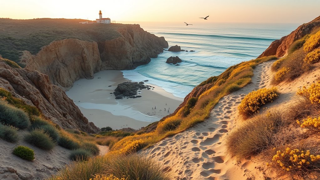
Crystal Cove State Park combines 3.2 miles of beach with roughly 2,400 acres of backcountry ridges and canyons. Short bluff walks work for a relaxed coastal outing, while Moro Canyon, Moro Ridge, No Name Ridge, and connecting trails can be combined into longer loops.
“El Moro Canyon Trail” is not one fixed 4.94-mile official route. The park’s map lists individual trail segments, so your total distance depends on the junctions you choose. Do not plan the hike around a promised waterfall. Drainages may hold water after rain, but flow is intermittent and is not presented by the park as a dependable waterfall attraction.
Back Bay Loop at Upper Newport Bay
The City of Newport Beach describes the signed Back Bay Loop as approximately 10.5 miles. The terrain is generally gentle, but the complete loop still requires several hours, sun protection, and enough water for a long walk or ride.
The route passes scenic overlooks and connects with locations such as Upper Castaways Park and the Peter and Mary Muth Interpretive Center. Leashed dogs are allowed within the OC Parks preserve, but owners must follow posted rules along every jurisdiction crossed by the full loop.
Bolsa Chica Ecological Reserve
Bolsa Chica Ecological Reserve has a four-mile network of public trails, scenic overlooks, interpretive panels, packed-sand paths, gravel surfaces, and boardwalks. It is one of the best choices near Anaheim for shorebirds, wetland wildlife, and a mostly flat outing.
CDFW prohibits both dogs and bicycles in the reserve. Two public parking areas connect with the trail network, and restrooms are available beside the Interpretive Center near the north lot.
Warning: Coastal and foothill trails can close after rain, during wildfire danger, or for habitat protection. Check the managing park’s alert page on the day of your hike and obey every closure sign or locked gate.
Best Local Trails for Families and Beginners
Oak Canyon Nature Center
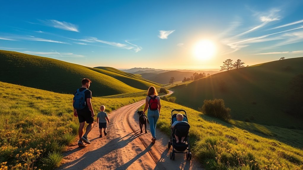
Oak Canyon Nature Center is the most convenient natural hiking area within Anaheim itself. The 58-acre park contains four miles of trails spread across three adjoining canyons, with oak woodland, coastal sage scrub, a year-round stream, and an interpretive center.
The four-mile figure describes the entire trail network, so families can choose a much shorter outing. Lower canyon paths provide the easiest introduction, while steeper connectors let older children and adults add elevation. Check posted rules before visiting; dogs are not permitted on the nature-center trails.
Quail Hill Loop
Quail Hill Loop is an easy two-mile natural-surface trail in Irvine. It is open from dawn to dusk and is the only wilderness trail in the Irvine Ranch Natural Landmarks system that allows leashed dogs.
The open hillside has little shade, so mornings and cooler seasons are more comfortable. The loop works well for beginners who want a clear route without committing to a large trail network.
Carbon Canyon Redwood Grove
Carbon Canyon Regional Park contains Orange County’s only grove of coastal redwoods. A 1.1-mile nature trail leads from the developed park area to the three-acre grove, making it a manageable family walk with a memorable destination.
The regional park also has playgrounds, picnic areas, restrooms, fishing, and leashed-dog access. A vehicle-entry fee may apply, so check the current OC Parks fee page before leaving.
Weir Canyon and Santiago Oaks
Weir Canyon should not be treated as one universally open, gentle three-mile trail. The preserve protects sensitive habitat, and many outings require advance registration through Irvine Ranch Natural Landmarks. Scheduled routes range from short interpretive walks to strenuous hikes exceeding nine miles.
For more dependable everyday access, nearby Santiago Oaks Regional Park has interconnecting easy, moderate, and difficult trails through creek corridors, oak groves, foothills, and overlooks. Choose a short signed loop rather than assuming the entire Weir Canyon system is open for self-guided use.
Challenging Day Hikes and Peak Climbs

Santiago Peak
Santiago Peak, also called Saddleback Mountain, is the highest point in Orange County. The Forest Service describes its named route as a strenuous 15-mile out-and-back hike with approximately 4,000 feet of elevation gain and an eight-hour hiking estimate.
This is not a summer beginner hike. The route is long, exposed, and dependent on access through the Trabuco Ranger District. Carry enough food and water for a full day, bring navigation, and know which road or trailhead you will use before driving into the forest.
Long Crystal Cove Ridge Loops
Crystal Cove can become a demanding coastal hike when you combine Moro Ridge, No Name Ridge, Deer Canyon, and canyon connectors. Some hiking apps label a roughly nine-mile combination the “Red Route,” but that name does not appear as one official route on the State Parks map.
Build the route from official trail segments, note every junction, and expect sustained climbing with limited shade. Dogs are prohibited in the Crystal Cove backcountry.
Black Star Canyon
Black Star Canyon Road is available for public hiking and biking access toward Cleveland National Forest, while other parts of the surrounding Irvine Ranch Open Space may operate through scheduled programs. Official activities include short introductory walks and challenging outings of seven miles or more.
The commonly described Black Star Canyon Falls outing is not a simple maintained waterfall loop with one official decimal mileage. It can involve rough creek travel, loose rock, route-finding, and conditions that change after storms. Check both OC Parks access information and Cleveland National Forest current conditions.
Modjeska Peak, Indian Truck Trail, and Harding Routes
Modjeska Peak, Indian Truck Trail, Harding Truck Trail, and the route sometimes called Harding Falls can produce long, exposed days with significant elevation. Their access and total mileage depend on the selected trailhead, connecting roads, closures, and turnaround point.
Do not rely on an old app track for these routes. The Forest Service may close roads because of weather, fire danger, storm damage, or burned-area hazards. A road closed to vehicles may also have different rules for hikers and cyclists, so read the exact current-condition entry rather than assuming what “closed” means.
Warning: Access was verified on July 28, 2026. Parts of the Trabuco Ranger District remain covered by the Airport Fire burned-area closure through May 26, 2027, and individual road statuses can change sooner. Check the closure order and current conditions immediately before departure.
Pro Tip: Start demanding summit and ridge hikes early enough to finish before the hottest part of the day. Set a firm turnaround time even when you have not reached the summit.
Hidden Canyon Walks and Waterfall Routes

Orange County waterfall outings depend on recent rainfall. A route may be scenic but completely dry for much of the year, and heavy rain can create flooding, unstable slopes, mud, and unsafe stream crossings. Treat flowing water as a seasonal possibility rather than a guaranteed attraction.
Black Star Canyon Falls
Black Star is the best-known waterfall outing in this group, but the rough approach deserves more respect than a standard park walk. Exact mileage varies with parking, access, creek conditions, and the chosen track. Turn around when water is moving too fast to cross safely or when wet boulders exceed your ability.
El Moro and Deer Canyon
El Moro Canyon and Deer Canyon are official parts of Crystal Cove’s backcountry trail system. Both can be combined with ridge and connector trails to create moderate or strenuous loops. Use the official segment map to calculate the distance rather than relying on a single 4.94-mile El Moro or 7.76-mile Deer Canyon figure.
These are primarily canyon-and-ridge hikes, not dependable waterfall routes. After rain, you may encounter drainage flow, mud, and temporary closures.
Harding Falls and Hellman Park
The Harding Falls route requires a current access check and should not be represented as a universally open 5.96-mile trail. Nearby Harding Truck Trail conditions and national-forest restrictions can affect the practical route.
Hellman Park in Whittier provides a steep foothill workout north of Anaheim, but it is outside the central Orange County trail group and route totals depend on the connected Puente Hills trail combination. Consult the City of Whittier’s current park and trail information before using a third-party four-mile track.
Note: Waterfall flow is most likely after winter or spring rain, but recent rain can also close trails or make rocks dangerously slick. Stay away from the edge of falls, do not climb wet rock, and never enter fast or uncertain water.
Trails for Fishing and Wildlife Viewing

Carbon Canyon Regional Park
Carbon Canyon combines a developed fishing lake with picnic areas, playgrounds, walking paths, and the 1.1-mile trail to the redwood grove. OC Parks lists fishing as an available activity and publishes seasonal stocking schedules. Check the latest schedule rather than assuming trout or catfish were stocked recently.
Yorba Regional Park
Yorba Regional Park has four lakes connected by streams, paved bicycle and walking paths, picnic areas, and fishing access. The paths also connect with the Santa Ana River Trail, so visitors can extend a short park walk without claiming that the regional park itself contains more than 100 miles of trails.
Anglers age 16 or older generally need a valid California sport-fishing license. Follow posted limits, lake rules, and the current stocking schedule.
Bolsa Chica and Upper Newport Bay
Bolsa Chica is the stronger choice for a focused wetland walk because its public trail network passes overlooks, boardwalks, and interpretive panels. Leave dogs and bicycles at home to protect the reserve and comply with CDFW rules.
Upper Newport Bay Nature Preserve allows leashed dogs and provides hiking, bicycling, scenic overlooks, restrooms, and an interpretive center. The longer Back Bay Loop lets you combine wildlife viewing with substantial mileage.
Santiago Oaks Regional Park
Santiago Oaks offers a different habitat, with a creek, oak woodland, mature trees, foothill overlooks, and interconnecting trails. It is a better choice for shaded woodland and foothill wildlife than for fishing.
What to Bring on Any Hike Near Anaheim
Many foothill and forest routes have little shade and no dependable drinking-water source. Match your supplies to the planned time, temperature, elevation, and difficulty rather than using one packing quantity for every trail.
- Water: California State Parks recommends at least one quart every two hours as a baseline. Carry more in heat, on exposed trails, and during strenuous climbs. Do not depend on streams or seasonal flow.
- Food: Bring snacks with carbohydrates and salt for outings lasting several hours. Full-day routes need enough food for delays.
- Sun protection: Pack sunscreen, sunglasses, a brimmed hat, and lightweight covering layers. Coastal cloud cover does not eliminate UV exposure.
- Footwear: Wear sturdy, comfortable shoes with traction. Canyon, waterfall, and summit routes require more grip than paved park paths.
- Navigation: Save the official map offline and carry a backup battery. Cell coverage can weaken in canyons and remote forest areas.
- Layers: Coastal wind, ridge exposure, and changing temperatures can make a light layer useful even when Anaheim feels warm.
- Emergency basics: Carry identification, a small first-aid kit, a whistle, and any essential medication. Tell someone your route and expected return time.
- Permits and fees: Check the managing agency. State parks may charge day-use parking, OC Parks may charge vehicle entry, and some national-forest trailheads require an Adventure Pass.
Note: A downloaded app map does not confirm that a route is legally open. Closures, private-property boundaries, habitat protections, and scheduled-access rules still apply.
Parking, Fees, Dogs, and Accessibility
Parking and fees
Oak Canyon Nature Center and Quail Hill have nearby public parking, but spaces can fill during popular times. OC Parks locations such as Carbon Canyon, Yorba Regional Park, and Santiago Oaks may charge a vehicle-entry fee. Crystal Cove uses state-park day-use parking, while some Cleveland National Forest trailheads require a recreation or Adventure Pass.
Arrive early, read every posted sign, and avoid parking in residential no-parking zones or in front of emergency-access gates.
Dog rules
Dog policies differ sharply. Quail Hill, Upper Newport Bay, Carbon Canyon, Yorba Regional Park, and many OC Parks locations allow dogs on a leash. Bolsa Chica prohibits dogs, Crystal Cove prohibits pets in its backcountry, and Oak Canyon Nature Center does not allow dogs on its trails.
Wildfire restrictions, habitat rules, and individual event policies can create additional limits, so check the exact destination rather than applying one countywide rule.
Restrooms and drinking water
Developed parks and interpretive centers are more likely to have restrooms. Bolsa Chica has restrooms beside its Interpretive Center, and Oak Canyon Nature Center has restrooms near the parking area. Remote canyon and forest trailheads may have no facilities or potable water.
Bring all the water you need even when a website lists a fountain. Maintenance issues and temporary shutoffs can occur.
Wheelchairs and strollers
Bolsa Chica’s accessible ramps, packed-sand and gravel paths, and boardwalks provide considerable wheelchair access, although surface conditions can vary. Crystal Cove’s paved Bluff Top Trail and accessible coastal facilities are better choices than its steep backcountry.
Natural-surface routes such as Quail Hill may work for sturdy all-terrain strollers but are not equivalent to a paved accessible path. Steep trails at Santiago Oaks, Black Star Canyon, Crystal Cove backcountry, and Santiago Peak are unsuitable for standard strollers and most mobility devices.
Frequently Asked Questions
Are dogs allowed on these trails year-round?
Rules vary by property. Quail Hill and Upper Newport Bay allow leashed dogs, while Bolsa Chica, Oak Canyon Nature Center, and Crystal Cove’s backcountry prohibit them. Fire restrictions, habitat rules, or scheduled programs may create additional limits, so check the destination’s official page before bringing a dog.
What are the closest public parking options?
Oak Canyon Nature Center has an on-site lot, while Quail Hill has parking near its trailhead. State and regional parks generally use designated day-use lots. Arrive early on weekends, obey residential restrictions, and never block a gate or emergency-access road.
Are permits or fees required for any hikes?
Many trails do not require a hiking permit, but parking or access fees may apply. Crystal Cove charges state-park day-use fees, some OC Parks locations charge vehicle entry, and certain national-forest trailheads require an Adventure Pass. Weir Canyon and other sensitive preserves may require free advance registration for scheduled access.
Which trails have restrooms or potable water?
Developed locations such as Oak Canyon Nature Center, Bolsa Chica’s Interpretive Center area, Carbon Canyon, Yorba Regional Park, and parts of Crystal Cove have restrooms. Remote canyon and national-forest trailheads may have neither restrooms nor potable water. Carry the full water supply you expect to need.
Are any trails suitable for strollers or wheelchairs?
Bolsa Chica has ramps, boardwalks, and firm trail surfaces that provide considerable wheelchair access. Crystal Cove’s paved Bluff Top Trail is another stronger option. Natural-surface and backcountry trails vary in width, grade, and condition, so review the official accessibility page before visiting.
What is the easiest hike near Anaheim?
Quail Hill Loop is one of the simplest defined routes at two miles, while Oak Canyon Nature Center lets families choose a short section from its larger trail network. The Carbon Canyon Redwood Grove trail is another easy option at 1.1 miles.
What is the best season for hiking near Anaheim?
Fall through spring usually brings cooler conditions for exposed foothill and summit routes. Winter and spring rain may produce greener canyons and seasonal water, but it can also cause mud, flooding, and closures. In summer, choose short shaded or coastal routes and avoid strenuous hiking during peak heat.
Conclusion
The best hike near Anaheim is the one that matches your available time, ability, and current trail access. Oak Canyon and Quail Hill make easy starting points, Bolsa Chica and Upper Newport Bay are strong wildlife choices, and Crystal Cove offers the widest range of coastal difficulty. Save Santiago Peak and rough waterfall routes for days when you have the fitness, supplies, navigation, and verified access to complete them safely.
Before leaving, check the managing agency’s map and alerts, carry enough water for the conditions, and choose a turnaround time. That preparation matters more than reaching any particular viewpoint or waterfall.
Sources
- California State Parks — Crystal Cove State Park — park size, coastal features, backcountry access, maps, and trail rules.
- California Department of Fish and Wildlife — Bolsa Chica Ecological Reserve — trail network, dog and bicycle restrictions, facilities, and accessibility.
- City of Anaheim — Oak Canyon Nature Center — park acreage, trail-network length, habitat, stream, and interpretive center.
- Irvine Ranch Natural Landmarks — Quail Hill — loop distance, difficulty, hours, and dog policy.
- OC Parks — Carbon Canyon Regional Park — redwood-grove trail distance, fishing, dog access, and park amenities.
- U.S. Forest Service — Santiago Peak — route distance, elevation gain, difficulty, estimated time, fee, and current forest-alert links.