
Last Updated on September 10, 2026 by Daniel Globe
Los Angeles is one of the few major cities where you can hike through chaparral-covered hills, walk beneath mountain peaks, reach Pacific Ocean viewpoints, and still be close to urban neighborhoods. The best hiking spots in Los Angeles range from easy city trails in Griffith Park to demanding summit routes on Mount San Antonio. Trail access has changed significantly since the 2025 wildfires, however, so checking current conditions is now an important part of planning any LA hike.
Quick Answer
For classic Los Angeles hiking, start with Griffith Park for Hollywood views, Runyon Canyon for a quick urban workout, Topanga State Park for longer Santa Monica Mountains routes, or Solstice Canyon for an easier creek-and-ruins hike. For a serious mountain challenge, Mount San Antonio is the standout. Always check current closures before leaving.
Key Takeaways
- Griffith Park combines accessible hiking with views of the Griffith Observatory, Hollywood Sign, and Los Angeles skyline.
- Runyon Canyon is convenient for a short city hike, although its West Trail remains subject to a closure.
- Topanga State Park offers coastal and mountain scenery, but several trails remain closed following the Palisades Fire.
- Eaton Canyon and its waterfall access remain closed during post-Eaton Fire recovery.
- Temescal Gateway Park reopened in July 2026, but the Temescal Canyon Trail to the waterfall remains closed.
- Mount San Antonio, also called Mount Baldy, is a strenuous mountain hike and can become technical and dangerous when snow or ice is present.
Warning: Southern California trail conditions can change quickly because of wildfire damage, extreme heat, rain, flooding, maintenance, and fire restrictions. As of July 2026, Eaton Canyon remains closed, the Temescal waterfall trail remains closed, and Topanga State Park has partial closures. Check the managing agency’s current alerts on the day of your hike.
Disclosure: As an Amazon Associate I earn from qualifying purchases. Some links on this page are affiliate links, at no extra cost to you.
Best Hiking Spots in Los Angeles at a Glance
| Hiking Area | Best For | General Difficulty | Current Planning Note |
| Griffith Park | Hollywood Sign and city views | Easy to strenuous, depending on route | Use authorized trails and stay outside the restricted Hollywood Sign enclosure. |
| Runyon Canyon | Quick urban workout and skyline views | Easy to moderate | West Trail is listed as closed; use open designated routes. |
| Topanga State Park | Longer coastal and mountain hikes | Moderate to strenuous | Open with partial Palisades Fire-related restrictions. |
| Eaton Canyon | Waterfall scenery when reopened | Normally easy to moderate | Closed during wildfire recovery. |
| Solstice Canyon | Creek, waterfall, ruins, and Malibu scenery | Easy to moderate | Popular parking area; arrive early on busy days. |
| Temescal Gateway Park | Coastal overlooks and reopened ridge trails | Easy to moderate | Park is open, but Temescal Canyon Trail to the waterfall remains closed. |
| Mount San Antonio | Big mountain challenge and alpine scenery | Strenuous | Check Forest Service alerts, weather, fire danger, and snow conditions first. |
Griffith Park: The Observatory and Hollywood Sign
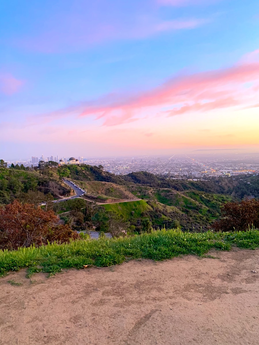
Griffith Park is one of Los Angeles’ signature hiking destinations. The City of Los Angeles reports that the park covers more than 4,210 acres of natural terrain and developed parkland. Its trail network connects canyon paths, ridges, viewpoints, the Griffith Observatory, and several legal viewpoints of the Hollywood Sign.
For an easier outing, trails near the Observatory and Mt. Hollywood provide broad views over the Los Angeles Basin without requiring an all-day hike. The Observatory itself adds an unusual bonus: visitors can combine a hike with astronomy exhibits and views of downtown Los Angeles, the surrounding hills, and the Hollywood Sign.
Hikers who want a closer look at the Hollywood Sign can choose authorized routes such as the Mt. Hollywood, Brush Canyon, or Cahuenga Peak trails. The official Hollywood Sign hiking information lists routes ranging from easier walks to difficult climbs.
Note: You cannot legally hike to or touch the letters themselves. The Hollywood Sign sits inside a fenced restricted area monitored for trespassing. Authorized trails take hikers to viewpoints behind, above, or near the Sign.
Parking near the Observatory and upper park can become congested on weekends and holidays. The City recommends public transportation, including the DASH Observatory shuttle, as an alternative to searching for parking. Dogs in Griffith Park must remain leashed.
Check the official Griffith Park information and alerts before leaving.
Runyon Canyon: City Views and Celebrity Sightings
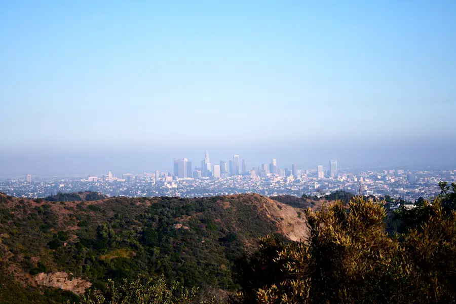
Runyon Canyon is one of Los Angeles’ best-known urban hiking areas because it sits close to Hollywood while still providing open hillsides and panoramic city views. The 160-acre park has several interconnected routes, so hikers can adjust the length and steepness of their outing instead of committing to one fixed loop.
The higher sections open views toward Hollywood, downtown Los Angeles, and the surrounding Santa Monica Mountains. Runyon also has a strong social and fitness culture, which is part of the reason it has a reputation for occasional celebrity sightings. Treat that as a possible bonus rather than the reason to choose the hike.
Current access requires more care than older trail guides suggest. The Los Angeles Department of Recreation and Parks lists Runyon Canyon as open but identifies the West Trail as closed until further notice. Stay on designated open trails and follow posted signs rather than trying to reproduce an older online loop.
Runyon has no restroom facilities. Dogs are permitted off leash only in designated areas; elsewhere, follow posted leash rules. Because shade is limited, summer heat can make even a short route much harder than its mileage suggests.
Pro Tip: Runyon works best early in the morning on warm days. You will usually encounter cooler temperatures, less intense sun, and lighter crowds than you would around midday.
See the official Runyon Canyon Park page for current closures and park rules.
Topanga State Park: Coastal Views and Mountain Trails
| Trail / Area | What to Expect | Planning Note |
| Los Leones Trail | A steady climb through coastal vegetation with wider views as you gain elevation. | Distance depends on your turnaround and connection with other trails. |
| Topanga backcountry routes | Longer combinations of fire roads and trails through chaparral, oak woodland, and ridges. | Check current closure maps before building a loop. |
| Eagle Rock via Musch Trail | A popular Trippet Ranch-area hike to a large sandstone outcrop with panoramic park views. | Moderate terrain; route length varies with the exact loop or turnaround. |
Topanga State Park stretches across the Santa Monica Mountains and contains 36 miles of trails, according to California State Parks. Its terrain includes grassland, oak woodland, chaparral, sandstone formations, canyon bottoms, and elevated viewpoints toward the Pacific.
One of the best-known destinations is Eagle Rock. From the Trippet Ranch area, hikers can use the Musch Trail and connecting routes toward Eagle Junction and the prominent sandstone outcrop. The reward is an expansive view across the park rather than a developed attraction.
Los Leones is another useful entry point for hikers who want a sustained climb toward higher portions of the park. Because Topanga contains an interconnected network rather than a single signature route, mileage and elevation gain change considerably depending on the exact turnaround or loop.
Warning: Topanga State Park remains open with restrictions following the Palisades Fire. California State Parks currently lists several trails and areas as closed, including Temescal Canyon Trail and Lower Topanga routes. Short-term maintenance closures can also occur. Check the current restrictions page before selecting your route.
Do not plan on bringing a dog onto Topanga State Park hiking trails. California State Parks states that dogs are not allowed on park trails, fire roads, or in the backcountry.
For current access information, visit California State Parks’ Topanga State Park page.
Eaton Canyon: Waterfall Area Currently Closed
Eaton Canyon has long been one of the San Gabriel Valley’s most popular waterfall hikes, but older guides describing it as an easy family outing are no longer current. The Eaton Fire damaged the surrounding landscape, trails, bridges, and infrastructure, and the Eaton Canyon Natural Area and affected trail access remain closed during recovery.
This means hikers should not attempt to reach Eaton Canyon Falls through closed entrances or unofficial detours. LA County says the closure covers the natural area and waterfall access along with multiple surrounding access points.
Warning: Do not bypass Eaton Canyon closure signs. Burned landscapes can contain unstable slopes, damaged trees, washed-out trail structures, and elevated debris-flow risk long after the fire itself is over.
The closure also removes Eaton Canyon from the current list of beginner and family hikes in this guide. Before making future plans, check the LA County Trails Eaton Canyon closure information and the Angeles National Forest alerts page.
Solstice Canyon: Ocean Views and Historic Ruins
Solstice Canyon in Malibu combines several features that are unusual to find on one relatively approachable hike: a shaded creek corridor, native vegetation, historic ruins, a waterfall, and optional higher viewpoints toward the Pacific Ocean.
The National Park Service rates the main Solstice Canyon Trail as easy to moderate and lists it at 2.1 miles round trip. The route follows a riparian corridor toward the remains of historic structures and the Roberts Ranch house.
Along the way, hikers pass the remains of the Keller House, an older stone hunting cabin damaged by fire. Near the waterfall are the stone and brick ruins of the Roberts Ranch house, designed by architect Paul Revere Williams in 1952.
Hikers who want more elevation can use connecting routes such as the Rising Sun Trail when open, creating a more demanding return with broader coastal views. Those looking for an easier outing can return on the gentler canyon route.
Solstice Canyon is extremely popular, particularly on weekends, and parking is limited. The National Park Service recommends planning for crowds and bringing adequate water on warm days. Dogs are permitted but must remain on a leash no longer than six feet.
Check the National Park Service Solstice Canyon Trail information before your visit.
Temescal Canyon: Coastal Views While the Waterfall Trail Is Closed
Temescal Gateway Park in Pacific Palisades has historically been known for a loop through oak and sycamore canyon habitat, ridgeline views, and Temescal Falls. That experience changed after the 2025 Palisades Fire.
The good news is that Temescal Gateway Park reopened to the public on July 17, 2026. Visitors can again use the rebuilt Rivas Trail to scenic overlooks, continue toward Will Rogers State Historic Park, and use the Sunset Trail for access toward Temescal Ridge and Topanga State Park where connecting routes are open.
The waterfall route is a different story. MRCA says the popular Temescal Canyon Trail leading to the waterfall remains closed until further notice because fire damage created unsafe trail conditions. Hikers should not try to cross the closure to reach Temescal Falls.
Note: Temescal Gateway Park and Topanga State Park are managed by different agencies, and connecting trails can have different rules or closure statuses. Verify both jurisdictions before planning a route that crosses park boundaries.
The reopened areas still make Temescal worthwhile for coastal views and shorter hikes. Dogs are listed as permitted on leash within MRCA’s Temescal Gateway Park, but they cannot continue onto Topanga State Park trails, where dogs are prohibited.
See the MRCA Temescal Gateway Park page for current access information.
Mount Baldy: Panoramic Mountain Views and Alpine Landscapes
Mount San Antonio, commonly called Mount Baldy, rises to about 10,064 feet and is the highest summit in the San Gabriel Mountains. It offers a completely different experience from Los Angeles’ urban and coastal hikes, with long climbs, thinner air, exposed ridges, and alpine conditions at higher elevations.
Common summit approaches use trail systems around Manker Flat, Baldy Bowl, and the Devil’s Backbone area. Exact mileage and route difficulty depend on the approach and which trails are open, but a summit day is a strenuous undertaking requiring substantially more fitness and preparation than Griffith Park, Runyon Canyon, or Solstice Canyon.
On a clear, dry day, hikers can experience sweeping views across the San Gabriel Mountains and Southern California. The higher elevation also supports plant communities and weather conditions that feel far removed from the Los Angeles Basin.
Warning: Do not treat a snowy Mount Baldy summit hike as an ordinary winter walk. Snow and ice can create steep, consequential alpine terrain. Hikers without winter mountaineering skills, appropriate equipment, and the ability to assess avalanche and ice conditions should choose a lower, snow-free hike instead.
Summer brings a different risk. Angeles National Forest raised its fire danger level to Very High effective July 24, 2026. Hot weather, dry vegetation, changing fire restrictions, and limited shade can affect a planned hike even when the trail itself is open.
Always review Angeles National Forest alerts and fire-danger information along with the mountain weather forecast before driving to the trailhead.
How to Choose the Right Los Angeles Hike
The best trail depends less on which hike is most famous and more on your available time, fitness, weather, and preferred scenery.
- For a first LA hike: Try an open Griffith Park route near the Observatory.
- For a short workout: Choose an open route at Runyon Canyon.
- For Santa Monica Mountains scenery: Consider Topanga State Park, but build your route around current closures.
- For history plus a waterfall: Solstice Canyon is currently the strongest option among the hikes covered here.
- For Pacific Palisades views: Use the reopened Rivas or Sunset Trail options at Temescal Gateway Park rather than the closed waterfall trail.
- For a major summit challenge: Choose Mount San Antonio only when your experience and the conditions match the objective.
A reliable map or guidebook can still help with route planning. This guide on how to choose the best travel guidebook for your next trip explains what to look for when comparing travel resources. For trail closures and safety conditions, however, always give the managing agency’s current website priority over a printed guide or older trail description.
Los Angeles Hiking Safety
LA hiking conditions vary sharply with elevation and season. A mild morning near the coast can become extremely hot inland, while winter conditions on Mount San Antonio can include snow and ice even when the city below is warm.
Start early during hot weather
Many LA trails have little shade. Carry enough water for the route, reduce your pace as temperatures climb, and turn around early if heat is becoming a problem. Do not assume a short trail is automatically safe in extreme heat.
Check fire danger and closures
Wildfire closures can affect individual trails, entire natural areas, road access, and connecting jurisdictions. Never cross a closure barrier simply because an older app or hiking guide shows the route as open.
Avoid canyons during dangerous rain
Canyon trails and post-fire landscapes can become hazardous during heavy rainfall because of flash flooding, debris flows, falling rocks, and unstable slopes. Delay the hike when the managing agency or National Weather Service warns of flooding or dangerous storms.
Stay on authorized trails
Shortcuts damage fragile vegetation and can lead onto unstable slopes or private property. This is particularly important around the Hollywood Sign, burned landscapes, and waterfall areas where unofficial paths often develop.
The best Los Angeles hike is not simply the trail with the biggest view. It is the trail that is open, safe for the day’s conditions, and appropriate for your experience.
Frequently Asked Questions
What are some popular hiking trails in Los Angeles?
Popular choices include Griffith Park’s Mt. Hollywood and Hollywood Sign-area routes, Runyon Canyon, trails in Topanga State Park, Solstice Canyon, Temescal Gateway Park, and Mount San Antonio. Eaton Canyon has historically been very popular but remains closed during wildfire recovery.
Are there beginner-friendly hiking trails in Los Angeles?
Yes. Open routes near Griffith Observatory and the main Solstice Canyon Trail are good places to start. Temescal Gateway Park also has reopened options, although its waterfall trail remains closed. Match the hike to the weather as well as the mileage because exposed LA trails can become difficult in extreme heat.
What are some challenging hiking trails in Los Angeles for experienced hikers?
Mount San Antonio is the most demanding hike covered here and requires strong fitness even in dry conditions. Experienced hikers can also build longer routes through Topanga State Park when the required trails are open. Snow or ice on Mount San Antonio can turn hiking routes into technical winter-mountaineering terrain.
Are there family-friendly hiking trails in Los Angeles?
Griffith Park offers several family-friendly options, particularly near the Observatory and Mt. Hollywood, and the main Solstice Canyon Trail is another approachable choice. Eaton Canyon should not currently be treated as a family hiking option because the natural area and affected trails remain closed.
What are some scenic hiking trails in Los Angeles?
For city scenery, Griffith Park and Runyon Canyon are excellent. Topanga State Park offers broad Santa Monica Mountains and Pacific views, while Solstice Canyon combines coastal scenery with a creek, waterfall, and historic ruins. Mount San Antonio provides the most dramatic high-elevation landscape when conditions are suitable.
Are there dog-friendly hiking trails in Los Angeles?
Yes, but rules depend on the park. Griffith Park requires dogs to be leashed. Runyon Canyon has designated off-leash areas. Solstice Canyon allows dogs on leashes up to six feet, and Temescal Gateway Park lists dogs on leash as an allowed use. Dogs are not allowed on Topanga State Park trails, fire roads, or in its backcountry. Always confirm current rules before visiting.
Sources
- City of Los Angeles Department of Recreation and Parks — Griffith Park — park acreage, rules, access, transportation, and trail information.
- California State Parks — Topanga State Park — trail system, current Palisades Fire restrictions, and dog rules.
- Los Angeles County Trails — Eaton Canyon Closure Information — current Eaton Fire recovery closure and reopening criteria.
- National Park Service — Solstice Canyon Trail — trail distance, difficulty, waterfall, and historic ruins.
- Mountains Recreation and Conservation Authority — Temescal Gateway Park — July 2026 reopening and continuing waterfall-trail closure.
- USDA Forest Service — Angeles National Forest Alerts — fire danger, closures, and current forest conditions.

