
Last Updated on September 11, 2026 by Daniel Globe
Some “underwater waterfalls” are dramatic visual illusions, while others are real ocean currents that behave like enormous submerged cascades. Mauritius is famous for the first kind: moving sand, seabed patterns, changing water color, and aerial perspective create the appearance of water plunging into the ocean. The Denmark Strait shows the second kind, where dense cold water flows beneath warmer water and descends over underwater terrain.
Quick Answer
Underwater waterfalls can describe two different phenomena. Mauritius has an optical illusion produced mainly by moving sand, seabed patterns, water-color contrast, and viewing angle. Real oceanic “waterfalls,” such as the Denmark Strait cataract, form when cold, dense seawater flows beneath warmer water and descends over underwater slopes.
Key Takeaways
- The famous Mauritius underwater waterfall is an optical illusion, not a column of ocean water falling through the sea.
- Sand and silt, currents, shallow-water color, seabed features, and aerial perspective combine to create the Mauritius effect.
- Cold-versus-warm water density is not the main cause of the Mauritius illusion.
- The Denmark Strait contains a real density-driven ocean overflow in which cold Nordic Seas water moves beneath warmer Irminger Sea water.
- NOAA estimates the Denmark Strait downward flow at more than 123 million cubic feet (3.5 million cubic meters) per second.
Disclosure: As an Amazon Associate I earn from qualifying purchases. Some links on this page are affiliate links, at no extra cost to you.
What Is the Mauritius Underwater Waterfall?
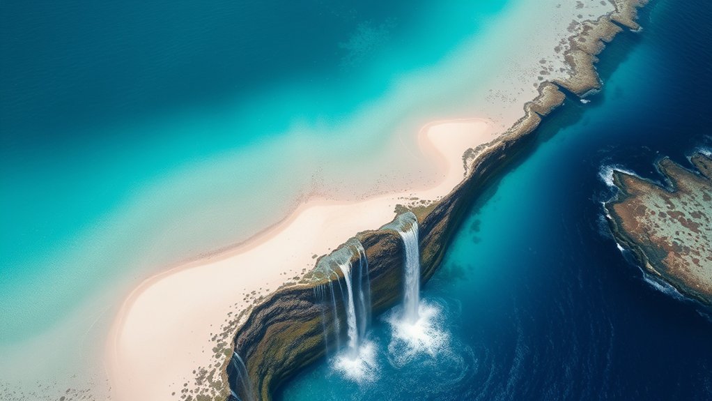
The Mauritius underwater waterfall is a natural optical illusion off the southwest of the island near the Le Morne Peninsula. It looks as though turquoise water is pouring into a dark-blue abyss, but the visible pattern is not a conventional waterfall.
The effect is closely associated with sand and silt moving through the coastal marine environment. Currents redistribute sediment around the shallow lagoon and reef system, while variations in seabed color and water depth create streaks of pale and dark blue. When these features are viewed from high above, the brain interprets the pattern as a three-dimensional cascade.
Air Mauritius describes the phenomenon as an optical illusion involving shifting sand and silt and underwater currents. Research on the Le Morne coast also documents active sediment transport influenced by the area’s lagoon hydrodynamics.
The illusion appears just offshore from Le Morne Cultural Landscape, a UNESCO World Heritage Site in southwest Mauritius.
Why Does Mauritius Look Like a Waterfall?
Mauritius looks as though it has an underwater waterfall because several visual effects overlap in one place:
- Light-colored sediment: Sand and silt create pale streaks beneath and within the water.
- Moving currents: Water movement transports and reshapes those sediment patterns.
- Water-color contrast: Sunlit shallow water can appear turquoise, while deeper or differently oriented water appears darker blue.
- Seabed patterns: channels, slopes, reef features, and sediment deposits help create lines that resemble flowing water.
- Aerial perspective: From high above, these two-dimensional patterns can look like a deep vertical plunge.
Some popular descriptions claim that the illusion marks a giant cliff or a horseshoe-shaped crevasse dropping thousands of meters directly beneath the visible “fall.” That explanation should be treated cautiously. The best-supported part of the phenomenon is the interaction of sediment, currents, bathymetry, color contrast, and viewing angle, rather than one precisely defined underwater cliff.
Note: The Mauritius illusion and the Denmark Strait waterfall should not be explained with the same mechanism. Mauritius is primarily a visible sediment-and-perspective effect; Denmark Strait is a density-driven movement of seawater.
How Does the Underwater Waterfall Illusion Form?
The Mauritius illusion begins with sediment in a dynamic coastal environment. Waves and currents move sand and fine material through the lagoon and around reef openings. A published study of coastal erosion at Le Morne found that local hydrodynamics influence sediment transport and shoreline change, confirming that sand movement is an active process in this area.
As sediment forms pale trails against darker water and seabed areas, the patterns begin to resemble white water streaming over an edge. The effect becomes much stronger from above because an aerial viewing angle compresses distance and depth into a single image.
Sunlight also matters. Shallow, clear tropical water often appears bright turquoise because light reaches and reflects from the seabed. Darker water or darker bottom material provides the visual contrast that makes the pale sediment trails look as though they are descending.
Cold, dense water sinking beneath warmer water is not necessary to produce this Mauritius illusion. That density-driven mechanism belongs to real oceanic overflows such as the Denmark Strait.
Where Is the Mauritius Underwater Waterfall?
The illusion is found off the Le Morne Peninsula on the southwest coast of Mauritius. Le Morne Brabant rises prominently above the peninsula and forms part of the UNESCO-listed Le Morne Cultural Landscape.
The famous waterfall shape is easiest to recognize in aerial photographs because height provides the viewing angle needed to see the full sediment and color pattern at once. From the water’s surface, the same marine landscape does not normally resemble a giant waterfall.
Pro Tip: If you want to see the classic Mauritius “waterfall” shape, an aerial perspective from a legal sightseeing flight provides a much clearer view than looking from sea level. Visibility still depends on weather, glare, cloud cover, and viewing angle.
Mauritius vs. a Real Underwater Waterfall
| Feature | Mauritius | Denmark Strait |
| What it is | Optical illusion | Density-driven ocean overflow or cataract |
| Main cause | Sediment patterns, currents, seabed features, color contrast, and perspective | Cold, dense water flowing below warmer, lighter water |
| Visible like a waterfall? | Yes, especially from the air | No; instruments are needed to measure the submerged flow |
| Water actually descending? | Not as the apparent waterfall shown in photographs | Yes, dense seawater flows downslope |
How Do Real Underwater Waterfalls Form?
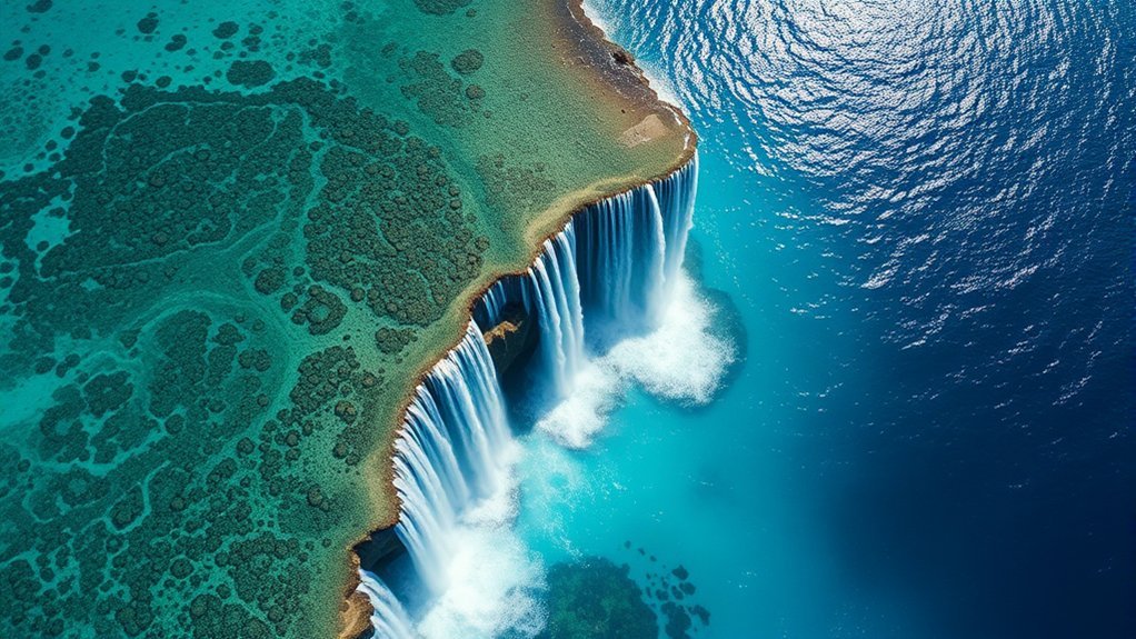
Real underwater “waterfalls” form when differences in seawater density create a strong downslope flow. Temperature is important because colder seawater is generally denser than warmer seawater, although salinity also affects density.
The Denmark Strait Overflow is the best-known example. According to the U.S. National Oceanic and Atmospheric Administration, frigid water moving south from the Nordic Seas meets warmer water from the Irminger Sea. The colder, denser water sinks beneath the warmer layer and flows over major underwater relief.
- Dense water approaches the strait: Cold northern water moves southward.
- Different water masses meet: The cold water is denser than the warmer Irminger Sea water.
- Gravity drives the dense layer downward: It remains beneath the lighter water and accelerates downslope.
- The overflow continues into the deeper North Atlantic: It mixes with surrounding water and becomes part of larger deep-ocean circulation.
Oceanographers commonly call this process an overflow. “Underwater waterfall” or “cataract” is a useful analogy because the dense water descends over underwater terrain, but it does not resemble a land waterfall falling through air.
NOAA estimates the Denmark Strait downward flow at well over 123 million cubic feet (3.5 million cubic meters) per second and gives the cataract an approximate height of 11,500 feet.
How Does the Denmark Strait Waterfall Work?
The Denmark Strait lies between Greenland and Iceland. Cold, dense water from the Nordic Seas moves south through the strait and descends into the deeper Irminger Sea beneath warmer, less-dense water.
NOAA describes the cataracts as beginning roughly 2,000 feet (650 meters) below the surface. Its infographic gives the underwater cataract an approximate height of 11,500 feet (3.51 kilometers) and estimates the downward flow at more than 123 million cubic feet per second.
Unlike the Mauritius illusion, this flow cannot be watched from above as a visible waterfall. Scientists detect and measure it using oceanographic instruments that record properties such as temperature, salinity, pressure, and current velocity.
The flow also matters beyond the Denmark Strait. Woods Hole Oceanographic Institution explains that dense overflow water entering the Irminger Sea feeds deep southward circulation. More recent WHOI-supported research identifies Denmark Strait Overflow Water as part of the deepest branch of the Atlantic Meridional Overturning Circulation.
Frequently Asked Questions
How does the underwater waterfall work?
It depends on which underwater waterfall you mean. In Mauritius, moving sediment, currents, seabed patterns, water-color contrast, and aerial perspective create an optical illusion. In the Denmark Strait, cold, dense seawater actually flows beneath warmer water and descends over underwater terrain.
What’s at the bottom of the underwater waterfall?
There is no single “bottom” beneath the Mauritius illusion because it is not a vertical waterfall shaft. The aerial pattern represents sediment and seabed features beneath the sea. At Denmark Strait, dense water continues downslope into the deeper Irminger Sea rather than landing in a plunge pool like a terrestrial waterfall.
How do waterfalls work step by step?
A land waterfall forms where flowing surface water crosses a sudden change in elevation and gravity pulls it downward. Erosion can gradually reshape the ledge and plunge pool. A density-driven underwater cascade works differently: dense seawater moves beneath lighter water and follows sloping seafloor under gravity.
What are the 4 stages of a waterfall formation?
A simplified description of a terrestrial waterfall can include initial erosion at a resistant rock layer, development of a plunge pool, undercutting and collapse, and gradual upstream retreat. Those stages describe river waterfalls and should not be used to explain either the Mauritius optical illusion or Denmark Strait’s density-driven ocean overflow.
Is the Mauritius underwater waterfall real?
The visual phenomenon is real, but it is not a conventional waterfall. The waterfall-like shape is an optical illusion associated with moving sand and silt, currents, seabed patterns, water-color differences, and the aerial viewing angle.
What is the world’s largest underwater waterfall?
NOAA identifies the Denmark Strait cataract between Greenland and Iceland as the world’s largest waterfall. It is a massive density-driven ocean overflow rather than a waterfall visible from the surface.
Conclusion
The Mauritius “underwater waterfall” and the Denmark Strait cataract may look related in name, but they represent very different natural processes. Mauritius gives us a striking optical illusion created by sediment, currents, seabed patterns, water color, and perspective. No visible mass of ocean water is plunging through the sea.
The Denmark Strait Overflow, by contrast, is a genuine gravity-driven movement of dense seawater. Cold Nordic Seas water flows beneath warmer Irminger Sea water and descends across underwater terrain on an enormous scale. Understanding that distinction makes both phenomena more interesting—and prevents one mechanism from being mistakenly used to explain the other.
Sources
- NOAA Ocean Service — Where Is Earth’s Largest Waterfall? — Denmark Strait location, density mechanism, approximate height, depth, and flow estimate.
- Woods Hole Oceanographic Institution — Into the Wild Irminger Sea — Denmark Strait Overflow Water and deep North Atlantic circulation.
- Woods Hole Oceanographic Institution — Overflow Water Pathways in the North Atlantic — modern research on Denmark Strait Overflow Water pathways and the Atlantic overturning circulation.
- Assessment and Management of Coastal Erosion: Insights From Two Tropical Sandy Shores in Mauritius Island — Le Morne hydrodynamics, erosion, and sediment transport.
- UNESCO World Heritage Centre — Le Morne Cultural Landscape — official location and World Heritage context for Le Morne in southwest Mauritius.
- Air Mauritius — The “Underwater Waterfall” of Mauritius — official local explanation of the optical illusion and shifting sand and silt.

