
Last Updated on September 11, 2026 by Daniel Globe
Few natural phenomena capture the imagination quite like the concept of an underwater waterfall. Aerial photographs of the southwest tip of Mauritius appear to show the ocean itself plunging into an infinite, bottomless abyss. However, in the world of oceanography, the term refers to two completely different phenomena: a breathtaking optical illusion driven by coastal sediment in Mauritius, and an immense, true physical cascade hidden thousands of feet below the surface in the Denmark Strait.
Quick Answer
The famous Mauritius underwater waterfall is an optical illusion created by sand and silt washing off a shallow coastal shelf into a 4,000-meter-deep oceanic abyss. Conversely, the planet’s largest actual underwater waterfall is the Denmark Strait cataract, where dense, frigid Arctic water plunges 11,500 feet beneath warmer Atlantic water.
Key Takeaways
- Mauritius is an Optical Illusion: The ocean surface remains completely level; moving sand and runoff create the visual impression of a plunging cascade.
- The Mascarene Plateau: A sudden underwater drop-off from a shallow shelf (5–15 meters) into an oceanic trench (up to 4,000 meters) magnifies the visual effect.
- Earth’s Largest True Waterfall: The Denmark Strait cataract moves over 123 million cubic feet of water per second—dwarfing any waterfall on land.
- Global Climate Driver: Subsurface cascades drive the thermohaline circulation system (ocean conveyor belt) that distributes heat and nutrients across the globe.
Disclosure: As an Amazon Associate I earn from qualifying purchases. Some links on this page are affiliate links, at no extra cost to you.
Does Mauritius Really Have an Underwater Waterfall?
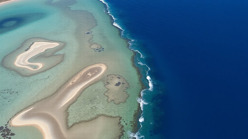
Mauritius does have an underwater waterfall, but it is not a waterfall in the literal sense. What you see from the air is a dramatic optical illusion off the coast of the UNESCO-listed Le Morne Cultural Landscape. While aerial footage makes it appear as though water is draining into a massive subterranean sinkhole, the surface of the Indian Ocean remains entirely flat and stable.
The illusion is generated by the continuous movement of biogenic sand, coral silt, and sediment being flushed off the shallow coastal shelf by powerful ocean currents. Because the geological shelf ends in an abrupt bathymetric drop-off that plunges thousands of meters into the oceanic basin, the downward drift of pale sediment creates the visual signature of rushing, cascading water.
What Creates the Mauritius Underwater Waterfall Illusion?
The illusion relies on a unique combination of coastal bathymetry, dynamic ocean currents, and water color contrast. Mauritius sits on the edge of the Mascarene Plateau, a relatively young volcanic shelf that rises out of the deep Indian Ocean floor.
| Geological & Hydrodynamic Factor | Role in Producing the Illusion |
|---|---|
| Shallow Coastal Shelf | The turquoise lagoon floor averages just 5 to 15 meters in depth, allowing bright sunlight to illuminate pale coral sands. |
| Steep Continental Drop-off | At the edge of the reef, the seabed suddenly plunges into an abyssal plain reaching depths between 3,000 and 4,000 meters. |
| Littoral Drift & Wave Action | Tidal surges funnel loose sediment through an opening in the coral reef barrier, pushing it steadily down the underwater slope. |
| Optical Color Gradient | The stark contrast between glowing turquoise lagoon shallows and dark cobalt deep water simulates dramatic three-dimensional depth. |
How Does the Mauritius Illusion Work?
When you look down on the southwestern corner of Mauritius from an aircraft, your brain interprets the movement of sediment and color gradation through three distinct visual steps:
- Sediment Funneling: Waves breaking across the coral reef push white sand and silt toward a submarine channel cut into the edge of the plateau.
- Downward Drift: Gravity and undertow pull the heavier sediment down the contours of the continental slope into the deep ocean.
- Perspective Conversion: Viewed from an oblique aerial angle, the moving streaks of white sand against deep sapphire-blue depths mimic the exact texture, foam, and motion of a terrestrial waterfall.
Note: If you swim or take a boat directly over the area, the illusion disappears completely. From water level, you will only see gentle turquoise waves and clear waters. The phenomenon is entirely perspective-dependent.
Where and How to View the Mauritius Underwater Waterfall
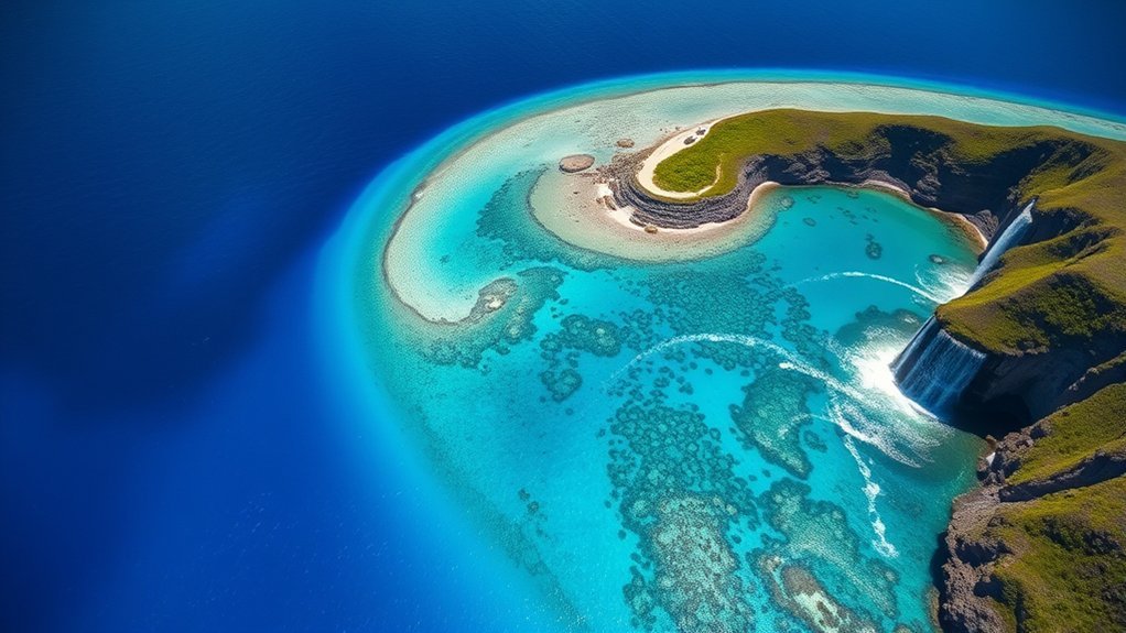
The illusion is situated off the southwest tip of Mauritius, right beside the towering basalt monolith of Le Morne Brabant. Because elevation is required to align the angle of refraction and see through the surface glare, choosing the right vantage point is essential.
Helicopter and Seaplane Tours
An aerial flight is the undisputed best way to experience the phenomenon. Two primary flight formats operate in the region:
- Helicopter Flights: Operators like Air Mauritius and private charters run 15- to 45-minute scenic flights departing from the international airport or nearby southern heliports. Helicopters provide stable, panoramic vantage points for wide-angle photography.
- Seaplane Excursions: Light seaplanes (such as those operated by Lagoonflight) take off directly from the water near La Prairie beach. They fly at lower altitudes, offering a close-up, dynamic perspective of the reef channel.
Pro Tip: Book your flight between 10:00 AM and 2:00 PM on a sunny day. Midday overhead sun eliminates surface glare and illuminates the white sand on the shelf, maximizing the vibrancy of the underwater waterfall illusion.
Le Morne Brabant Hiking Viewpoint
If you prefer to stay on land, hiking to the summit ridge of Le Morne Brabant (556 meters above sea level) offers a scenic vantage point overlooking the lagoon. While this elevated lookout allows you to see the distinct blue-green reef edge and the offshore channel, it provides an oblique angle that does not match the full vertical depth perception seen from an aircraft.
What Is the Denmark Strait Underwater Waterfall?
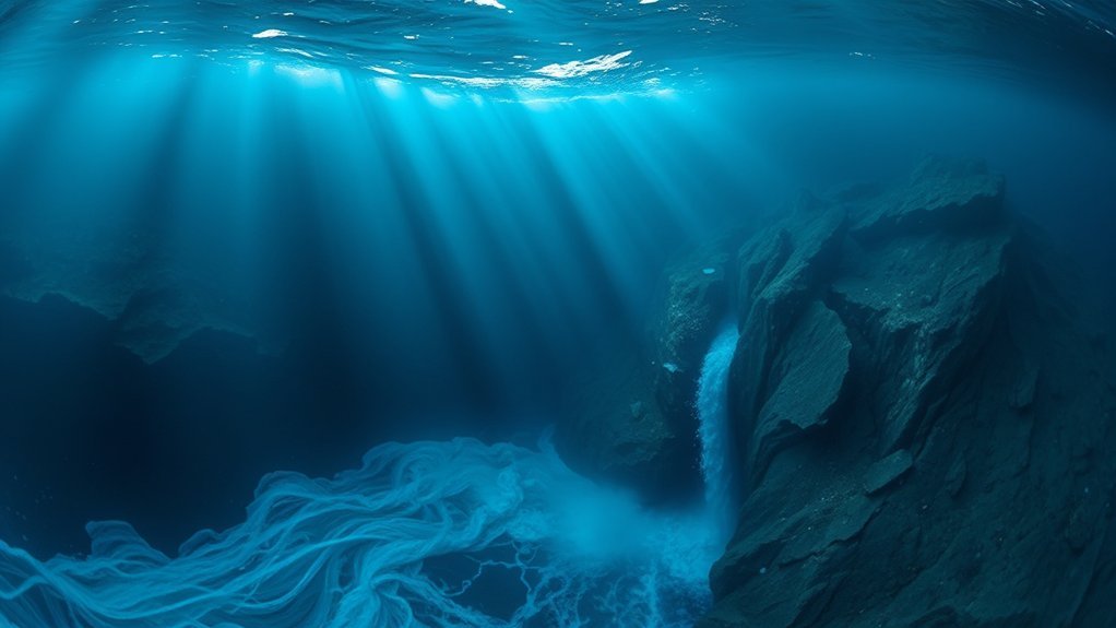
While Mauritius offers an optical illusion, Earth is home to genuine, massive underwater cascades known as ocean cataracts. The most spectacular is the Denmark Strait cataract, located in the deep ocean passage between Greenland and Iceland.
This submerged marvel is the largest waterfall on Earth by an overwhelming margin:
- Total Drop: The cascade begins roughly 2,000 feet (600 meters) below the sea surface and plunges down to 11,500 feet (3,500 meters)—a vertical drop more than three times the height of Angel Falls.
- Flow Rate: It discharges an estimated 123 million to 175 million cubic feet per second (3.5 to 5.0 million cubic meters per second), equivalent to thousands of Niagara Falls flowing simultaneously.
- Width: The descending front spans approximately 100 miles (160 kilometers) across the seafloor sill.
How the Denmark Strait Cataract Forms
Subsurface waterfalls are not powered by gravity pulling water over an exposed cliff into air. Instead, they are driven by thermohaline density differences between colliding water masses.
1. Temperature and Salinity Gradients
In the Denmark Strait, the icy, highly saline waters of the Nordic Seas (flowing south via the East Greenland Current) meet the significantly warmer waters of the Irminger Sea in the North Atlantic. Cold water is significantly denser than warm water, and high salinity increases its density further.
2. The Subsea Density Cascade
When these two water masses collide at the submarine ridge spanning Iceland and Greenland, the heavy, frigid Arctic water slides beneath the lighter, warmer Atlantic water. It pours down the southern slope of the ridge, plummeting thousands of feet along the ocean floor into the deep North Atlantic basin.
“The Denmark Strait cataract carries more than 2,000 times the peak flow volume of Niagara Falls, yet its massive plunge remains completely invisible from the surface of the sea.”
Comparison: Mauritius Illusion vs. Denmark Strait Cataract
| Feature | Mauritius Waterfall | Denmark Strait Cataract |
|---|---|---|
| Physical Nature | Optical illusion (sediment drift) | True hydrodynamic cascade |
| Location | Southwest coast of Mauritius (Indian Ocean) | Between Greenland and Iceland (North Atlantic) |
| Visibility | Highly visible from aerial perspectives | Invisible to the eye (detected via ocean sonar) |
| Vertical Drop | Slope drops ~4,000 m (sediment descent) | Water drops ~3,500 m (11,500 ft) |
| Primary Driver | Tides, wave action, and coastal erosion | Density & temperature differentials (thermohaline) |
Why Underwater Waterfalls Matter to Ocean Life
True underwater cascades like the Denmark Strait cataract are essential engines of global climate and marine ecology. They drive the Atlantic Meridional Overturning Circulation (AMOC), the massive conveyor belt that circulates heat, carbon, and nutrients across planetary oceans.
- Deep Ocean Oxygenation: Surface waters rich in dissolved oxygen are carried rapidly down into the abyssal zones, preventing the deep ocean floor from becoming anoxic.
- Nutrient Upwelling: The turbulent plunge forces deep, mineral-rich sediments to cycle toward the margins, feeding blooms of phytoplankton that sustain entire pelagic food webs.
- Global Climate Regulation: By pulling massive volumes of cold Arctic water southward along the sea floor, these cascades help balance global temperatures and sustain weather patterns across North America and Europe.
Frequently Asked Questions
Is there such a thing as a real underwater waterfall?
Yes. While Mauritius is an optical illusion created by sand runoff, genuine underwater waterfalls exist in the deep ocean. Known as ocean cataracts, they form when cold, dense water sinks beneath warmer, lighter water along submarine ridges, as seen in the Denmark Strait.
What is the water under a waterfall called?
At the base of a terrestrial waterfall, the deep depression carved out by falling water and rock debris is called a plunge pool. In deep-sea cataracts, descending dense water creates deep boundary currents and turbulent bottom plumes rather than traditional plunge pools.
What is at the bottom of the Mauritius underwater waterfall?
At the base of the underwater drop-off off Mauritius lies the deep Indian Ocean seabed, dropping down to roughly 4,000 meters. The seafloor here consists of accumulated marine sediment, coral silt, and deep-sea basaltic rock from the Mascarene Plateau.
Can you swim or boat over the Mauritius underwater waterfall?
Yes. You can swim, paddleboard, or boat in the lagoon waters directly above the formation. Because it is an optical illusion and the ocean surface is calm and flat, it is completely safe to navigate, though strong tidal currents exist near the outer reef channel.
Conclusion
The concept of the underwater waterfall encompasses both human perception and planetary physics. Off the coast of Mauritius, nature stages a spectacular visual trick, utilizing coral sands, coastal currents, and sharp bathymetric drop-offs to create an optical illusion that delights aerial travelers. Meanwhile, in the icy depths of the Denmark Strait, Earth operates an immense, hidden hydraulic engine that quietly drives global ocean circulation. Whether visual or physical, these marine wonders reveal the incredible complexity of Earth’s oceans beneath the surface.
Sources
- NOAA National Ocean Service — Where is the Earth’s Largest Waterfall? (Denmark Strait Cataract Data)
- UNESCO World Heritage Centre — Le Morne Cultural Landscape and Marine Topography
- Woods Hole Oceanographic Institution — Thermohaline Circulation and Deep-Sea Cascades
