
Last Updated on July 25, 2026 by Daniel Globe
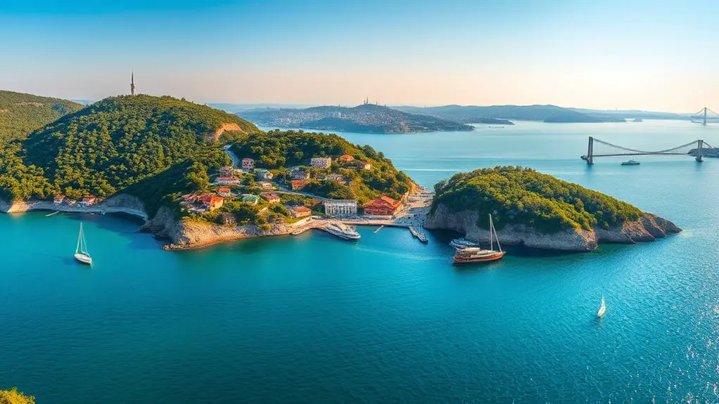
The Princes’ Islands offer some of Istanbul’s most memorable views, but the best lookout depends on what you want to see. Büyükada has the highest summit, Heybeliada combines sea views with pine-covered hills, Burgazada excels at sunsets, and Kınalıada pairs open coastal scenery with compact hill walks. Smaller Sedef Adası can also be visited, while privately owned Kaşık Adası is better admired from a distance.
Quick Answer
The best Princes’ Islands viewpoints include Büyükada’s Yücetepe by Aya Yorgi, Heybeliada’s Değirmenburnu and permitted hill routes, Burgazada’s Kalpazankaya, and Kınalıada’s hill-and-coast walks. Sedef Adası offers quieter coastal scenery, while privately owned Kaşık Adası should be viewed from Burgazada or the water rather than treated as a public walking destination.
Key Takeaways
- Büyükada: Yücetepe, home to Aya Yorgi, is the highest point in the Princes’ Islands at 202 metres.
- Heybeliada: Değirmenburnu is one of the easiest scenic areas to combine with a day trip, while Değirmentepe is the island’s highest hill.
- Burgazada: Kalpazankaya is the standout choice for a relaxed sea view and sunset.
- Kınalıada: Its relatively open landscape makes it good for combining hill views with an easy coastal walk.
- Kaşık Adası: The island is privately owned, so do not plan on landing there or exploring it like the four main visitor islands.
2026 Access Alert: As of July 25, 2026, entry into most forest areas in Istanbul’s Adalar district is prohibited from June 8 through October 15, 2026 as a wildfire-prevention measure. The İstanbul Governor’s Office lists designated areas including Büyükada Nature Park, Dilburnu Nature Park, and Değirmenburnu Nature Park among the exceptions. Stay on permitted roads, parks, and signed routes and obey local closure notices. Check the official 2026 forest-access announcement before setting out.
Disclosure: As an Amazon Associate I earn from qualifying purchases. Some links on this page are affiliate links, at no extra cost to you.
Best Princes’ Islands Viewpoints at a Glance
| Island | Best Viewpoint | Best For | Access Note |
| Büyükada | Yücetepe / Aya Yorgi | High panoramic views | Final approach is uphill; check current route restrictions. |
| Heybeliada | Değirmenburnu | Sea, pine and mainland views | Designated nature park; some other forest routes are restricted in summer 2026. |
| Burgazada | Kalpazankaya | Sunset and west-coast views | Reachable from the settlement; IETT also operates the BU1 island route. |
| Kınalıada | Hill and coastal routes | Open views and a compact walk | The island has three principal hills and relatively sparse vegetation. |
| Sedef Adası | Coastal viewpoints | Quiet sea scenery | Public ferry service is much more limited than on the four main islands. |
| Kaşık Adası | View from Burgazada | Island scenery from afar | Private property; not a standard public sightseeing stop. |
Büyükada Hilltop Views
Büyükada is the strongest choice when you want a true hilltop panorama. The island has two major peaks, and its highest point is Yücetepe at 202 metres, according to Adalar Municipality’s elevation data.
Yücetepe is best known as the home of Aya Yorgi Rum Orthodox Monastery. From the upper part of the hill, the Sea of Marmara spreads around the island, with neighbouring islands and the distant mainland visible when the weather is clear. GoTürkiye’s Büyükada guide also highlights the views from the island’s two peaks.
The route becomes noticeably steeper on the final approach, so supportive shoes and water are useful. During periods of forest-access restriction, use open roads and signed routes rather than taking unofficial shortcuts through wooded areas.
Hristos and İsa Tepesi
Büyükada’s other major height is İsa Tepesi, or Hristos Hill, where Hristos Monastery stands. The area also contains the striking former Greek Orphanage. It gives Büyükada a second elevated landscape distinct from the more famous Aya Yorgi summit.
Access conditions around wooded areas can change with wildfire-prevention measures, so check current signs before treating every hillside track as an open hiking route.
Pro Tip: For clearer photographs, arrive outside the busiest middle part of the day. Morning light often gives cleaner views toward the mainland, while later light adds warmer tones to the Marmara Sea.
Heybeliada’s Pine-Covered Peaks
Heybeliada offers a softer, greener landscape than Büyükada. The island has four principal hills, with Değirmentepe reaching 136 metres, making it Heybeliada’s highest point. Adalar Municipality documents the island’s four-hill geography.
For most visitors, however, the easiest scenic experience is not necessarily the highest summit. Değirmenburnu combines pine-covered surroundings with open views over the water and is close enough to the ferry area to fit comfortably into a day trip.
Scenic Hiking Trails and Değirmenburnu
Değirmenburnu Nature Park is one of the most practical places to enjoy Heybeliada’s mix of trees, sea and distant mainland views. Importantly for summer 2026 visitors, it is one of the designated nature parks specifically listed outside İstanbul’s general forest-entry restriction.
That exception does not mean every forest trail elsewhere on Heybeliada is open. Follow signs and stay within permitted roads, paths and recreation areas rather than disappearing onto unsigned tracks.
Another verified historic destination is Aya Yorgi Uçurum Manastırı, a monastery on the island’s southern side overlooking the sea. Its cliffside setting makes it one of Heybeliada’s more distinctive combinations of history and scenery. Access to religious properties can vary, so treat the surrounding setting and public approach as part of the experience rather than assuming every building will be open.
Majestic Island Sunsets
Heybeliada can be particularly atmospheric as the sun drops and the bright midday glare softens. Elevated open areas and waterfront viewpoints can frame the Marmara Sea against the island’s pine-covered slopes.
For better photographs:
- Use trees, railings or the shoreline as foreground elements rather than photographing only the horizon.
- Expose for the sky near sunset so the brightest areas do not wash out.
- Use a tripod only where it will not obstruct a path or create a hazard for other visitors.
Because summer forest restrictions can affect access to elevated routes, never cross barriers or leave an approved path simply to reach a better camera angle.
Burgazada’s Seaside Serenity
Burgazada gives you two different types of scenery: an easygoing west-coast sunset experience and higher panoramas from the island’s hill country.
Kalpazankaya, on the western side of Burgazada, is the most dependable recommendation for a relaxing viewpoint. GoTürkiye specifically highlights Kalpazankaya for its sea views and sunset. Pine shade, rocky shoreline scenery and the open western horizon make it ideal when you care more about atmosphere than reaching the island’s highest point.
The area also works well as a break during a circuit of Burgazada. Restaurants and cafés around the island offer seafood and other local dishes, but it is better to choose by menu and current availability rather than assume every fish served was caught immediately around the island.
Bayrak and Hristos Tepesi
For a higher panorama, official tourism information points to Bayrak Tepesi, while municipal geography identifies Burgazada’s Hristos summit at about 170 metres. From elevated areas, the reward is a broader view across neighbouring islands and toward the Anatolian mainland.
These higher routes deserve extra caution during the 2026 fire season because wooded access can fall within temporary forest restrictions. Kalpazankaya remains the simpler option for visitors who do not want to depend on summit-route availability.
Kınalıada’s Coastal Lookouts
Kınalıada is the closest of the main Princes’ Islands to Istanbul and has a noticeably more open appearance than heavily wooded Heybeliada or Büyükada. Adalar Municipality identifies three principal hills: Çınar Tepesi, Teşvikiye Tepesi and Manastır Tepesi.
Çınar Tepesi is the island’s highest point at about 155 metres. Because Kınalıada is compact, you can combine an elevated walk with substantial stretches of waterfront without committing an entire day to a long island circuit.
For cultural interest, the Hristos or Metamorphosis monastery area adds history to the hill scenery. Lower down, the shoreline offers another type of lookout, with ferries, the Marmara Sea and the distant mainland constantly changing the view.
- Hill views: best when you want a wider sense of the island and surrounding sea.
- Waterfront views: easiest for a relaxed walk with cafés and ferry activity nearby.
- Late-day views: useful for warmer light and sunset colors when skies are clear.
Kınalıada’s relatively sparse vegetation also means less shade on exposed streets and hills. Carry water and sun protection in warm weather.
Sedef Adası’s Hidden Views
Sedef Adası offers a quieter coastal setting, but it requires more planning than the four principal visitor islands. Adalar Municipality describes it as the smallest island in the district that is open to settlement and notes that it has two beaches.
Unlike the frequent services connecting Büyükada, Heybeliada, Burgazada and Kınalıada, public transport to Sedef is limited. As of July 2026, Şehir Hatları operates a limited Büyükada–Sedef Adası service.
The appeal is therefore less about hunting for supposedly secret hiking trails and more about enjoying a small-island coastal setting at a slower pace. Some residential and recreational areas are not equivalent to unrestricted public parkland, so respect signs, gates and private property.
Note: Check both your outbound and return Sedef sailings before leaving Büyükada. The service is much less frequent than ferry service to the four main Princes’ Islands.
Kaşık Adası’s Shoreline Vistas
Kaşık Adası is a small island immediately east of Burgazada, but it should not be treated as another public sightseeing stop. According to Adalar Municipality, Kaşık Adası is privately owned.
The municipality describes a simple pier and two small houses on the island. There is no basis for planning a casual public beach walk, wildlife hike or swimming excursion there.
Instead, enjoy Kaşık Adası as part of the wider Princes’ Islands landscape. Its low profile can be seen from Burgazada and from the surrounding water, adding another layer to the archipelago’s scenery without requiring a landing.
Kaşık Adası is best appreciated as a private island within the panorama, not as an unrestricted beach or hiking destination.
How to Reach the Princes’ Islands Viewpoints
For most visitors, the journey begins with a ferry from Istanbul. Şehir Hatları operates services linking Istanbul with the Princes’ Islands, including Büyükada, Heybeliada, Burgazada and Kınalıada. Routes and departure times vary by day and season, so check the live timetable rather than relying on an old screenshot or blog schedule.
Once ashore, walking remains one of the best ways to experience the islands. Conventional motor traffic is heavily restricted, but the four main islands are not literally vehicle-free. IETT operates electric public-transport routes on Büyükada, Heybeliada, Burgazada and Kınalıada.
Trying to cover every island in one day usually means spending too much time waiting for ferries. For viewpoint-focused sightseeing, one large island or two nearby main islands is a more relaxed plan.
Pro Tip: Choose Büyükada when a high summit is your priority, Burgazada for sunset, Heybeliada for pine-and-sea scenery, and Kınalıada for the easiest combination of compact hill and waterfront walking.
Viewpoint Safety and Photography Tips
A few simple preparations make island viewpoints much more enjoyable:
- Wear shoes with dependable grip for steep or uneven streets and paths.
- Carry drinking water, especially on exposed Büyükada and Kınalıada climbs.
- Use sun protection during spring and summer.
- Do not cross forest-closure signs, barriers or private-property gates.
- Keep away from unstable cliff edges and exposed rocks, particularly when taking photographs.
- Check the last practical ferry connection before staying for sunset.
- During hot, dry periods, follow all current fire-prevention rules and never light fires in restricted areas.
Weather also changes the quality of a viewpoint. Haze can reduce distant mainland visibility, while clear mornings often reveal much more detail across the Marmara Sea.
Frequently Asked Questions
What Is the Best Time of Year to Visit the Princes’ Islands?
Spring and early autumn are especially comfortable for walking because temperatures are generally milder than at the height of summer. Summer offers long days but also brings larger crowds, stronger sun and possible fire-prevention restrictions. In 2026, most forest areas are subject to access restrictions from June 8 through October 15, with specified recreation and nature-park exceptions.
Are There Any Guided Tours Available for Exploring the Viewpoints?
Private operators sell guided Princes’ Islands excursions, although routes and included islands vary. Before paying for a tour, verify that the operator is a registered travel agency through the TÜRSAB agency search.
How Can I Get to the Princes’ Islands From Istanbul?
Use a ferry serving the Princes’ Islands and check the current Şehir Hatları timetable for the most convenient departure point and return connection. Büyükada, Heybeliada, Burgazada and Kınalıada receive regular public ferry service. Once ashore, visitors mainly walk or use available electric public transport.
Are There Any Accommodation Options Near the Viewpoints?
Yes. The main inhabited islands have hotels, guesthouses and other accommodation, with Büyükada offering the broadest choice. Hilltop viewpoints themselves are generally reached from the settled areas rather than surrounded by hotels, so check walking distance and elevation before booking solely on map distance.
Is There an Entrance Fee to Access These Viewpoints?
There is no single island-wide viewpoint admission fee. Public streets and ordinary coastal viewpoints can generally be enjoyed without a separate sightseeing ticket, but nature parks, beaches, recreational facilities and individual attractions can have their own fees or access rules. Check the specific destination before visiting.
Can Tourists Visit Kaşık Adası?
Kaşık Adası is privately owned and should not be treated as a normal public tourist island. Plan to view it from Burgazada or from the surrounding water rather than assuming that you can land, walk its shoreline or use it as a public swimming destination.
Are the Princes’ Islands Forest Trails Open in Summer 2026?
Not all of them. İstanbul’s 2026 fire-prevention measures restrict entry into most forest areas from June 8 through October 15. The Governor’s Office specifically lists certain recreation and nature-park areas, including Büyükada Nature Park, Dilburnu Nature Park and Değirmenburnu Nature Park, outside the general restriction. Always follow current signs and official notices.
Conclusion
The best Princes’ Islands viewpoint depends on the experience you want. Büyükada’s Yücetepe delivers the highest panorama, Heybeliada blends sea views with green surroundings, Burgazada’s Kalpazankaya is a natural sunset choice, and compact Kınalıada makes it easy to combine hills with the waterfront. Sedef requires more careful ferry planning, while private Kaşık Adası is best appreciated from afar. Check current access rules before walking into wooded areas, then let the ferry ride, sea air and changing Marmara views become part of the experience.
Sources
- Adalar Municipality — Island Elevations — official summit elevations for Büyükada, Heybeliada, Burgazada and Kınalıada.
- GoTürkiye — Büyükada — Büyükada’s peaks, Aya Yorgi and scenic visitor information.
- GoTürkiye — Burgazada — Kalpazankaya, sunset views and Bayrak Tepesi.
- Şehir Hatları — Princes’ Islands Ferry Timetables — current public ferry connections for the main islands.
- İstanbul Governor’s Office — 2026 Forest Access Measures — current June 8–October 15 restrictions and listed exceptions.
- Adalar Municipality — Kaşık Adası — official information confirming the island’s private ownership and physical characteristics.
