
Last Updated on July 25, 2026 by Daniel Globe
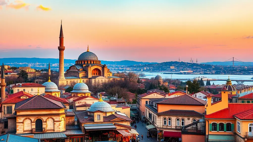
Fatih offers some of Istanbul’s strongest photography locations, from the domes and minarets around Sultanahmet to the Golden Horn views near Süleymaniye, colorful Balat streets, the historic land walls, and the busy Eminönü waterfront. Galata Tower and Pierre Loti Hill also deliver memorable panoramas, but they sit outside Fatih and are best treated as nearby additions to a photography itinerary.
Quick Answer
The best viewpoints in Fatih for photos include Sultanahmet Square for Hagia Sophia and Blue Mosque compositions, Süleymaniye for broad Golden Horn views, Balat for colorful street scenes, the Theodosian land walls for historic architecture, and Eminönü for waterfront city life. Early morning and golden hour usually provide the best light.
Key Takeaways
- Sultanahmet is the best all-around Fatih location for classic Hagia Sophia and Blue Mosque photographs.
- Süleymaniye is one of the strongest true Fatih choices for an elevated Golden Horn and historic-peninsula panorama.
- Balat works best early in the day, when its steep streets are quieter and the light is softer.
- Eminönü is ideal for ferries, fishermen, Galata Bridge, Yeni Mosque, and blue-hour street scenes.
- Galata Tower and Pierre Loti Hill are not in Fatih; include them only as nearby extensions to your route.
Note: Fatih covers Istanbul’s historic peninsula. Galata Tower is across the Golden Horn in Beyoğlu, while Pierre Loti Hill is in Eyüpsultan. Both remain useful photography locations, but they should not be described as viewpoints inside Fatih.
Disclosure: As an Amazon Associate I earn from qualifying purchases. Some links on this page are affiliate links, at no extra cost to you.
Best Fatih Photo Spots at a Glance
| Location | District | Best Light | Cost Type | What to Expect |
|---|---|---|---|---|
| Sultanahmet Square | Fatih | Sunrise, golden hour, blue hour | Public square | Classic mosque silhouettes and relatively level public areas |
| Süleymaniye | Fatih | Late afternoon and sunset | Public exterior areas | Elevated Golden Horn and historic-rooftop views; uphill approach |
| Balat | Fatih | Early morning | Public streets | Colorful façades, steep lanes, shops, street details, and changing murals |
| Theodosian Land Walls | Fatih edge | Late afternoon | Public open areas | Fortifications, gates, towers, greenery, and textured stone |
| Eminönü Waterfront | Fatih | Golden hour and blue hour | Public waterfront | Ferries, Galata Bridge, fishermen, mosque silhouettes, and city motion |
| Galata Tower | Beyoğlu | Late afternoon through night | Ticketed attraction | High panorama looking back toward Fatih; outside the district |
| Pierre Loti Hill | Eyüpsultan | Sunset and night | Public viewpoint; transport and café costs extra | Golden Horn panorama; outside Fatih |
Nearby Panorama From Galata Tower in Beyoğlu
Galata Tower provides one of Istanbul’s best-known high panoramas, but it is important to place it correctly. The official Galata Tower Museum listing gives its address in Beyoğlu, across the Golden Horn from Fatih.
The current stone tower was built by the Genoese in the mid-14th century as part of the fortified Galata settlement. During the Ottoman period, it served different functions, including use as a fire lookout. That history is more precise than describing it simply as an ancient commercial watchtower.
From the upper levels, the Historic Peninsula spreads across the water, with the Golden Horn, Bosphorus, mosque domes, minarets, bridges, and dense rooftops forming layered compositions. A medium telephoto lens can compress those layers, while a wider lens works better when you want water and skyline in the same frame.
Because Galata Tower is ticketed and can be busy, check the official museum page before visiting for current admission and operating information.
Pro Tip: Use Galata Tower when you want to photograph Fatih from above. For the reverse composition, stay in Fatih around Eminönü and photograph Galata Tower rising beyond the Golden Horn.
The Majestic Silhouette of Hagia Sophia
Within Fatih itself, Hagia Sophia is one of the strongest architectural subjects you can photograph. UNESCO dates the present structure to 532–537, making its vast dome a defining element of Istanbul’s sixth-century Byzantine heritage. Ottoman-era minarets and other additions later became part of the silhouette seen today.
The most useful viewpoint for exterior photography is the Sultanahmet area around the square and landscaped space between Hagia Sophia and the Blue Mosque. Depending on your position, you can isolate the dome and minarets with a telephoto lens or include trees, fountains, people, and paving for environmental context.
Hagia Sophia’s photographic power comes from its layered history: a sixth-century Byzantine monument whose skyline was later reshaped by centuries of Ottoman use and additions.
Golden-hour light can add warmth to the stone and domes, while blue hour gives the building a cooler backdrop and often produces cleaner contrast around illuminated architectural details.
Hagia Sophia also contains historically important mosaics, but interior access and photography conditions can change. Treat it first as an active religious and heritage site, follow posted rules, and avoid disrupting worshippers for a photograph.
Sunset and Sunrise at Sultanahmet Square
Sultanahmet Square is one of the most productive photography locations in Fatih because several major landmarks sit within a compact walking area. Hagia Sophia, the Blue Mosque, the historic Hippodrome area, fountains, trees, and changing pedestrian activity give you many compositions without needing a high viewpoint.
Sunset can produce warm side light and colorful skies, but sunrise often has an important advantage: fewer people. Blue hour is also useful when the mosques and surrounding streets begin to glow against a darker sky.
Ideal Timing for Sunset
For sunset photography, arrive roughly 30 to 45 minutes before the sun reaches the horizon. This gives you time to scout a position instead of trying to compose while the light is changing quickly.
- Check the exact sunset time: It changes significantly through the year, so use a current weather or sun-position app on the day of your visit.
- Watch the clouds: Thin or broken cloud can reflect evening color, while a completely clear sky often gives a simpler gradient.
- Stay through blue hour: Some of the strongest mosque photographs happen after sunset, when artificial lighting begins to balance with the remaining color in the sky.
Iconic Landmarks to Capture
The obvious subjects are Hagia Sophia and the Blue Mosque, but do not limit yourself to postcard-wide compositions. Look for minarets framed by trees, architectural details, fountain reflections, paving lines, silhouettes of visitors, and the contrast between monumental buildings and everyday street life.
The area is busy and religiously important. Avoid blocking entrances, photographing people at prayer without permission, or turning active worship areas into staged portrait sets.
Best Photography Angles
- Low angle: Lower the camera to emphasize minarets and domes against a clean sky while reducing visual clutter near eye level.
- Wide environmental frame: Use roughly a 24–35mm full-frame equivalent to include architecture, square, gardens, and people in one composition.
- Telephoto compression: A longer focal length—or a phone’s optical 2x or 3x camera—can make domes and minarets appear closer together for a denser skyline.
- Water reflection: When the fountains or reflective surfaces in Sultanahmet Park are suitable, position yourself carefully to include architectural reflections without stepping into landscaped areas.
Pro Tip: For fewer people, make Sultanahmet your first stop of the morning. Sunset provides richer color, but sunrise often gives you far more freedom to adjust your position and wait for a clean frame.
Süleymaniye Mosque and the Golden Horn Skyline
One of the biggest gaps in a Fatih viewpoint guide is Süleymaniye Mosque. The Ministry of Culture and Tourism lists the complex in the Süleymaniye neighborhood of Fatih and identifies it as one of the major works of classical Ottoman architecture.
Its elevated position on the historic peninsula makes the surrounding terraces, streets, and public exterior areas especially useful for photographing the Golden Horn, bridges, layered rooftops, and the skyline on the opposite shore.
Late afternoon is particularly useful because the lower sun creates stronger texture across domes and rooftops. A wide lens can show the scale of the city, while a moderate telephoto lens helps isolate ferries, bridge traffic, mosque silhouettes, and distant towers.
Süleymaniye is an active mosque, so build your photography around respectful public areas and prayer schedules. Dress appropriately when entering religious spaces, keep noise low, and prioritize worshippers over your composition.
Nearby Perspectives From Pierre Loti Hill in Eyüpsultan
Pierre Loti Hill is another excellent Golden Horn viewpoint that is often grouped with historic-Istanbul itineraries, but it is outside Fatih. It is in Eyüpsultan, north of the district.
The hill overlooks the Golden Horn and can be reached on foot or by the TF2 Eyüp–Piyer Loti cable-car line. Metro Istanbul describes the upper station area as an important observation point over the Golden Horn.
Because the view includes water, hills, neighborhoods, mosques, trees, and distant skyline features, it works well with both wide-angle and telephoto compositions. The café area can also provide a place to pause between shots, though seating and purchases are separate from simply enjoying the public view.
| Best Times to Visit | Photo Opportunities |
|---|---|
| Early Morning | Softer light and calmer Golden Horn scenes |
| Late Afternoon | Warm side light across the surrounding neighborhoods |
| Sunset | Color over the Golden Horn and layered silhouettes |
| Night | City lights and reflections across the water |
| Autumn | Seasonal foliage adding foreground color |
For an article focused strictly on Fatih, Pierre Loti works best as an optional add-on after Balat rather than as one of the district’s own viewpoints.
Vibrant Streets of Balat
Balat is firmly within Fatih and offers a different style of photography from Sultanahmet or Süleymaniye. Rather than one grand panorama, the neighborhood rewards close observation: colorful façades, steep streets, doorways, balconies, antique storefronts, cafés, cats, religious architecture, and layers of everyday neighborhood life.
Fatih Municipality includes Balat among the district’s neighborhoods, making it one of the strongest street-photography stops for a Fatih-focused itinerary.
Colorful Streets and Street Art
Balat’s visual character changes constantly, so it is better to photograph real streets than rely on vaguely named murals that may have disappeared or never existed as formal attractions.
Kiremit Caddesi and the surrounding lanes are known for rows of colorful façades, while Merdivenli Yokuş provides steep street compositions. Yıldırım Caddesi and Vodina Caddesi are useful for shopfronts, cafés, antique displays, signs, architectural details, and changing street art.
- Look beyond the famous façades: Side streets often produce quieter, more personal compositions than the busiest photo stops.
- Use the slope: Photograph uphill for stacked façades or downhill to introduce depth and glimpses toward the Golden Horn.
- Treat murals as temporary: Street art changes, so photograph what is actually present rather than searching for an old internet checklist.
Early morning is usually easier because narrow streets have fewer visitors and the light can be softer than at midday.
Historic Architecture Highlights
Balat and neighboring Fener contain historic wooden houses, masonry buildings, churches, mosques, schools, balconies, and narrow streets that reflect the area’s layered Greek, Jewish, Armenian, Ottoman, and modern history.
Instead of calling every old-looking façade “ancient,” pay attention to specific architectural details: timber construction, bay windows, wrought-iron balconies, painted plaster, stone courses, gates, rooflines, and the relationship between restored and weathered buildings.
Telephoto lenses are useful on narrow streets because they compress repeating windows and façades. A wider lens works better when the curve or slope of the street is part of the composition.
Quaint Cafés and Shops
Balat has a constantly changing mix of independent cafés, antique dealers, vintage displays, art spaces, and small shops. Rather than building a photography route around unverified venue names, explore the shopfronts along Yıldırım Caddesi, Vodina Caddesi, and connecting lanes.
Antiques spilling toward a doorway, old signs, café windows, plants, chairs, and textured walls can all become strong foreground elements. When photographing inside a business—or when a member of staff is clearly identifiable—ask permission first.
This approach gives you more authentic images and keeps the guide useful even as individual businesses open, close, or change names.
Historic Views Along the Walls of Constantinople
Fatih’s land walls offer a completely different photographic atmosphere from the mosque-filled center. According to UNESCO, the historic peninsula was protected by walls first built under Theodosius in the early fifth century, and the terrestrial Theodosian defensive system extended for roughly 6,650 meters.
Instead of assuming that visitors can stand on top of every section, treat the walls as a long architectural subject. Towers, gateways, stone textures, restored sections, vegetation, moat areas, and surrounding neighborhoods can all create stronger photographs from ground level.
The Theodosian land walls are not simply a scenic backdrop; they are part of the UNESCO-listed historic fabric of Istanbul and should be photographed with the same care given to any major archaeological monument.
Late-afternoon side light is especially effective because it reveals the texture of stonework and creates stronger shadows around towers and openings.
Warning: Do not climb closed, damaged, fenced, or unstable sections of the historic walls for a photograph. Use signed public paths, open gates, parks, and clearly accessible viewpoints. Conditions can vary from one stretch of the walls to another.
Scenic Photography at Eminönü Waterfront
The Eminönü waterfront is one of Fatih’s best locations when you want movement instead of a static panorama. Ferries arrive and depart, fishermen line the bridge, commuters cross the waterfront, birds move over the water, and historic architecture rises behind the activity.
Three approaches work particularly well:
- Golden-hour light: Photograph across the water when low sunlight catches ferries, mosque stonework, spray, and bridge traffic.
- Dynamic compositions: Include fishermen, ferry passengers, gulls, street vendors, or moving boats to show the waterfront as a living transport hub rather than an empty landscape.
- Layered landmarks: Use Yeni Mosque, Galata Bridge, Galata Tower across the water, Süleymaniye higher on the peninsula, or passing ferries as visual anchors.
Blue hour can be even more effective than sunset because bridge, ferry, street, and building lights start to balance with the remaining color in the sky.
Pro Tip: Try a slower shutter speed after sunset to blur ferry movement while keeping the surrounding architecture sharp. Use a stable support only where it does not obstruct pedestrians.
How to Plan a Fatih Photography Route
The locations become much easier to photograph when you group nearby areas instead of trying to cross Istanbul repeatedly.
Historic Core Route
- Start at Sultanahmet around sunrise for Hagia Sophia and Blue Mosque photographs with lighter crowds.
- Continue toward Süleymaniye for elevated city and Golden Horn compositions.
- Walk or ride toward Eminönü for ferries, Galata Bridge, Yeni Mosque, and waterfront scenes.
- Stay for blue hour if you want traffic, ferry, and city lights.
Balat and Land Walls Route
- Begin in Balat early while the most photographed streets are still relatively quiet.
- Explore Fener and Balat on foot, focusing on façades, shops, architectural details, and street life.
- Continue toward the land-wall area later in the day when lower sunlight adds texture to the fortifications.
Galata Tower can be paired with Eminönü by crossing the Golden Horn, while Pierre Loti works naturally as an extension from Balat toward Eyüpsultan. Neither should be counted as a Fatih stop.
Photography Etiquette and Rules
Fatih is both a major visitor destination and a lived-in district. Good photography should not come at the expense of residents, worshippers, pedestrians, or protected heritage.
- At mosques: Respect prayer times, posted photography restrictions, clothing requirements, and worshippers’ privacy.
- In Balat: Remember that colorful façades are often people’s homes. Avoid blocking doors or arranging strangers in your frame without permission.
- With tripods: Keep walkways, ferry approaches, entrances, and crowded squares clear.
- At historic walls: Stay on open public routes and do not climb closed masonry.
- With drones: Do not assume that a small consumer drone can legally be launched from a crowded historic district.
Warning: Turkey’s Directorate General of Civil Aviation states that pilots flying UAVs weighing 500 g or more must register in the national system, and flights outside designated free areas require permission. Permission is also required for flights in prohibited, populated, crowded, or very crowded areas. Check the live SHGM UAV system before every planned flight because restrictions can change.
Frequently Asked Questions
What is the best time to visit Fatih viewpoints for photos?
Early morning is best for Sultanahmet and Balat when you want fewer people and softer light. Late afternoon and sunset work well for Süleymaniye and the land walls, while Eminönü is especially photogenic from golden hour through blue hour.
Are there entry fees for these photography locations?
Public streets, squares, and waterfront viewpoints such as Sultanahmet, Balat, Eminönü, and many exterior wall viewpoints do not have a general photography admission fee. Galata Tower is a ticketed museum, however, and optional transport, museums, cafés, or special visitor areas may cost extra. Check official attraction pages for current prices.
Can I use a drone for aerial photography in Fatih?
Do not assume you can launch a drone in Fatih. SHGM currently requires registration for UAVs weighing 500 g or more, and flight permission is required outside designated free areas as well as in prohibited, populated, crowded, or very crowded locations. Check the live SHGM UAV map and permission system before every flight.
What camera equipment is best for Fatih photography?
A phone or any modern interchangeable-lens camera can work well. A 24–70mm-equivalent range covers most streets and landmarks, while a longer telephoto helps compress domes, minarets, ferries, and layered skylines. A small tripod can help at blue hour where permitted, but keep pedestrian areas clear.
Are Fatih viewpoints accessible for people with disabilities?
Accessibility varies considerably. Sultanahmet Square and sections of the Eminönü waterfront are generally easier to navigate than Balat’s steep cobbled streets or uneven areas near the historic walls. Historic buildings and elevated viewpoints can also involve stairs. Check current site-specific accessibility information before visiting rather than assuming every viewpoint is step-free.
Are Galata Tower and Pierre Loti Hill actually in Fatih?
No. Galata Tower is in Beyoğlu, across the Golden Horn from Fatih. Pierre Loti Hill is in Eyüpsultan. Both are worthwhile nearby viewpoints, but Sultanahmet, Süleymaniye, Balat, Eminönü, and the historic land-wall area are better choices when you specifically want photography locations within Fatih.
Can I photograph inside mosques?
Photography rules can vary by mosque, area, and time of day. Follow posted instructions, avoid flash or equipment where prohibited, stay clear of people who are praying, and never interrupt worship for a photograph. For the viewpoints in this guide, exterior compositions are often the easiest and most respectful option.
Sources
- Fatih Municipality — Fatih Today — confirms Fatih’s historic-peninsula geography and neighborhoods including Balat and Sultanahmet-area locations.
- Republic of Türkiye Ministry of Culture and Tourism — Galata Tower Museum — confirms the tower’s Beyoğlu address, Genoese origins, history, and current visitor status.
- UNESCO World Heritage Centre — Historic Areas of Istanbul — supports Hagia Sophia’s sixth-century date and the history and scale of the Theodosian land walls.
- Türkiye Cultural Portal — Süleymaniye Mosque — confirms the mosque’s Fatih location and architectural history.
- Metro Istanbul — TF2 Eyüp–Piyer Loti Cable Car — confirms Pierre Loti’s Eyüp/Eyüpsultan location context and transport connection.
- Directorate General of Civil Aviation — UAV Registration System — current official source for UAV registration, flight zones, and permission requirements in Türkiye.
