
Last Updated on July 27, 2026 by Daniel Globe
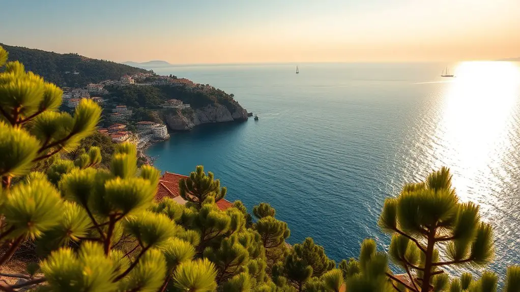
Büyükada, the largest of Istanbul’s Princes’ Islands in the Sea of Marmara, offers an idyllic escape from the urban hustle. Bounded by quiet pine forests, Victorian-era wooden mansions, and rocky coasts, the island is best explored on foot, by bicycle, or via municipal electric shuttles — private motor vehicles and historic horse-drawn phaetons have been entirely banned. Rising above the Sea of Marmara, Büyükada’s two wooded hills and coastal lookouts feature spectacular 360-degree vistas ranging from neighboring islets to the distant Istanbul skyline.
Quick Answer
Büyükada’s top viewpoints are Yücetepe Hill (202m), home to the historic Aya Yorgi Church; İsa Tepesi (164m), site of the monumental Prinkipo Greek Orphanage; Adakule Fire Tower, offering 360° island panoramas; and Dilburnu Nature Park on the west coast, ideal for sunset picnics overlooking Heybeliada. All viewpoints are accessible by foot, bicycle, or İETT electric shuttle from the main ferry pier.
Key Takeaways
- Büyükada sits in the Sea of Marmara; its high elevation points overlook neighboring Princes’ Islands and the Anatolian and European coastlines of Istanbul.
- Horse-drawn carriages (phaetons) were banned in 2020 and replaced by silent İETT electric public shuttles and taxis.
- Yücetepe (Aya Yorgi Hill) and İsa Tepesi represent the two main peaks offering the most comprehensive panoramic vistas.
- A full coastal bicycle loop covers approximately 12 kilometers along scenic cliffside paths and quiet coves.
Disclosure: As an Amazon Associate I earn from qualifying purchases. Some links on this page are affiliate links, at no extra cost to you.
Top Hilltop Viewpoints: Yücetepe and İsa Tepesi
Climbing away from Büyükada’s bustling ferry harbor leads into pine-shaded cobblestone paths and quiet residential lanes. The island features two distinct hilltops that reward hikers with unforgettable vistas:
Yücetepe (202 meters): As the highest peak on Büyükada, Yücetepe is crowned by the Aya Yorgi (St. George) Monastery complex. While monastic roots on this hilltop date back to the 6th century, the current Eastern Orthodox chapel was built in 1905. The summit serves as a celebrated pilgrimage destination, particularly during feast days on April 23 (St. George’s Day) and September 24. On these days, thousands of visitors hike the steep hill, often unraveling spools of thread along the trail or climbing in barefoot silence as part of a local wish-making tradition. From the stone terrace at the top, visitors enjoy sweeping, unobstructed vistas of the Sea of Marmara, neighboring islands, and the distant skyline of Istanbul. The adjacent Yücetepe Kır Gazinosu outdoor cafe provides refreshments alongside the views.
İsa Tepesi (164 meters): Positioned on the northern hill, İsa Tepesi (Hristos Hill) is famous for housing the historic Prinkipo Greek Orthodox Orphanage. Constructed in 1898 as a luxury hotel and casino by French-Ottoman architect Alexandre Vallaury, this colossal timber building is recognized as one of the largest wooden structures in Europe. Although closed to entry and enclosed by a protective perimeter fence due to structural instability, viewing the historic building from the outside remains a highlight. The surrounding elevated grounds offer serene, shaded lookouts over the Marmara shoreline and lower village roofs.
Pro Tip: The final ascent from Luna Park Square up to Aya Yorgi Church is steep, paved with smooth cobblestones, and inaccessible to motorized vehicles or public shuttles. Plan for a 15–20 minute uphill hike, wear sturdy footwear, and carry water during warm summer days.
Adakule Fire Tower and Forest Lookouts
Deeper in the island’s interior, dense pine and cypress forests cushion the paths, lowering temperatures and dampening sound. These high forest trails link the two major hills and harbor several elevated lookout posts.
Near Yücetepe on Hızır İlyas Hill stands Adakule, a multi-story stone fire observation tower operated by the Turkish General Directorate of Forestry. Elevated high above the canopy, Adakule commands a panoramic 360-degree view of Heybeliada, Burgazada, Kınalıada, and the open Sea of Marmara. While interior access depends on active forestry service operations, the hilltop clearing surrounding Adakule offers one of the quietest photo opportunities on the island.
Büyükada spans just 5.4 square kilometers, yet its forested hills and coastal cliffs provide enough scenic trails and historic vistas for a full day of exploration.
Note: Following a city-wide environmental mandate in 2020 by the Istanbul Metropolitan Municipality (İETT), traditional horse-drawn carriages were completely decommissioned. Visitors now navigate the island using silent electric public shuttles (BA-1, BA-2, and BA-3 routes), electric “Adamini” taxis, rental bicycles, e-scooters, or on foot.
Panoramic Village and Vista Points
Büyükada’s urban grid features elegant late-19th-century Victorian and Ottoman timber mansions, vibrant bougainvillea, and narrow cobblestone avenues. A variety of vista points provide vantage angles across both the historic village center and the sea.
Büyükada Viewpoint Comparison
To help plan your itinerary, the primary observation points across the island vary significantly in elevation, visual focus, and terrain:
| Vista Point | Elevation | Primary Panoramic View |
|---|---|---|
| Yücetepe (Aya Yorgi Hill) | 202m | Sea of Marmara, neighboring Princes’ Islands, Istanbul Asian & European coastlines |
| İsa Tepesi (Hristos Hill) | 164m | Northern coastline, village rooftops, and historic Greek Orphanage grounds |
| Adakule Fire Tower | ~200m | 360-degree panorama of forest canopy, Sea of Marmara, and Heybeliada |
| Dilburnu Nature Park | Coastal Cliff | Western sea channel, neighboring Heybeliada, and sunset horizon |
| Aşıklar Tepesi (“Lovers’ Hill”) | Mid-slope | Southern shoreline, quiet sea views, and romantic sunset vistas |
Historic Mansion Quarters
Walking through the Nizam and Maden neighborhoods reveals grand Victorian-era timber architecture, such as the famous Splendid Palas Hotel with its crimson shutters and domes. Looking back down from these elevated residential slopes rewards walkers with framed vistas of red-tiled roofs against the deep blue waters of the Marmara.
Coastal Slopes and Promenades
As roads gently decline toward the sea, visitors reach rocky coves and organized beach areas. The perimeter routes provide cool maritime breezes and continuous shoreline scenery ideal for cycling or casual walks.
Coastal Escapes and Sunset Spots
Beyond the high peaks, Büyükada’s shoreline contains distinct coastal viewpoints that showcase different aspects of the island’s natural geography.
Dilburnu Nature Park (West Coast)
Situated on a pine-covered peninsula projecting from Büyükada’s western shore, Dilburnu Nature Park overlooks the narrow strait separating Büyükada from neighboring Heybeliada. Unlike the eastern slopes facing the Asian mainland, Dilburnu is perfectly positioned for afternoon shade, coastal picnics, and watching the sun set directly behind Heybeliada.
Aşıklar Tepesi and Eastern Sunrise Views
For visitors seeking quiet romantic vistas, Aşıklar Tepesi (“Lovers’ Hill”) offers elevated bench seating along the southern ridge. On the island’s eastern coastline (along Maden district), early risers can watch the sunrise over the Maltepe and Kartal districts of Istanbul’s Asian shore.
Ferry Pier Promenade
The historical Ottoman ferry terminal built in 1915 serves as a vibrant gateway. The adjacent waterfront promenade offers charming cafes serving fresh seafood and Turkish tea, complete with direct views of passing passenger ferries and fishing vessels.
Warning: The forest paths leading up to Aya Yorgi Hill and Adakule are unlit after dark. If staying at the summit for sunset, carry a flashlight or headlamp and descend carefully along the steep cobblestone path before complete darkness falls.
Getting There & Practical Tips
Planning a trip to Büyükada’s viewpoints requires a basic understanding of ferry transit and island transportation:
- Ferry Routes & Departure Terminals: Public ferries operated by Şehir Hatları depart regularly from major European piers (Kabataş, Eminönü, Beşiktaş) and Asian piers (Kadıköy, Bostancı). Private fast ferries operated by Dentur Avrasya, Mavi Marmara, and Turyol also provide frequent service, particularly from Kabataş and Bostancı. Voyage duration ranges from 30 minutes (fast ferry from Bostancı) to 90 minutes (public ferry from Eminönü or Kabataş).
- Island Public Transportation: Pay for municipal İETT electric public shuttles (BA-1 Great Tour, BA-2 Small Tour, and BA-3 routes) and “Adamini” electric taxis using a standard Istanbulkart transit card. Rental bicycles and e-scooters are available near the main pier terminal. Note that steep cobbled paths leading up to Yücetepe require walking your bicycle.
- Best Time to Visit: Weekdays during spring (April–May) and autumn (September–October) offer comfortable hiking weather and shorter ferry queues. Summer weekends bring heavy crowds and higher temperatures on unshaded hill ascents.
Frequently Asked Questions
Are any viewpoints on Büyükada accessible for people with disabilities?
The ferry pier and lower village streets are flat and paved. Municipal electric shuttles take visitors to central junction points like Luna Park Square. However, the final steep cobblestone ascent to Yücetepe (Aya Yorgi) and the unpaved forest paths around İsa Tepesi and Adakule are not wheelchair accessible.
Can I bring my pet to the viewpoints?
Yes, pets are welcome on public ferries and hiking paths. Keep dogs leashed, particularly near church grounds, busy village streets, and forested areas where stray animals or local wildlife are present.
Are there dining or rest facilities near the high viewpoints?
Yes. At the summit of Yücetepe Hill, Yücetepe Kır Gazinosu provides outdoor seating, Turkish tea, cold beverages, and light snacks with sweeping sea views. Benches and water fountains are also positioned along the trail from Luna Park Square.
Are horse-drawn phaetons still available on Büyükada?
No. All horse-drawn phaetons were permanently banned in 2020 by local authorities to protect animal welfare. They have been completely replaced by silent, eco-friendly İETT electric minibuses and electric taxis.
Are the hilltop viewpoints open at night?
While hill roads are not gated, forest paths and the Aya Yorgi cobblestone trail lack night illumination. Visiting at night is discouraged for safety reasons. For late evening views, the waterfront pier promenade and harbor cafes offer illuminated sea views.
Conclusion
Büyükada rewards travelers who venture past the bustling ferry harbor: from the steep cobblestone climb up to Aya Yorgi Church on Yücetepe Hill to the majestic, historical silhouette of the Greek Orphanage on İsa Tepesi, and the peaceful sunset shores of Dilburnu Nature Park. With motorized cars and horse-drawn carriages replaced by quiet electric transit and bicycle pathways, Büyükada’s panoramic viewpoints remain serene, offering unmatched lookouts across the Sea of Marmara and the Istanbul coastline.
Sources
- Wikipedia: Büyükada — Island geography, location, and dimensions in the Sea of Marmara
- Wikipedia: Prinkipo Greek Orthodox Orphanage — Historical heritage and architectural significance of İsa Tepesi
- İETT (Istanbul Electricity, Tramway and Tunnel General Management) — Official transport regulations, electric vehicle routes, and banning of horse-drawn carriages
- İstanbul Valiliği (Governorship of Istanbul) — Provincial nature parks including Dilburnu Nature Park geography
