

Last Updated on July 24, 2026 by Ethan Caldwell
A good road trip route does more than connect two places. It balances driving time, safe breaks, fuel or charging stops, lodging, weather, road conditions, and the places you actually want to see. The best plan gives you a clear route for each day while leaving enough flexibility to handle traffic, closures, fatigue, or an unexpected stop.
Quick Answer
Plan a road trip route by choosing your must-see stops, setting a realistic daily driving limit, comparing primary and backup routes, and checking weather, closures, fuel, lodging, and rest areas. Save the route offline, share it with someone, and recheck live conditions before each driving day.
Key Takeaways
- Start with fixed destinations and dates, then add optional scenic stops around them.
- Plan breaks about every two hours or 100 miles, and stop sooner whenever you feel tired.
- Check official weather, 511 road information, closures, tolls, reservations, and vehicle limits.
- Use one app for the master itinerary and another for live navigation, traffic, or fuel prices.
- Download offline maps and keep a backup route in case service, weather, or road access changes.
At a Glance
| Time Required | About 30 to 60 minutes for a simple trip; longer for a multi-day route |
| Difficulty | Easy to moderate |
| Tools Needed | Map or trip-planning app, weather forecast, 511 road information, lodging details, and vehicle range data |
| Cost | Basic planning can be free; optional app subscriptions, tolls, permits, and reservations vary |
Disclosure: As an Amazon Associate I earn from qualifying purchases. Some links on this page are affiliate links, at no extra cost to you.
How Do You Plan the Best Road Trip Route?
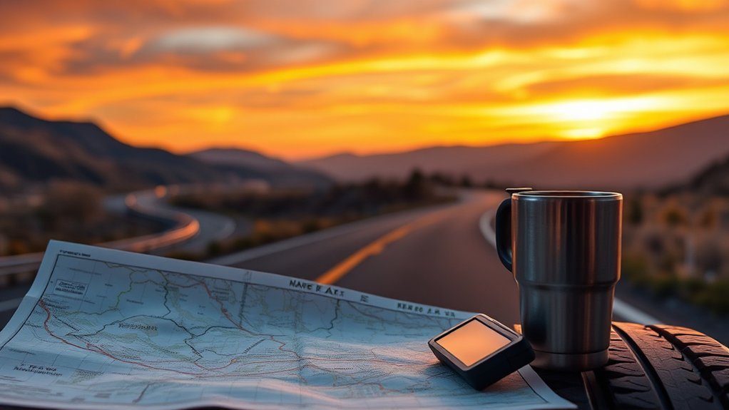
Start with the parts of the trip that cannot move, such as your departure date, final destination, hotel bookings, event times, or park reservations. Then build the route around those anchors. This keeps an attractive detour from causing a late arrival or an unsafe rush at the end of the day.
- Set the trip goal. Decide whether your priority is speed, scenery, food, national parks, small towns, or a mix.
- Choose must-see stops. Add only the places that would truly disappoint you to miss. Keep lower-priority places on a separate optional list.
- Compare route options. Look at total distance, drive time, tolls, road type, construction, seasonal closures, and fuel or charging access.
- Break the route into days. Plan each day around the driver, weather, daylight, road difficulty, and time needed at stops. Do not treat one fixed driving-hour target as safe for every person or route.
- Add rest, meal, fuel, and charging stops. Space them before you expect to need them, especially in rural areas.
- Confirm opening hours and reservations. Check attractions, parks, ferries, campgrounds, and hotels directly rather than relying only on map listings.
- Create a backup route. Save an alternate highway or overnight stop for closures, storms, traffic, or fatigue.
- Recheck the plan. Review weather and official road information the evening before and again before departure.
Google Maps supports multiple destinations, but it currently limits a route to nine stops including the final destination. For a longer trip, split the itinerary into daily routes or use a dedicated road trip planner.
Pro Tip: Put arrival deadlines, hotel check-in details, reservation numbers, and the last reliable fuel or charging stop in the notes for each day. This makes the route useful even when plans change.
Which Road Trip Planning Tools Work Best?
The best road trip planning tool depends on the job. Use a trip planner to build the full itinerary, a navigation app for live driving, and official sources for weather and road closures. No single app should be your only source.
| Tool | Best Use | Important Limit |
|---|---|---|
| Google Maps | Everyday directions, alternate routes, live traffic, and short multi-stop days | It does not automatically create the best stop order for a complex sales or delivery route, and stop limits apply |
| Waze | Live traffic, incident reports, and alternate routes during a drive | Driver reports may be incomplete, and the safest legal road signs and restrictions always take priority |
| Roadtrippers | Multi-day itineraries, attractions, waypoints, daily drive totals, and fuel estimates | Some planning features depend on the membership level and platform |
| GasBuddy | Finding reported fuel prices and stations along a route | Prices and user information can change, so confirm the station and detour before leaving the highway |
| iExit or similar exit guides | Services at upcoming interstate exits | Coverage and business details may vary by road and region |
| Roadside attraction tools and local tourism sites | Quirky landmarks, scenic stops, festivals, and lesser-known attractions | Check official hours, access rules, and parking before changing your route |
Use planning apps for convenience, but use official weather, road, park, and reservation sources for decisions that affect safety or access.
What Should You Check Before You Leave?
A route can look perfect on a map and still fail because of weather, construction, seasonal gates, low fuel availability, or a vehicle problem. Complete these checks before you lock the plan.
Weather and Road Conditions
Review the forecast for the full route, not only the destination. Mountain passes, desert heat, fog, wildfire smoke, flooding, and snow can affect different parts of the same trip. In the United States, use the 511 traveler information system or the relevant state transportation department for current closures, construction, and road conditions. The National Weather Service travel forecast tool can help with planning, but current road restrictions should still come from the responsible road agency.
Vehicle and Emergency Readiness
Check tires, tire pressure, fluids, lights, wipers, battery condition, brakes, and any open safety recalls. Pack a phone charger, first-aid kit, flashlight, jumper cables, drinking water, nonperishable food, basic tools, and weather-appropriate clothing. The National Highway Traffic Safety Administration road trip checklist gives a fuller emergency-kit and vehicle-preparation list.
Tolls, Permits, and Reservations
Check whether the route includes toll roads, ferries, border crossings, timed-entry areas, campgrounds, or attractions that need advance booking. Confirm cancellation rules and late-arrival procedures. For public lands in the United States, official park pages and Recreation.gov are safer sources than an old social post or map review.
Warning: Do not keep driving when you are struggling to stay awake. NHTSA advises getting adequate sleep before a long trip and pulling over in a safe, lighted place if drowsiness starts. A short nap and caffeine may help briefly, but they do not replace sleep.
How Do You Choose Safe Stops Along the Way?
Choose stops before you need them. A good stop is easy to enter and leave, has clear lighting and sightlines, and provides the service you need without a long detour. Busy does not always mean safe, and an app review cannot guarantee security, food safety, or fuel quality.
Well-Lit Rest Areas
At night, favor designated rest areas, travel plazas, or established businesses with lighting, visible entrances, working facilities, and other travelers nearby. Park where you can leave without being blocked, lock the vehicle, keep valuables out of sight, and stay aware of your surroundings. If a stop feels isolated or unsafe, leave and continue to another location when it is safe to do so.
- Check the stop before exiting the main road.
- Use official rest-area or state transportation information when available.
- Tell a passenger where you are going if you leave the vehicle.
- Keep your phone charged and avoid displaying cash or valuables.
Trusted Food and Fuel
For restaurants, look for recent reviews, posted inspection information where available, clean facilities, and steady customer activity. A familiar chain name alone does not prove food safety. For fuel, confirm the station carries the grade or connector you need and that the detour does not erase the savings.
| Stop Type | What to Check | Why It Matters |
|---|---|---|
| Restaurant | Current hours, recent reviews, inspection information, and cleanliness | Reduces the chance of arriving at a closed or unsuitable stop |
| Fuel Station | Fuel type, reported price, opening hours, payment method, and detour distance | Helps prevent range problems and false savings |
| EV Charger | Connector, charging speed, network access, recent status, and backup charger | Reduces the risk of reaching an incompatible or unavailable charger |
| Travel Plaza or Rest Area | Lighting, restrooms, parking layout, accessibility, and posted rules | Supports a safer and more useful break |
What Makes a Road Trip Schedule Enjoyable?
An enjoyable schedule leaves room for breaks, meals, traffic, and at least one unplanned stop. Instead of forcing the same number of driving hours every day, adjust the schedule for the driver, road type, weather, daylight, and how demanding the stops will be.
A practical day may include:
- A clear departure window rather than an exact minute-by-minute schedule.
- A planned break about every two hours or 100 miles, with earlier stops when needed.
- One main attraction and one optional stop instead of several rushed visits.
- Arrival before you are tired, especially on unfamiliar or rural roads.
- Extra time for parking, meals, charging, check-in, and local traffic.
The CDC drowsy-driving tip sheet recommends a break about every two hours or 100 miles. Treat that as a maximum planning interval, not permission to continue when you feel sleepy. Frequent yawning, heavy eyes, missed signs, lane drifting, or hitting a rumble strip mean it is time to stop safely.
How Do You Budget for Gas, Food, and Stays?
Build the budget from your actual route and current quotes instead of using one national daily average. Prices change by season, city, vehicle, and travel style.
Calculate Fuel or Charging Cost
For a gasoline vehicle, use this basic estimate:
Total fuel cost = total route miles ÷ expected real-world miles per gallon × expected fuel price per gallon.
Add extra miles for local driving, detours, and searching for parking. For an EV, use the vehicle’s expected efficiency, planned charger prices, charging losses, and possible session or parking fees. Keep a backup charging stop on long rural segments.
Price Food, Lodging, and Activities
- Food: List planned restaurant meals, groceries, snacks, water, and dietary needs.
- Lodging: Use the final checkout price, including taxes, parking, resort fees, pet fees, or charging fees.
- Activities: Include admission, permits, tours, equipment rental, and reservation charges.
- Road costs: Add tolls, ferries, parking, border fees, and public-transport connections.
- Contingency: Keep a separate amount for a tire problem, towing, a route change, or an unplanned hotel night.
Note: A cheaper fuel station is not always cheaper overall. Include the extra distance, time, tolls, and risk of reaching the station with a nearly empty tank.
Which Apps Help You Save Time and Money?
Use apps in a simple workflow rather than opening several while driving:
- Before the trip: Build the full itinerary in Google Maps, Roadtrippers, Wanderlog, or another planner that fits your trip.
- The night before: Check official weather, 511 road information, reservations, and the next day’s fuel or charging stops.
- During the drive: Let a passenger manage Waze, Google Maps, GasBuddy, or exit-guide searches. A solo driver should stop safely before changing the route or using the phone.
- At each major stop: Recheck the next segment because traffic, closures, prices, and charger status can change.
Roadtrippers can show trip distance, estimated drive time, waypoints, and fuel estimates. GasBuddy can help search for reported prices along a route. Waze and Google Maps can provide live traffic-based navigation. These tools may save time or money, but they cannot guarantee an open road, an accurate user report, or a safe stop.
How Do You Add Scenic Stops and Hidden Gems?
Add scenic stops only after the core route works. Search near the route rather than across a whole state, then compare the detour time with the time you can actually spend there. Check recent photos, access rules, opening hours, parking, and seasonal conditions before adding the stop.
Map Scenic Detours
Use Google Maps or a road trip planner to compare the main highway with a scenic byway or back road. Look at the full time difference, not only the mileage. A short mountain or coastal route can take much longer because of curves, viewpoints, traffic, weather, or slow speed limits.
- Choose an overlook, short trail, local restaurant, or roadside attraction that fits the day’s theme.
- Set a latest departure time so the detour does not push the final drive into darkness.
- Confirm that the road suits your vehicle and is open in the season you plan to travel.
Find Hidden Gems
Local tourism offices, official park pages, visitor centers, travel forums, local blogs, and social media can reveal waterfalls, murals, historic districts, diners, and quiet viewpoints. Treat personal posts as ideas, then verify access and hours with the attraction, land manager, or local authority.
Plan Local Stops
Group nearby stops so you do not cross the same town several times. Add a parking location when the attraction is in a busy area. Check festivals and seasonal events because they can create a memorable stop, but they can also change traffic, parking, room prices, and opening hours.
How Do You Prepare for Offline Areas and Route Changes?
Download the needed map areas before leaving Wi-Fi. Google Maps offline maps can provide driving directions when the full route is inside the downloaded area, but offline mode does not provide live traffic or alternate routes. Keep the day plan in more than one form.
- Save offline maps for each day’s route and update them before departure.
- Take screenshots or save a PDF of key turns, addresses, and reservation details.
- Carry a charging cable, power bank, and vehicle charger.
- Share the itinerary and expected arrival time with a trusted person.
- Keep a paper map for remote regions or a written list of major highways and towns.
- Save a backup hotel, fuel stop, charger, and alternate road for each long segment.
How Do You Adjust the Route for EVs, RVs, and Trailers?
Vehicle type changes the route. Standard navigation apps may not account for height, weight, length, propane restrictions, steep grades, trailer limits, or charger compatibility.
- EVs: Plan around real-world range, temperature, speed, elevation, charging speed, connector type, and a backup charger.
- RVs: Check bridge clearances, road width, campground access, fuel type, dump stations, and overnight parking rules.
- Trailers: Confirm tow ratings, tongue weight, brake requirements, turning space, parking, and roads that restrict trailers.
- Oversized vehicles: Use routing designed for the vehicle and verify restrictions with official road agencies. Google states that its standard navigation is not intended for oversized or emergency vehicles.
Frequently Asked Questions
How do you choose the best road trip route?
Choose the route that best balances time, safety, road conditions, scenery, tolls, fuel or charging access, and the stops that matter most. Compare at least one backup route and recheck weather and closures before each driving day.
Can ChatGPT help with route planning?
Yes. ChatGPT can help organize destinations, compare itinerary ideas, build checklists, estimate a budget from numbers you provide, and search for current information when web search is available. It is not a turn-by-turn navigation system, so verify routes, closures, weather, and access with navigation apps and official sources.
How do you get better at route finding?
Practice previewing the full route before departure. Learn the main highway numbers, towns, compass direction, and major turns. Compare the digital route with road signs and a paper or offline map so you are not dependent on one screen.
What app finds the most efficient route?
For a normal trip from one place to another, Google Maps or Waze can compare routes using current traffic. For many stops, use a dedicated multi-stop route optimizer or road trip planner. Google Maps lets you reorder stops, but it does not promise automatic stop-order optimization for a complex route.
How often should you stop on a long road trip?
Plan a break about every two hours or 100 miles, and stop earlier if you feel tired, stiff, hungry, or unfocused. Break timing should be shorter for difficult weather, night driving, mountain roads, older drivers, children, pets, or medical needs.
How many stops can you add in Google Maps?
Google Maps currently allows up to nine stops, including the final destination, in a multi-destination route. For a longer road trip, create a separate route for each day or use a dedicated itinerary planner.
What should you do if there is no cell service?
Use a downloaded offline map, follow road signs, and refer to saved addresses or a paper map. Remember that offline navigation may not show live traffic, closures, or alternate routes, so check current conditions before entering a remote area.
Conclusion
The best road trip route is safe, realistic, and flexible. Start with your fixed destinations, build manageable driving days, and add fuel, charging, food, rest, and scenic stops without crowding the schedule. Check official weather and road information, prepare the vehicle, save offline maps, and keep a backup route. With those steps in place, you can spend less time fixing problems and more time enjoying the drive.
Sources
- National Highway Traffic Safety Administration: Summer Driving and Road Trip Tips – vehicle checks, emergency kits, route checks, and safe driving.
- National Highway Traffic Safety Administration: Drowsy Driving – sleep, warning signs, and safe short-term responses.
- Centers for Disease Control and Prevention: Drowsy Driving Tip Sheet – the two-hour or 100-mile break recommendation.
- Google Maps Help: Get Directions and Show Routes and Offline Maps – stop limits, route choices, and offline limitations.
- Federal Highway Administration: About 511 – official traveler information for traffic and road conditions.
- Roadtrippers Support: Planning a Trip – waypoints, route customization, trip statistics, and feature limits.
