
Last Updated on July 28, 2026 by Daniel Globe
Santa Cruz lets you move from wind-shaped coastal bluffs to quiet redwood forest in the same day. The best route depends on how much time you have, whether you need an accessible surface, and whether you are bringing children or a dog. This guide compares the strongest coastal, redwood, family, and strenuous hikes while also covering current fees, closures, and safety basics.
Quick Answer
The best Santa Cruz hikes include the 2.5-mile Old Cove Landing–Ohlone Bluff route at Wilder Ranch, Henry Cowell’s 0.8-mile accessible Redwood Grove Loop, and the 6.3-mile Wilder Ridge Loop. For an easy coastal walk, choose West Cliff Drive, East Cliff Drive, or Seascape. Always check closures and dog rules first.
Key Takeaways
- For ocean views, start with Old Cove Landing and Ohlone Bluff at Wilder Ranch or the 2.5-mile West Cliff pathway.
- For old-growth redwoods, Henry Cowell’s 0.8-mile Redwood Grove Loop is the simplest first choice.
- Santa Cruz County lists 0.5-mile paths at Anna Jean Cummings, East Cliff Drive, and Seascape as suitable for strollers, walkers, and wheelchairs.
- Vehicle day-use fees are currently $10 at Wilder Ranch and Henry Cowell and $8 at the Forest of Nisene Marks; free county paths may still have limited parking.
- Dog access differs sharply by park, and several popular redwood and bluff trails do not allow pets.
- Storm damage, erosion, high water, and seasonal work can close trails with little notice, so check the official park page on the day of your hike.
Best Santa Cruz Hikes at a Glance
| Old Cove Landing–Ohlone Bluff | 2.5 miles, mostly flat; best easy coastal hike at Wilder Ranch. |
| Wilder Ridge Loop | 6.3 miles with about 600 feet of elevation change; moderate hills and Monterey Bay views. |
| Redwood Grove Loop | 0.8 mile with about 30 feet of elevation change; accessible old-growth redwood walk at Henry Cowell. |
| Cowell Highlights Loop | 5.9 miles with about 420 feet of elevation change; redwoods, sandhills, river, and broad views. |
| Big Ben | About 7.5 miles with 1,400 feet of elevation change; strenuous Fall Creek redwood hike. |
| West Cliff Drive | 2.5-mile wheelchair-accessible coastal pathway with benches, lighthouse views, and several access points. |
| East Cliff Drive or Seascape | Each is about 0.5 mile and listed by the county as suitable for strollers, walkers, and wheelchairs. |
Disclosure: As an Amazon Associate I earn from qualifying purchases. Some links on this page are affiliate links, at no extra cost to you.
How to Choose the Right Santa Cruz Hike
Start with your available time, then narrow the list by surface, shade, and park rules. Distances can change when you add overlooks or combine connecting trails, so use the mileage below as a planning baseline rather than a substitute for the map at the trailhead.
- Less than one hour: Redwood Grove Loop, Anna Jean Cummings Athletic Fields Loop, East Cliff Drive, or Seascape Coastal Bluff Trail.
- One to three hours: Old Cove Landing–Ohlone Bluff, Henry Cowell’s Observation Deck from the campground, or A.J.’s Point of View at Byrne-Milliron Forest.
- Half day: Wilder Ridge Loop, Cowell Highlights Loop, or a longer out-and-back in the lower Forest of Nisene Marks.
- Full day: Wilder Ranch’s Destination: Redwoods route or Henry Cowell’s Big Ben hike.
- With wheels: Favor county-listed accessible paths or Henry Cowell’s Redwood Grove Loop; recent rain, debris, and maintenance can still affect the surface.
Pro Tip: Download the official map before leaving town. Cell service can fade in redwood canyons, and several parks have intersecting fire roads and similarly named trails.
Before You Go: Fees, Closures, and Safety
Check the official park page shortly before departure. As of July 2026, the Forest of Nisene Marks lists the West Ridge Trail Camp, Aptos Creek Trail, and the route toward Five Finger Falls beyond the Big Slide/Aptos Creek intersection as closed because of storm damage and erosion. The park also has single-lane vehicle access in some areas and prohibits parking on Aptos Creek Road.
Current regular vehicle day-use fees are $10 at Wilder Ranch, $10 at Henry Cowell, and $8 at the Forest of Nisene Marks. Payment options and lot availability can change. Follow the entrance-station, kiosk, or pay-by-phone instructions posted at the park.
Warning: Stay well back from unstable bluff edges and never turn your back on the ocean. Large or unexpected waves can sweep across beaches and exposed rocks. On inland hikes, turn around if a creek crossing is fast, deep, or difficult to identify.
Note: Poison oak and ticks are common in the Santa Cruz Mountains. Stay near the center of marked trails, avoid brushing against vegetation, use an appropriate insect repellent, and check clothing, children, and pets after the hike.
Top Coastal Hikes With Ocean Views
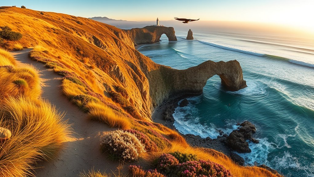
Santa Cruz’s strongest coastal walks range from mostly flat bluff paths to rolling inland ridges. Wilder Ranch gives you the most complete trail experience, while West Cliff Drive, East Cliff Drive, and Seascape work better when you want a shorter or more accessible outing.
Old Cove Landing and Ohlone Bluff
California State Parks recommends a 2.5-mile, mostly flat route from the Wilder Ranch parking lot along Old Cove Landing Trail and Ohlone Bluff Trail. The walk passes an overlook above Wilder Beach, historic landing sites, and coastal habitat where you may see pelicans, harbor seals, sea otters, dolphins, or migrating whales. Stay on signed routes and respect fenced habitat areas.
Wilder Ridge Loop
The full Wilder Ridge Loop is 6.3 miles with about 600 feet of elevation change. A shorter option is to hike roughly two miles to the Monterey Bay overlook and return for an outing of about four miles. The route crosses rolling grassland, chaparral, oak woodland, and small redwood pockets. It is more exposed than the bluff route, so carry sun protection and a wind layer.
West Cliff Drive
The City of Santa Cruz describes West Cliff as a 2.5-mile wheelchair-accessible multi-use pathway. It links ocean overlooks, the lighthouse area, surf breaks, benches, and access toward Natural Bridges. Coastal erosion projects and temporary detours can affect sections of the corridor, so follow current signs rather than assuming the whole route has its usual layout.
East Cliff Drive and Seascape
For a quick ocean-view walk, choose the 0.5-mile East Cliff Drive County Parkway at Pleasure Point or the 0.5-mile Seascape Coastal Bluff Trail in Aptos. Both are listed by Santa Cruz County as suitable for strollers, walkers, and wheelchairs. Seascape has benches and a restroom; East Cliff has restrooms at both ends.
Best Redwood Trails for Serene Forest Walks

For old-growth trees and a simple route, Henry Cowell is the easiest recommendation. The Forest of Nisene Marks feels wilder and has far more route combinations, while Wilder Ranch’s Enchanted Loop adds a small redwood ravine to a longer grassland hike.
- Henry Cowell Redwood Grove Loop: 0.8 mile, about 30 feet of elevation change, wheelchair accessible, and close to the visitor center.
- Henry Cowell Cowell Highlights Loop: 5.9 miles with about 420 feet of elevation change through redwoods, sandhills, river habitat, and viewpoints.
- Forest of Nisene Marks: 30 miles of trails and roads through second- and third-growth redwood forest; choose a lower-park out-and-back that avoids current closure zones.
- Wilder Ranch Destination: Redwoods: about 8 miles with 600 feet of elevation change, combining Wilder Ridge with the Enchanted Loop ravine.
At Nisene Marks, the 0.12-mile Waggoner Overlook Trail provides a short accessible redwood experience and an overlook of Aptos Creek. The first 0.12 mile of Aptos Creek Fire Road is also generally accessible, but grades become much steeper beyond that point.
Family-Friendly Short Trails and Park Loops
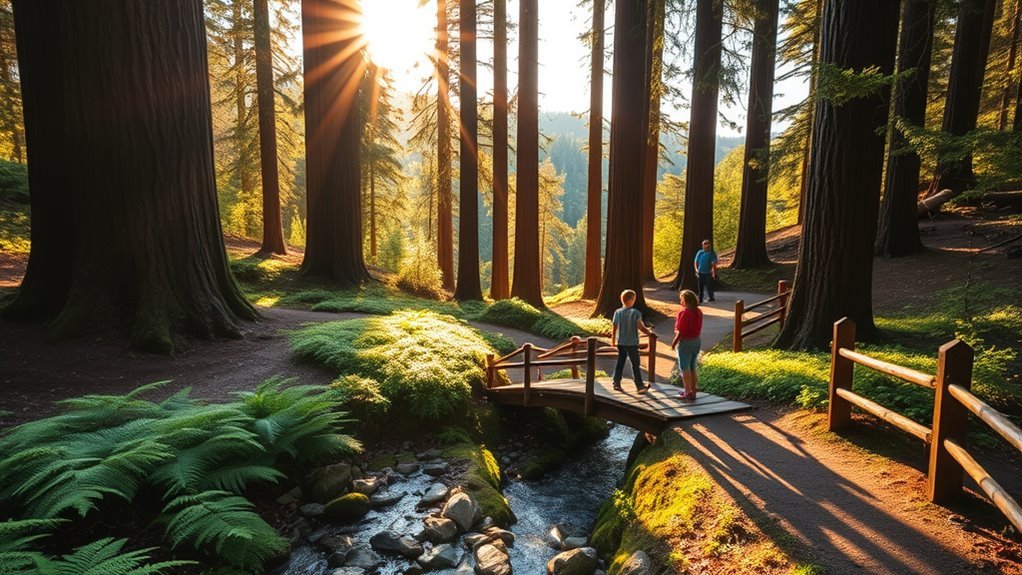
Short county paths are useful when children need a predictable surface, nearby restrooms, and room for a snack break. The county’s trail guide is especially helpful because it states which routes are suitable for strollers, walkers, and wheelchairs.
Short Paved Loops
- Anna Jean Cummings Athletic Fields Loop: 0.5 mile on compacted dirt and concrete paving, with restrooms, picnic tables, lawn, and a playground.
- East Cliff Drive County Parkway: 0.5 mile on decomposed granite and paved concrete, with Monterey Bay views and restrooms at both ends.
- Seascape Coastal Bluff Trail: 0.5 mile on decomposed granite, with benches, a restroom, and coastal viewpoints.
Picnic-Ready Green Spaces
Anna Jean Cummings and Seascape combine short paths with lawns or picnic space. Pinto Lake County Park gives families a longer option: its 2.7-mile trail is relatively flat, shaded in places, and passes a meadow, disc-golf area, mature coast live oaks, and lake habitat. Wilder Ranch has a picnic lawn near the historic complex, making it easy to pair lunch with the Old Cove Landing route.
Accessible Beach Strolls
East Cliff Drive and Seascape are the clearest county-listed choices for stroller and wheelchair users who want ocean views. West Cliff provides a much longer accessible corridor, although construction, crowding, cross slopes, and weather can affect the experience. Check the most recent accessibility details and plan a shorter turnaround point when needed.
Challenging Day Hikes for Experienced Hikers

For a hard local day hike, use routes published by California State Parks rather than relying on a crowd-sourced loop name that may combine closed, unsigned, or seasonally unsafe segments.
- Big Ben, Henry Cowell Fall Creek Unit: about 7.5 miles round trip with 1,400 feet of elevation change. The route passes kiln ruins and reaches one of the unit’s remaining old redwoods.
- Destination: Redwoods, Wilder Ranch: about 8 miles with 600 feet of elevation change. It combines exposed terraces with the Enchanted Loop’s shaded redwood ravine.
- Cowell Highlights Loop: 5.9 miles with 420 feet of elevation change. It is not as steep as Big Ben, but the varied terrain and route network require a map.
- Four Crossings, Henry Cowell: about 5 miles with 600 feet of elevation change and four unbridged river crossings. State Parks recommends it from July through October and warns that the crossings can be hard to locate.
Warning: Do not attempt Four Crossings when the river is high. California State Parks advises choosing another hike if the water rises above knee height. Carry a map, extra water, layers, food, and a headlamp on long routes.
Wilder Ranch State Park Highlights
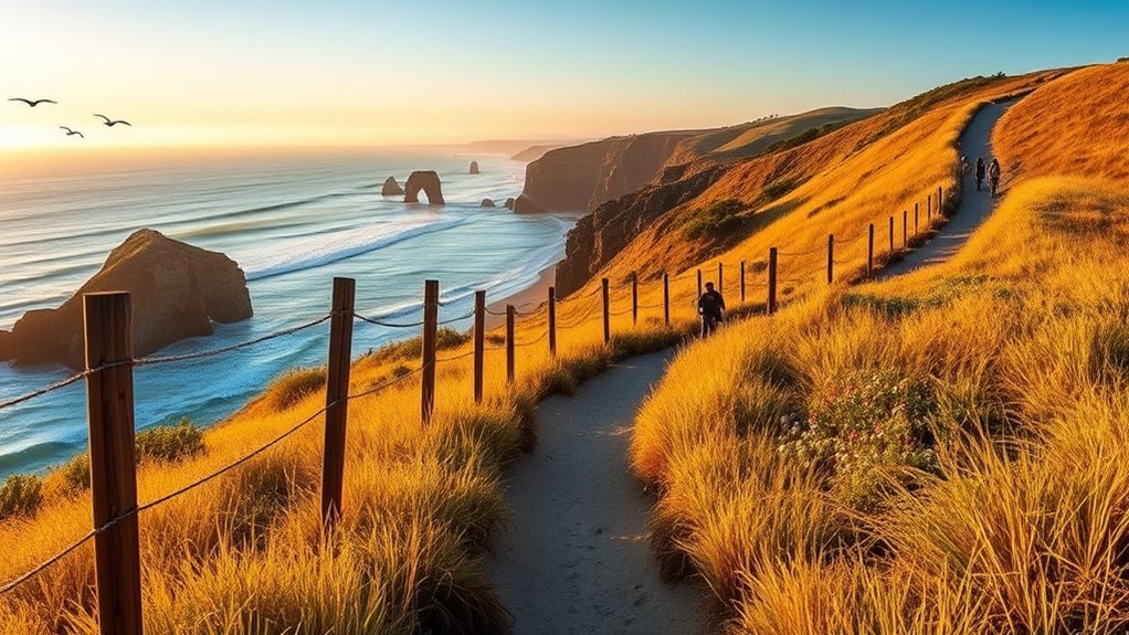
Wilder Ranch covers about 7,000 acres and has more than 35 miles of trails across coastal bluffs, working ranchland, grass terraces, oak woodland, and redwood pockets. Historic features include an 1897 Victorian home, an 1859 Gothic Revival farmhouse, and an 1896 water-powered machine shop.
Wilder Ranch is the best single park for combining a mostly flat ocean-bluff walk, a moderate ridge hike, redwood pockets, wildlife viewing, and California ranch history.
Regular vehicle day use is $10. California State Parks currently lists free public ranch tours on Saturdays and Sundays at 1 p.m., with no reservation required, but visitors should check the event calendar or call the park to confirm. Dogs are not allowed at Wilder Ranch except for service animals. Hikers share trails with bicycles, and some inland routes also carry equestrian traffic.
- Best easy hike: Old Cove Landing to Ohlone Bluff, 2.5 miles and mostly flat.
- Best moderate hike: Wilder Ridge Loop, 6.3 miles and 600 feet of elevation change.
- Best long route: Destination: Redwoods, about 8 miles.
- Best non-hiking stop: Historic ranch complex and picnic lawn.
The Forest of Nisene Marks Must-Do Routes
The Forest of Nisene Marks protects nearly 10,000 acres and offers 30 miles of trails and roads in rugged redwood country. Much of the forest is second- and third-growth, with a smaller old-growth grove near the Pourroy picnic area. The setting is quieter and less developed than Henry Cowell, but route planning matters because the network is large and storm damage can close interior trails.
- Short accessible option: Waggoner Overlook Trail, 0.12 mile through redwoods to an Aptos Creek overlook.
- Flexible easy-to-moderate option: Walk an out-and-back on the open lower section of Aptos Creek Fire Road, turning around before grades or conditions exceed your group’s comfort.
- History-focused outing: Use open routes near the lower park to see evidence of the former logging landscape; do not enter closed sections toward Aptos Creek Trail or Five Finger Falls.
The regular vehicle day-use fee is $8. Dogs on leashes no longer than six feet are allowed on Aptos Creek Fire Road and four single-track trails below the steel bridge: Aptos Rancho, Split Stuff, Terrace, and Vienna Woods. Except for service animals, dogs are prohibited beyond the gate at the Porter picnic-area parking lot. There is currently no camping in the park.
Current Access Note: As of July 2026, West Ridge Trail Camp, Aptos Creek Trail, and the route to Five Finger Falls beyond the Big Slide/Aptos Creek intersection are closed until further notice. Recheck the official park page before publication and before each visit.
Henry Cowell Redwoods State Park Picks
Henry Cowell spans more than 4,650 acres and offers 30 miles of hiking trails across old-growth redwoods, river habitat, grassland, and rare sandhills. It is the best Santa Cruz-area park when your group includes both first-time visitors and stronger hikers.
- Easy: Redwood Grove Loop, 0.8 mile and 30 feet of elevation change.
- Easy with river habitat: Meadow–River Loop, about 1 mile on gentle terrain.
- Short viewpoint: Observation Deck from the campground, about 1 mile round trip with 250 feet of elevation change.
- Moderate viewpoint: Observation Deck from the visitor center, about 5 miles round trip with 600 feet of elevation change.
- Varied half-day hike: Cowell Highlights Loop, 5.9 miles with 420 feet of elevation change.
- Strenuous: Big Ben, about 7.5 miles with 1,400 feet of elevation change.
Regular vehicle day use is $10. The Redwood Grove Loop does not allow dogs, bicycles, or horses. Dogs are allowed on leash in picnic areas and campsites and on Meadow Trail, Pipeline Road, Graham Hill Trail, and Powder Mill Fire Road; they are not allowed in the Fall Creek Unit.
South County Beach and Wetland Walks
South County offers shorter bluff paths, lake walks, and a steeper forest overlook without the crowds found near central Santa Cruz.
- Seascape County Park: 0.5-mile accessible Coastal Bluff Trail with benches, a restroom, picnic space, and possible marine-wildlife sightings.
- A.J.’s Point of View: about 2.2 miles round trip in the 402-acre Byrne-Milliron Forest, reached by a steep climb through redwoods and bay oaks. Review the Land Trust’s current visitor information before using the narrow access road.
- Pinto Lake County Park: 2.7 miles on a relatively flat, partly shaded trail with meadow and waterbird habitat.
These areas are better for quiet walking and birding than for dramatic ocean cliffs. Bring binoculars, keep noise low, and avoid blocking narrow access roads or neighborhood driveways.
Easy Accessible Trails for Strollers and Wheelchairs
Accessibility varies by surface, slope, weather, and the user’s equipment. The following routes have the clearest official accessibility information:
- West Cliff Drive: 2.5-mile wheelchair-accessible multi-use coastal pathway; temporary projects or detours may alter a section.
- East Cliff Drive County Parkway: 0.5 mile; good for strollers, walkers, and wheelchairs.
- Seascape Coastal Bluff Trail: 0.5 mile; good for strollers, walkers, and wheelchairs.
- Anna Jean Cummings Athletic Fields Loop: 0.5 mile; compacted dirt and concrete paving, with restrooms and a playground.
- Henry Cowell Redwood Grove Loop: accessible for 0.75 mile of the 0.8-mile loop.
- Henry Cowell Meadow Trail: accessible for at least 0.5 mile.
- Henry Cowell River Trail: accessible for the first 4,000 feet after connecting from Meadow Trail.
- Nisene Marks Waggoner Overlook Trail: 0.12 mile to a redwood overlook and accessible picnic area.
Call the park when a visitor needs detailed information about grades, cross slopes, restroom access, drop-off points, or wheelchair availability. Rain and fallen debris can temporarily change an otherwise usable route.
Seasonal Wildflower and Wildlife Viewing Spots
Wildlife is present year-round, but timing changes what you are most likely to see. NOAA notes that gray whales migrate south through Monterey Bay in winter and that cow-calf pairs travel north close to shore in spring. Humpback whales begin arriving in spring and may remain into fall. Sightings are never guaranteed.
Spring Wildflower Hotspots
Open grasslands and coastal terraces usually provide the clearest spring displays. Try Wilder Ranch’s Old Cove Landing and Wilder Ridge routes, the sandhill paths near Henry Cowell’s Observation Deck, or the climb to A.J.’s Point of View. Stay on the trail so you do not trample small plants or enter protected habitat.
- Wilder Ranch: coastal terraces, grassland, and bluff edges.
- Henry Cowell: sandhills and open routes near the Observation Deck.
- Byrne-Milliron: forest-edge blooms and a broad South County overlook.
Coastal Marine Wildlife Viewing
Old Cove Landing, Ohlone Bluff, West Cliff Drive, East Cliff Drive, and Seascape provide the easiest places to scan the water. Look for sea otters, harbor seals, dolphins, seabirds, and whale blows. Use binoculars instead of approaching wildlife, and remain outside fenced nesting or resting areas.
Birding in Wetlands
Pinto Lake is the simplest flat birding walk in this guide. A.J.’s Point of View gives a higher look across South County wetlands, while Wilder Ranch adds coastal raptors and seabirds. Early morning usually brings lighter foot traffic and calmer observation conditions.
- Pinto Lake: waterbirds, mature oaks, and a relatively flat loop.
- A.J.’s Point of View: a steep route to a wetland overlook.
- Wilder Ranch and Seascape: seabirds, raptors, and marine wildlife from bluff viewpoints.
Frequently Asked Questions
Are dogs allowed on Santa Cruz hiking trails?
Rules vary. Wilder Ranch does not allow dogs except service animals. Henry Cowell allows leashed dogs in picnic areas, campsites, and on Meadow Trail, Pipeline Road, Graham Hill Trail, and Powder Mill Fire Road, but not on Redwood Grove Loop or in Fall Creek. Nisene Marks allows leashed dogs on Aptos Creek Fire Road and four named trails below the steel bridge. County parks generally allow leashed dogs, with posted exceptions.
What is the best easy redwood hike near Santa Cruz?
Henry Cowell’s Redwood Grove Loop is the best first choice. It is 0.8 mile with about 30 feet of elevation change, passes through a 40-acre old-growth grove, and is wheelchair accessible for 0.75 mile.
Which Santa Cruz hikes are best for strollers or wheelchairs?
Strong options include West Cliff Drive, East Cliff Drive County Parkway, Seascape Coastal Bluff Trail, Anna Jean Cummings Athletic Fields Loop, and most of Henry Cowell’s Redwood Grove Loop. Surface conditions and construction can change, so review the official accessibility page or call ahead when grade and cross-slope details matter.
How much does parking cost at the main state parks?
Regular vehicle day use is currently $10 at Wilder Ranch and Henry Cowell and $8 at the Forest of Nisene Marks. Prices, payment systems, and lot availability can change. County coastal paths are generally free to enter, but parking may be limited or regulated.
Which trails are open year-round?
Many coastal and lower-park routes are normally available throughout the year, but storms, erosion, high creek levels, habitat protection, and maintenance can trigger temporary closures. As of July 2026, several interior routes at Nisene Marks remain closed. Check the official park alert page on the day of your hike.
What are the best nearby campgrounds or overnight stays?
Henry Cowell and New Brighton State Beach offer reservable camping. As of July 2026, Seacliff State Beach campground remains closed because of 2023 storm damage, and all Big Basin campgrounds are closed during wildfire recovery. Check ReserveCalifornia and each park’s official alert page before booking.
Where can I find guided walks or tours?
California State Parks lists public programs on each park’s event calendar. Wilder Ranch currently advertises free ranch tours on Saturdays and Sundays at 1 p.m., and Henry Cowell offers guided Redwood Grove walks on selected dates. Confirm the schedule before driving to the park.
Conclusion
Santa Cruz rewards a simple plan: choose coast or redwoods first, match the mileage to your group, and leave time to stop at viewpoints. Old Cove Landing is the best easy bluff walk, Redwood Grove Loop is the strongest short redwood hike, and Wilder Ridge or Big Ben delivers a harder day. Bring layers, water, a downloaded map, and enough flexibility to change routes when weather or closures demand it.
Sources
- Wilder Ranch State Park — California State Parks — current fees, dog policy, trail mileage, park history, and public tours
- Henry Cowell Redwoods State Park — California State Parks — trail distances, accessibility, fees, and dog rules
- The Forest of Nisene Marks State Park — California State Parks — closures, fees, dog access, and camping status
- Santa Cruz County Trails & Hikes — county trail distances, restrooms, dog rules, and stroller/wheelchair guidance
- West Cliff — City of Santa Cruz — pathway length, accessibility, parking, and facilities
- Hiking Safety Tips — California State Parks — map, tick, poison-oak, hydration, and trail-safety guidance
