
Last Updated on July 24, 2026 by Daniel Globe
Hiking near Los Angeles can mean anything from a short desert loop to a full-day mountain climb. The region gives you access to Griffith Park, the San Gabriel Mountains, Joshua Tree, and even Channel Islands National Park, while bigger California hikes such as Big Pine Lakes and Half Dome work better as extended road trips. The best choice depends on your fitness, season, driving time, and whether the route requires a permit, ferry, or special safety planning.
Quick Answer
The best hikes near Los Angeles range from the roughly 6-mile Brush Canyon route to the Hollywood Sign and the demanding Bridge to Nowhere to short Joshua Tree loops such as Hidden Valley and Barker Dam. For bigger road trips, Big Pine Lakes and Half Dome add alpine scenery but require more planning.
Key Takeaways
- For a classic LA hike, the Hollywood Sign via Brush Canyon combines city views with a moderate workout.
- Bridge to Nowhere and Mt. Islip are stronger choices when you want a harder San Gabriel Mountains hike.
- Hidden Valley and Barker Dam are short Joshua Tree options, while 49 Palms Oasis is closed every year from June 1 through September 30.
- The Devil’s Punchbowl Loop Trail is open, but the longer Devil’s Chair Trail is currently closed until further notice.
- Potato Harbor requires a boat trip to Santa Cruz Island, while Big Pine Lakes and Half Dome are better treated as weekend or road-trip hikes from Los Angeles.
Note: “Near Los Angeles” is used broadly here. Hollywood, the San Gabriels, and Joshua Tree can work as day trips for many travelers, while Big Pine Lakes and Yosemite require substantially more driving and are usually better as overnight or weekend trips.
Disclosure: As an Amazon Associate I earn from qualifying purchases. Some links on this page are affiliate links, at no extra cost to you.
How to Choose a Hike Near Los Angeles
Start with the amount of time you have. For a shorter outing, Hidden Valley, Barker Dam, or the Devil’s Punchbowl Loop can fit into a relaxed day. Brush Canyon offers a longer urban hike without leaving Los Angeles, while Bridge to Nowhere and Mt. Islip demand more stamina and mountain preparation.
| Hike | Approx. Distance | Difficulty | Best For | Key Planning Note |
|---|---|---|---|---|
| Bridge to Nowhere | About 10 miles | Strenuous | Canyon adventure | River crossings and heat |
| Hollywood Sign via Brush Canyon | About 6 miles | Moderate | LA skyline views | Exposed trail; limited parking |
| Big Pine Lakes | Varies by turnaround | Strenuous | High-alpine lakes | Best as an extended road trip |
| Half Dome | 14–16.4 miles | Very strenuous | Iconic Yosemite challenge | Permit required when cables are up |
| Devil’s Punchbowl Loop | About 1 mile | Moderate | Geology | Devil’s Chair remains closed |
| Potato Harbor | 5 miles round trip | Moderate | Island coastline | Advance ferry planning |
| 49 Palms Oasis | 3 miles round trip | Moderate | Desert oasis | Closed June 1–September 30 |
| Hidden Valley | 1 mile | Easy | Families and first visits | Little shade |
| Barker Dam | 1.1 miles | Easy | Rock formations and history | Reservoir may be dry |
| Mt. Islip | Roughly 6–7 miles, route dependent | Moderate to strenuous | Mountain views | Check snow and forest conditions |
Before You Go: Closures, Permits, Weather, and Safety
Trail conditions around Southern California can change quickly because of wildfire damage, washouts, heat, snow, and restoration work. Check the managing agency’s official trail or alert page shortly before leaving, even if you have hiked the route before.
- Carry enough water: Desert routes and exposed San Gabriel trails may have little or no dependable drinking water.
- Plan around heat: Joshua Tree and low-elevation canyon hikes can become dangerous during hot weather. Start early and turn around before heat becomes a problem.
- Respect water crossings: Never force a river or creek crossing when the current, depth, or footing looks unsafe.
- Watch high-elevation weather: Snow and ice can linger in the San Gabriels and Sierra Nevada well beyond winter.
- Know your permit and transportation requirements: Half Dome has a permit system, overnight wilderness trips may require permits, and Santa Cruz Island requires advance boat planning.
Warning: Do not treat mileage alone as a measure of difficulty. Heat, elevation, river crossings, exposed terrain, thunderstorms, snow, and limited cell service can turn a familiar-looking trail into a serious outing. Turn around when conditions exceed your experience or equipment.
Pro Tip: Save the official trail or park page offline before leaving. Several of these areas have weak or nonexistent mobile coverage, so you should not depend on a live connection for navigation or last-minute logistics.
Bridge to Nowhere — San Gabriel Mountains
The Bridge to Nowhere is one of the more adventurous full-day hikes within reach of Los Angeles. The outing is roughly 10 miles round trip through the East Fork of the San Gabriel River, with repeated river crossings and stretches of exposed canyon terrain. Plan on several hours rather than treating it as a quick morning walk.
The destination is a roughly 120-foot-high bridge left behind after a planned mountain road was abandoned. The bridge sits on a private inholding, where a commercial bungee operator has long offered jumps. That activity is separate from the public hiking route, so follow posted boundaries and instructions rather than assuming the bridge itself is public recreation property.
The river is the biggest variable. Water depth and current can change after storms or snowmelt, while summer heat can make the canyon punishing. Flash-flood risk also deserves respect. Check current Angeles National Forest alerts before leaving, and do not attempt a crossing that looks unsafe.
Hollywood Sign Hike via Brush Canyon Trail
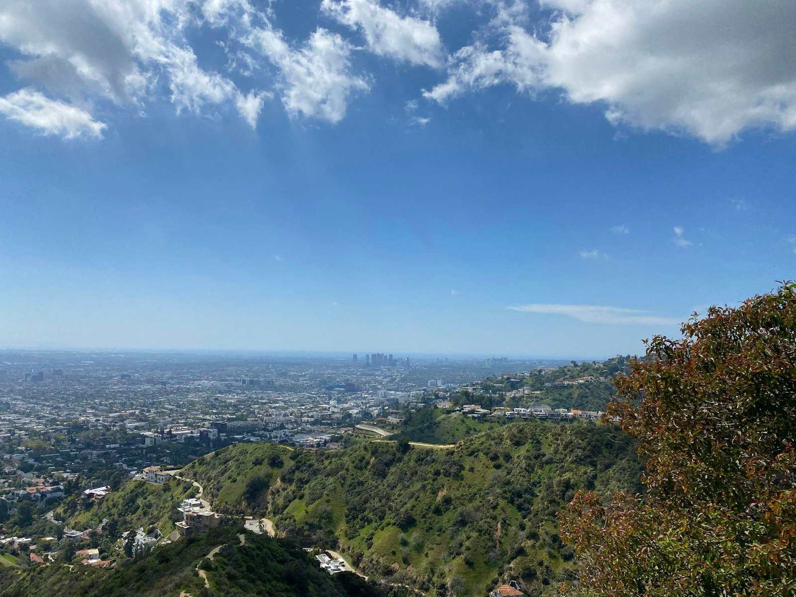
For a hike that feels unmistakably Los Angeles, the Brush Canyon route to the Hollywood Sign combines Griffith Park scenery with broad city views. The official Hollywood Sign hiking guide lists the route at about 6 miles, and hikers should expect a steady uphill workout with substantial sun exposure.
The route climbs from the Canyon Drive area toward Mt. Lee, where you can reach viewpoints behind and above the Hollywood Sign. The letters themselves are fenced and protected, so stay on authorized trails and do not attempt to approach or touch them. Griffith Park trails are generally open from sunrise to sunset.
Parking can be one of the hardest parts of a busy weekend visit. Arrive early and review the official Hollywood Sign hiking information before you go. Bronson Caves, sometimes called the “Batman Cave” because of its television history, can be treated as a separate nearby detour rather than part of the core Brush Canyon hike.
Big Pine Lakes — Sierra Nevada Mountains
Big Pine Lakes is not a quick Los Angeles-area hike, but it earns a place on the list as a high-alpine road-trip option. The North Fork of Big Pine Creek climbs into the eastern Sierra through a chain of lakes framed by steep granite peaks. First, Second, and Third Lakes are among the best-known stops, and Third Lake is directly fed by Palisade Glacier.
There is no single mileage that fits every Big Pine Lakes outing because hikers can turn around at different lakes or continue farther into the basin. Even reaching the earlier lakes involves meaningful elevation gain, so treat this as a strenuous mountain day rather than a casual lakeside walk.
The Inyo National Forest Big Pine Canyon guide is useful for trailhead, route, and wilderness information. Weather can change rapidly at elevation, and water from natural sources should be properly treated. Overnight wilderness trips require additional permit planning, so check current Inyo National Forest and Recreation.gov requirements before booking a backpacking trip.
Half Dome Hike — Yosemite National Park
Half Dome is the biggest undertaking in this roundup and should be treated as a dedicated Yosemite trip rather than a normal day hike from Los Angeles. Depending on the exact route, the outing is about 14 to 16.4 miles round trip with roughly 4,800 feet of elevation gain.
The trail passes Vernal Fall and Nevada Fall before climbing toward the subdome and the famous cable section. A Half Dome permit is required whenever the cables are up. Yosemite distributes day-hiking permits through preseason and daily lotteries, so this is a hike that must be planned rather than improvised.
The final cable ascent is steep and exposed. Wet granite, thunderstorms, fatigue, and crowding can dramatically increase the danger. Do not continue onto the cables when rain or thunderstorms threaten, and be willing to turn around even after investing most of the day in the climb.
Warning: A Half Dome permit is not proof that conditions are safe. Weather and trail conditions still determine whether you should continue, especially on the exposed subdome and cable section.
The Devil’s Punchbowl — San Gabriel Mountains
Devil’s Punchbowl Natural Area near Pearblossom is a good choice when you want dramatic geology without committing to an all-day mountain climb. The open Loop Trail is roughly a mile long, but it is not level: the route drops about 300 feet into the formation before climbing back out.
The landscape is defined by steeply tilted sedimentary sandstone formations shaped by the active fault systems of the region. That gives the Punchbowl its sharp, folded appearance and makes the short route much more interesting than its mileage suggests.
The longer Devil’s Chair Trail should not currently be part of your plan. LA County reports that it is closed until further notice because of washouts, downed trees, and an unsafe Punchbowl Creek crossing. Use the Loop Trail instead and check for updated conditions before traveling to the area.
Potato Harbor — Channel Islands National Park
Potato Harbor on Santa Cruz Island gives you a completely different experience from the mainland hikes. From the Scorpion area, the National Park Service lists the hike at about 5 miles round trip and rates it moderate. The route follows exposed island terrain to high coastal viewpoints above Potato Harbor.
Expect open-ocean views, rugged cliffs, grassland, and the possibility of seeing island wildlife along the way. Potato Harbor itself does not provide beach access, so this is primarily a viewpoint hike rather than a place to finish with a swim.
Getting there requires more planning than driving to a trailhead. The islands are reached by concessionaire or private boat, and advance reservations are strongly recommended. Review the NPS pages for Santa Cruz Island hiking and island transportation. Carry everything you need for the day, allow enough time to return to the landing, and do not count on reliable cell service.
49 Palms Oasis Trail — Joshua Tree National Park
The 49 Palms Oasis Trail is a roughly 3-mile out-and-back hike through rocky desert hills to a secluded fan-palm oasis. The route gains about 300 feet in each direction, so the return trip includes another climb rather than being an easy downhill walk back to the trailhead.
This is best treated as a cool-season hike. Joshua Tree National Park closes the trail every year from June 1 through September 30 because of extreme heat and wildlife use of the oasis. During that closure window, choose another open park trail instead of trying to enter the route.
Outside the seasonal closure, expect little shade before reaching the palms. Carry plenty of water, protect yourself from the sun, and check the park’s seasonal closures and restrictions before making the drive.
Hidden Valley Trail — Joshua Tree National Park
Hidden Valley is one of the easiest ways to experience Joshua Tree’s signature granite formations. The trail is a 1-mile loop with roughly 100 feet of total elevation gain, and many visitors complete it in about 30 to 60 minutes.
Although the route is beginner-friendly, it is not simply a perfectly flat paved stroll. Expect natural trail surfaces and some rocky sections as you move through the enclosed valley. There is also little dependable shade, so even a short hike deserves water and sun protection.
Its central location and dramatic boulders make Hidden Valley especially useful for families, first-time park visitors, and travelers who want a short walk between longer stops. Parking can fill during busy periods, so an early start helps on crowded weekends and holidays.
Barker Dam — Joshua Tree National Park
Barker Dam offers another short Joshua Tree hike with more variety than its distance suggests. The National Park Service lists the loop at about 1.1 miles with roughly 50 feet of elevation gain, making it accessible to many visitors who are comfortable on a natural desert trail.
The route passes granite formations, desert vegetation, historic ranching features, and the dam itself. Water in the reservoir is not guaranteed. It may collect after sufficient rainfall, but the area is often dry for long periods, so do not plan the hike around seeing a full pond.
Stay on the established route, respect cultural and historic features, and remember that park water sources are not swimming or wading areas. The NPS Barker Dam trail information provides current planning details.
Mt. Islip — San Gabriel Mountains
Mt. Islip is a strong choice when you want a higher-elevation San Gabriel Mountains hike without committing to the scale of a Sierra Nevada trip. From the Islip Saddle area, common routes are roughly 6 to 7 miles round trip, depending on the exact trail combination, with around 1,500 to 1,700 feet of climbing.
The summit sits at roughly 8,250 feet and opens up broad views across surrounding ridges and valleys on clear days. Remnants associated with the mountain’s former fire-lookout history add some character near the top.
Do not assume Southern California means snow-free conditions. The Forest Service warns that high elevations around Mt. Islip can hold snow or ice into spring and sometimes beyond, creating conditions that may require winter travel or mountaineering skills. Check Angeles National Forest alerts and current mountain conditions before leaving.
Conclusion
The best hike near Los Angeles depends as much on logistics as scenery. Choose Hidden Valley or Barker Dam for an easier desert walk, Brush Canyon for classic LA views, and Bridge to Nowhere or Mt. Islip for a harder mountain day. Potato Harbor adds an island adventure, while Big Pine Lakes and Half Dome are better saved for dedicated road trips. Whatever you choose, check the official trail status shortly before departure because closures, heat, snow, water levels, and permit rules can change the experience quickly.
Sources
- USDA Forest Service — Angeles National Forest Alerts — current forest closures and access information for San Gabriel Mountains hikes.
- USDA Forest Service — Big Pine Canyon Guide — Big Pine Creek routes, alpine lakes, trailhead information, and wilderness guidance.
- National Park Service — Half Dome Permits — cable-season permit requirements and lottery information.
- LA County Trails — Devil’s Punchbowl Alert — current Devil’s Chair closure and Loop Trail status.
- National Park Service — Hiking Santa Cruz Island — Potato Harbor hiking and island trail planning.
- National Park Service — Joshua Tree Seasonal Closures — annual 49 Palms Oasis closure and summer restrictions.
