
Last Updated on July 27, 2026 by Daniel Globe
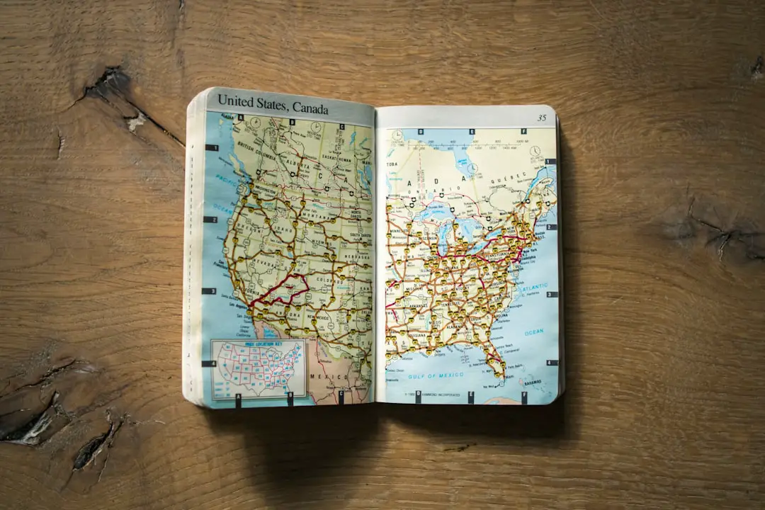
Traveling up north from Mesa, Arizona can take you from the Sonoran Desert to Sedona’s red rocks, Flagstaff’s pine forests, the Grand Canyon, and the sandstone country around Page. The key is to choose a realistic route instead of trying to squeeze every Northern Arizona attraction into one long day. Weather, elevation, road work, wildfire restrictions, and seasonal crowds can all affect your plans.
Quick Answer
Driving is usually the simplest way to travel north from Mesa. A practical trip connects Mesa with Sedona or Flagstaff via I-17, then continues to the Grand Canyon South Rim or Page. Allow 3–5 days for several major stops, check AZ511 and park alerts before leaving, and reserve Antelope Canyon tours and popular lodging ahead.
Key Takeaways
- From Mesa, most Northern Arizona road trips connect with I-17 north before branching toward Sedona, Flagstaff, the Grand Canyon, or Page.
- Sedona and Flagstaff work well together, while the Grand Canyon South Rim and Page need more driving time.
- Antelope Canyon requires an authorized guided tour; Horseshoe Bend has separate parking rules and fees.
- Check road, wildfire, snow, monsoon, and park conditions immediately before departure because conditions can change quickly.
- Carry water, sun protection, sturdy footwear, warm layers, offline maps, and a backup plan for areas with weak cell service.
At a Glance
| Time Required | 1–2 days for one area; about 3–5 days for Sedona, Flagstaff, the South Rim, and Page |
| Difficulty | Moderate trip planning; hiking difficulty ranges from easy paved viewpoints to strenuous canyon routes |
| Tools Needed | Navigation app plus offline maps, AZ511, weather forecast, water, sun protection, layers, and day-hiking gear |
| Cost | Gas and lodging vary. Grand Canyon private-vehicle admission is currently $35 for a 7-day pass; Antelope Canyon tour costs and Horseshoe Bend parking are separate. |
Disclosure: As an Amazon Associate I earn from qualifying purchases. Some links on this page are affiliate links, at no extra cost to you.
Best Route From Mesa to Northern Arizona
Your best route depends on where you are staying in Mesa and which destination comes first. For most trips, the goal is to connect with I-17 north and then branch toward Sedona, Flagstaff, the Grand Canyon, or Page. Always compare your planned route with current conditions on AZ511 before leaving.
| Destination | Typical Route From Mesa | Planning Time |
|---|---|---|
| Sedona | Connect to I-17 north, then take SR 179 toward Sedona | About 2–2.5 hours |
| Flagstaff | Connect to I-17 north and continue to Flagstaff | About 2.5–3 hours |
| Grand Canyon South Rim | I-17 north to Flagstaff, then I-40 west to Williams and AZ-64 north | About 3.75–4.25 hours |
| Page | I-17 north to Flagstaff, then US-89 north | About 4.5–5 hours |
These are planning ranges rather than guarantees. Phoenix-area traffic, construction, snow, crashes, wildfire activity, and summer storms can add substantial time.
Pro Tip: Download your route for offline use before leaving Mesa. Cell coverage can become unreliable on remote highways, Tribal lands, forest roads, and backcountry trails.
A Practical 5-Day Northern Arizona Road Trip From Mesa
You can shorten or extend this itinerary, but five days gives you enough time to see several major areas without spending the entire trip behind the wheel.
Day 1: Mesa to Sedona
Leave Mesa early, reach Sedona before the busiest part of the day, and choose one or two activities rather than trying to hike every famous trail. Bell Rock, Cathedral Rock viewpoints, scenic drives, and a walk through Uptown Sedona are popular options.
Parking at major trailheads can be limited. Check the Sedona Shuttle before your visit because several high-demand trailheads are served by free shuttle routes, and parking restrictions can apply while shuttle service is operating.
Day 2: Sedona and Flagstaff
Spend the morning on another Sedona trail or scenic stop, then drive north toward Flagstaff. Depending on road conditions, the SR 89A route through Oak Creek Canyon can be beautiful, but it is also vulnerable to construction, weather, and temporary restrictions. I-17 provides an alternative route.
In Flagstaff, explore the historic downtown and Route 66 corridor or visit the Museum of Northern Arizona. Flagstaff sits at a much higher elevation than Mesa, so temperatures can be dramatically cooler, especially after sunset.
Day 3: Grand Canyon South Rim
Drive to Grand Canyon National Park’s South Rim and focus on a manageable group of viewpoints. Mather Point and Yavapai Geology Museum are convenient first stops. The Rim Trail also offers excellent views without requiring a steep descent into the canyon.
Check the National Park Service Grand Canyon trip-planning page before arrival for road, shuttle, trail, water, weather, and fire information.
Day 4: Grand Canyon to Page
Continue toward Page for Horseshoe Bend, Antelope Canyon, and Lake Powell. Allow extra time rather than scheduling a tightly timed Antelope Canyon tour immediately after a long drive.
Antelope Canyon requires an authorized guided tour. Book with an approved operator and follow Navajo Nation rules. Do not plan on arriving and entering the canyon independently.
Day 5: Page and Return to Mesa
Visit Lake Powell or another Page-area attraction in the morning, then allow most of the afternoon for the return to Mesa. A long drive after a full day of hiking or paddling is tiring, so shorten the morning activity when needed.
Must-See Destinations Along the Way
Grand Canyon South Rim
The South Rim is the most practical Grand Canyon destination for most travelers coming from Mesa. It is open year-round, although snow and ice can affect winter travel. Mather Point, Yavapai Geology Museum, Desert View, and sections of the Rim Trail provide excellent views without requiring an inner-canyon hike.
Grand Canyon National Park currently charges $35 per private vehicle for a 7-day pass. The park does not currently require a general vehicle-entry reservation, but lodging and campgrounds can fill far in advance. Check the current NPS fees and passes page before your trip because policies can change.
Warning: Do not treat an inner-canyon hike like a normal sightseeing walk. The climb back to the rim is long and steep, and temperatures below the rim can be far hotter than at the rim. The National Park Service advises against attempting a rim-to-river-and-back hike in one day. Check current trail conditions, carry adequate water and food, and turn around before you become exhausted.
At the Grand Canyon, reaching the bottom is optional; having enough energy, water, daylight, and temperature margin to climb back out is essential.
Grand Canyon North Rim
The North Rim offers a different experience, but it is not a quick side trip from the South Rim. The road journey around the canyon takes several hours, so most Mesa-based trips should choose one rim unless they have extra days.
Note: As of July 2026, the North Rim is open for the 2026 season after the Dragon Bravo Fire, but services remain limited. There is no overnight lodging inside the North Rim in 2026, and some trails remain closed because of fire impacts. Check the current NPS North Rim status before making the drive.
Sedona
Sedona is known for red-rock scenery, hiking, mountain biking, jeep tours, galleries, and scenic drives. Cathedral Rock and Bell Rock are among the best-known hiking areas, but trailhead parking can become crowded quickly.
Sedona is also known for sites described locally as “vortexes.” Some visitors view these places as spiritually significant or use them for meditation. Those beliefs are part of Sedona’s tourism culture, but claims of special energy or healing effects should not be treated as established medical facts.
Page, Antelope Canyon, and Horseshoe Bend
Page makes a useful base for Antelope Canyon, Horseshoe Bend, and Lake Powell. Antelope Canyon is on Navajo Nation land and requires a guided visit through an authorized operator. Tour availability, check-in rules, weather cancellations, and fees vary, so reserve ahead and read the operator’s instructions carefully.
Horseshoe Bend is reached by a short but exposed walk from the parking area. The parking lot is not covered by National Park Service entrance passes, so expect separate parking rules and fees. Check the NPS Horseshoe Bend information before going.
Packing Essentials for Northern Arizona
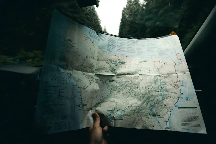
Do not pack for Northern Arizona as though it has the same weather as Mesa. Elevation changes can produce large temperature differences between the desert, Sedona, Flagstaff, the Grand Canyon rim, and the bottom of the canyon.
Layering works well. Bring a moisture-wicking base layer, a warmer layer for mornings and evenings, and a rain or wind shell when conditions call for one. In winter, snow, ice, and freezing temperatures are possible around Flagstaff and the Grand Canyon.
Day-Hiking Essentials
- Refillable water bottles or a hydration reservoir
- Electrolytes and salty snacks for longer or hotter hikes
- Sun hat, sunscreen, and sunglasses
- Sturdy hiking footwear with good traction
- Weather-appropriate layers
- Small first-aid kit
- Navigation app plus downloaded offline maps
- Headlamp if there is any chance you could be out near sunset
- Portable battery pack
- Any required park pass, permit, reservation, or tour confirmation
A camera and binoculars can be useful for landscapes and wildlife. If you are camping, add shelter, a suitable sleeping system, cooking equipment where permitted, and more water-storage capacity.
Best Places to Eat and Stay
| Base | Food Strategy | Best Lodging Strategy |
|---|---|---|
| Flagstaff | Downtown restaurants such as Diablo Burger, plus reservation-oriented dining for a more upscale meal | Downtown for walkability or a hotel near I-17/I-40 for an easier early departure |
| Sedona | Scenic-view restaurants such as The Hudson plus casual options in Uptown and West Sedona | Stay near the part of town you plan to explore and consider shuttle access when hiking |
| Page | Casual local restaurants work well around scheduled Antelope Canyon and Lake Powell activities | A Page hotel near US-89 makes Horseshoe Bend, Antelope Canyon tours, and the return drive easier |
In Flagstaff, Diablo Burger remains a popular casual option. Older travel guides may recommend The Cottage, but that restaurant is permanently closed and should no longer be part of a current itinerary.
For lodging, the property formerly known as the Inn at 410 now operates as Bespoke Inn Flagstaff. Flagstaff also has many conventional hotels, motels, and vacation rentals, making it one of the easiest places to use as a multi-night base.
In Sedona, The Hudson remains a well-known option for American food and red-rock views. Sedona lodging can become expensive during busy periods, so compare Uptown, West Sedona, and Village of Oak Creek locations based on the trails and attractions you plan to visit.
Page is practical for an overnight stay before or after Antelope Canyon. Choose lodging based on tour check-in time rather than booking the cheapest room on the opposite side of your itinerary.
Restaurant hours and hotel ownership can change, so confirm directly before making a special trip for a specific property.
Outdoor Activities and Adventures
Hiking
Northern Arizona has everything from short paved walks to demanding backcountry routes. At the Grand Canyon, the Rim Trail is a much easier sightseeing choice than descending Bright Angel or South Kaibab Trail. Anyone hiking below the rim should review the NPS day-hiking guidance first.
In Sedona, choose trails based on distance, elevation gain, exposure, parking, and current closures—not only social-media popularity. Begin early when temperatures are high and avoid exposed trails when thunderstorms threaten.
Mountain Biking and Rock Climbing
Sedona and the Coconino National Forest have extensive mountain-biking opportunities, while the region’s cliffs and rock formations attract climbers. Match routes to your actual experience level and use a qualified local guide when you lack the skills or equipment for technical terrain.
Lake Powell Kayaking and Paddleboarding
Lake Powell near Page can be excellent for kayaking and paddleboarding, but conditions change with water level, wind, storms, and launch access. Review Glen Canyon National Recreation Area safety information before launching and wear an appropriate life jacket.
Strong winds can build quickly on open water. Do not paddle farther from shelter than your skill, weather window, and remaining energy safely allow.
Exploring Northern Arizona’s Culture and History
Northern Arizona is the homeland of Indigenous peoples with living cultures, governments, traditions, and communities—not simply a collection of historical attractions. The region includes lands and culturally important places associated with the Navajo Nation, Hopi Tribe, Havasupai Tribe, Hualapai Tribe, and other Tribal communities.
Places such as Monument Valley Navajo Tribal Park and Antelope Canyon operate under Tribal rules and may have their own entry fees, guides, photography policies, operating hours, and closures. Check the responsible Tribal authority before visiting and respect areas that are closed or culturally sensitive.
Flagstaff and Williams also preserve parts of Arizona’s Route 66 history. Vintage signs, historic buildings, rail history, and roadside attractions make these towns worthwhile stops even when you are not planning a long hike.
The Museum of Northern Arizona in Flagstaff can add valuable context about the Colorado Plateau’s geology, ecology, archaeology, art, and Indigenous cultures.
Tips for Navigating Northern Arizona’s Terrain and Weather
Northern Arizona combines high mountains, desert plateaus, forests, canyon country, and remote highways. That variety is part of the appeal, but it also means one weather forecast is not enough for an entire trip.
Check Conditions the Day You Leave
Before departing Mesa, check:
- AZ511 for highway crashes, construction, restrictions, and closures
- National Weather Service Flagstaff for Northern Arizona forecasts, watches, warnings, and monsoon information
- National Park Service alerts for the Grand Canyon or Glen Canyon
- Sedona Shuttle status when using popular trailheads
- Your lodging, tour operator, or campground for same-day operational changes
Summer Heat and Monsoon Storms
Summer conditions vary sharply by elevation. Flagstaff and the Grand Canyon rim can feel much cooler than Mesa, while the Grand Canyon’s inner gorge can become dangerously hot.
Summer thunderstorms can also produce lightning, sudden downpours, flash floods, falling rocks, and temporary road problems. Slot canyons and normally dry washes are especially poor places to be when flooding is possible.
Warning: Never enter a slot canyon, wash, or flood-prone drainage when thunderstorms or flash-flood warnings threaten the area. A storm does not have to be directly overhead for runoff to create dangerous conditions downstream.
Winter Snow and Ice
Flagstaff and the Grand Canyon rim receive winter snow. Roads that are dry in Mesa can become snowy or icy farther north. Check highway conditions before departure, carry appropriate winter equipment, keep the fuel tank well above empty, and allow extra stopping distance.
Elevation
Flagstaff and the Grand Canyon rims sit thousands of feet above Mesa. Some visitors notice shortness of breath, headache, fatigue, or reduced hiking performance at elevation. Ease into strenuous activity, stay hydrated, and do not use your normal low-elevation hiking pace as a requirement.
Safety Precautions and Emergency Contacts
Preparation matters more than having a long list of emergency numbers. Tell someone where you are going when hiking in remote areas, know your turnaround time, and do not rely on continuous mobile-phone coverage.
For an Emergency
Call 911 when you have service and there is a life-threatening emergency. Inside a national park, follow ranger instructions and use emergency phones or ranger stations where available.
Cliff and Canyon Safety
Stay back from unprotected edges and supervise children closely. Do not step backward for photographs, climb barriers, or assume that a rock ledge is stable simply because other visitors are standing on it.
Wildlife
Never feed or approach wildlife. Elk and deer are common in parts of Northern Arizona, and snakes may be encountered in warmer areas. Give every animal room to move away and keep food stored properly at campsites.
Driving After a Long Hike
Fatigue is easy to underestimate. A four-hour drive back to Mesa after a strenuous hike can be more demanding than expected. Share driving when possible, stop when drowsy, or spend another night rather than forcing the return trip.
Transportation Options From Mesa
Driving
For most travelers, a personal or rental vehicle offers the greatest flexibility. It makes it much easier to combine Sedona, Flagstaff, the Grand Canyon, and Page while adjusting plans around weather or closures.
Bus and Shuttle
Intercity bus tickets are available between Mesa and Flagstaff, including Greyhound/FlixBus itineraries. Schedules, stops, and whether a particular departure requires a transfer can change, so check the live timetable before buying.
For the Grand Canyon, travelers without a car commonly connect through Flagstaff and use a separate shuttle service. Compare the full door-to-door travel time before choosing this option.
Flying
Phoenix Sky Harbor International Airport and Phoenix-Mesa Gateway Airport are the major airports nearest Mesa. For a trip that begins in Mesa, however, flying north is usually less convenient than driving.
Flagstaff Pulliam Airport has scheduled commercial airline service, with routes that can change by season and airline. Grand Canyon National Park Airport does not currently provide scheduled airline service, so do not book a trip assuming you can take a normal commercial flight directly to the South Rim.
Train
There is no direct Amtrak train from Mesa or Phoenix to Flagstaff. Flagstaff is served by the Southwest Chief, which is useful for travelers arriving from cities along that rail route.
The Phoenix area’s Amtrak connection to Maricopa is tied to the Sunset Limited/Texas Eagle corridor. That is a separate rail route and does not create a direct Phoenix-to-Flagstaff train trip.
Frequently Asked Questions
What are the transportation options for traveling up north from Mesa, AZ?
Driving is usually the easiest option because Northern Arizona attractions are spread out. Intercity buses can connect Mesa with Flagstaff, while private shuttle services provide additional connections from Flagstaff toward the Grand Canyon and other destinations. Flying to Flagstaff is possible through commercial air service, but it is usually less practical for someone already starting in Mesa. There is no direct Mesa-to-Flagstaff Amtrak train.
How long does it take to drive from Mesa, AZ to Northern Arizona destinations?
For planning purposes, allow about 2–2.5 hours to Sedona, 2.5–3 hours to Flagstaff, roughly 3.75–4.25 hours to the Grand Canyon South Rim, and about 4.5–5 hours to Page. Traffic, construction, snow, crashes, and weather can increase these times, so check your live route before departure.
Are there direct bus routes from Mesa, AZ to northern destinations?
Intercity bus service is available between Mesa and Flagstaff, although the number of stops and transfers depends on the current schedule. Do not assume every departure is nonstop. For the Grand Canyon, travelers commonly continue from Flagstaff on a separate shuttle service rather than using one direct Mesa-to-canyon bus.
What are the nearest airports to Mesa, AZ for traveling north?
Phoenix Sky Harbor International Airport and Phoenix-Mesa Gateway Airport are the main airports near Mesa. Flagstaff Pulliam Airport has scheduled commercial airline service and is the primary commercial airport in Northern Arizona. Grand Canyon National Park Airport does not currently offer scheduled airline service, so driving or using a shuttle is normally required for the final trip to the South Rim.
Is there a train service from Mesa, AZ to Flagstaff or the Grand Canyon?
No direct Amtrak train runs from Mesa or Phoenix to Flagstaff. Flagstaff is served by Amtrak’s Southwest Chief, while Phoenix-area Amtrak connections run through Maricopa on the separate Sunset Limited/Texas Eagle corridor. Travelers arriving in Flagstaff by train can then rent a car or arrange ground transportation to other Northern Arizona destinations.
Do I need reservations for the Grand Canyon, Antelope Canyon, or Horseshoe Bend?
Grand Canyon National Park does not currently require a general vehicle-entry reservation, although lodging and campgrounds can fill well ahead. Antelope Canyon requires an authorized guided tour and should be reserved in advance. Horseshoe Bend does not use the Grand Canyon entrance system; its parking area has separate rules and fees, and national-park passes do not cover that parking charge.
What is the best time of year for a Northern Arizona road trip from Mesa?
Spring and fall often provide comfortable sightseeing temperatures, although popular destinations can still be busy. Summer brings intense heat at lower elevations and inside the Grand Canyon, along with monsoon thunderstorms and flash-flood risk. Winter can be beautiful around Flagstaff and the Grand Canyon but may bring snow, ice, and road delays.
Can I visit Sedona and the Grand Canyon in one day from Mesa?
It is physically possible to pass through both areas on a very long day, but it leaves little time to enjoy either destination and creates a tiring return drive. A better plan is to spend at least one night in Sedona, Flagstaff, Williams, or near the South Rim and give the Grand Canyon its own sightseeing day.
Sources
- National Park Service — Grand Canyon Plan Your Visit — park access, alerts, trails, roads, weather, shuttles, and visitor planning.
- National Park Service — North Rim Status — current 2026 North Rim openings, services, fire impacts, and trail restrictions.
- Navajo Nation Parks & Recreation — Antelope Canyon Tour Operators — authorized tour and guided-access requirements.
- Arizona 511 — live Arizona highway incidents, construction, closures, restrictions, and travel conditions.
- National Weather Service Flagstaff — Northern Arizona forecasts, warnings, monsoon information, and hazardous-weather alerts.
- National Park Service — Glen Canyon Safety — Lake Powell boating, paddling, weather, heat, and changing-condition guidance.
