

Last Updated on August 26, 2026 by Daniel Globe
San Diego hiking ranges from sandstone cliffs and Pacific Ocean overlooks to waterfall canyons, chaparral-covered summits, and demanding backcountry routes. The best trail depends on how much time you have, how much climbing you want, and whether you need a family-friendly route, a permit-free outing, or a serious mountain challenge. Distances can also change depending on the trailhead, so use the route details below as a planning guide and check the managing agency before you leave.
Quick Answer
For classic San Diego hiking, choose Torrey Pines for coastal scenery, Annie’s Canyon for a short slot-canyon adventure, Stonewall Peak for a moderate summit, Cedar Creek Falls for a permit-required waterfall hike, and El Cajon Mountain for an expert-level challenge. Always check heat, trail hours, permits, and closures before starting.
Key Takeaways
- Best coastal choice: Torrey Pines State Natural Reserve, where official trails combine ocean overlooks, sandstone formations, and beach access.
- Best short canyon adventure: Annie’s Canyon, with round-trip distances of roughly 1.4 to 2 miles depending on the trailhead.
- Permit required: Cedar Creek Falls visitors entering the permit area must obtain a Forest Service visitor-use permit.
- Watch the heat: Inland and desert hikes can become dangerous in warm weather. El Capitan County Preserve, home to El Cajon Mountain, closes throughout August.
- Check pet rules trail by trail: Torrey Pines prohibits dogs, while other areas have different leash and access restrictions.
Disclosure: As an Amazon Associate I earn from qualifying purchases. Some links on this page are affiliate links, at no extra cost to you.
Best San Diego Hikes at a Glance
| Trail | Typical Distance | Difficulty | Best For | Important Note |
|---|---|---|---|---|
| Torrey Pines Beach Trail | About 1.5 mi out-and-back from the upper trailhead; longer combinations available | Moderate | Coastal views | No dogs; stay away from unstable cliff bases |
| Annie’s Canyon | About 1.4–2 mi RT, depending on trailhead | Easy with strenuous portions | Slot canyon | Tight spaces, scrambling, ladder-style stairs |
| Stonewall Peak | About 4 mi RT | Moderate–challenging | Mountain panorama | Exposed final ridge |
| Cuyamaca Peak | About 7 mi RT from Paso Picacho | Strenuous | High-elevation views | Check park hours before sunrise or sunset plans |
| Cedar Creek Falls | About 5–6 mi RT | Strenuous in heat | Waterfall scenery | Visitor-use permit required for permit area |
| Three Sisters Falls | About 4.5 mi RT | Moderate–strenuous | Waterfalls and canyon scenery | Very exposed to heat |
| El Cajon Mountain | 11+ mi RT | Expert / difficult | Endurance challenge | El Capitan County Preserve closes in August |
Warning: San Diego’s inland trails can become dangerously hot, and many have little shade. Do not rely on coastal temperatures when planning Cedar Creek Falls, Three Sisters Falls, Iron Mountain, Mount Woodson, El Cajon Mountain, or desert routes. Check the forecast, official closures, and trail alerts before leaving.
Top Coastal and Beach Hikes
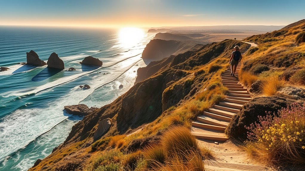
For classic ocean scenery, start with Torrey Pines State Natural Reserve. According to the official Torrey Pines trail guide, the Beach Trail runs about three-quarters of a mile from the upper trail area to Flat Rock and descends roughly 300 feet. An out-and-back is therefore about 1.5 miles, while connecting it with Razor Point, Broken Hill, or other reserve trails creates a longer hike.
The Beach Trail ends near the shoreline, but this is not a casual place to stand beneath the bluffs. California State Parks warns that cliff collapses and rockslides can occur without notice. Give the cliff base a wide berth, pay attention to tides, remain on marked trails, and remember that dogs are not permitted anywhere in Torrey Pines State Natural Reserve or Torrey Pines State Beach. The reserve also closes at sunset.
Annie’s Canyon Trail in the San Elijo Lagoon area offers a completely different coastal experience. Nature Collective lists several route lengths depending on where you begin: roughly 1.4 miles from Rios Avenue, 1.6 miles from Solana Hills, or 2 miles from Via Poco. The approach is generally easy, but the slot-canyon portion includes tight sandstone walls, scrambling, and ladder-style stairs. Hikers who do not want the squeeze can use the switchback route instead. The slot section is one-way, and leashed dogs are not allowed through that portion. See the current Annie’s Canyon trail information before visiting.
The Seven Bridges Walk is better treated as an urban walking route than a wilderness hike. Depending on exactly where you begin and which connectors you use, expect roughly five to six miles through San Diego neighborhoods and historic bridge crossings with modest elevation change. It works well when you want distance without a mountain climb, but you will share the route with streets, intersections, and neighborhood activity.
You can also combine several official trails inside Torrey Pines for a longer loop rather than relying on one fixed “five-mile park loop.” Route length changes according to the combination you choose. For an easier bluff-top outing, the La Jolla Coast Walk offers a much shorter coastal stroll with ocean views and wildlife-watching opportunities.
Pro Tip: For Torrey Pines beach access, check the tide before you go and use the official trail map rather than relying on a single mileage number from a hiking app. Trail combinations can change your total distance considerably.
Products Worth Considering


Best Sunset and Sunrise Summits

San Diego’s inland peaks trade ocean-level walking for broader mountain and desert views. Stonewall Peak is one of the best moderate summit choices. California State Parks describes the hike from Paso Picacho as about a 4-mile round trip, with an exposed final ridge, steps, a handrail, and panoramic views from the summit.
Iron Mountain near Poway is a popular middle-ground option: longer and more exposed than Stonewall, but more manageable for many hikers than El Cajon Mountain. Route estimates are commonly around five to six miles round trip. The City of Poway emphasizes that its trails can become dangerous in high heat and requires visitors to remain on designated trails. Poway trails are open from sunrise to sunset, so do not plan to be on the trail outside legal hours.
Cuyamaca Peak offers a higher-elevation outing with views toward the Pacific coastline, mountains, and desert. California State Parks lists the peak at about 3.5 trail miles from Paso Picacho, making the straightforward out-and-back roughly seven miles. The climb is substantial, and operating hours should be checked before planning a sunrise or sunset hike.
Garnet Peak is a shorter Laguna Mountain-area summit with broad desert views, while Corte Madera provides a more remote backcountry experience. Exact mileage for both depends on the chosen approach and current road or trail access, so use the latest Forest Service map and alerts rather than assuming one fixed distance.
| Peak | Quick Snapshot |
|---|---|
| Stonewall Peak | About 4 mi RT; moderate to challenging; exposed final ridge |
| Iron Mountain | Roughly 5–6 mi RT; exposed, sunny summit hike |
| Cuyamaca Peak | About 7 mi RT from Paso Picacho; strenuous climbing |
| Corte Madera / Garnet Peak | Route-dependent backcountry options; check Forest Service conditions |
Note: “Sunrise hike” and “sunset hike” do not automatically mean overnight access is permitted. Park and preserve hours vary. Check posted hours and make sure you can finish the route before the managing agency requires visitors to exit.
Waterfall and Canyon Adventures
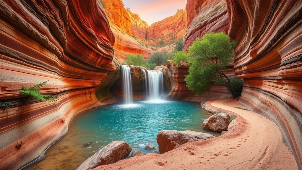
Cedar Creek Falls is one of the San Diego region’s best-known waterfall hikes, but it requires more planning than a normal trailhead walk. The route is roughly five to six miles round trip depending on the start, with a long exposed descent followed by a demanding climb back out. Water flow is seasonal and can vary dramatically from year to year.
Most importantly, visitors entering the Cedar Creek Falls permit area must obtain a USDA Forest Service visitor-use permit. Current Forest Service orders also keep the cliffs surrounding the falls closed and prohibit alcohol in the trail system. A permit does not authorize climbing or jumping from the cliffs.
Three Sisters Falls is another demanding waterfall route. The Forest Service describes it as about 4.5 miles with roughly 1,000 feet of elevation change and rates it moderate to strenuous. Much of the hike is exposed, so cooler-season conditions are far safer and more comfortable than hot summer afternoons.
Annie’s Canyon provides the canyon experience without a full-day backcountry commitment. Depending on your trailhead, the round trip is approximately 1.4 to 2 miles. The slot is narrow and requires some scrambling, while the adjacent switchback offers an alternative for hikers who dislike tight spaces.
The Ho Chi Minh Trail in La Jolla is often mentioned online as a short technical route, but it should not be grouped with maintained family trails. It is an informal route over steep, eroded sandstone with exposed sections. The combination of loose footing, narrow tread, and steep terrain makes it inappropriate for beginners, young children, or anyone uncomfortable with fall exposure. For a short adventure with clearer management and established access, Annie’s Canyon or an official Torrey Pines trail is a better choice.
The safest “best hike” is the one that matches the day’s heat, trail conditions, access rules, and your actual experience level—not simply the route with the most dramatic photos.
Short, Technical, and Family-Friendly Trails: Know the Difference

Short mileage does not always mean easy terrain. San Diego has several compact routes that range from relaxed family walks to exposed scrambles, so choose based on footing and hazards rather than distance alone.
Short trails can still include steep sandstone, ladders, exposure, cliffs, or road crossings. Match the route to the least-experienced person in your group.
- Ho Chi Minh Trail: very short but technical and exposed. Treat it as an informal advanced route rather than a family hike. Avoid it in wet conditions and skip it entirely if anyone in the group is uncomfortable with unstable footing or exposure.
- Annie’s Canyon: roughly 1.4–2 miles round trip depending on the trailhead. Adventurous older children may enjoy the slot, but the tight walls, scrambling, and ladder-style stairs are not appropriate for everyone. Use the switchback option if needed.
- Beach Trail at Torrey Pines: about three-quarters of a mile each way from the upper trail area to Flat Rock, with roughly 300 feet of descent. Families can enjoy it, but children should be kept close around cliffs, stairs, and the shoreline.
- Seven Bridges Walk: typically about five to six miles depending on route choices. The elevation is mild, but it is an urban walk with streets and crossings rather than a protected natural trail.
Strenuous Peaks and Backcountry Routes
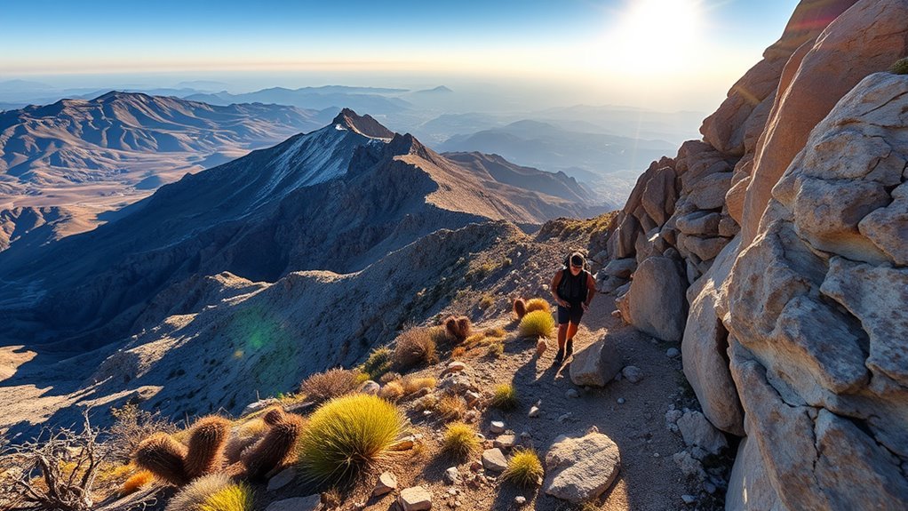
San Diego’s toughest hikes combine long mileage, steep grades, exposed chaparral, limited shade, and sometimes remote access. These routes deserve more preparation than a normal neighborhood trail.
Goat Canyon and the well-known trestle area are remote desert objectives rather than simple front-country hikes. Route mileage can vary with lawful access and chosen approach, so a single 5.8-mile figure should not be treated as universal. Check current Anza-Borrego conditions, land-access rules, route information, and desert temperatures before attempting the area. This is not a sensible hot-weather hike.
Cuyamaca Peak is roughly seven miles round trip from Paso Picacho and provides a sustained climb to one of the highest accessible viewpoints in the county. Potato Chip Rock on Mount Woodson is also route-dependent: the Lake Poway approach is substantially longer than approaches from the east, so confirm your exact trailhead before relying on a mileage estimate.
El Cajon Mountain in El Capitan County Preserve is the standout endurance challenge. San Diego County describes the summit route as 11+ miles round trip and among the county’s toughest hikes. The trail is steep, exposed, and demanding enough to take many hikers several hours. The preserve is closed throughout August because of extreme heat, and that seasonal closure should be treated as a firm safety rule. See the current San Diego County Parks information before planning the hike.
Cedar Creek Falls remains a strenuous option even though its mileage is shorter. The difficult part is often the exposed climb back to the trailhead after visiting the falls, especially when temperatures rise. Carry adequate water and do not underestimate the return.
| Trail | Distance | Main Challenge |
|---|---|---|
| Goat Canyon | Route-dependent | Remote desert access and route finding |
| Cuyamaca Peak | About 7 mi RT from Paso Picacho | Sustained climbing |
| Potato Chip Rock / Mt. Woodson | Varies by trailhead | Exposed ascent and heat |
| El Cajon Mountain | 11+ mi RT | Long, steep, exposed terrain |
| Cedar Creek Falls | About 5–6 mi RT | Hot uphill return; permit required |
Warning: Turn around early if heat, water supply, navigation, thunderstorms, injury, or fatigue becomes a concern. Reaching a summit or waterfall is optional; getting back safely is not.
Best Time to Hike in San Diego
There is no single best hiking season for every part of San Diego County. The coast, inland mountains, and desert can have very different conditions on the same day.
- Coastal hikes: Torrey Pines, La Jolla, and San Elijo Lagoon can work much of the year, although fog, rain, tides, and cliff conditions still matter.
- Inland peaks: Fall through spring is generally more comfortable for exposed hikes such as Iron Mountain, Mount Woodson, and El Cajon Mountain.
- Waterfall hikes: Cedar Creek Falls and Three Sisters Falls are most visually rewarding when seasonal water is flowing, but wet rocks and strong runoff can create additional hazards.
- Desert hikes: Cooler months are strongly preferred. Summer heat can be extreme and some areas have seasonal closures.
- Wildflowers: Anza-Borrego’s strongest annual displays often occur in late winter or spring, but timing varies with rainfall, temperature, wind, and elevation. Check the current California State Parks wildflower update rather than planning from the calendar alone.
Permits, Parking, Dogs, and Trail Rules
Permits: Most normal day hikes in this guide do not require an individual hiking permit, but Cedar Creek Falls is a major exception: a visitor-use permit is required for entry into the designated permit area. Organized groups and special activities may have additional requirements.
Parking: Do not assume every popular trail has free roadside parking. Torrey Pines has designated park parking areas and nearby public options; Annie’s Canyon has trailhead-specific parking, including the San Elijo Activity Hub Park & Ride for the Via Poco approach and neighborhood street parking for some other approaches; Iron Mountain has a designated trailhead lot; and El Capitan County Preserve lists free parking at its trailhead. Follow signs and never block driveways, gates, bike lanes, or emergency access.
Dogs: Rules vary by land manager. Torrey Pines prohibits dogs throughout the reserve and state beach. At Cuyamaca Rancho State Park, dogs are generally limited to campgrounds and designated paved roads rather than ordinary hiking trails. Annie’s Canyon allows leashed dogs on some approaches but excludes them from the slot-canyon portion. Poway requires dogs to remain leashed on its trails. Always verify the specific trail rather than assuming a countywide rule.
Hours: Many city, county, and state-managed trails close at sunset or have fixed operating hours. Early-start and sunset plans should always be checked against official access hours.
Products Worth Considering
🔥➀【MATERIAL】Tin and metal. Color: as shown.

【 CUTE SIGNS 】 Size: 4" W X 16" L / 10cm x 40cm. Material:High-quality metal tin.

🍓Size:8"x12"Inch Material:These Are High quality Metal Sign.100% Brand New
What to Carry on San Diego Hikes
For short maintained hikes, carry enough water for the weather, sun protection, a charged phone, and appropriate footwear. Longer or more remote routes need a more complete safety kit.
- Water appropriate to the heat and route length, plus extra for delays
- Electrolytes or salty snacks for long, hot outings
- Sun hat, sunscreen, and sunglasses
- Offline map or GPS plus a backup navigation method
- Fully charged phone and portable battery
- Headlamp, even if you expect to finish before dark
- Basic first-aid supplies
- Whistle
- Emergency blanket or lightweight extra layer
- Food beyond the minimum you expect to eat
- Trekking poles for steep descents if they help your balance
Pro Tip: Download the official map or save it offline before leaving home. Cell coverage can disappear quickly in canyons, mountains, and desert terrain.
Frequently Asked Questions
Are permits required for overnight backcountry camping near San Diego?
There is no single San Diego-wide rule. Overnight camping is allowed only where the managing agency permits it, and reservations, registration, campground fees, or backcountry rules vary by park and forest. For example, Cuyamaca Rancho State Park has designated primitive trail camps that require campers to register. Always use the specific park or forest’s current camping rules rather than assuming you can camp beside a hiking trail.
When is the best season for wildflower blooms in nearby deserts?
Late winter through spring is the usual window, but there is no guaranteed peak date. Anza-Borrego’s bloom depends on rainfall timing, temperature, wind, and elevation. In some years flowers appear early; in others the display is limited. Check California State Parks’ current wildflower report shortly before your visit.
Are dogs allowed on these San Diego trails?
It depends on the trail. Torrey Pines prohibits dogs throughout the reserve and state beach. Cuyamaca restricts pets largely to campgrounds and designated paved roads. Annie’s Canyon allows leashed dogs on some approach trails but not in the slot canyon. Poway trails require dogs to be leashed. Check the managing agency’s current rule before bringing a pet.
Where can I park near popular San Diego trailheads?
Use designated trailhead, park, or legal street parking. Torrey Pines has designated parking areas; Annie’s Canyon parking depends on the chosen trailhead; Iron Mountain has a trailhead lot; and El Capitan County Preserve lists free trailhead parking. Arrive early on busy weekends and never block a driveway, gate, bike lane, fire lane, or signed no-parking area.
What trail safety gear should I carry for desert and inland hikes?
Carry ample water, sun protection, food, offline navigation, a charged phone and battery, headlamp, first-aid kit, whistle, and an emergency layer or blanket. Longer exposed hikes may justify trekking poles and additional water. Follow all fire restrictions; do not plan on starting a fire as an emergency strategy.
Do I need a permit for Cedar Creek Falls?
Yes. Visitors entering the Cedar Creek Falls permit area need a Forest Service visitor-use permit. The permit provides access to the designated area but does not allow alcohol, cliff climbing, or cliff jumping. Check current Cleveland National Forest orders before your trip.
Which San Diego hike is best for beginners?
For beginners, choose a maintained coastal or short park trail rather than an exposed mountain route. Guy Fleming Trail at Torrey Pines is one of the easier official reserve trails. Annie’s Canyon can also work for active beginners, but the slot section has tight spaces, scrambling, and ladder-style stairs, so use the switchback option when needed.
Conclusion
San Diego has a hiking route for almost every kind of day, from ocean bluffs at Torrey Pines and the sandstone slot at Annie’s Canyon to Stonewall Peak, Cedar Creek Falls, and the demanding climb up El Cajon Mountain. The key is choosing a route that matches your experience, the weather, and current access rules. Check the managing agency before leaving, carry enough water, respect closures and wildlife, stay on established trails, and turn around when conditions stop being safe.
Sources
- California State Parks — Torrey Pines State Natural Reserve — current park hours, trail status, pet rules, and visitor information.
- Nature Collective — Annie’s Canyon Trail — route distances, difficulty, trailheads, slot-canyon conditions, and pet restrictions.
- California State Parks — Cuyamaca Rancho State Park — Cuyamaca Peak access, park information, hours, and pet rules.
- USDA Forest Service — Cedar Creek Falls Visitor Use Permit — permit requirements and restrictions around the falls.
- City of Poway — Trails & Hiking — operating hours, heat safety, trail rules, and hiking preparation.
- San Diego County Parks — El Capitan County Preserve / Warrior Hike — El Cajon Mountain distance, difficulty, heat guidance, and August closure.
