
![Egypt to Canaan Distance: Trade Routes Guide [2026]](https://taketravelinfo.com/wp-content/uploads/2025/03/bonkers_image_distance_from_egypt-1.jpeg "Egypt to Canaan Distance: Trade Routes Guide [2026]")
Last Updated on July 28, 2026 by Daniel Globe
Egypt and Canaan were two of the ancient Near East’s most closely linked regions — connected not by a short hop, but by hundreds of miles of desert, coastline, and mountain terrain. Understanding that physical distance helps explain why trade, migration, and conflict between the two areas took the shape they did throughout antiquity.
Quick Answer
The straight-line distance between Egypt and Canaan varies widely depending on the specific locations compared. Cairo to Jerusalem is roughly 260–430 miles depending on the route, while Thebes (modern Luxor) in Upper Egypt sits 650–700 miles away. Ancient donkey caravans crossing the Sinai desert covered about 15–20 miles per day, requiring 10 to 30 days of continuous travel.
Key Takeaways
- Physical distance between Egypt and Canaan spanned hundreds of miles, varying greatly depending on whether starting in the Nile Delta or Upper Egypt.
- The arid Sinai Peninsula formed the primary natural barrier, requiring specialized water logistics and well-known route networks.
- The “Ways of Horus” along the coast connected to the Via Maris and King’s Highway, forming the primary arteries for trade and military campaigns.
- Caravan travel transferred not only commodities like grain and metals, but also art, architecture, writing systems, and religious narratives.
Disclosure: As an Amazon Associate I earn from qualifying purchases. Some links on this page are affiliate links, at no extra cost to you.
Overview of the Geographical Locations of Egypt and Canaan
Egypt and Canaan sit in neighboring but distinct parts of the ancient Near East. Egypt lies along the Nile River in northeastern Africa, supported by fertile annual river flooding and bordered by the Mediterranean Sea and expansive deserts. Canaan, by contrast, was a historical region centered in the Levant, covering parts of modern-day Israel, Palestine, Jordan, and Lebanon. Its landscape is a mosaic of coastal plains, rugged mountains, and fertile valleys — terrain that heavily dictated travel routes and settlement patterns.
Historical Significance of the Relationship Between Egypt and Canaan
The relationship between Egypt and Canaan was built on trade, cultural exchange, and periodic military conquest. Egypt viewed Canaan as an essential economic buffer zone and trade corridor leading north into Syria and Mesopotamia. In return, Canaanite city-states received Egyptian grain, luxury items, and administrative influence. Modern understanding of this relationship comes largely from archaeological excavations and primary texts such as the Amarna Letters — 14th-century BCE clay tablets recording correspondence between Egyptian pharaohs and Levant vassal rulers.
Introduction to the Travel and Trade Routes Connecting the Two Regions
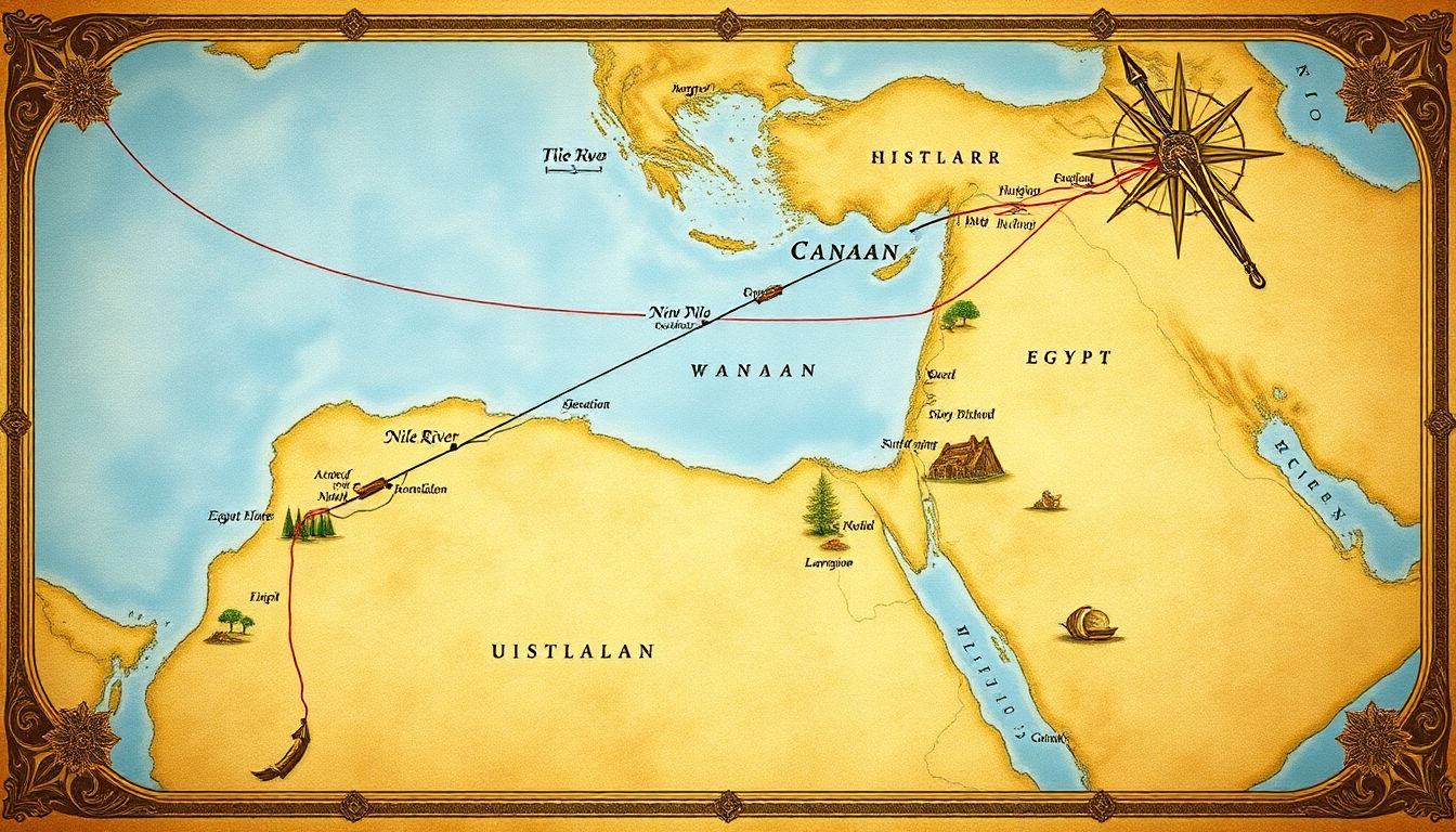
Two main pathways connected Egypt and Canaan: an overland network crossing the Sinai Peninsula and a maritime coastal route along the southeastern Mediterranean. Land routes branched into several distinct tracks linking border garrisons to major inland trading hubs, while merchant vessels carried timber, wine, olive oil, and metals directly between coastal ports like Byblos, Jaffa, and Nile Delta harbors.
The “Ways of Horus”: The Fortified Sinai Military Road
The most crucial overland segment linking Egypt to Canaan was known to ancient Egyptians as the “Ways of Horus.” Running along the northern coast of the Sinai Peninsula from the border fortress of Tjaru (near modern El-Kantara) to Gaza, this strategic highway served as Egypt’s primary military artery during the New Kingdom. Reliefs carved by Pharaoh Seti I at Karnak depict this road lined with state-maintained fortresses, fortified wells, and reservoirs situated roughly one day’s march apart (15 to 20 miles), ensuring troops and royal caravans could safely navigate the harsh desert border.
Egypt in Ancient Near Eastern Politics and Economy
Egypt was one of the wealthiest and most centralized powers in the ancient Near East. The Nile’s predictable agricultural cycle funded a surplus economy capable of sustaining standing armies, monumental building projects, and diplomatic networks. Egyptian pharaohs regularly launched military campaigns into Canaan to secure trade access, extract tribute, and protect trade routes from rival empires such as the Hittites and Mitanni.
Canaan as a Crossroads for Trade and Cultural Exchange
Canaan’s geographic position made it an international cultural crossroads. Goods and ideas moving between Egypt, Anatolia, Mesopotamia, and the Aegean all converged in Canaanite market cities. Canaanite art, religion, and technology reflected a rich synthesis of foreign influences — from Egyptian scarabs and architectural motifs to Mesopotamian cylinder seals and Mycenaean pottery.
Note: Major archaeological excavations at Canaanite sites including Hazor, Megiddo, Gezer, Lachish, Jericho, and Beit She’an have uncovered extensive Egyptian artifacts, administrative buildings, and military stelae proving centuries of direct Egyptian presence.
Historical Events Linking Egypt and Canaan
Numerous historic events linked the two regions, most famously the biblical Exodus. According to biblical tradition, the Israelites escaped bondage in Egypt and journeyed through the Sinai wilderness before settling in Canaan. While religious chronologies traditionally place this narrative around 1400 BCE or during the 13th-century BCE reign of Ramesses II, direct archaeological evidence remains debated. Historically documented events include the Hyksos period (when Levant rulers governed northern Egypt) and the famous Battle of Megiddo under Pharaoh Thutmose III.
The Physical Distance: City Comparisons
Determining the physical distance between Egypt and Canaan depends heavily on the specific starting and ending points selected:
- Memphis / Cairo to Jerusalem: Roughly 260 miles in a straight line, or 350 to 430 miles following coastal road networks around the Sinai.
- Avaris (Nile Delta) to Gaza: Approximately 150 miles along the coastal “Ways of Horus” route.
- Thebes (Luxor) to Jerusalem: Roughly 650 to 700 miles, requiring extensive river transit down the Nile before beginning the overland desert journey.
Modes of Transport, Travel Rates, and Logistics
In antiquity, distance was measured in time rather than miles. During the Bronze Age, travel relied on walking and donkey caravans. A packed donkey caravan typically covered 15 to 20 miles per day depending on terrain and heat. Under these conditions, traveling from the Nile Delta to southern Canaan took approximately 8 to 12 days, while traveling from Upper Egypt to Jerusalem could take a full month. Dromedary camels were not widely adopted for long-distance desert trade until the late Iron Age (c. 1000 BCE).
Natural Barriers and Desert Challenges
Crossing the Sinai Peninsula presented severe environmental hazards. Temperatures soared during summer months, surface water was extremely scarce, and shifting sand dunes made transport difficult for heavy wagons. Travelers relied on networks of coastal brackish wells, oasis springs, and fortified supply posts. Beyond the Sinai, travelers entering inland Canaan faced the steep climbs of the Judean Mountains.
Warning: Traversing the Sinai without adequate water supplies and experienced guides was life-threatening in antiquity. Merchants almost always traveled in large, organized caravans for mutual defense against desert bandits and environmental exposure.
Modern Measurements vs. Ancient Perceptions
Modern GPS coordinates provide fixed mileage, but ancient travelers evaluated journeys by logistical difficulty, seasonal weather, and access to water. A 20-mile stretch of flat coastal plain was perceived as vastly shorter than a 10-mile trek through mountain passes or waterless sand dunes. Ancient itineraries consequently recorded travel in units of “day journeys.”
Common Routes for Trade and Migration
Two major highway systems facilitated long-distance travel between Egypt, Canaan, and the broader Fertile Crescent:
The Significance of the Via Maris
The Via Maris (Latin for “Way of the Sea”) was the ancient trade road running along the Mediterranean coast. Continuing from the Egyptian “Ways of Horus,” it passed through Gaza, Ashkelon, and Jaffa before cutting inland through the Megiddo Pass toward Syria. It carried bulk agricultural goods, textiles, wine, and luxury items, serving as the main highway for both commerce and invading armies.
Impact of Caravan Travel
Regular caravan traffic served as the primary engine of cultural diffusion. Merchants carried news, religious ideas, administrative practices, and artistic styles alongside physical commodities. Scribes and diplomats accompanying caravans facilitated formal international relations between Egyptian and Canaanite courts.
Pro Tip: When studying ancient Levantine archaeology, examine pottery styles along the Via Maris. The blending of Egyptian clay techniques and Canaanite vessel shapes provides direct evidence of bi-directional cultural integration.
Influence of Egyptian Culture on Canaanite Society
Centuries of continuous contact left deep Egyptian imprints on Canaanite culture. Canaanite elite tombs frequently contained Egyptian scarabs, alabaster vessels, and ivory carvings. In administrative centers like Beit She’an, Egyptian architecture, governor residences, and hieroglyphic inscriptions demonstrate direct imperial administration during the New Kingdom period.
Literary References and Primary Sources on Travel
Surviving ancient literature offers vivid firsthand glimpses into Sinai travel and Canaanite geography:
- The Tale of Sinuhe (c. 1900 BCE): A Middle Kingdom Egyptian courtier flees into the Sinai desert, describing extreme thirst and rescue by Bedouin nomads before settling in Canaan.
- Papyrus Anastasi I (13th century BCE): A satirical New Kingdom text in which a senior scribe tests a junior colleague’s knowledge of Canaanite mountain passes, distances, and travel hazards along the Levant coast.
- The Report of Wenamun (c. 1075 BCE): Details a maritime journey from Egypt to the Canaanite port of Byblos to purchase cedar wood, highlighting trade logistics and diplomatic friction.
Religious Implications of Geographic Distance in Biblical Texts
In biblical literature, the physical gap between Egypt and Canaan carries profound theological meaning. Egypt represents a place of bondage and worldly power, while Canaan represents the Promised Land. The wilderness journey bridging the two regions serves as a symbolic period of spiritual testing, transformation, and covenantal formation.
“The hundreds of miles separating Egypt and Canaan were never just empty desert — they were a vital corridor that carried goods, ideas, and entire peoples between two of the ancient world’s most influential civilizations.”
Conclusion and Modern Implications
Summary of Key Points
The historical distance between Egypt and Canaan spanned roughly 150 to 700 miles depending on the specific starting points. The Sinai Peninsula acted as both a daunting natural barrier and a heavily traveled corridor. Networks like the “Ways of Horus” and the Via Maris enabled trade, military expeditions, and cultural exchanges that permanently shaped both societies.
Influence on Modern Perceptions
Understanding ancient transit times reframes how modern readers interpret historical and religious texts. Recognizing that a journey between the Nile and the Levant required weeks of grueling travel highlights the immense logistical feat behind ancient trade networks and military campaigns.
Importance of Historical Geography
Historical geography provides essential context for archaeology and anthropology. By analyzing terrain, water access, and physical distances, scholars move past modern assumptions and reconstruct how ancient Near Eastern societies actually interacted.
Frequently Asked Questions
What are the geographical locations of Egypt and Canaan?
Egypt is located in northeastern Africa along the fertile Nile River valley. Canaan was a historical region in the Levant, covering parts of modern-day Israel, Palestine, Jordan, and Lebanon along the eastern Mediterranean coast.
How far is Egypt from Canaan in miles and days of travel?
Cairo to Jerusalem is roughly 260 miles in a straight line (350–430 road miles), taking about 18–25 days on foot. The Nile Delta to southern Canaan is about 150 miles, taking 8–12 days by donkey caravan.
What was the “Ways of Horus”?
The “Ways of Horus” was the ancient Egyptian name for the heavily fortified military road running along the northern Sinai coast from Tjaru to Gaza. It featured state-maintained fortresses and wells spaced one day’s march apart.
What travel routes connected Egypt and Canaan?
The primary overland routes were the coastal Via Maris (connecting to the Ways of Horus across Sinai) and the inland King’s Highway. Maritime shipping routes along the Mediterranean coast were also heavily utilized.
What pack animals were used for Sinai travel?
During the Bronze Age, pack donkeys and human foot travel were the primary modes of transport. Dromedary camels were not widely integrated into desert caravans until the late Iron Age (c. 1000 BCE).
What ancient texts describe travel between Egypt and Canaan?
Key literary sources include the biblical Book of Exodus, the Middle Kingdom *Tale of Sinuhe*, the Ramesside-era *Papyrus Anastasi I*, the *Amarna Letters*, and the *Report of Wenamun*.
Sources
- Britannica: Canaan — Overview of Canaanite geography, culture, and archaeological history.
- Metropolitan Museum of Art: Amarna Letters — Primary correspondence detailing diplomatic relations between Egypt and Levantine rulers.
- Via Maris Trade Route — Historical overview of the coastal highway linking Egypt with Syria and Mesopotamia.
