
Last Updated on July 28, 2026 by Daniel Globe
Dry Falls in central Washington is a vast, horseshoe-shaped cliff left behind by repeated Ice Age floods. Its sheer basalt walls, plunge-pool lakes, shrubsteppe habitat, and location within Sun Lakes-Dry Falls State Park make it both an important geological site and a rewarding stop for travelers exploring the Columbia Plateau.
Quick Answer
Dry Falls is a 3.5-mile-wide, 400-foot-high former waterfall carved into Columbia River basalt by repeated Ice Age floods. Today it is the centerpiece of Sun Lakes-Dry Falls State Park, where visitors can hike, camp, fish, photograph wildlife, and explore the flood-sculpted lower Grand Coulee.
Key Takeaways
- Dry Falls was carved by repeated Ice Age floods rather than one isolated event.
- The former waterfall is approximately 3.5 miles wide and 400 feet high.
- Sun Lakes-Dry Falls State Park offers more than 15 miles of trails, camping, boating, fishing, wildlife viewing, picnicking, and golf.
- The Dry Falls Visitor Center, its parking lot, and its outdoor overlook are closed for renovation during 2026.
- Spring and fall usually provide the most comfortable conditions, while summer heat, wildfire smoke, and winter closures require extra planning.
Disclosure: As an Amazon Associate I earn from qualifying purchases. Some links on this page are affiliate links, at no extra cost to you.
Why Dry Falls Is a Geological Landmark
Dry Falls is one of the most striking features of Washington’s Channeled Scabland. During the final part of the Ice Age, enormous volumes of water crossed the Columbia Plateau and plunged over layers of basalt. The water cut backward into the rock, leaving the broad cataract edge, steep cliffs, isolated rock masses, coulees, and deep plunge pools visible today.
The cliff is approximately 3.5 miles wide and 400 feet high. That makes the ancient cataract several times wider than the combined brink of modern Niagara Falls. Comparing exact flow rates is difficult because Dry Falls carried different amounts of water during different floods, but its scale clearly exceeded that of any waterfall flowing today.
The 3.5-mile-wide cliff at Dry Falls records not one flood, but a long sequence of enormous Ice Age floods that repeatedly crossed central Washington.
Scientific Importance
In the 1920s, geologist J Harlen Bretz argued that catastrophic flooding had carved the Channeled Scabland. Many geologists initially rejected his interpretation because it challenged the gradual explanations favored at the time. Later evidence from Glacial Lake Missoula, flood deposits, giant current ripples, erratic boulders, and scoured channels helped establish that repeated megafloods had crossed the region.
Dry Falls is now part of the Ice Age Floods National Geologic Trail. It has also been selected as part of the International Union of Geological Sciences’ First 100 Geological Heritage Sites because of its importance to understanding large-scale erosion and Ice Age flood processes.
Indigenous and Park History
The landscape lies within the traditional territories of Sahaptian and Inland Salish peoples. Washington State Parks identifies present-day descendants connected with this area as including members of the Confederated Tribes of the Colville Reservation and the Confederated Tribes and Bands of the Yakama Nation. These communities have longstanding cultural, subsistence, and spiritual relationships with the Columbia Plateau.
European-American homesteading expanded after government land surveys were completed in 1882. In 1925, Coulee City grocer Frank McCann proposed creating a state park at Dry Falls. The state began acquiring park property in the 1930s, with later additions joining the cataract, Umatilla Rock, Deep Lake, and surrounding recreation areas into today’s Sun Lakes-Dry Falls State Park.
At a Glance
| Location | Sun Lakes-Dry Falls State Park near Coulee City, central Washington |
| Main Park Address | 34875 Park Lake Road NE, Coulee City, WA 99115 |
| Landscape Size | Approximately 3.5 miles wide and 400 feet high |
| Suggested Visit | Allow at least half a day for the state park; stay longer for hiking, boating, fishing, or camping |
| Day-Use Parking | A Discover Pass is generally required in the main state park: $10 for one day or $45 annually as of 2026, before transaction fees |
| 2026 Visitor Status | The visitor-center building, its parking lot, and the outdoor overlook are closed for renovation; the main state park remains open |
| Best Seasons | Spring and early fall for milder hiking weather |
2026 Access Note: The Dry Falls Visitor Center, its parking lot, and the outdoor overlook are closed for renovation. Washington State Parks is providing a mobile interpretive location in the day-use parking area near the main park amphitheater, about three miles south on State Route 17. Check the official page before traveling because construction access may change.
The Geology Behind Dry Falls
How the Ice Age Floods Formed Dry Falls
The story began when the Purcell Trench lobe of the Cordilleran Ice Sheet blocked the Clark Fork River near the present Idaho-Montana border. Water collected behind the ice dam and formed Glacial Lake Missoula, which covered roughly 3,000 square miles at its largest stages.
As the lake deepened, water eventually floated, fractured, or drained beneath the ice dam. The lake then emptied rapidly across Idaho, Washington, and Oregon. The ice advanced again, the lake refilled, and the process repeated.
Geologists have identified evidence for dozens and probably more than 100 Missoula floods during the last glacial period. The largest events carried millions of cubic meters of water per second. These floods followed several routes across eastern Washington, depending on the position of the ice and the channels available at the time.
The Okanogan ice lobe also blocked the Columbia River and formed Glacial Lake Columbia. Floodwater entering that lake was redirected south through channels that included Grand Coulee. At Dry Falls, the water crossed a broad basalt ledge and eroded the cataract backward toward its present location.
The Composition of the Cliffs
The cliffs are made mainly of layered lava flows belonging to the Columbia River Basalt Group. These flood basalts erupted from long fissures millions of years before the Ice Age floods. Successive lava flows cooled into thick, hard rock layers separated in places by weaker contacts, sediment, and fractured zones.
Floodwater attacked those weaknesses. Water entered cracks, lifted blocks, deepened plunge pools, and removed loosened rock. The result is a stepped landscape of vertical cliffs, benches, isolated rock masses, and lake-filled basins.
Erosion, Plunge Pools, and Cataract Retreat
The floods did more than wear down the surface. Turbulent water carried rock fragments that struck and scraped the basalt. Water dropping over the cataract also excavated deep plunge pools. As the pools enlarged, sections of the overhanging cliff collapsed, causing the waterfall edge to retreat upstream.
Coulees, dry channels, potholes, streamlined hills, gravel bars, and displaced boulders throughout the Columbia Plateau preserve evidence of the same flood system. Together, these features allow geologists to reconstruct the routes, depths, and approximate power of the ancient floods.
Pro Tip: Look for horizontal boundaries in the cliff. Many mark separate basalt flows. The ledges, fractures, and differences in erosion reveal how the floods removed some layers more easily than others.
Wildlife and Plant Life Around Dry Falls
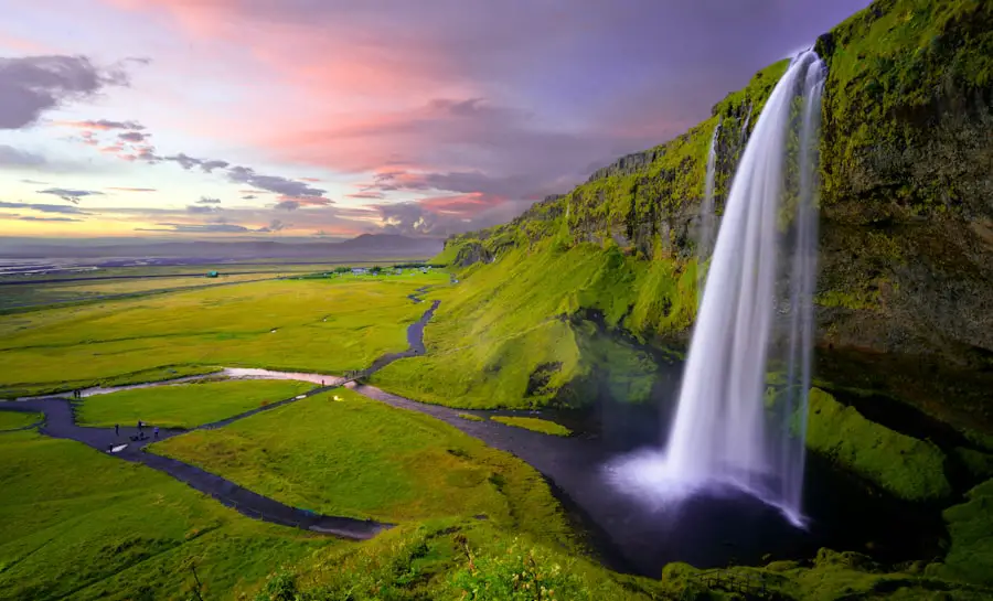
The ecosystem around Dry Falls combines basalt cliffs, sagebrush-steppe, dry grasslands, lakes, and wet areas. This mix creates feeding, nesting, and shelter opportunities for mammals, birds, reptiles, insects, and aquatic species.
Sagebrush, Sandberg bluegrass, bluebunch wheatgrass, and other drought-tolerant plants dominate much of the surrounding landscape. Seasonal wildflowers add color in spring, while plants near lakes and wetlands benefit from more dependable moisture.
Visitors may see mule deer, coyotes, rabbits, small mammals, reptiles, waterfowl, songbirds, and birds of prey. The adjoining Sun Lakes Wildlife Area specifically identifies peregrine falcons among the wildlife found around its cliffs and shrubsteppe habitat.
The lakes below the ancient cataract also support aquatic food webs and provide resting or feeding habitat for birds. Wildlife sightings vary by season, water level, weather, and time of day.
Note: Dawn and the final hours before sunset often offer better wildlife activity and softer light for photography. Use binoculars or a zoom lens rather than approaching animals.
Activities and Recreation at Dry Falls
| Activity | What to Expect |
| Scenic Viewing | Broad views of cliffs, coulees, lakes, and the lower Grand Coulee. The main visitor-center overlook is closed during the 2026 renovation. |
| Hiking | More than 15 miles of park trails cross sagebrush hills, old roadbeds, lake edges, and exposed basalt terrain. |
| Camping | Standard and full-hookup campsites are available in the state park. Reservations are recommended during busy periods. |
| Fishing | Dry Falls Lake is managed for trout, while Park Lake, Blue Lake, Deep Lake, and Lake Lenore provide additional opportunities under current WDFW regulations. |
| Boating and Paddling | Park Lake and Deep Lake provide water access, although wind, seasonal closures, and individual launch conditions should be checked before arrival. |
| Wildlife Viewing | Look for shrubsteppe birds, raptors, waterfowl, deer, coyotes, rabbits, and other wildlife from a respectful distance. |
| Photography | Cliff shadows, lake reflections, basalt textures, wildflowers, wildlife, and changing weather provide varied subjects. |
| Picnicking and Golf | The park offers picnic areas as well as nine-hole and miniature golf. |
Hiking is one of the best ways to see the broader landscape beyond the main roadside viewpoint. Park routes range from gentle walks on old roadbeds to rougher, exposed terrain near cliffs and basalt formations. Check the official park map and current notices before choosing a route.
Photography conditions are often strongest in the morning and late afternoon, when low-angle light gives the cliffs more texture. Midday light can be harsh, especially during summer, but it can work well for photographing the contrasting colors of dark basalt, pale grass, and blue water.
Anglers should review the current Dry Falls Lake fishing information and statewide rules before visiting. A valid Washington fishing license may be required, and lake seasons, species rules, gear restrictions, and access conditions can change.
How to Visit Dry Falls Washington
Getting There
Sun Lakes-Dry Falls State Park is located along State Route 17 between Soap Lake and Coulee City. The main state-park entrance is at 34875 Park Lake Road NE, Coulee City, Washington. Services are limited compared with a large city, so fill your fuel tank and carry food, water, and basic supplies before exploring remote areas.
Parking, Passes, and Fees
A Discover Pass is generally required for day-use vehicle parking in Washington state parks. As of 2026, the standard price is $10 for a one-day pass or $45 for an annual pass, before transaction fees. Camping, boating, golf, reservations, and other activities may have separate charges.
The visitor-center parking area normally has different pass rules, but it is closed with the building and outdoor overlook during the 2026 renovation. Follow posted signs and use only designated open parking areas.
What to Bring
- Water: Carry more than you expect to need, especially during warm or windy weather.
- Sun protection: Use sunscreen, sunglasses, a brimmed hat, and light protective clothing.
- Footwear: Wear shoes with dependable traction for loose gravel, uneven basalt, and dusty trails.
- Navigation: Carry an offline map or printed park map because mobile coverage may be inconsistent.
- Layers: Wind and temperatures can change quickly in the open coulee.
- Binoculars or camera: These allow wildlife viewing without disturbing animals.
Warning: Stay back from unprotected cliff edges and remain on designated routes. Basalt can be loose or fractured, and gravel near drop-offs may shift underfoot. Summer heat, wildfire smoke, changing burn restrictions, winter ice, and sudden strong winds can also affect safety.
Before leaving, check the official state-park page, current Washington State Parks alerts, and the AirNow wildfire-smoke information. Fire rules can change quickly during the dry season.
The Importance of Preserving Dry Falls
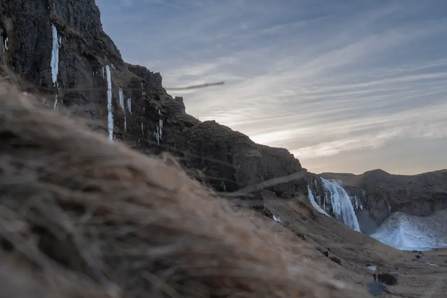
Dry Falls preserves evidence of geological processes on a scale that is difficult to understand from books or diagrams alone. Its cliffs, plunge pools, coulees, and flood-scoured rock help scientists, students, and visitors see how repeated megafloods transformed the Columbia Plateau.
The park also protects shrubsteppe, cliff, grassland, lake, and wetland habitats. These ecosystems support native plants and provide food, water, shelter, and migration space for wildlife. Remaining on marked routes helps prevent erosion and protects fragile plants growing in thin, dry soils.
Preservation also includes respecting the cultural history of Indigenous peoples connected with this landscape. Archaeological sites, cultural materials, rocks, plants, and artifacts should be left where they are found. Visitors should follow Leave No Trace practices, dispose of waste properly, and never feed wildlife.
Dry Falls has received international recognition as an outstanding geological heritage site. Protecting it allows future generations to examine the evidence that helped change scientific understanding of catastrophic flooding and landscape formation.
Nearby Attractions and Accommodations
Sun Lakes-Dry Falls State Park
The wider state park offers camping, hiking, boating, paddling, fishing, swimming areas, picnicking, golf, and access to several lakes. Park Lake has a developed recreation setting, while Deep Lake feels more remote. Some roads, gates, launches, and recreation areas operate seasonally.
Lake Lenore and Lenore Caves
South of the park, the Lake Lenore area adds more Ice Age flood scenery, basalt cliffs, wildlife habitat, and fishing access. The Lenore Caves area contains shallow caves and rock shelters formed in flood-eroded basalt. Visitors should use established access routes and avoid disturbing archaeological or cultural resources.
Coulee City
Coulee City is the closest community for basic supplies, fuel, meals, and locally operated accommodations. Availability can be limited during busy weekends, fishing seasons, and special events, so advance planning is useful.
Grand Coulee Dam
Grand Coulee Dam is a worthwhile addition for visitors interested in engineering and regional history. Its visitor center contains exhibits about the Columbia Basin Project and the dam’s construction and operation.
Public pump-generating plant tours are seasonal. For 2026, the Bureau of Reclamation scheduled tours Friday through Sunday from May 22 through October 31 on a first-come, first-served basis. Schedules and security requirements can change, so check the official Grand Coulee Dam tour page before driving there.
Where to Stay
Options include reservable campsites within Sun Lakes-Dry Falls State Park, privately operated resort accommodations, and motels or vacation rentals in communities such as Coulee City and Electric City. Campers should confirm seasonal water availability, fire restrictions, check-in rules, and vehicle-length limits before arrival.
The Best Times to Visit Dry Falls Washington
Spring: Wildflowers and Comfortable Hiking
Spring is one of the best periods for hiking, photography, and wildlife viewing. Days are generally milder than in midsummer, seasonal plants begin growing, and wildflowers may brighten the shrubsteppe. Nights and windy days can still feel cold, so bring layers.
Water, mud, or lingering snow may affect some routes early in the season. Check trail and road conditions after storms.
Summer: Camping, Boating, and Long Days
Summer offers long daylight hours and the widest range of lake-based recreation. It is a popular season for camping, fishing, paddling, swimming, and family trips.
Daytime heat can be intense in the exposed landscape. Begin hikes early, limit strenuous activity during the hottest part of the day, and carry ample drinking water. Wildfire smoke and burn restrictions can also affect summer visits.
Fall: Cooler Weather and Fewer Crowds
Early fall often provides comfortable hiking temperatures, clearer views, and lower crowd levels after the main summer season. Changing grasses and lakeside vegetation can add warmer colors to photographs.
Daylight becomes shorter, nights cool quickly, and some services may reduce their schedules later in the season. Check closing dates for seasonal facilities.
Winter: Solitude With Limited Access
Winter can create stark views of snow-covered cliffs and quiet coulees. However, snow, ice, wind, and freezing temperatures can make roads and trails more difficult.
Dry Falls Lake and Deep Lake areas close during the winter season, even though other parts of Sun Lakes-Dry Falls State Park remain available for year-round camping and recreation. Review the official winter schedule and weather forecast before traveling.
Frequently Asked Questions
What is Dry Falls in Washington?
Dry Falls is a broad former waterfall in central Washington. Repeated Ice Age floods carved its cliffs, plunge pools, and surrounding coulees into layers of Columbia River basalt.
How was Dry Falls formed?
Glacial Lake Missoula repeatedly filled behind an ice dam and then drained when the dam failed or water escaped beneath it. Floodwater crossed eastern Washington, entered channels including Grand Coulee, and eroded the Dry Falls cataract backward through layered basalt.
How big is Dry Falls?
The cliff is approximately 3.5 miles wide and 400 feet high. Its size makes it one of the most impressive known former waterfall landscapes.
Was Dry Falls larger than Niagara Falls?
Yes, in physical scale. The Dry Falls cataract is several times wider than the combined brink of modern Niagara Falls and is also substantially higher. Exact discharge comparisons are less certain because Dry Falls carried different volumes during different Ice Age floods.
Does water still flow over Dry Falls?
No major river flows over the old cataract today. Groundwater-fed lakes now occupy several of the deep plunge pools below the cliffs.
Can you visit Dry Falls in 2026?
The main Sun Lakes-Dry Falls State Park remains open, but the Dry Falls Visitor Center, its parking lot, and the outdoor overlook are closed for renovation during 2026. A mobile interpretive location is available near the main park amphitheater. Check the official state-park page for construction updates.
Do you have to hike to experience Dry Falls?
Under normal conditions, the visitor-center overlook provides a view without a long hike. That overlook is closed during the 2026 renovation. The larger park still offers trails and flood-shaped scenery, but visitors should check current access information before choosing a route.
What activities can you do at Dry Falls?
Popular activities include hiking, camping, picnicking, boating, paddling, fishing, wildlife viewing, birdwatching, photography, golf, and learning about Ice Age geology through interpretive programs.
When is the best time to visit Dry Falls?
Spring and early fall usually offer the most comfortable hiking conditions. Summer is best for camping and water recreation but can be hot and smoky. Winter is quieter, although snow, ice, and seasonal closures limit access.
Sources
- Washington State Parks — Sun Lakes-Dry Falls State Park — park address, trails, activities, camping, facilities, and current visitor information
- Washington State Parks — Dry Falls Visitor Center — 2026 renovation closure and mobile interpretive-center information
- National Park Service — Ice Age Floods National Geologic Trail — Glacial Lake Missoula, flood history, and regional geological context
- U.S. Geological Survey — Review of the Missoula and Bonneville Floods — flood timing, frequency, routes, discharge estimates, and scientific evidence
- Washington Geological Survey — Dry Falls — basalt geology, Grand Coulee formation, and geologic significance
- Washington Department of Fish and Wildlife — Sun Lakes Wildlife Area — local shrubsteppe habitat, wildlife, public access, and fishing context
